The L10 3 postcode sector is within the county of Merseyside.
Did you know? According to the 2021 Census, the L10 3 postcode sector is home to a bustling 1,454 residents!
Given that each sector allows for 400 unique postcode combinations. Letters C, I, K, M, O and V are not allowed in the last two letters of a postcode. With 30 postcodes already in use, this leaves 370 units available.
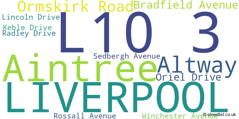
The largest settlements in the L10 3 postal code are LIVERPOOL and Aintree.
The L10 3 Postcode shares a border with L9 5 (LIVERPOOL, Aintree Racecourse Retail & Bus Pk), L31 1 (Melling, Maghull, LIVERPOOL), L30 7 (BOOTLE), L30 8 (BOOTLE), L29 9 (LIVERPOOL, Sefton), L10 2 (LIVERPOOL, Old Roan), L10 6 (LIVERPOOL, Aintree, Old Roan) and L31 5 (LIVERPOOL, Maghull).
The sector is within the post town of LIVERPOOL.
L10 3 is a postcode sector within the L10 postcode district which is within the L Liverpool postcode area.
The Royal Mail delivery office for the L10 3 postal sector is the Walton (l) Delivery Office.
The area of the L10 3 postcode sector is 0.34 square miles which is 0.87 square kilometres or 214.75 square acres.
The L10 3 postcode sector is crossed by the M57 motorway.
The L10 3 postcode sector is crossed by the A59 Major A road.
The L10 3 postcode sector is crossed by the M58 motorway.
Waterways within the L10 3 postcode sector include the River Alt.

Map of the L10 3 Postcode Sector
Explore the L10 3 postcode sector by using our free interactive map.
| L | 1 | 0 | - | 3 | X | X |
| L | 1 | 0 | Space | 3 | Letter | Letter |
Official List of Streets
LIVERPOOL (9 Streets)
Aintree (1 Streets)
Unofficial Streets or Alternative Spellings
LIVERPOOL
ELLESMERE DRIVE MOLYNEUX WAY STONEYHURST AVENUEAughton
NORTHWAYBOOTLE
DUNNINGS BRIDGE ROAD BROOMS CROSS ROAD OUNDLE DRIVE SWITCH ISLAND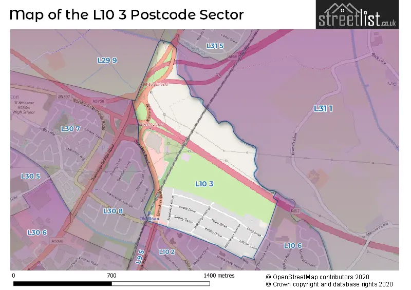
House Prices in the L10 3 Postcode Sector
| Type of Property | 2018 Average | 2018 Sales | 2017 Average | 2017 Sales | 2016 Average | 2016 Sales | 2015 Average | 2015 Sales |
|---|---|---|---|---|---|---|---|---|
| Detached | £297,000 | 1 | £0 | 0 | £0 | 0 | £0 | 0 |
| Semi-Detached | £160,784 | 22 | £157,337 | 19 | £143,500 | 22 | £153,355 | 11 |
| Terraced | £0 | 0 | £155,000 | 1 | £120,000 | 1 | £0 | 0 |
| Flats | £0 | 0 | £0 | 0 | £0 | 0 | £0 | 0 |
| The L10 3 Sector is within these Local Authorities |
|
|---|---|
| The L10 3 Sector is within these Counties |
|
| The L10 3 Sector is within these Water Company Areas |
|