The L30 5 postcode sector is within the county of Merseyside.
Did you know? According to the 2021 Census, the L30 5 postcode sector is home to a bustling 2,941 residents!
Given that each sector allows for 400 unique postcode combinations. Letters C, I, K, M, O and V are not allowed in the last two letters of a postcode. With 53 postcodes already in use, this leaves 347 units available.
The L30 5 postal code covers the settlement of BOOTLE.
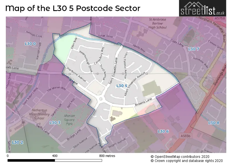
The L30 5 Postcode shares a border with L30 6 (BOOTLE), L30 7 (BOOTLE), L30 3 (BOOTLE) and L30 0 (BOOTLE).
The sector is within the post town of BOOTLE.
L30 5 is a postcode sector within the L3 postcode district which is within the L Liverpool postcode area.
The Royal Mail delivery office for the L30 5 postal sector is the Liverpool 1-3.
The area of the L30 5 postcode sector is 0.21 square miles which is 0.53 square kilometres or 131.96 square acres.
Waterways within the L30 5 postcode sector include the Leeds and Liverpool Canal.

Map of the L30 5 Postcode Sector
Explore the L30 5 postcode sector by using our free interactive map.
| L | 3 | 0 | - | 5 | X | X |
| L | 3 | 0 | Space | 5 | Letter | Letter |
Official List of Streets
BOOTLE (33 Streets)
Unofficial Streets or Alternative Spellings
Schools and Places of Education Within the L30 5 Postcode Sector
St Oswald's Church of England Primary School
Voluntary aided school
Ronald Ross Avenue, Bootle, Merseyside, L30 5RH
Head: Miss Emma Murtagh
Ofsted Rating: Good
Inspection: 2022-11-16 (559 days ago)
Website: Visit St Oswald's Church of England Primary School Website
Phone: 01515254580
Number of Pupils: 233
House Prices in the L30 5 Postcode Sector
| Type of Property | 2018 Average | 2018 Sales | 2017 Average | 2017 Sales | 2016 Average | 2016 Sales | 2015 Average | 2015 Sales |
|---|---|---|---|---|---|---|---|---|
| Detached | £0 | 0 | £0 | 0 | £0 | 0 | £0 | 0 |
| Semi-Detached | £114,214 | 7 | £85,250 | 4 | £75,833 | 3 | £96,725 | 2 |
| Terraced | £78,958 | 24 | £75,528 | 18 | £75,148 | 24 | £67,672 | 16 |
| Flats | £0 | 0 | £44,750 | 2 | £28,200 | 1 | £28,000 | 1 |
Important Postcodes L30 5 in the Postcode Sector
L30 5QH is the postcode for New Centre Stage, David Brown Centre, and Netherton Childrens Centre, Magdalen Square
L30 5RH is the postcode for St. Oswalds C of E Primary School, Ronald Ross Avenue
L30 5RN is the postcode for Bootle High School, Browns Lane
L30 5SP is the postcode for Mersey Care NHS Foundation Trust, South Sefton Primary Care Trust, NETHERTON HEALTH CENTRE, MERSEYCARE NHSFOUNDATION TRUST, MAGDALENE SQUARE, and Netherton Health Centre, Merseycare NHS Foundation Trust, Magdalene Square
L30 5TA is the postcode for Glovers Lane Practice, Glovers Lane
| The L30 5 Sector is within these Local Authorities |
|
|---|---|
| The L30 5 Sector is within these Counties |
|
| The L30 5 Sector is within these Water Company Areas |
|