The L34 3 postcode sector is within the county of Merseyside.
Did you know? According to the 2021 Census, the L34 3 postcode sector is home to a bustling 568 residents!
Given that each sector allows for 400 unique postcode combinations. Letters C, I, K, M, O and V are not allowed in the last two letters of a postcode. With 23 postcodes already in use, this leaves 377 units available.
The L34 3 postal code covers the settlement of PRESCOT.
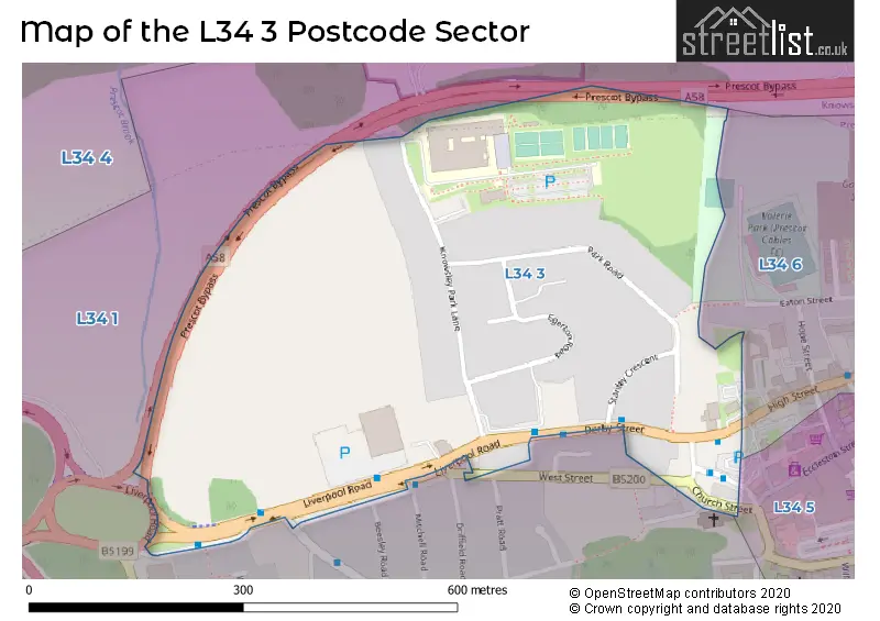
The L34 3 Postcode shares a border with L34 5 (PRESCOT), L34 6 (PRESCOT, Eccleston Lane Ends) and L34 1 (PRESCOT).
The sector is within the post town of PRESCOT.
L34 3 is a postcode sector within the L34 postcode district which is within the L Liverpool postcode area.
The Royal Mail delivery office for the L34 3 postal sector is the Prescot Delivery Office.
The area of the L34 3 postcode sector is 0.15 square miles which is 0.39 square kilometres or 95.36 square acres.

Map of the L34 3 Postcode Sector
Explore the L34 3 postcode sector by using our free interactive map.
| L | 3 | 4 | - | 3 | X | X |
| L | 3 | 4 | Space | 3 | Letter | Letter |
Official List of Streets
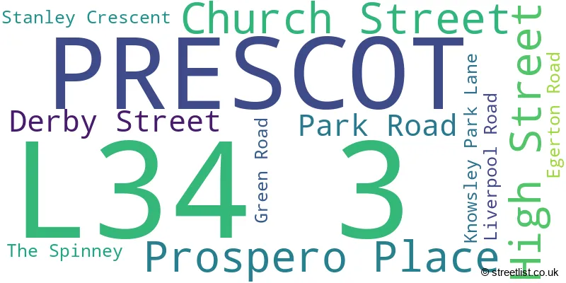
PRESCOT (15 Streets)
Unofficial Streets or Alternative Spellings
Schools and Places of Education Within the L34 3 Postcode Sector
The Prescot School
Academy converter
Knowsley Park Lane, Liverpool, Merseyside, L34 3NB
Head: Mr Jamie Jardine
Ofsted Rating: Requires improvement
Inspection: 2021-10-20 (946 days ago)
Website: Visit The Prescot School Website
Phone: 01514778680
Number of Pupils: 855
House Prices in the L34 3 Postcode Sector
| Type of Property | 2018 Average | 2018 Sales | 2017 Average | 2017 Sales | 2016 Average | 2016 Sales | 2015 Average | 2015 Sales |
|---|---|---|---|---|---|---|---|---|
| Detached | £287,500 | 4 | £332,500 | 2 | £231,650 | 3 | £233,000 | 5 |
| Semi-Detached | £97,000 | 1 | £147,833 | 6 | £107,000 | 1 | £159,317 | 3 |
| Terraced | £0 | 0 | £0 | 0 | £0 | 0 | £265,000 | 1 |
| Flats | £68,333 | 3 | £88,750 | 2 | £79,325 | 10 | £75,000 | 1 |
Important Postcodes L34 3 in the Postcode Sector
L34 3LD is the postcode for Prescot Register Office, High Street
L34 3NB is the postcode for Knowsley Park Centre for Learning Serving Prescot, Whiston and the wider Community, Knowsley Park Lane, The Prescot School, Knowsley Park Lane, and Prescot School, Knowsley Park Lane
| The L34 3 Sector is within these Local Authorities |
|
|---|---|
| The L34 3 Sector is within these Counties |
|
| The L34 3 Sector is within these Water Company Areas |
|