The L34 6 postcode sector is within the county of Merseyside.
Did you know? According to the 2021 Census, the L34 6 postcode sector is home to a bustling 1,578 residents!
Given that each sector allows for 400 unique postcode combinations. Letters C, I, K, M, O and V are not allowed in the last two letters of a postcode. With 55 postcodes already in use, this leaves 345 units available.
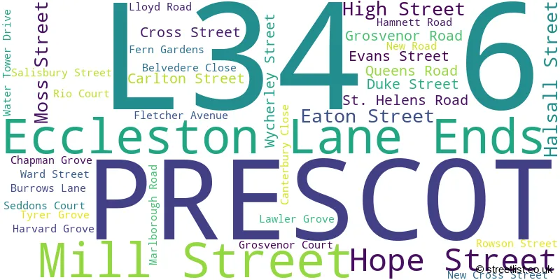
The largest settlements in the L34 6 postal code are PRESCOT and Eccleston Lane Ends.
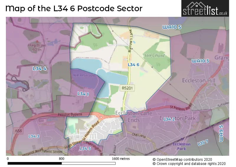
The L34 6 Postcode shares a border with WA10 3 (ST. HELENS, Grange Park), WA10 5 (Eccleston, ST. HELENS), L34 5 (PRESCOT), L34 1 (PRESCOT), L34 2 (PRESCOT, Eccleston Park), L34 3 (PRESCOT) and L34 4 (Knowsley, Knowsley Park).
The sector is within the post town of PRESCOT.
L34 6 is a postcode sector within the L34 postcode district which is within the L Liverpool postcode area.
The Royal Mail delivery office for the L34 6 postal sector is the Prescot Delivery Office.
The area of the L34 6 postcode sector is 0.71 square miles which is 1.83 square kilometres or 453.19 square acres.

Map of the L34 6 Postcode Sector
Explore the L34 6 postcode sector by using our free interactive map.
| L | 3 | 4 | - | 6 | X | X |
| L | 3 | 4 | Space | 6 | Letter | Letter |
Official List of Streets
PRESCOT (31 Streets)
Eccleston Lane Ends (4 Streets)
Unofficial Streets or Alternative Spellings
Schools and Places of Education Within the L34 6 Postcode Sector
Our Lady's Catholic Primary School
Voluntary aided school
Ward Street, Prescot, Merseyside, L34 6JJ
Head: Mrs Angela Sutton
Ofsted Rating: Good
Inspection: 2023-07-04 (324 days ago)
Website: Visit Our Lady's Catholic Primary School Website
Phone: 01514778220
Number of Pupils: 225
House Prices in the L34 6 Postcode Sector
| Type of Property | 2018 Average | 2018 Sales | 2017 Average | 2017 Sales | 2016 Average | 2016 Sales | 2015 Average | 2015 Sales |
|---|---|---|---|---|---|---|---|---|
| Detached | £205,000 | 4 | £225,625 | 4 | £250,778 | 9 | £176,786 | 7 |
| Semi-Detached | £0 | 0 | £147,500 | 6 | £155,167 | 6 | £141,000 | 2 |
| Terraced | £77,269 | 13 | £94,167 | 12 | £68,481 | 13 | £71,985 | 17 |
| Flats | £70,833 | 3 | £0 | 0 | £82,000 | 2 | £0 | 0 |
Important Postcodes L34 6 in the Postcode Sector
L34 6JJ is the postcode for Our Ladys Primary School, Ward Street
| The L34 6 Sector is within these Local Authorities |
|
|---|---|
| The L34 6 Sector is within these Counties |
|
| The L34 6 Sector is within these Water Company Areas |
|