The L36 6 postcode sector is within the county of Merseyside.
Did you know? According to the 2021 Census, the L36 6 postcode sector is home to a bustling 2,899 residents!
Given that each sector allows for 400 unique postcode combinations. Letters C, I, K, M, O and V are not allowed in the last two letters of a postcode. With 106 postcodes already in use, this leaves 294 units available.
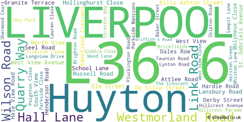
The largest settlements in the L36 6 postal code are LIVERPOOL and Huyton.
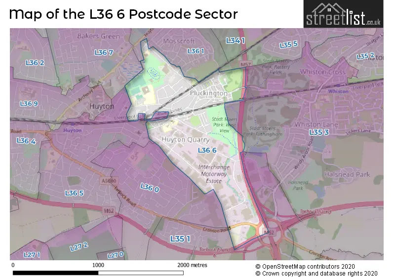
The L36 6 Postcode shares a border with L35 3 (Whiston, Halsnead Park), L35 5 (PRESCOT, Whiston), L36 0 (LIVERPOOL, Huyton), L36 1 (LIVERPOOL, Huyton), L35 1 (Tarbock Green, Whiston, Tarbock), L36 5 (LIVERPOOL, Huyton) and L36 7 (LIVERPOOL, Huyton).
The sector is within the post town of LIVERPOOL.
L36 6 is a postcode sector within the L36 postcode district which is within the L Liverpool postcode area.
The Royal Mail delivery office for the L36 6 postal sector is the Huyton Delivery Office.
The area of the L36 6 postcode sector is 0.68 square miles which is 1.75 square kilometres or 433.30 square acres.
The L36 6 postcode sector is crossed by the M57 motorway.
The L36 6 postcode sector is crossed by the M62 motorway.

Map of the L36 6 Postcode Sector
Explore the L36 6 postcode sector by using our free interactive map.
| L | 3 | 6 | - | 6 | X | X |
| L | 3 | 6 | Space | 6 | Letter | Letter |
Official List of Streets
LIVERPOOL (33 Streets)
Huyton (19 Streets)
Unofficial Streets or Alternative Spellings
Tarbock
COPPICE LANE CRONTON ROADHuyton
BEDFORD CLOSE VICTORIA ROAD YORK ROAD BAKERS STREET DESILVA STREET KNOWSLEY VELODROME LONG JUMP OLIVIA WAY POPLAR WAY QUARRY GARDENS ROOFERS WAY SAINT GABRIELS AVENUE STATION WAY TARBOCK ROUNDABOUTWhiston
POTTERY LANELIVERPOOL
HEY ROAD HILLCREST PARADE HURST PARK DRIVE MANOR FARM ROAD PLUMBERS WAY WALLACE DRIVEWeather Forecast for L36 6
Press Button to Show Forecast for Huyton
| Time Period | Icon | Description | Temperature | Rain Probability | Wind |
|---|---|---|---|---|---|
| 18:00 to 21:00 | Overcast | 13.0°C (feels like 11.0°C) | 21.00% | W 7 mph | |
| 21:00 to 00:00 | Light rain | 12.0°C (feels like 11.0°C) | 47.00% | WSW 7 mph |
Press Button to Show Forecast for Huyton
| Time Period | Icon | Description | Temperature | Rain Probability | Wind |
|---|---|---|---|---|---|
| 00:00 to 03:00 | Light rain | 11.0°C (feels like 10.0°C) | 47.00% | SW 7 mph | |
| 03:00 to 06:00 | Overcast | 11.0°C (feels like 9.0°C) | 16.00% | SSW 7 mph | |
| 06:00 to 09:00 | Overcast | 11.0°C (feels like 9.0°C) | 12.00% | S 7 mph | |
| 09:00 to 12:00 | Overcast | 13.0°C (feels like 11.0°C) | 10.00% | SSW 7 mph | |
| 12:00 to 15:00 | Overcast | 14.0°C (feels like 13.0°C) | 12.00% | SW 7 mph | |
| 15:00 to 18:00 | Cloudy | 15.0°C (feels like 14.0°C) | 13.00% | WSW 7 mph | |
| 18:00 to 21:00 | Overcast | 14.0°C (feels like 13.0°C) | 15.00% | WNW 4 mph | |
| 21:00 to 00:00 | Cloudy | 13.0°C (feels like 12.0°C) | 9.00% | NNW 7 mph |
Press Button to Show Forecast for Huyton
| Time Period | Icon | Description | Temperature | Rain Probability | Wind |
|---|---|---|---|---|---|
| 00:00 to 03:00 | Cloudy | 11.0°C (feels like 10.0°C) | 8.00% | NNW 4 mph | |
| 03:00 to 06:00 | Cloudy | 10.0°C (feels like 9.0°C) | 10.00% | E 7 mph | |
| 06:00 to 09:00 | Partly cloudy (day) | 10.0°C (feels like 9.0°C) | 7.00% | E 7 mph | |
| 09:00 to 12:00 | Cloudy | 13.0°C (feels like 12.0°C) | 9.00% | ESE 7 mph | |
| 12:00 to 15:00 | Cloudy | 15.0°C (feels like 13.0°C) | 11.00% | E 9 mph | |
| 15:00 to 18:00 | Cloudy | 15.0°C (feels like 14.0°C) | 15.00% | SW 7 mph | |
| 18:00 to 21:00 | Partly cloudy (day) | 14.0°C (feels like 13.0°C) | 14.00% | WNW 7 mph | |
| 21:00 to 00:00 | Partly cloudy (night) | 12.0°C (feels like 11.0°C) | 8.00% | N 7 mph |
Schools and Places of Education Within the L36 6 Postcode Sector
Lord Derby Academy
Academy sponsor led
Seel Road, Liverpool, Merseyside, L36 6DG
Head: Miss Victoria Gowan
Ofsted Rating: Good
Inspection: 2023-06-28 (310 days ago)
Website: Visit Lord Derby Academy Website
Phone: 01514778860
Number of Pupils: 1072
St Joseph's Catholic Primary School
Voluntary aided school
Edenfield Crescent, Liverpool, Merseyside, L36 6DS
Head: Ms Pauline McIlroy
Ofsted Rating: Outstanding
Inspection: 2023-10-19 (197 days ago)
Website: Visit St Joseph's Catholic Primary School Website
Phone: 01514778990
Number of Pupils: 204
House Prices in the L36 6 Postcode Sector
| Type of Property | 2018 Average | 2018 Sales | 2017 Average | 2017 Sales | 2016 Average | 2016 Sales | 2015 Average | 2015 Sales |
|---|---|---|---|---|---|---|---|---|
| Detached | £176,500 | 4 | £170,667 | 6 | £138,417 | 3 | £115,000 | 1 |
| Semi-Detached | £125,583 | 18 | £126,441 | 17 | £110,393 | 14 | £103,839 | 14 |
| Terraced | £99,722 | 18 | £87,933 | 15 | £96,400 | 10 | £84,025 | 10 |
| Flats | £47,317 | 3 | £68,375 | 4 | £52,500 | 2 | £45,633 | 3 |
Important Postcodes L36 6 in the Postcode Sector
L36 6AA is the postcode for Royal Mail, Huyton Delivery Office, Westmorland Road
L36 6AP is the postcode for Knowsley Housing Trust, Link Road
L36 6BH is the postcode for St. Gabriels C of E Primary School, Ellis Ashton Street, and JUNIOR BLOCK, St. Gabriels C of E Primary School, Ellis Ashton Street
L36 6BP is the postcode for Parcelforce Worldwide, Unit 1-6 Link North, Ellis Ashton Street
L36 6DG is the postcode for Lord Derby Acadmey, Seel Road, Lord Derby Academy, Seel Road, and Knowsley Hey School, Seel Road
L36 6DS is the postcode for St. Josephs Primary School, Edenfield Crescent
L36 6EB is the postcode for LONGVIEW MEDICAL CENTRE, LONGVIEW DRIVE PRIMARY CARE, LONGVIEW DRIVE, and Longview Medical Centre, Longview Drive
L36 6EG is the postcode for Our Place Youth Facility, Longview Drive, Knowsley Leisure & Culture Park, Longview Drive, and Knowsley Leisure & Culture Park, and Our Place, Longview Drive
L36 6GA is the postcode for Nutgrove Villa NHS Walk-in Centre, Nutgrove Villa, Westmorland Road, and Nutgrove Villa NHS Walk-in Centre, Nutgrove Villa, Westmorland Road, Huyton
L36 6HY is the postcode for Centre for Independent Living, Unit 11
L36 6JF is the postcode for Knowsley Metropolitan Borough Council, Stretton Way
| The L36 6 Sector is within these Local Authorities |
|
|---|---|
| The L36 6 Sector is within these Counties |
|
| The L36 6 Sector is within these Water Company Areas |
|