The LL20 8 postcode sector is within the county of Clwyd.
Did you know? According to the 2021 Census, the LL20 8 postcode sector is home to a bustling 3,420 residents!
Given that each sector allows for 400 unique postcode combinations. Letters C, I, K, M, O and V are not allowed in the last two letters of a postcode. With 164 postcodes already in use, this leaves 236 units available.
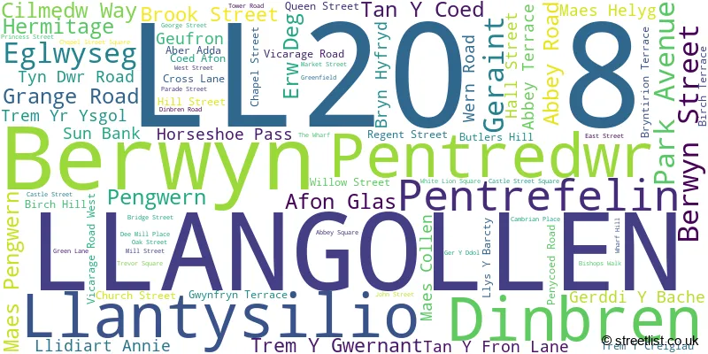
The largest settlement in the LL20 8 postal code is LLANGOLLEN followed by LLANTYSILIO, and EGLWYSEG.
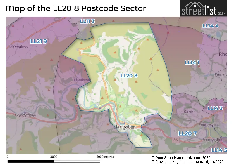
The LL20 8 Postcode shares a border with LL11 3 (COEDPOETH, LLANDEGLA, MINERA), LL20 7 (GLYN CEIRIOG, TREVOR, FRONCYSYLLTE), LL21 9 (CORWEN, GWYDDELWERN, GLYNDYFRDWY) and LL14 1 (RHOSLLANERCHRUGOG, PONCIAU, JOHNSTOWN).
The sector is within the post town of LLANGOLLEN.
LL20 8 is a postcode sector within the LL20 postcode district which is within the LL Llandudno postcode area.
The Royal Mail delivery office for the LL20 8 postal sector is the Llangollen Delivery Office.
The area of the LL20 8 postcode sector is 13.86 square miles which is 35.90 square kilometres or 8,870.93 square acres.

Map of the LL20 8 Postcode Sector
Explore the LL20 8 postcode sector by using our free interactive map.
| L | L | 2 | 0 | - | 8 | X | X |
| L | L | 2 | 0 | Space | 8 | Letter | Letter |
Official List of Streets
LLANGOLLEN (70 Streets)
Llantysilio (2 Streets)
Eglwyseg (1 Streets)
House Prices in the LL20 8 Postcode Sector
| Type of Property | 2018 Average | 2018 Sales | 2017 Average | 2017 Sales | 2016 Average | 2016 Sales | 2015 Average | 2015 Sales |
|---|---|---|---|---|---|---|---|---|
| Detached | £292,028 | 16 | £282,673 | 20 | £344,408 | 12 | £301,331 | 20 |
| Semi-Detached | £191,210 | 15 | £170,386 | 18 | £187,886 | 14 | £205,372 | 9 |
| Terraced | £134,467 | 18 | £132,032 | 14 | £126,720 | 22 | £144,150 | 24 |
| Flats | £125,929 | 7 | £114,723 | 11 | £116,444 | 9 | £140,787 | 12 |
Important Postcodes LL20 8 in the Postcode Sector
LL20 8AR is the postcode for UNIVERSITY OF CENTRAL LANCASHIRE, U C L A, Tyndwr Hall,, Ysgol Bryn Collen, Pengwern, and U C L A, Tyndwr Hall,
LL20 8HH is the postcode for Llangollen Youth Centre, Willow Street
LL20 8NU is the postcode for Denbighshire County Council, Y Capel, Castle Street
LL20 8RZ is the postcode for Llangollen Health Centre, River Lodge PCC, Bishops Walk, and Canolfan Iechyd Llangollen Health Centre, Bishops Walk
LL20 8SP is the postcode for Llangollen Community Hospital, Abbey Road
LL20 8SW is the postcode for Pafiliwn Llangollen Pavilion, Royal International Pavilion, Llangollen International Musical Eisteddfod, Royal International Pavilion, Abbey Road, and Pafiliwn Llangollen Pavilion, Royal International Pavilion, Abbey Road
LL20 8TG is the postcode for WELSH BLOCK, Ysgol Dinas Bran, Dinbren Road, MAIN BUILDING, Ysgol Dinas Bran, Dinbren Road, DT BLOCK, Ysgol Dinas Bran, Dinbren Road, Llangollen Leisure Centre, Dinbren Road, and Dinas Bran Bilateral School, Dinbren Road
| The LL20 8 Sector is within these Local Authorities |
|
|---|---|
| The LL20 8 Sector is within these Counties |
|
| The LL20 8 Sector is within these Water Company Areas |
|
Tourist Attractions within the LL20 8 Postcode Area
We found 1 visitor attractions within the LL20 postcode area
| Valle Crucis Abbey |
|---|
| View Valle Crucis Abbey on Google Maps |