The LL54 7 postcode sector is within the county of Gwynedd.
Did you know? According to the 2021 Census, the LL54 7 postcode sector is home to a bustling 4,098 residents!
Given that each sector allows for 400 unique postcode combinations. Letters C, I, K, M, O and V are not allowed in the last two letters of a postcode. With 195 postcodes already in use, this leaves 205 units available.
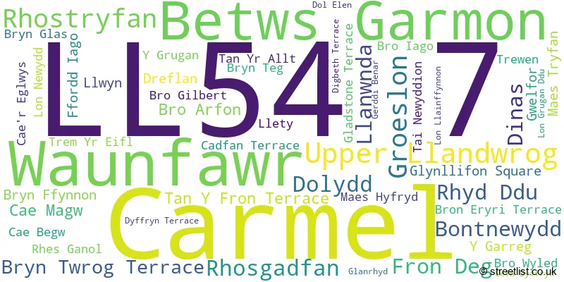
The largest settlement in the LL54 7 postal code is Y GROESLON followed by RHOSGADFAN, and RHOSTRYFAN.
The LL54 7 Postcode shares a border with LL54 5 (TREFOR, LLANDWROG, CLYNNOG FAWR), LL54 6 (PENYGROES, TALYSARN, LLANLLYFNI), LL55 4 (LLANBERIS, LLANRUG, WAUNFAWR) and LL55 2 (CAERNARFON, Caeathro, BONTNEWYDD).
The sector is within the post town of CAERNARFON.
LL54 7 is a postcode sector within the LL54 postcode district which is within the LL Llandudno postcode area.
The Royal Mail delivery office for the LL54 7 postal sector is the Caernarfon Delivery Office.
The area of the LL54 7 postcode sector is 19.19 square miles which is 49.70 square kilometres or 12,281.16 square acres.

Map of the LL54 7 Postcode Sector
Explore the LL54 7 postcode sector by using our free interactive map.
| L | L | 5 | 4 | - | 7 | X | X |
| L | L | 5 | 4 | Space | 7 | Letter | Letter |
Official List of Streets
Upper Llandwrog (3 Streets)
Rhostryfan (7 Streets)
Groeslon (16 Streets)
Rhosgadfan (8 Streets)
Bontnewydd (2 Streets)
Dinas (2 Streets)
Unofficial Streets or Alternative Spellings
Groeslon
D�L ELEN L�N LLAINFFYNNON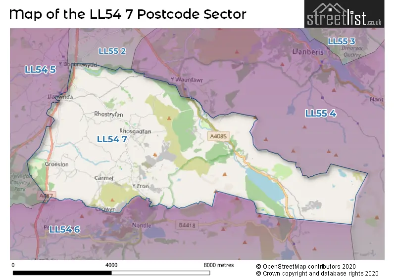
House Prices in the LL54 7 Postcode Sector
| Type of Property | 2018 Average | 2018 Sales | 2017 Average | 2017 Sales | 2016 Average | 2016 Sales | 2015 Average | 2015 Sales |
|---|---|---|---|---|---|---|---|---|
| Detached | £188,405 | 21 | £215,128 | 18 | £200,222 | 25 | £205,014 | 27 |
| Semi-Detached | £144,945 | 10 | £154,750 | 10 | £148,400 | 5 | £126,523 | 11 |
| Terraced | £85,333 | 12 | £93,067 | 15 | £93,517 | 12 | £120,589 | 13 |
| Flats | £0 | 0 | £0 | 0 | £0 | 0 | £0 | 0 |
Important Postcodes LL54 7 in the Postcode Sector
LL54 7DT is the postcode for Ysgol Bro Llifon, Groeslon, and Groeslon Primary School, Groeslon
LL54 7EU is the postcode for Rhosgadfan Primary School, Rhosgadfan
LL54 7LR is the postcode for Ysgol Gynradd Rhostryfan, Rhostryfan
| The LL54 7 Sector is within these Local Authorities |
|
|---|---|
| The LL54 7 Sector is within these Counties |
|
| The LL54 7 Sector is within these Water Company Areas |
|