The LS26 9 postcode sector is within the county of West Yorkshire.
Did you know? According to the 2021 Census, the LS26 9 postcode sector is home to a bustling 4,714 residents!
Given that each sector allows for 400 unique postcode combinations. Letters C, I, K, M, O and V are not allowed in the last two letters of a postcode. With 133 postcodes already in use, this leaves 267 units available.
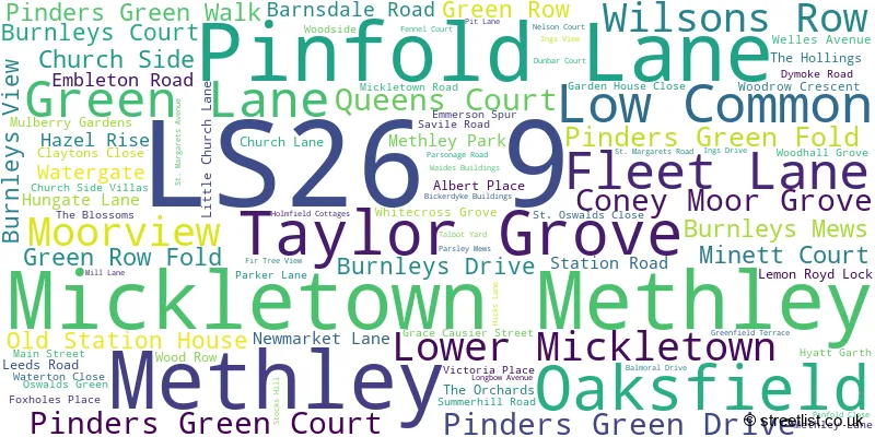
The largest settlements in the LS26 9 postal code are Methley and Mickletown Methley.
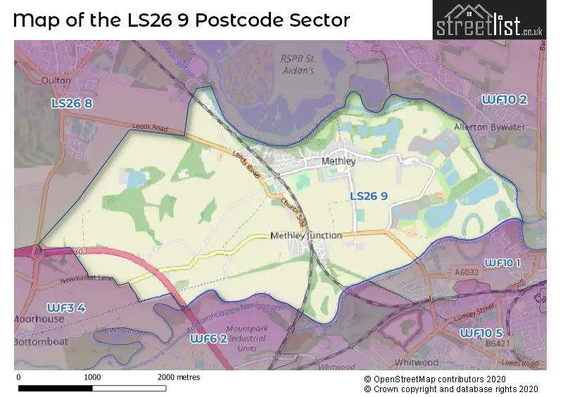
The LS26 9 Postcode shares a border with WF3 4 (Stanley, WAKEFIELD), WF10 1 (CASTLEFORD, Whitwood Mere), WF10 5 (CASTLEFORD, Cutsyke, Whitwood), WF6 2 (NORMANTON, Altofts), WF10 2 (Allerton Bywater, CASTLEFORD, Ledston) and LS26 8 (Woodlesford, Oulton, Swillington).
The sector is within the post town of LEEDS.
LS26 9 is a postcode sector within the LS26 postcode district which is within the LS Leeds postcode area.
The Royal Mail delivery office for the LS26 9 postal sector is the Garforth Delivery Office.
The area of the LS26 9 postcode sector is 4.77 square miles which is 12.36 square kilometres or 3,054.07 square acres.
The LS26 9 postcode sector is crossed by the M62 motorway.
Waterways within the LS26 9 postcode sector include the Aire and Calder Navigation, River Calder.

Map of the LS26 9 Postcode Sector
Explore the LS26 9 postcode sector by using our free interactive map.
| L | S | 2 | 6 | - | 9 | X | X |
| L | S | 2 | 6 | Space | 9 | Letter | Letter |
Official List of Streets
Methley (84 Streets)
Mickletown Methley (1 Streets)
Unofficial Streets or Alternative Spellings
House Prices in the LS26 9 Postcode Sector
| Type of Property | 2018 Average | 2018 Sales | 2017 Average | 2017 Sales | 2016 Average | 2016 Sales | 2015 Average | 2015 Sales |
|---|---|---|---|---|---|---|---|---|
| Detached | £341,770 | 40 | £288,130 | 51 | £273,666 | 18 | £285,615 | 15 |
| Semi-Detached | £197,709 | 50 | £175,870 | 33 | £162,698 | 29 | £148,870 | 27 |
| Terraced | £183,131 | 30 | £160,758 | 25 | £129,702 | 28 | £114,111 | 13 |
| Flats | £112,500 | 1 | £82,500 | 1 | £85,000 | 2 | £0 | 0 |
Important Postcodes LS26 9 in the Postcode Sector
LS26 9AA is the postcode for 23 Pinfold Lane, Mickletown Methley
LS26 9HT is the postcode for Methley Primary School, Savile Road, and Methley Primary School, Savile Road, Methley
| The LS26 9 Sector is within these Local Authorities |
|
|---|---|
| The LS26 9 Sector is within these Counties |
|
| The LS26 9 Sector is within these Water Company Areas |
|