The MK2 2 postcode sector is within the county of Buckinghamshire.
Did you know? According to the 2021 Census, the MK2 2 postcode sector is home to a bustling 8,047 residents!
Given that each sector allows for 400 unique postcode combinations. Letters C, I, K, M, O and V are not allowed in the last two letters of a postcode. With 209 postcodes already in use, this leaves 191 units available.
The MK2 2 postal code covers the settlement of Bletchley.
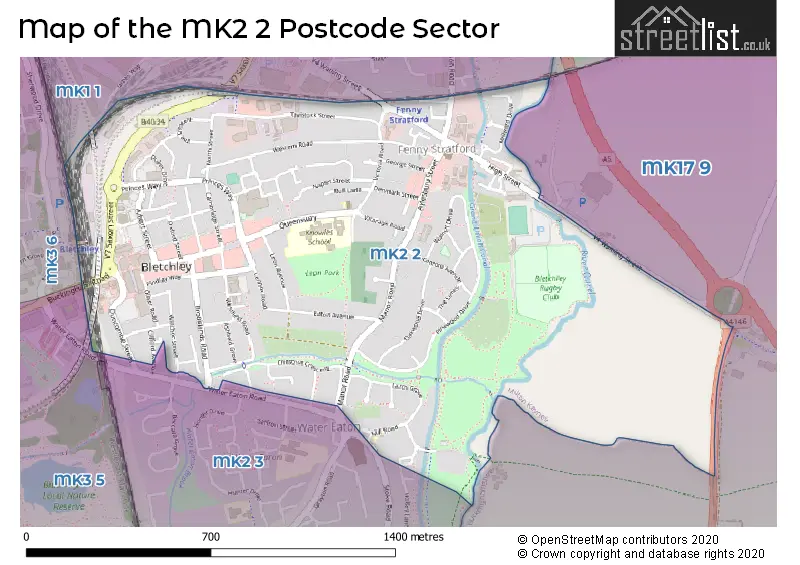
The MK2 2 Postcode shares a border with MK17 9 (Woburn, Stoke Hammond, Great Brickhill), MK1 1 (Bletchley, MILTON KEYNES), MK2 3 (Bletchley), MK3 5 (Bletchley) and MK3 6 (Bletchley).
The sector is within the post town of MILTON KEYNES.
MK2 2 is a postcode sector within the MK2 postcode district which is within the MK Milton Keynes postcode area.
The Royal Mail delivery office for the MK2 2 postal sector is the Bletchley Delivery Office.
The area of the MK2 2 postcode sector is 0.98 square miles which is 2.53 square kilometres or 625.48 square acres.
The MK2 2 postcode sector is crossed by the A5 Major A road.
Waterways within the MK2 2 postcode sector include the Grand Union Canal, Ouzel River.

Map of the MK2 2 Postcode Sector
Explore the MK2 2 postcode sector by using our free interactive map.
| M | K | 2 | - | 2 | X | X |
| M | K | 2 | Space | 2 | Letter | Letter |
Official List of Streets
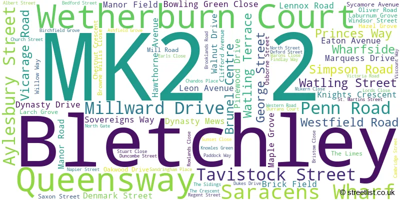
Bletchley (83 Streets)
Schools and Places of Education Within the MK2 2 Postcode Sector
Knowles Nursery School
Local authority nursery school
Queensway, Milton Keynes, Buckinghamshire, MK2 2HB
Head: Mrs Natalie Fowler
Ofsted Rating: Good
Inspection: 2022-07-19 (677 days ago)
Website: Visit Knowles Nursery School Website
Phone: 01908373753
Number of Pupils: 83
Knowles Primary School
Academy sponsor led
Queensway, Milton Keynes, Buckinghamshire, MK2 2HB
Head: Mrs S Rice
Ofsted Rating: Good
Inspection: 2023-10-04 (235 days ago)
Website: Visit Knowles Primary School Website
Phone: 01908373588
Number of Pupils: 311
House Prices in the MK2 2 Postcode Sector
| Type of Property | 2018 Average | 2018 Sales | 2017 Average | 2017 Sales | 2016 Average | 2016 Sales | 2015 Average | 2015 Sales |
|---|---|---|---|---|---|---|---|---|
| Detached | £393,895 | 19 | £321,111 | 9 | £301,871 | 14 | £252,803 | 16 |
| Semi-Detached | £291,461 | 56 | £247,319 | 41 | £234,471 | 33 | £216,798 | 33 |
| Terraced | £229,003 | 45 | £236,213 | 60 | £224,881 | 55 | £207,411 | 76 |
| Flats | £195,045 | 94 | £187,015 | 88 | £146,990 | 51 | £139,856 | 70 |
Important Postcodes MK2 2 in the Postcode Sector
MK2 2BE is the postcode for Bracknell House, Aylesbury Street
MK2 2DJ is the postcode for Westfield Road Surgery, 11 Westfield Road
MK2 2EH is the postcode for The Redhouse Surgery, 241 Queensway
MK2 2HB is the postcode for Knowles Junior School, Queensway, WOODLANDS, Knowles Primary School, Queensway, ORCHARDS, Knowles Primary School, Queensway, Knowles Infant School, Queensway, and EVERGREENS, Knowles Primary School, Queensway
MK2 2HP is the postcode for Bridge Academy South, Manor Road
MK2 2HQ is the postcode for Bletchley Leisure Centre, Princes Way
MK2 2JG is the postcode for Youth Offending Team, Oakwood Drive
MK2 2RA is the postcode for Bletchley Library, Westfield Road
| The MK2 2 Sector is within these Local Authorities |
|
|---|---|
| The MK2 2 Sector is within these Counties |
|
| The MK2 2 Sector is within these Water Company Areas |
|