This section of the site is all about the MK Postcode area, also known as the Milton Keynes Postal Area. Explore links to the next level to learn more about specific postcode districts such as MK1.
The MK postcode area represents a group of postal districts in the Milton Keynes area of the United Kingdom. The area code MK stands for the letters m and k in Milton Keynes. MK has a population of 507,978 and covers an area of 1,365,607 hectares. Fun fact: 0.78% of the population of Great Britain lives in this area.
The postcode area falls within the following counties: Buckinghamshire (60.34%), Bedfordshire (38.54%), Northamptonshire (1.00%), Oxfordshire (0.10%), Cambridgeshire (0.02%).
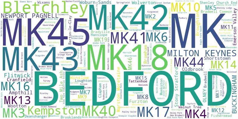
Post Towns and Postcode Districts for the MK Postcode
-
MK1 BuckinghamshireMK2 BuckinghamshireMK3 BuckinghamshireMK4 BuckinghamshireMK5 BuckinghamshireMK6 BuckinghamshireMK7 BuckinghamshireMK8 BuckinghamshireMK9 BuckinghamshireMK10 BuckinghamshireMK11 BuckinghamshireMK12 BuckinghamshireMK13 BuckinghamshireMK14 BuckinghamshireMK15 BuckinghamshireMK17 Bedfordshire (23%), Buckinghamshire (76%)MK19 Buckinghamshire (55%), Northamptonshire (44%)MK77
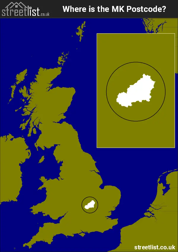
Where is the MK Postcode Area?
The MK Milton Keynes postcode has it's West in South East and it's West in Eastern England. The postal area borders the following neighbouring postal areas: PE - Peterborough, OX - Oxford, SG - Stevenage, NN - Northampton, HP - Hemel Hempstead and LU - Luton, and is located inland.
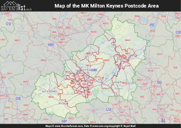
Map of the MK Milton Keynes Postcode Area
Explore the MK Milton Keynes postcode area by using our interactive map.
Postcode Districts within the MK Milton Keynes Postcode Area
There are 26 postcode districts within the Milton Keynes postcode area
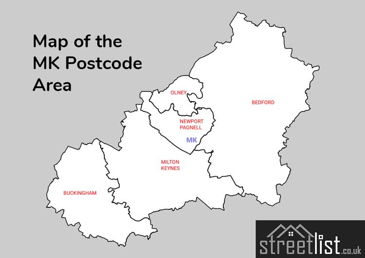
A map showing the boundary of in relation to other areas
There are 12 towns within the Milton Keynes postcode area.
| Unit | Area² |
|---|---|
| Hectares | 1,365,607² |
| Miles | 5,273² |
| Feet | 146,992,571,873² |
| Kilometres | 13,656² |
Postal Delivery Offices serving the MK Milton Keynes Postcode Area
- Ampthill Postal Delivery Office
- Aspley Guise Scale Payment Delivery Office
- Barton-le-clay Scale Payment Delivery Office
- Bedford Mk40-42 Delivery Office
- Bedford Mk41 Delivery Office
- Bedford Mk42 Delivery Office
- Bedford Rurals Delivery Office (mk)
- Bletchley Delivery Office
- Brinklow (mk) Postal Delivery Office
- Bromham Scale Payment Delivery Office
- Buckingham Delivery Office
- Carlton (mk) Scale Payment Delivery Office
- Castlethorpe Scale Payment Delivery Office
- Clapham (mk) Scale Payment Delivery Office
- Clophill Scale Payment Delivery Office
- Cosgrove Scale Payment Delivery Office
- Cranfield Scale Payment Delivery Office
- Deanshanger Scale Payment Delivery Office
- Great Barford Scale Payment Delivery Office
- Great Horwood Scale Payment Delivery Office
- Hanslope Scale Payment Delivery Office
- Harrold Scale Payment Delivery Office
- Kiln Farm Delivery Office
- Little Brickhill Scale Payment Delivery Office
- Marston Moreteyne Scale Payment Delivery Office
- Maulden Scale Payment Delivery Office
- Mursley Scale Payment Delivery Office
- Newport Pagnell Delivery Office
- Oakley Scale Payment Delivery Office
- Olney Postal Delivery Office
- Renhold Scale Payment Delivery Office
- Riseley (mk44) Scale Payment Delivery Office
- Sharnbrook Scale Payment Delivery Office
- Silsoe Scale Payment Delivery Office
- Steeple Clay Delivery Office N Scale Payment Delivery Office
- Stevington Scale Payment Delivery Office
- Thurleigh Scale Payment Delivery Office
- Turvey Scale Payment Delivery Office
- Willington Scale Payment Delivery Office
- Wilstead Scale Payment Delivery Office
- Winslow Postal Delivery Office
- Woburn Scale Payment Delivery Office
- Wootton Scale Payment Delivery Office
Councils with Postcodes in MK
Towns and Villages within the MK Milton Keynes Postcode Area
- Adstock - village
- Akeley - village
- Ampthill - town
- Aspley Guise - village
- Aspley Heath - village
- Astwood - village
- Barton-le-Clay - village
- Beachampton - village
- Bedford - town
- Bletchley - town
- Bletsoe - village
- Blunham - village
- Botolph Claydon - village
- Bow Brickhill - village
- Box End - village
- Brogborough - village
- Bromham - village
- Buckingham - town
- Calvert - village
- Calverton - village
- Cardington - village
- Carlton - village
- Castlethorpe - village
- Caulcott - village
- Chackmore - village
- Chawston - village
- Chellington - village
- Chicheley - village
- Clapham - village
- Clapham Green - village
- Clifton Reynes - village
- Clophill - village
- Cold Brayfield - village
- Colmworth - village
- Cople - village
- Cosgrove - village
- Cotton End - village
- Cranfield - village
- Dadford - village
- Deanshanger - village
- Drayton Parslow - village
- East Claydon - village
- Elstow - village
- Emberton - village
- Eversholt - otherSettlement
- Felmersham - village
- Finmere - village
- Flitton - village
- Flitwick - town
- Gawcott - village
- Gibraltar - village
- Granborough - village
- Great Barford - village
- Great Brickhill - village
- Great Denham - village
- Great Horwood - village
- Greenfield - village
- Hanslope - village
- Harrold - village
- Haversham - village
- Haynes - village
- Hillesden - village
- Hoggeston - village
- Houghton Conquest - village
- Husborne Crawley - village
- Kempston - town
- Kempston Hardwick - village
- Keysoe - village
- Keysoe Row - village
- Lathbury - village
- Lavendon - village
- Leckhampstead - village
- Lidlington - village
- Lillingstone Lovell - village
- Little Brickhill - village
- Little Horwood - village
- Little Odell - village
- Little Staughton - village
- Long Street - village
- Lower Shelton - village
- Maids Moreton - village
- Marston Moretaine - village
- Maulden - village
- Melchbourne - village
- Millbrook - village
- Milton Bryan - village
- Milton Ernest - village
- Milton Keynes - town
- Moggerhanger - village
- Moulsoe - village
- Mursley - village
- Nash - village
- Newport Pagnell - town
- Newton Blossomville - village
- Newton Longville - village
- Newton Purcell - village
- North Crawley - village
- North Marston - village
- Oakley - village
- Odell - village
- Old Stratford - village
- Olney - town
- Padbury - village
- Pavenham - village
- Pertenhall - village
- Preston Bissett - village
- Pulloxhill - village
- Radwell - village
- Ravensden - village
- Ravensden - village
- Ravenstone - village
- Renhold - village
- Ridgmont - village
- Riseley - village
- Roxton - village
- Salford - village
- Salph End - village
- Shalstone - village
- Sharnbrook - village
- Sherington - village
- Shortstown - village
- Silsoe - village
- Souldrop - village
- Stagsden - village
- Steeple Claydon - village
- Steppingley - village
- Stevington - village
- Stewartby - village
- Stoke Goldington - village
- Stoke Hammond - village
- Swanbourne - village
- Swineshead - village
- Thornborough - village
- Thurleigh - village
- Tingewick - village
- Tingrith - village
- Turvey - village
- Twyford - village
- Upper Gravenhurst - village
- Upper Shelton - village
- Wardhedges - village
- Water Stratford - village
- Wavendon - village
- Weston Underwood - village
- Westoning - village
- Whaddon - village
- Wharley End - village
- Wicken - village
- Wilden - village
- Willington - village
- Wilstead - village
- Winslow - town
- Woburn - town
- Woburn Sands - town
- Wood End - village
- Wootton - village
- Workhouse End - village
- Wyboston - village
- Yelden - village