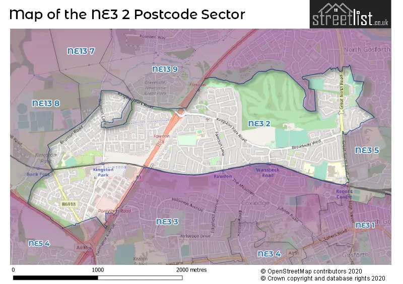
The NE3 2 postcode sector is within the county of Tyne & Wear.
Did you know? According to the 2021 Census, the NE3 2 postcode sector is home to a bustling 12,959 residents!
Given that each sector allows for 400 unique postcode combinations. Letters C, I, K, M, O and V are not allowed in the last two letters of a postcode. With 281 postcodes already in use, this leaves 119 units available.
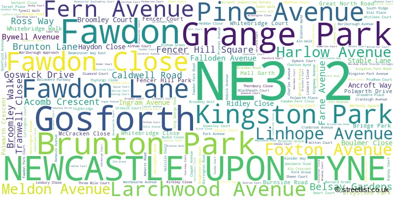
The largest settlement in the NE3 2 postal code is NEWCASTLE UPON TYNE followed by Gosforth, and Fawdon.
The NE3 2 Postcode shares a border with NE5 4 (NEWCASTLE UPON TYNE), NE13 8 (Kenton Bank Foot, Woolsington), NE3 3 (NEWCASTLE UPON TYNE, Gosforth), NE3 5 (NEWCASTLE UPON TYNE, Gosforth, High Gosforth Park), NE13 7 (Hazlerigg, Dinnington, Brunswick Village) and NE13 9 (NEWCASTLE UPON TYNE).
The sector is within the post town of NEWCASTLE UPON TYNE.
NE3 2 is a postcode sector within the NE3 postcode district which is within the NE Newcastle upon Tyne postcode area.
The Royal Mail delivery office for the NE3 2 postal sector is the Gosforth Delivery Office.
The area of the NE3 2 postcode sector is 1.52 square miles which is 3.95 square kilometres or 975.43 square acres.
The NE3 2 postcode sector is crossed by the A1 Major A road.
The NE3 2 postcode sector is crossed by the A696 Major A road.
Waterways within the NE3 2 postcode sector include the Ouseburn.

Map of the NE3 2 Postcode Sector
Explore the NE3 2 postcode sector by using our free interactive map.
| N | E | 3 | - | 2 | X | X |
| N | E | 3 | Space | 2 | Letter | Letter |
Official List of Streets
NEWCASTLE UPON TYNE (179 Streets)
Fawdon (11 Streets)
Gosforth (7 Streets)
Brunton Park (1 Streets)
Grange Park (1 Streets)
Kingston Park (4 Streets)
Unofficial Streets or Alternative Spellings
NEWCASTLE UPON TYNE
BRACKENSIDE BROADWAY EAST CELANDINE CLOSE CLAYWORTH ROAD FAIRWAY CLOSE LAYFIELD ROAD STRATHMORE ROAD THE FAIRWAYMelton Park
PARK DRIVEGosforth
GRANVILLE ROAD HIGH STREET HOLLYWOOD AVENUE BROADWAY COURT DORCHESTER PLACE EDEN PARK COURT KIRKHAM AVENUE KNIGHTSBRIDGE LANCING COURT TEDDINGTON CLOSE WANSBECK ROAD NORTH WHITEBRIDGE PARK WHITELEES COURTBrunton Park
PRINCES ROADBrunton Bridge
BRUNTON LANE FAWDON WALK WOODEND WAYCowgate
PONTELAND ROADKenton Bank Foot
BRUNTON ROADSchools and Places of Education Within the NE3 2 Postcode Sector
Gosforth Academy
Academy converter
Knightsbridge, Newcastle-upon-Tyne, Tyne and Wear, NE3 2JH
Head: Principal Preit Chahal
Ofsted Rating: Good
Inspection: 2022-06-23 (700 days ago)
Website: Visit Gosforth Academy Website
Phone: 01912851000
Number of Pupils: 1932
Grange First School
Foundation school
Norham Road, Newcastle-upon-Tyne, Tyne and Wear, NE3 2NP
Head: Mrs Clare Clougher
Ofsted Rating: Good
Inspection: 2021-11-24 (911 days ago)
Website: Visit Grange First School Website
Phone: 01912852954
Number of Pupils: 332
Kingston Park Primary School
Academy converter
Cranleigh Avenue, Newcastle-upon-Tyne, Tyne and Wear, NE3 2EL
Head: Mrs Jayne Evans
Ofsted Rating: Good
Inspection: 2019-10-23 (1674 days ago)
Website: Visit Kingston Park Primary School Website
Phone: 01912140363
Number of Pupils: 432
North Fawdon Primary School
Academy converter
Brotherlee Road, Newcastle-upon-Tyne, Tyne and Wear, NE3 2SL
Head: Mrs Emma Elliott
Ofsted Rating: Good
Inspection: 2019-07-05 (1784 days ago)
Website: Visit North Fawdon Primary School Website
Phone: 01912851350
Number of Pupils: 174
House Prices in the NE3 2 Postcode Sector
| Type of Property | 2018 Average | 2018 Sales | 2017 Average | 2017 Sales | 2016 Average | 2016 Sales | 2015 Average | 2015 Sales |
|---|---|---|---|---|---|---|---|---|
| Detached | £252,139 | 23 | £305,950 | 24 | £254,654 | 13 | £239,785 | 20 |
| Semi-Detached | £186,606 | 94 | £166,437 | 91 | £168,631 | 103 | £161,127 | 90 |
| Terraced | £163,043 | 79 | £157,795 | 63 | £153,175 | 64 | £150,462 | 63 |
| Flats | £97,245 | 46 | £120,361 | 42 | £107,634 | 35 | £95,753 | 43 |
Important Postcodes NE3 2 in the Postcode Sector
NE3 2EL is the postcode for Kingston Park Primary School, Cranleigh Avenue
NE3 2JH is the postcode for Gosforth Academy, Knightsbridge, and Gosforth Academy, Knightsbridge, Great North Road
NE3 2NP is the postcode for Grange First School, Norham Road
NE3 2SL is the postcode for KITCHEN & DINING, North Fawdon Primary School, Brotherlee Road, and North Fawdon Primary School, Brotherlee Road
| The NE3 2 Sector is within these Local Authorities |
|
|---|---|
| The NE3 2 Sector is within these Counties |
|
| The NE3 2 Sector is within these Water Company Areas |
|