The NE30 1 postcode sector is within the county of Tyne & Wear.
Did you know? According to the 2021 Census, the NE30 1 postcode sector is home to a bustling 1,495 residents!
Given that each sector allows for 400 unique postcode combinations. Letters C, I, K, M, O and V are not allowed in the last two letters of a postcode. With 99 postcodes already in use, this leaves 301 units available.
The NE30 1 postal code covers the settlement of NORTH SHIELDS.
The NE30 1 Postcode shares a border with NE29 0 (NORTH SHIELDS), NE30 2 (NORTH SHIELDS), NE29 6 (NORTH SHIELDS, Percy Main, Smiths Dock) and NE30 4 (NORTH SHIELDS, Tynemouth, Cullercoats).
The sector is within the post town of NORTH SHIELDS.
NE30 1 is a postcode sector within the NE3 postcode district which is within the NE Newcastle upon Tyne postcode area.
The Royal Mail delivery office for the NE30 1 postal sector is the Gosforth Delivery Office.
The area of the NE30 1 postcode sector is 0.19 square miles which is 0.49 square kilometres or 120.46 square acres.

Map of the NE30 1 Postcode Sector
Explore the NE30 1 postcode sector by using our free interactive map.
| N | E | 3 | 0 | - | 1 | X | X |
| N | E | 3 | 0 | Space | 1 | Letter | Letter |
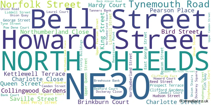
Official List of Streets
NORTH SHIELDS (52 Streets)
Unofficial Streets or Alternative Spellings
NORTH SHIELDS
ALBION ROAD BACK ALBION ROAD BEDFORD STREET CHURCH WAY COBURG STREET LINSKILL TERRACE NORTH CHURCH STREET NORTH KING STREET UNION ROAD WASHINGTON TERRACE WEST PERCY STREET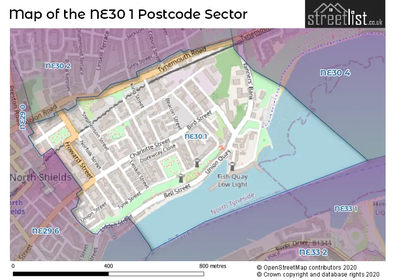
House Prices in the NE30 1 Postcode Sector
| Type of Property | 2018 Average | 2018 Sales | 2017 Average | 2017 Sales | 2016 Average | 2016 Sales | 2015 Average | 2015 Sales |
|---|---|---|---|---|---|---|---|---|
| Detached | £0 | 0 | £0 | 0 | £0 | 0 | £210,000 | 1 |
| Semi-Detached | £161,213 | 4 | £250,000 | 1 | £165,317 | 3 | £208,988 | 4 |
| Terraced | £283,875 | 4 | £203,000 | 7 | £214,500 | 9 | £215,750 | 6 |
| Flats | £129,429 | 7 | £108,685 | 46 | £121,000 | 12 | £128,144 | 9 |
Important Postcodes NE30 1 in the Postcode Sector
NE30 1AB is the postcode for Northumbria Police, North Shields Police Station, Upper Pearson Street, and Northumbria Police, Police Station, Upper Pearson Street
NE30 1AG is the postcode for Clerk to the Justices, The Courthouse, Tynemouth Road
NE30 1BB is the postcode for Unicorn House, Suez Street
NE30 1DL is the postcode for North Tyneside Youth Village, Hudson Street, and North Tyneside Youth Village, Phase 2
NE30 1EX is the postcode for County Court, Northumbria House, Norfolk Street
NE30 1ND is the postcode for Jobcentre Plus, Camden Street
NE30 1NT is the postcode for North Tyneside Business Centre, 54a Saville Street, North Tyneside Business Centre North Shields, Howard House, 54 Saville Street, 54a, Saville Street, and North Tyneside Business Centre, 54a, Saville Street
NE30 1QA is the postcode for North Tyneside Council, Stephenson House, Stephenson Street
NE30 1QU is the postcode for North Tyneside Council, Central Library, Northumberland Square, and NORTH SHIELDS CUSTOMER FIRST CENTRE, NORTHUMBERLAND SQUARE, NORTH SHIELDS
| The NE30 1 Sector is within these Local Authorities |
|
|---|---|
| The NE30 1 Sector is within these Counties |
|
| The NE30 1 Sector is within these Water Company Areas |
|