The NE47 5 postcode sector is within the county of Northumberland.
Did you know? According to the 2021 Census, the NE47 5 postcode sector is home to a bustling 1,142 residents!
Given that each sector allows for 400 unique postcode combinations. Letters C, I, K, M, O and V are not allowed in the last two letters of a postcode. With 78 postcodes already in use, this leaves 322 units available.
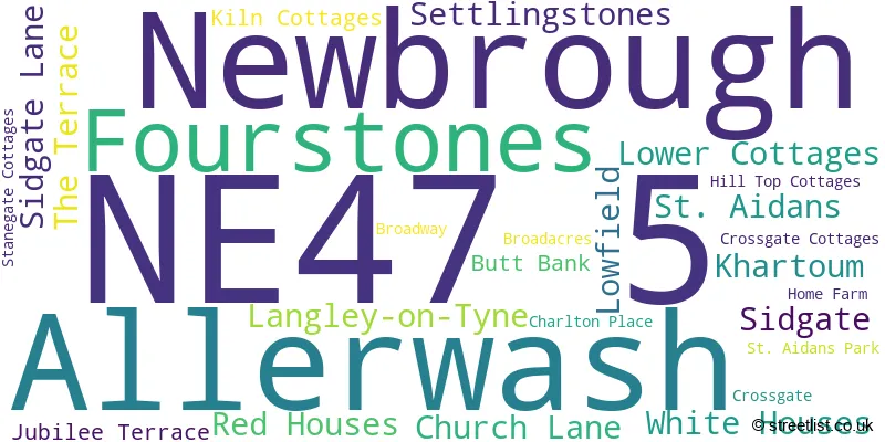
The largest settlement in the NE47 5 postal code is Newbrough followed by Fourstones, and Langley-on-Tyne.
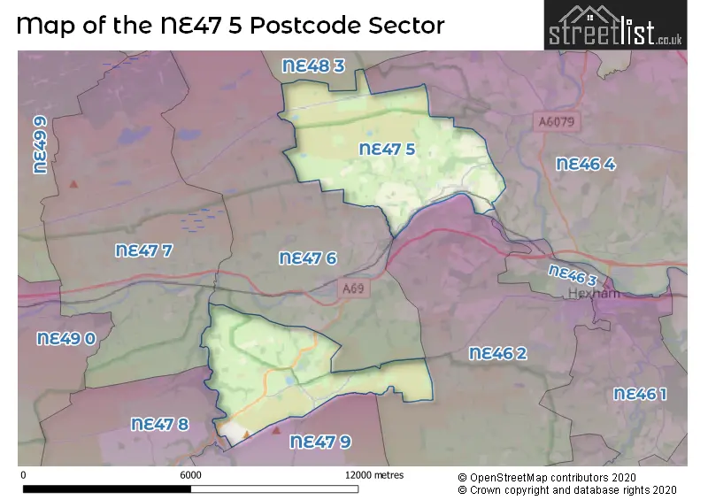
The NE47 5 Postcode shares a border with NE46 2 (HEXHAM), NE47 8 (Whitfield, Carrshield, Ninebanks), NE47 9 (Allendale, Catton, Allenheads), NE48 3 (Wark, Birtley, Simonburn), NE46 4 (Acomb, Humshaugh, HEXHAM), NE47 6 (Haydon Bridge, Chesterwood) and NE47 7 (Bardon Mill, Henshaw, Redburn).
The sector is within the post town of HEXHAM.
NE47 5 is a postcode sector within the NE47 postcode district which is within the NE Newcastle upon Tyne postcode area.
The Royal Mail delivery office for the NE47 5 postal sector is the Hexham Delivery Office.
The area of the NE47 5 postcode sector is 18.39 square miles which is 47.63 square kilometres or 11,769.12 square acres.
Waterways within the NE47 5 postcode sector include the River South Tyne.

Map of the NE47 5 Postcode Sector
Explore the NE47 5 postcode sector by using our free interactive map.
| N | E | 4 | 7 | - | 5 | X | X |
| N | E | 4 | 7 | Space | 5 | Letter | Letter |
Official List of Streets
Fourstones (9 Streets)
Newbrough (9 Streets)
Allerwash (1 Streets)
Langley-on-Tyne (1 Streets)
Settlingstones (2 Streets)
Unofficial Streets or Alternative Spellings
House Prices in the NE47 5 Postcode Sector
| Type of Property | 2018 Average | 2018 Sales | 2017 Average | 2017 Sales | 2016 Average | 2016 Sales | 2015 Average | 2015 Sales |
|---|---|---|---|---|---|---|---|---|
| Detached | £408,333 | 3 | £416,500 | 3 | £309,000 | 2 | £223,895 | 3 |
| Semi-Detached | £0 | 0 | £280,000 | 2 | £166,714 | 7 | £250,000 | 1 |
| Terraced | £330,490 | 4 | £150,490 | 5 | £216,862 | 10 | £251,500 | 6 |
| Flats | £0 | 0 | £0 | 0 | £0 | 0 | £81,000 | 1 |
Important Postcodes NE47 5 in the Postcode Sector
NE47 5AQ is the postcode for Newbrough C of E First School, Newbrough, and Newbrough C Of E First School, Stanegate Road Through Newbrough
| The NE47 5 Sector is within these Local Authorities |
|
|---|---|
| The NE47 5 Sector is within these Counties |
|
| The NE47 5 Sector is within these Water Company Areas |
|