The NE48 4 postcode sector is within the county of Northumberland.
Did you know? According to the 2021 Census, the NE48 4 postcode sector is home to a bustling 541 residents!
Given that each sector allows for 400 unique postcode combinations. Letters C, I, K, M, O and V are not allowed in the last two letters of a postcode. With 45 postcodes already in use, this leaves 355 units available.
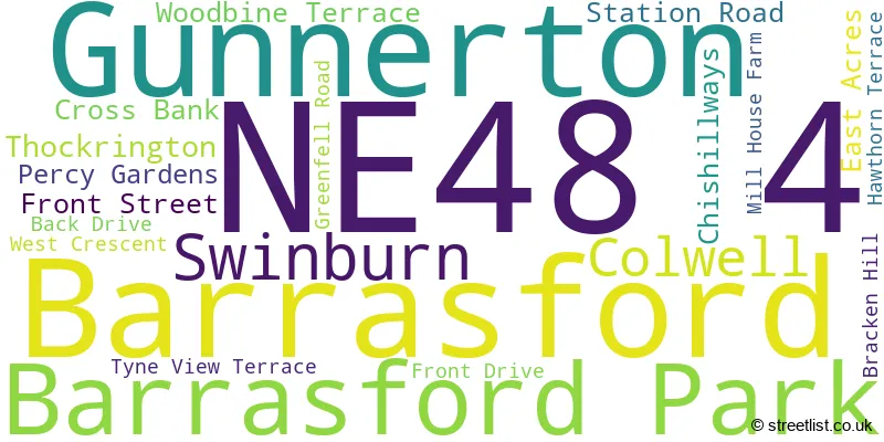
The largest settlement in the NE48 4 postal code is Barrasford followed by Gunnerton, and Barrasford Park.
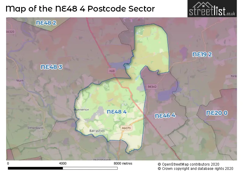
The NE48 4 Postcode shares a border with NE48 3 (Wark, Birtley, Simonburn), NE19 2 (Kirkwhelpington, Capheaton, Great Whittington) and NE46 4 (Acomb, Humshaugh, HEXHAM).
The sector is within the post town of HEXHAM.
NE48 4 is a postcode sector within the NE48 postcode district which is within the NE Newcastle upon Tyne postcode area.
The Royal Mail delivery office for the NE48 4 postal sector is the Hexham Delivery Office.
The area of the NE48 4 postcode sector is 11.76 square miles which is 30.45 square kilometres or 7,524.49 square acres.

Map of the NE48 4 Postcode Sector
Explore the NE48 4 postcode sector by using our free interactive map.
| N | E | 4 | 8 | - | 4 | X | X |
| N | E | 4 | 8 | Space | 4 | Letter | Letter |
Official List of Streets
Barrasford Park (2 Streets)
Gunnerton (5 Streets)
Unofficial Streets or Alternative Spellings
Schools and Places of Education Within the NE48 4 Postcode Sector
Chollerton Church of England Aided First School
Voluntary aided school
Station Road, Hexham, Northumberland, NE48 4AA
Head: Mrs Hazel Davey
Ofsted Rating: Good
Inspection: 2018-11-21 (2010 days ago)
Website: Visit Chollerton Church of England Aided First School Website
Phone: 01434681572
Number of Pupils: 39
House Prices in the NE48 4 Postcode Sector
| Type of Property | 2018 Average | 2018 Sales | 2017 Average | 2017 Sales | 2016 Average | 2016 Sales | 2015 Average | 2015 Sales |
|---|---|---|---|---|---|---|---|---|
| Detached | £0 | 0 | £297,500 | 2 | £300,000 | 1 | £0 | 0 |
| Semi-Detached | £181,375 | 4 | £125,000 | 1 | £150,000 | 1 | £151,000 | 1 |
| Terraced | £336,000 | 1 | £0 | 0 | £185,000 | 1 | £260,000 | 1 |
| Flats | £0 | 0 | £0 | 0 | £0 | 0 | £0 | 0 |
| The NE48 4 Sector is within these Local Authorities |
|
|---|---|
| The NE48 4 Sector is within these Counties |
|
| The NE48 4 Sector is within these Water Company Areas |
|