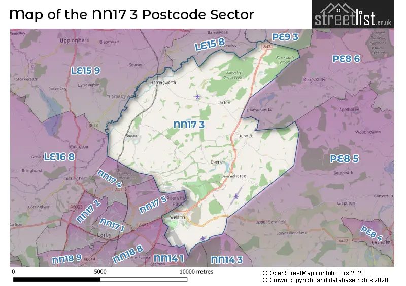
The NN17 3 postcode sector stands on the Northamptonshire and Rutland border.
Did you know? According to the 2021 Census, the NN17 3 postcode sector is home to a bustling 5,513 residents!
Given that each sector allows for 400 unique postcode combinations. Letters C, I, K, M, O and V are not allowed in the last two letters of a postcode. With 143 postcodes already in use, this leaves 257 units available.
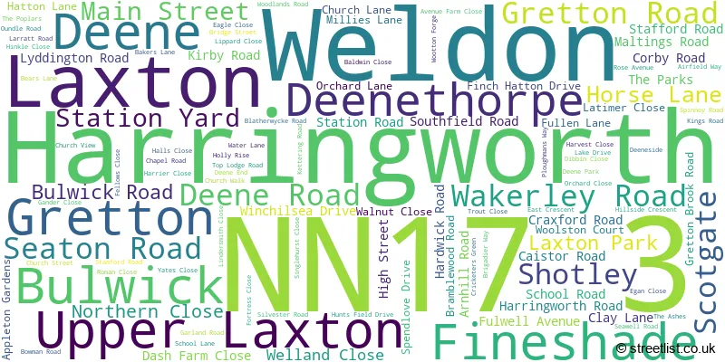
The largest settlement in the NN17 3 postal code is Weldon followed by Gretton, and Harringworth.
The NN17 3 Postcode shares a border with LE15 8 (Empingham, Edith Weston, North Luffenham), NN14 3 (Brigstock, Islip, Titchmarsh), NN14 1 (Broughton, Mawsley, Geddington), NN17 4 (Earlstrees Industrial Estate, CORBY), NN17 5 (CORBY, Willowbrook East Industrial Estate, Weldon North Industrial Estate), NN18 8 (CORBY, Great Oakley, St. James Industrial Estate), PE8 5 (Barnwell, Oundle, Polebrook), PE8 6 (Wittering, Kings Cliffe, Warmington), PE9 3 (Ketton, Easton On The Hill, Barnack), LE15 9 (Uppingham, Belton In Rutland, Lyddington) and LE16 8 (MARKET HARBOROUGH, Cottingham, Great Easton).
The sector is within the post town of CORBY.
NN17 3 is a postcode sector within the NN17 postcode district which is within the NN Northampton postcode area.
The Royal Mail delivery office for the NN17 3 postal sector is the Corby Delivery Office.
The area of the NN17 3 postcode sector is 29.48 square miles which is 76.35 square kilometres or 18,865.88 square acres.

Map of the NN17 3 Postcode Sector
Explore the NN17 3 postcode sector by using our free interactive map.
| N | N | 1 | 7 | - | 3 | X | X |
| N | N | 1 | 7 | Space | 3 | Letter | Letter |
Official List of Streets
Weldon (61 Streets)
Gretton (32 Streets)
Bulwick (5 Streets)
Laxton (4 Streets)
Deene (2 Streets)
Harringworth (7 Streets)
Fineshade (1 Streets)
Unofficial Streets or Alternative Spellings
CORBY
BIRKDALE DRIVE CARNOUSTIE DRIVE DUKE ROAD KESTREL ROAD LONDON ROAD MERLIN ROAD MICHAELS DRIVE PARK VIEW PRESTOE CLOSE THE AVENUEGeddington
STAMFORD ROADEarlstrees Industrial Estate
GRETTON BROOK ROADSchools and Places of Education Within the NN17 3 Postcode Sector
Gretton Primary Academy
Academy converter
Kirby Road, Corby, Northamptonshire, NN17 3DB
Head: Mrs Julia Dickinson
Ofsted Rating: Good
Inspection: 2020-01-29 (1586 days ago)
Website: Visit Gretton Primary Academy Website
Phone: 01536770366
Number of Pupils: 143
Weldon Church of England Primary School
Academy converter
Chapel Road, Corby, Northamptonshire, NN17 3HP
Head: Mrs Kirstin Howarth
Ofsted Rating: Good
Inspection: 2022-06-22 (711 days ago)
Website: Visit Weldon Church of England Primary School Website
Phone: 01536265288
Number of Pupils: 203
House Prices in the NN17 3 Postcode Sector
| Type of Property | 2018 Average | 2018 Sales | 2017 Average | 2017 Sales | 2016 Average | 2016 Sales | 2015 Average | 2015 Sales |
|---|---|---|---|---|---|---|---|---|
| Detached | £321,761 | 89 | £416,027 | 107 | £310,582 | 56 | £322,867 | 65 |
| Semi-Detached | £208,275 | 69 | £201,394 | 57 | £189,434 | 32 | £188,205 | 19 |
| Terraced | £200,500 | 8 | £235,363 | 11 | £226,038 | 12 | £222,860 | 12 |
| Flats | £135,000 | 1 | £111,747 | 6 | £110,333 | 6 | £107,225 | 2 |
Important Postcodes NN17 3 in the Postcode Sector
NN17 3HP is the postcode for Weldon C of E Primary School, Chapel Road
NN17 3JH is the postcode for Priors Hall Golf Club, Stamford Road
| The NN17 3 Sector is within these Local Authorities |
|
|---|---|
| The NN17 3 Sector is within these Counties |
|
| The NN17 3 Sector is within these Water Company Areas |
|
Tourist Attractions within the NN17 3 Postcode Area
We found 2 visitor attractions within the NN17 postcode area
| Kirby Hall |
|---|
| Historic Properties |
| Historic House / House and Garden / Palace |
| View Kirby Hall on Google Maps |
| Top Lodge, Fineshade Woods |
| Country Parks |
| Country Park |
| View Top Lodge, Fineshade Woods on Google Maps |