The NN17 4 postcode sector is within the county of Northamptonshire.
Did you know? According to the 2021 Census, the NN17 4 postcode sector is home to a bustling 643 residents!
Given that each sector allows for 400 unique postcode combinations. Letters C, I, K, M, O and V are not allowed in the last two letters of a postcode. With 35 postcodes already in use, this leaves 365 units available.
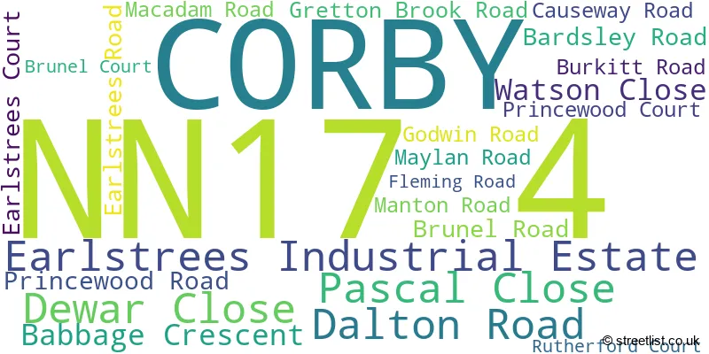
The largest settlements in the NN17 4 postal code are Earlstrees Industrial Estate and CORBY.
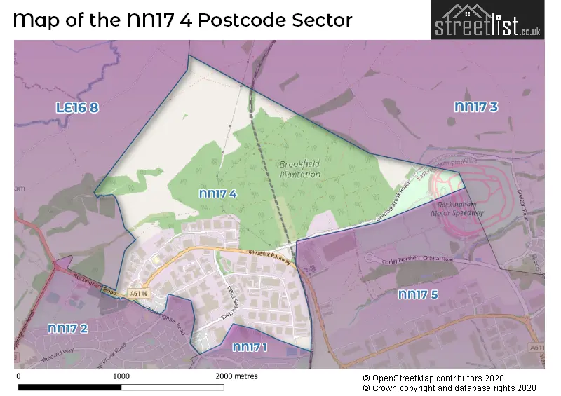
The NN17 4 Postcode shares a border with NN17 1 (CORBY), NN17 2 (CORBY), NN17 3 (Weldon, Gretton, Harringworth), NN17 5 (CORBY, Willowbrook East Industrial Estate, Weldon North Industrial Estate) and LE16 8 (MARKET HARBOROUGH, Cottingham, Great Easton).
The sector is within the post town of CORBY.
NN17 4 is a postcode sector within the NN17 postcode district which is within the NN Northampton postcode area.
The Royal Mail delivery office for the NN17 4 postal sector is the Corby Delivery Office.
The area of the NN17 4 postcode sector is 1.94 square miles which is 5.02 square kilometres or 1,239.76 square acres.

Map of the NN17 4 Postcode Sector
Explore the NN17 4 postcode sector by using our free interactive map.
| N | N | 1 | 7 | - | 4 | X | X |
| N | N | 1 | 7 | Space | 4 | Letter | Letter |
Official List of Streets
CORBY (7 Streets)
Earlstrees Industrial Estate (15 Streets)
Unofficial Streets or Alternative Spellings
House Prices in the NN17 4 Postcode Sector
| Type of Property | 2018 Average | 2018 Sales | 2017 Average | 2017 Sales | 2016 Average | 2016 Sales | 2015 Average | 2015 Sales |
|---|---|---|---|---|---|---|---|---|
| Detached | £249,950 | 1 | £216,498 | 2 | £0 | 0 | £180,375 | 4 |
| Semi-Detached | £196,857 | 7 | £183,000 | 1 | £174,167 | 6 | £156,417 | 6 |
| Terraced | £176,083 | 6 | £152,890 | 5 | £139,917 | 6 | £150,833 | 3 |
| Flats | £123,167 | 3 | £112,750 | 4 | £96,583 | 6 | £86,800 | 5 |
Important Postcodes NN17 4 in the Postcode Sector
NN17 4SW is the postcode for 10 Fleming Road, Earlstrees Industrial Estate
| The NN17 4 Sector is within these Local Authorities |
|
|---|---|
| The NN17 4 Sector is within these Counties |
|
| The NN17 4 Sector is within these Water Company Areas |
|