The OL2 5 postcode sector is within the county of Greater Manchester.
Did you know? According to the 2021 Census, the OL2 5 postcode sector is home to a bustling 9,969 residents!
Given that each sector allows for 400 unique postcode combinations. Letters C, I, K, M, O and V are not allowed in the last two letters of a postcode. With 259 postcodes already in use, this leaves 141 units available.
The OL2 5 postal code covers the settlement of Royton.
The OL2 5 Postcode shares a border with OL11 2 (ROCHDALE), M24 2 (Middleton), OL1 2 (OLDHAM, Chadderton) and OL2 6 (Royton).
The sector is within the post town of OLDHAM.
OL2 5 is a postcode sector within the OL2 postcode district which is within the OL Oldham postcode area.
The Royal Mail delivery office for the OL2 5 postal sector is the Oldham Delivery Office.
The area of the OL2 5 postcode sector is 1.62 square miles which is 4.18 square kilometres or 1,033.65 square acres.
The OL2 5 postcode sector is crossed by the A627M Major A road.

Map of the OL2 5 Postcode Sector
Explore the OL2 5 postcode sector by using our free interactive map.
| O | L | 2 | - | 5 | X | X |
| O | L | 2 | Space | 5 | Letter | Letter |
Official List of Streets
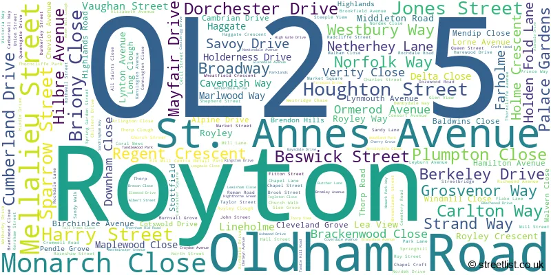
Royton (178 Streets)
Unofficial Streets or Alternative Spellings
Royton
BERKELEY STREET CAMPANIA STREET DOGFORD ROAD FIR BANK ROAD GRASMERE ROAD HIGH BARN STREET MOUNT STREET OLD EDGE LANE SCHOFIELD STREET SEVILLE STREET SPRINGFIELD LANE THORNHAM LANEROCHDALE
OLDHAM ROADOLDHAM
CHADDERTON WAYChadderton
BROADWAY BURNLEY LANE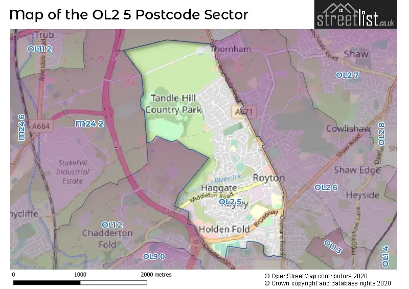
House Prices in the OL2 5 Postcode Sector
| Type of Property | 2018 Average | 2018 Sales | 2017 Average | 2017 Sales | 2016 Average | 2016 Sales | 2015 Average | 2015 Sales |
|---|---|---|---|---|---|---|---|---|
| Detached | £293,444 | 27 | £272,762 | 34 | £251,923 | 13 | £239,235 | 17 |
| Semi-Detached | £158,306 | 54 | £149,551 | 73 | £144,666 | 71 | £137,762 | 54 |
| Terraced | £120,752 | 63 | £106,758 | 57 | £117,504 | 54 | £107,188 | 43 |
| Flats | £87,667 | 6 | £80,744 | 8 | £76,400 | 5 | £88,333 | 9 |
Important Postcodes OL2 5 in the Postcode Sector
OL2 5BF is the postcode for E-Act Oldham Academy North, Broadway, Royton, SPORTS HALL, E-Act Oldham Academy North, Broadway, and E-Act Oldham Academy North, Broadway
OL2 5DH is the postcode for St. Annes C of E School, Ormerod Avenue, and St. Annes C of E School, Ormerod Avenue, Royton
OL2 5DL is the postcode for SCIENCE & TECHNOLOGY BLOCK, Our Ladys RC High School, Vaughan Street, BROADWAY BLOCK, Our Ladys RC High School, Vaughan Street, SIXTH FORM & LIBRARY BLOCK, Our Ladys RC High School, Vaughan Street, and VAUGHAN BUILDING, Our Ladys RC High School, Vaughan Street
OL2 5LU is the postcode for St. Pauls C E Primary School, Hindle Drive, and MAIN BUILDING, St. Pauls C E Primary School, Hindle Drive
OL2 5PQ is the postcode for SS Aidan and Oswald RC Primary School, Roman Road, MAIN BUILDING, SS Aidan and Oswald RC Primary School, Roman Road, and NEW HALL, SS Aidan and Oswald RC Primary School, Roman Road
OL2 5QB is the postcode for Royton Health Centre, Rochdale Road
OL2 5TY is the postcode for Thorp Primary School, Westerdale Drive, and Thorp Primary School, Westerdale Drive, Royton
| The OL2 5 Sector is within these Local Authorities |
|
|---|---|
| The OL2 5 Sector is within these Counties |
|
| The OL2 5 Sector is within these Water Company Areas |
|