The OL2 8 postcode sector is within the county of Greater Manchester.
Did you know? According to the 2021 Census, the OL2 8 postcode sector is home to a bustling 7,985 residents!
Given that each sector allows for 400 unique postcode combinations. Letters C, I, K, M, O and V are not allowed in the last two letters of a postcode. With 229 postcodes already in use, this leaves 171 units available.
The OL2 8 postal code covers the settlement of Shaw.
The OL2 8 Postcode shares a border with OL2 7 (Shaw), OL1 4 (OLDHAM), OL2 6 (Royton), OL3 5 (Delph, Diggle, Dobcross), OL16 3 (Milnrow, Newhey, ROCHDALE) and OL16 4 (ROCHDALE, Milnrow, Newhey).
The sector is within the post town of OLDHAM.
OL2 8 is a postcode sector within the OL2 postcode district which is within the OL Oldham postcode area.
The Royal Mail delivery office for the OL2 8 postal sector is the Oldham Delivery Office.
The area of the OL2 8 postcode sector is 1.81 square miles which is 4.69 square kilometres or 1,158.37 square acres.

Map of the OL2 8 Postcode Sector
Explore the OL2 8 postcode sector by using our free interactive map.
| O | L | 2 | - | 8 | X | X |
| O | L | 2 | Space | 8 | Letter | Letter |
Official List of Streets
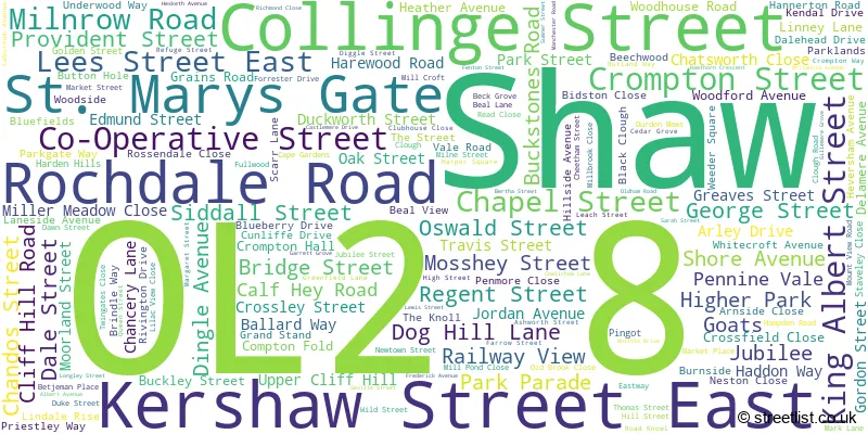
Shaw (157 Streets)
Unofficial Streets or Alternative Spellings
Shaw
BICKERSTAFFE CLOSE BUTTON HOLE CHURCH ROAD CO-OPERATIVE STREET CROMPTON HALL CYRIL STREET MOOR STREET PRINCESS ROAD SALTS STREET SCOWCROFT LANE SMALLBROOK ROAD SOCIETY STREET ASHWORTH COURT BEAL RIVERSIDE WALK BIRSHAW CLOSE CROSS FIELD CLOSE DUNWOOD PARK COURTS DUNWOODS PARK COURTS FARROW STREET EAST GARRET GROVE KNOWL ROAD MILL COTTAGE MOORLANDS STREET MOSS HEY STREET SAINT MARYS GATE WESTWAYRoyton
HEYSIDE MARCHES CLOSE OLDHAM ROAD OTMOOR WAY SHAW ROADMilnrow
MILNROW ROADBurnedge
ROCHDALE ROAD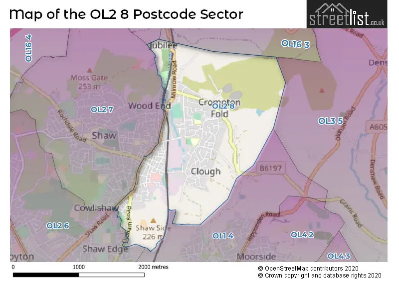
House Prices in the OL2 8 Postcode Sector
| Type of Property | 2018 Average | 2018 Sales | 2017 Average | 2017 Sales | 2016 Average | 2016 Sales | 2015 Average | 2015 Sales |
|---|---|---|---|---|---|---|---|---|
| Detached | £274,760 | 20 | £276,896 | 24 | £290,719 | 18 | £258,000 | 10 |
| Semi-Detached | £160,145 | 33 | £161,408 | 37 | £151,179 | 43 | £143,073 | 30 |
| Terraced | £100,556 | 69 | £102,637 | 60 | £97,521 | 60 | £94,165 | 62 |
| Flats | £82,000 | 1 | £64,000 | 2 | £67,000 | 3 | £75,500 | 2 |
Important Postcodes OL2 8 in the Postcode Sector
OL2 8AX is the postcode for East Crompton St Georges C Of E Primary School, George Street
OL2 8HG is the postcode for East Crompton St. Georges C of E Primary School, George Street
OL2 8HN is the postcode for Buckstones Primary School, Delamere Avenue, and Buckstones Primary School, Delamere Avenue, Shaw
OL2 8NR is the postcode for Coach & Horses, 1 Market Street
OL2 8NW is the postcode for Crompton Swimming Pool, 5 Farrow Street
OL2 8QY is the postcode for Oldham Council, Crompton Library, 7 Farrow Street
OL2 8ST is the postcode for Crompton Health Centre, High Street
OL2 8SZ is the postcode for St. Josephs RC Primary School, Oldham Road, Shaw, and St. Josephs RC Primary School, Oldham Road
OL2 8TB is the postcode for Shaw Lifelong Learning Centre, Shaw Centre, High Street
| The OL2 8 Sector is within these Local Authorities |
|
|---|---|
| The OL2 8 Sector is within these Counties |
|
| The OL2 8 Sector is within these Water Company Areas |
|