The RM17 6 postcode sector is within the county of Essex.
Did you know? According to the 2021 Census, the RM17 6 postcode sector is home to a bustling 15,753 residents!
Given that each sector allows for 400 unique postcode combinations. Letters C, I, K, M, O and V are not allowed in the last two letters of a postcode. With 245 postcodes already in use, this leaves 155 units available.
The RM17 6 postal code covers the settlement of GRAYS.
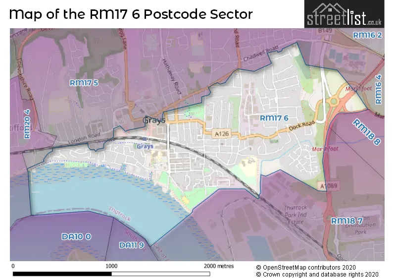
The RM17 6 Postcode shares a border with RM16 4 (GRAYS, Chadwell St. Mary), RM20 4 (WEST THURROCK , SOUTH STIFFORD ), RM17 5 (GRAYS, Badgers Dene), RM18 7 (TILBURY) and RM18 8 (TILBURY, East Tilbury, West Tilbury).
The sector is within the post town of GRAYS.
RM17 6 is a postcode sector within the RM17 postcode district which is within the RM Romford postcode area.
The Royal Mail delivery office for the RM17 6 postal sector is the Grays Delivery Office.
The area of the RM17 6 postcode sector is 0.94 square miles which is 2.44 square kilometres or 603.29 square acres.
The RM17 6 postcode sector is crossed by the A1089 Major A road.

Map of the RM17 6 Postcode Sector
Explore the RM17 6 postcode sector by using our free interactive map.
| R | M | 1 | 7 | - | 6 | X | X |
| R | M | 1 | 7 | Space | 6 | Letter | Letter |
Official List of Streets
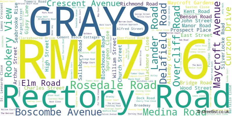
GRAYS (125 Streets)
Unofficial Streets or Alternative Spellings
GRAYS
BRADLEIGH AVENUE HASTINGS CLOSE HIGHGROVE MEWS MALVERN ROAD ORSETT ROAD WHARF ROAD WOULDHAM ROADGRAYS,
DOCK ROAD LONDON ROADSchools and Places of Education Within the RM17 6 Postcode Sector
Thameside Primary School
Academy sponsor led
Manor Road, Grays, Essex, RM17 6EF
Head: Mrs Joanna Bray
Ofsted Rating: Good
Inspection: 2018-10-02 (2060 days ago)
Website: Visit Thameside Primary School Website
Phone: 01375372188
Number of Pupils: 857
House Prices in the RM17 6 Postcode Sector
| Type of Property | 2018 Average | 2018 Sales | 2017 Average | 2017 Sales | 2016 Average | 2016 Sales | 2015 Average | 2015 Sales |
|---|---|---|---|---|---|---|---|---|
| Detached | £406,727 | 11 | £403,181 | 11 | £343,143 | 7 | £316,303 | 19 |
| Semi-Detached | £318,359 | 32 | £289,883 | 37 | £304,731 | 26 | £256,718 | 32 |
| Terraced | £258,636 | 96 | £251,845 | 102 | £240,842 | 131 | £206,249 | 127 |
| Flats | £181,696 | 116 | £171,450 | 128 | £160,640 | 143 | £134,121 | 148 |
Important Postcodes RM17 6 in the Postcode Sector
RM17 6DN is the postcode for Adult Community College, Richmond Road, and THURROCK ADULT COMMUNITY COLLEGE, Adult Community College, Richmond Road
RM17 6EF is the postcode for Thameside Infant School, Manor Road, Thameside County Junior School, Manor Road, Thameside Primary School, Manor Road, LOWER BUILDING, Thameside Primary School, Manor Road, UPPER BUILDING, Thameside Primary School, Manor Road, and MAIN BUILDING, Thameside Primary School, Manor Road
RM17 6NF is the postcode for Wrightsure House, 62 Maidstone Road
RM17 6QQ is the postcode for Jobcentre Plus, 2 Derby Road
RM17 6SL is the postcode for CIVIC BUILDING 2, Thurrock Borough Council, Civic Offices, New Road, CIVIC BUILDING 1, Thurrock Borough Council, Civic Offices, New Road, and COMBINED CIVIC BUILDINGS, Thurrock Borough Council, Civic Offices, New Road
RM17 6SP is the postcode for Medical Centre, 34 East Thurrock Road
RM17 6TF is the postcode for EAST BLOCK, South Essex College, High Street, South Essex College, High Street, WEST BLOCK, South Essex College, High Street, and TLC BLOCK, South Essex College, High Street
| The RM17 6 Sector is within these Local Authorities |
|
|---|---|
| The RM17 6 Sector is within these Counties |
|
| The RM17 6 Sector is within these Water Company Areas |
|