The S70 4 postcode sector is within the county of South Yorkshire.
Did you know? According to the 2021 Census, the S70 4 postcode sector is home to a bustling 8,595 residents!
Given that each sector allows for 400 unique postcode combinations. Letters C, I, K, M, O and V are not allowed in the last two letters of a postcode. With 227 postcodes already in use, this leaves 173 units available.
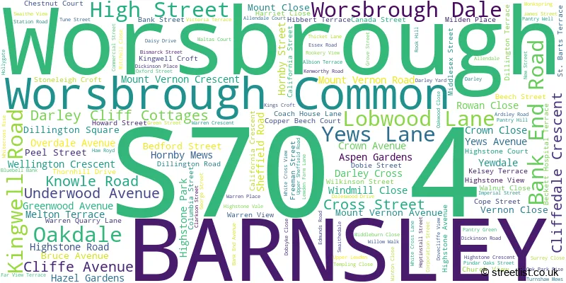
The largest settlement in the S70 4 postal code is BARNSLEY followed by Worsbrough, and Worsbrough Dale.
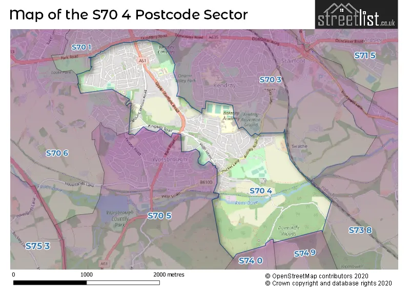
The S70 4 Postcode shares a border with S73 8 (Wombwell), S70 1 (BARNSLEY), S70 3 (BARNSLEY, Kendray, Stairfoot), S70 5 (Worsbrough, Birdwell, Worsbrough Bridge), S70 6 (BARNSLEY, Worsbrough), S74 0 (Hoyland, Jump, Blacker Hill) and S74 9 (Hoyland).
The sector is within the post town of BARNSLEY.
S70 4 is a postcode sector within the S70 postcode district which is within the S Sheffield postcode area.
The Royal Mail delivery office for the S70 4 postal sector is the Barnsley Delivery Office.
The area of the S70 4 postcode sector is 1.37 square miles which is 3.56 square kilometres or 879.68 square acres.

Map of the S70 4 Postcode Sector
Explore the S70 4 postcode sector by using our free interactive map.
| S | 7 | 0 | - | 4 | X | X |
| S | 7 | 0 | Space | 4 | Letter | Letter |
Official List of Streets
BARNSLEY (81 Streets)
Worsbrough (51 Streets)
Worsbrough Dale (5 Streets)
Worsbrough Common (1 Streets)
Unofficial Streets or Alternative Spellings
Hoyland
WOODHEAD LANEWorsbrough
BLACKBURN LANE HIGHSTONE LANE PARK ROAD SAXON CRESCENT WEST STREETKendray
YEWS LANE BLACKER LANE CROWN STREET DARK LANE DARLEY CLIFF FARVIEW TERRACE GARDEN STREET KINGWELL MEWS LOCKWOOD LANE LOWER FARM LANE PENNINE WALK PINFOLD HILL WOMBWELL LANEBARNSLEY
HUNNINGLEY LANE RACECOMMON LANE TOWER STREETWombwell
DOVECLIFFE ROADBlacker Hill
WENTWORTH ROADSchools and Places of Education Within the S70 4 Postcode Sector
Bank End Primary Academy
Academy converter
Underwood Avenue, Barnsley, South Yorkshire, S70 4AZ
Head: Mrs Faye Bettison
Ofsted Rating: Good
Inspection: 2021-09-15 (992 days ago)
Website: Visit Bank End Primary Academy Website
Phone: 01226282549
Number of Pupils: 220
House Prices in the S70 4 Postcode Sector
| Type of Property | 2018 Average | 2018 Sales | 2017 Average | 2017 Sales | 2016 Average | 2016 Sales | 2015 Average | 2015 Sales |
|---|---|---|---|---|---|---|---|---|
| Detached | £179,549 | 6 | £193,540 | 24 | £188,174 | 19 | £195,782 | 14 |
| Semi-Detached | £102,516 | 64 | £103,350 | 69 | £99,941 | 55 | £90,458 | 48 |
| Terraced | £73,669 | 59 | £72,258 | 55 | £67,642 | 70 | £65,087 | 57 |
| Flats | £0 | 0 | £100,000 | 1 | £73,434 | 2 | £63,000 | 2 |
Important Postcodes S70 4 in the Postcode Sector
S70 4AZ is the postcode for WORSBROUGH BANK END PRIMARY SCHOOL, UNDERWOOD AVENUE, WORSBROUGH DALE, and Bank End Junior & Infant School, Underwood Avenue
S70 4BD is the postcode for Surestart, Sunnybank Childrens Centre, Overdale Avenue
S70 4DJ is the postcode for Shaftesbury House Nursing & Residential Home, 53 Mount Vernon Road
S70 4DP is the postcode for Barnsley PCT, Mount Vernon Hospital, and Mount Vernon Hospital, Mount Vernon Road
S70 4EB is the postcode for Worsbrough Common Primary School, Bruce Avenue, Worsbrough Common, and Worsbrough Common Cp School, Bruce Avenue
S70 4NW is the postcode for The Kakoty Practice, 170 Sheffield Road
S70 4RL is the postcode for Barnsley Academy, Ardsley Road
| The S70 4 Sector is within these Local Authorities |
|
|---|---|
| The S70 4 Sector is within these Counties |
|
| The S70 4 Sector is within these Water Company Areas |
|