The SN2 5 postcode sector is within the county of Wiltshire.
Did you know? According to the 2021 Census, the SN2 5 postcode sector is home to a bustling 6,224 residents!
Given that each sector allows for 400 unique postcode combinations. Letters C, I, K, M, O and V are not allowed in the last two letters of a postcode. With 128 postcodes already in use, this leaves 272 units available.
The SN2 5 postal code covers the settlement of SWINDON.
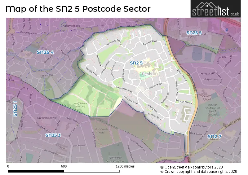
The SN2 5 Postcode shares a border with SN25 3 (SWINDON), SN25 4 (SWINDON), SN2 1 (SWINDON, Hawksworth Trading Estate), SN2 7 (SWINDON) and SN25 5 (Groundwell Industrial Estate, Blunsdon, SWINDON).
The sector is within the post town of SWINDON.
SN2 5 is a postcode sector within the SN2 postcode district which is within the SN Swindon postcode area.
The Royal Mail delivery office for the SN2 5 postal sector is the Hawksworth Delivery Office.
The area of the SN2 5 postcode sector is 0.44 square miles which is 1.14 square kilometres or 281.93 square acres.

Map of the SN2 5 Postcode Sector
Explore the SN2 5 postcode sector by using our free interactive map.
| S | N | 2 | - | 5 | X | X |
| S | N | 2 | Space | 5 | Letter | Letter |
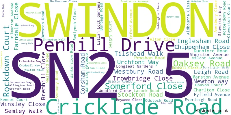
Official List of Streets
SWINDON (74 Streets)
Unofficial Streets or Alternative Spellings
Schools and Places of Education Within the SN2 5 Postcode Sector
Seven Fields Primary School
Academy converter
Leigh Road, Swindon, Wiltshire, SN2 5DE
Head: Mrs Gillian Young
Ofsted Rating: Requires improvement
Inspection: 2023-09-20 (256 days ago)
Website: Visit Seven Fields Primary School Website
Phone: 01793723833
Number of Pupils: 285
House Prices in the SN2 5 Postcode Sector
| Type of Property | 2018 Average | 2018 Sales | 2017 Average | 2017 Sales | 2016 Average | 2016 Sales | 2015 Average | 2015 Sales |
|---|---|---|---|---|---|---|---|---|
| Detached | £298,833 | 3 | £290,000 | 2 | £0 | 0 | £336,000 | 2 |
| Semi-Detached | £159,667 | 6 | £162,250 | 8 | £169,875 | 12 | £121,500 | 6 |
| Terraced | £158,050 | 20 | £144,255 | 31 | £138,986 | 32 | £115,497 | 16 |
| Flats | £103,000 | 1 | £84,000 | 1 | £82,750 | 2 | £71,250 | 2 |
Important Postcodes SN2 5 in the Postcode Sector
SN2 5DE is the postcode for SEVEN FIELDS PRIMARY SCHOOL, LEIGH ROAD, PENHILL, and Seven Fields Primary School, Leigh Road
SN2 5DU is the postcode for John Moulton Hall Community Centre, Penhill Drive
SN2 5HF is the postcode for Swindon Academy, Alton Close, and Penhill Primary School, Alton Close
SN2 5NP is the postcode for Uplands Educational Trust, Unit 1 Community Enterprise Centre, Atworth Close
| The SN2 5 Sector is within these Local Authorities |
|
|---|---|
| The SN2 5 Sector is within these Counties |
|
| The SN2 5 Sector is within these Water Company Areas |
|