The TS22 5 postcode sector is within the county of Durham.
Did you know? According to the 2021 Census, the TS22 5 postcode sector is home to a bustling 10,175 residents!
Given that each sector allows for 400 unique postcode combinations. Letters C, I, K, M, O and V are not allowed in the last two letters of a postcode. With 290 postcodes already in use, this leaves 110 units available.
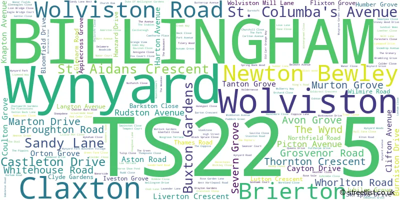
The largest settlement in the TS22 5 postal code is Wynyard followed by BILLINGHAM, and Wolviston.
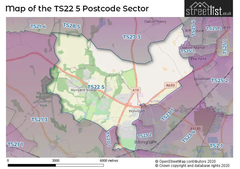
The TS22 5 Postcode shares a border with TS25 3 (HARTLEPOOL), TS25 4 (HARTLEPOOL), TS23 1 (BILLINGHAM), TS23 2 (BILLINGHAM), TS23 3 (BILLINGHAM), TS20 1 (STOCKTON-ON-TEES, Norton), TS21 3 (Sedgefield, Thorpe Thewles, STOCKTON-ON-TEES), TS21 4 (Fishburn), TS25 2 (HARTLEPOOL, Greatham, Seaton Carew), TS26 0 (HARTLEPOOL), TS27 3 (HARTLEPOOL, Elwick, Hart) and TS28 5 (WINGATE, Station Town).
The sector is within the post town of BILLINGHAM.
TS22 5 is a postcode sector within the TS2 postcode district which is within the TS Teeside postcode area.
The Royal Mail delivery office for the TS22 5 postal sector is the unknown.
The area of the TS22 5 postcode sector is 14.44 square miles which is 37.39 square kilometres or 9,240.23 square acres.
The TS22 5 postcode sector is crossed by the A19 Major A road.

Map of the TS22 5 Postcode Sector
Explore the TS22 5 postcode sector by using our free interactive map.
| T | S | 2 | 2 | - | 5 | X | X |
| T | S | 2 | 2 | Space | 5 | Letter | Letter |
Official List of Streets
Wynyard (108 Streets)
BILLINGHAM (74 Streets)
Wolviston (21 Streets)
Claxton (1 Streets)
Schools and Places of Education Within the TS22 5 Postcode Sector
Northfield School and Sports College
Community school
Thames Road, Billingham, Teesside, TS22 5EG
Head: Mr R. J. Henderson
Ofsted Rating: Good
Inspection: 2023-02-16 (466 days ago)
Website: Visit Northfield School and Sports College Website
Phone: 01642557373
Number of Pupils: 1484
Wynyard Church of England Primary School
Free schools
Redwood Drive, Wynyard, , TS22 5UB
Head: Mrs Sarah Wassell
Ofsted Rating: Outstanding
Inspection: 2018-04-25 (2224 days ago)
Website: Visit Wynyard Church of England Primary School Website
Phone: 01740555005
Number of Pupils: 465
House Prices in the TS22 5 Postcode Sector
| Type of Property | 2018 Average | 2018 Sales | 2017 Average | 2017 Sales | 2016 Average | 2016 Sales | 2015 Average | 2015 Sales |
|---|---|---|---|---|---|---|---|---|
| Detached | £370,284 | 136 | £361,602 | 142 | £374,763 | 100 | £366,260 | 91 |
| Semi-Detached | £150,781 | 116 | £158,138 | 86 | £153,707 | 84 | £150,196 | 57 |
| Terraced | £189,787 | 14 | £166,325 | 15 | £225,300 | 10 | £228,196 | 13 |
| Flats | £148,980 | 5 | £140,638 | 12 | £129,333 | 3 | £75,000 | 4 |
Important Postcodes TS22 5 in the Postcode Sector
TS22 5BX is the postcode for Bede Building, Priors Mill Church of England Primary School, Clifton Avenue, Priors Mill C of E Primary School, Clifton Avenue, CUTHBERT BUILDING, Priors Mill C of E Primary School, Clifton Avenue, and BEDE BUILDING, Priors Mill C of E Primary School, Clifton Avenue
TS22 5EG is the postcode for Northfield school and sports college, Thames Road, Northfield School & Sports College, Thames Road, Northfield School, Thames Road, and Northfield School & Sports College, Thames Rd, Billingham
TS22 5LN is the postcode for Wolviston Primary School, The Green
TS22 5LU is the postcode for St. Pauls RC Primary School, Wolviston Mill Lane, St. Paul's RC Primary Academy, Wolviston Mill Lane, and St. Pauls Catholic Primary Academy,, Wolviston Mill Lane,
TS22 5TH is the postcode for Roads Policing Unit, 1 North Chapel Lane, Wynyard Park, and Roads Policing Unit, 1 North Chapel Lane
TS22 5UB is the postcode for Wynyard Primary School, Redwood Drive
| The TS22 5 Sector is within these Local Authorities |
|
|---|---|
| The TS22 5 Sector is within these Counties |
|
| The TS22 5 Sector is within these Water Company Areas |
|