This section of the site is all about the TS Postcode area, also known as the Teeside Postal Area. Explore links to the next level to learn more about specific postcode districts such as TS1.
The TS postcode area represents a group of postal districts in the Teeside area of the United Kingdom. The area code TS stands for the letters t and s in TeeSide. TS has a population of 602,474 and covers an area of 1,033,268 hectares. Fun fact: 0.93% of the population of Great Britain lives in this area.
The postcode area falls within the following counties: North Yorkshire (57.20%), Durham (42.80%).
Post Towns and Postcode Districts for the TS Postcode
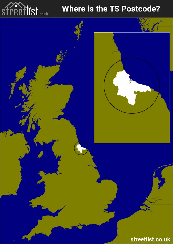
Where is the TS Postcode Area?
The TS Teeside postcode has it's North in The North East of England and it's South is in Yorkshire and the Humber Region. The postal area borders the following neighbouring postal areas: SR - Sunderland, YO - York, DL - Darlington and DH - Durham, It also borders The North Sea,
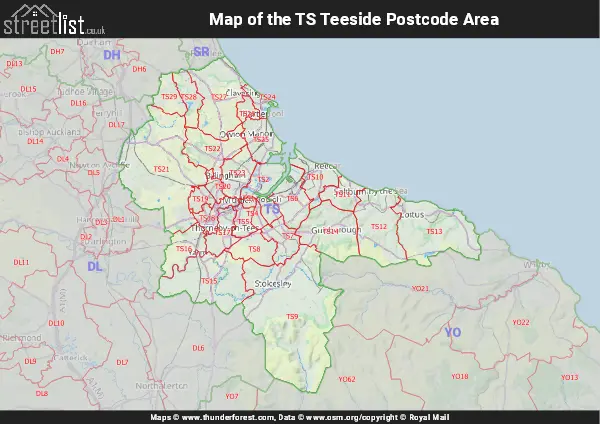
Map of the TS Teeside Postcode Area
Explore the TS Teeside postcode area by using our interactive map.
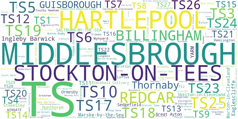
Postcode Districts within the TS Teeside Postcode Area
There are 29 postcode districts within the Teeside postcode area
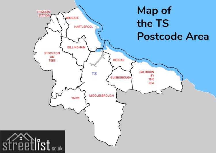
A map showing the boundary of in relation to other areas
There are 14 towns within the Teeside postcode area.
| Unit | Area² |
|---|---|
| Hectares | 1,033,268² |
| Miles | 3,989² |
| Feet | 111,219,934,252² |
| Kilometres | 10,333² |
Postal Delivery Offices serving the TS Teeside Postcode Area
- Coulby Newham Delivery Office
- Great Ayton Scale Payment Delivery Office
- Great Broughton Scale Payment Delivery Office
- Guisborough Delivery Office
- Hartlepool Delivery Office
- Middlesbrough Delivery Office
- Redcar Delivery Office
- Skelton-in-cleveland Delivery Office
- South Bank Delivery Office
- Stockton Delivery Office
- Trim Delivery Office N Station Scale Payment Delivery Office
- Wingate Scale Payment Delivery Office
Councils with Postcodes in TS
Towns and Villages within the TS Teeside Postcode Area
- Aislaby - village
- Billingham - town
- Bishopton - village
- Blackhall Rocks - village
- Boosbeck - village
- Brotton - town
- Carlin How - village
- Carlton - village
- Carlton in Cleveland - village
- Castle Eden - village
- Charltons - village
- Cowbar - village
- Cowpen Bewley - village
- Crathorne - village
- Dalton Piercy - village
- Deaf Hill - village
- Easington - village
- Egglescliffe - village
- Elwick - village
- Eston - village
- Faceby - village
- Fishburn - village
- Grangetown - village
- Great Ayton - village
- Great Broughton - village
- Greatham - village
- Guisborough - town
- Hart - village
- Hartlepool - town
- Hesleden - village
- High Hesleden - village
- Hilton - village
- Hinderwell - village
- Hutton Henry - village
- Hutton Rudby - village
- Ingleby Barwick - Settlement
- Ingleby Greenhow - village
- Kirkby - village
- Kirkleatham - village
- Kirklevington - village
- Lazenby - village
- Lingdale - village
- Liverton - village
- Liverton Mines - village
- Loftus - town
- Longnewton - village
- Low Worsall - village
- Maltby - village
- Marske-by-the-Sea - town
- Mickleby - village
- Middlesbrough - town
- Moorsholm - village
- Mordon - village
- New Marske - village
- Newby - village
- Newton under Roseberry - village
- North Skelton - village
- Port Mulgrave - village
- Redcar - town
- Redmarshall - village
- Rudby - village
- Runswick Bay - village
- Saltburn-by-the-Sea - town
- Seamer - village
- Sedgefield - town
- Skelton - town
- Skelton Green - village
- Skinningrove - village
- South Bank - village
- Stainton - village
- Staithes - village
- Stanghow - village
- Station Town - village
- Stillington - village
- Stockton-on-Tees - town
- Stokesley - village
- Thornaby-on-Tees - town
- Thornton - village
- Thorpe Thewles - village
- Trimdon - village
- Trimdon Grange - village
- Wingate - village
- Wolviston - village
- Wynyard Village - village
- Yarm - town
- Yearby - village