The TS8 postcode district is a postal district located in the TS Teeside postcode area with a population of 22,441 residents according to the 2021 England and Wales Census.
The area of the TS8 postcode district is 8.46 square miles which is 21.91 square kilometres or 5,414.81 acres.
Currently, the TS8 district has about 376 postcode units spread across 2 geographic postcode sectors.
Given that each sector allows for 400 unique postcode combinations, the district has a capacity of 800 postcodes. With 376 postcodes already in use, this leaves 424 units available.
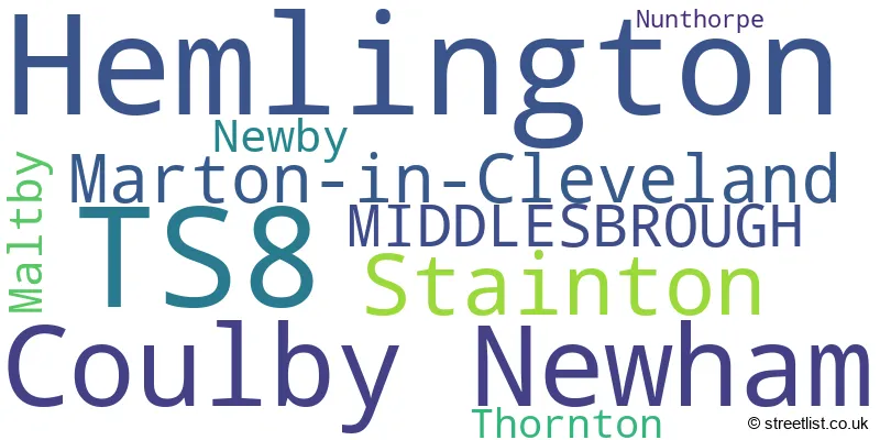
The largest settlement in the TS8 postal code is Hemlington followed by Coulby Newham, and Marton-in-Cleveland.
The TS8 Postcode shares a border with TS7 (Marton-in-Cleveland, Nunthorpe, Ormesby), TS9 (Stokesley, Great Ayton, Great Broughton), TS15 (YARM, Hutton Rudby, Kirklevington), TS17 (Thornaby, Ingleby Barwick, STOCKTON-ON-TEES), TS5 (MIDDLESBROUGH) and TS4 (MIDDLESBROUGH).
The primary settlement in the TS8 postcode district is Coulby Newham, which is located in Middlesbrough, North Yorkshire. It is the largest settlement with a count of 95. Other significant settlements in the district include Maltby, Newby, Stainton, and Thornton. The most significant post town in the TS8 postcode district is Middlesbrough, also located in North Yorkshire.
For the district TS8, we have data on 3 postcode sectors. Here's a breakdown: The sector TS8 0, covers Coulby Newham and Maltby in North Yorkshire. The sector TS8 8 is non-geographic. It's often designated for PO Boxes, large organisations, or special services. The sector TS8 9, covers Hemlington and Stainton and Marton-In-Cleveland in North Yorkshire.

Map of the TS8 Postcode District
Explore the TS8 postcode district by using our free interactive map.

When it comes to local government, postal geography often disregards political borders. However, for a breakdown in the TS8 District: the district mostly encompasses the Middlesbrough (B) (366 postcodes), followed by the Stockton-on-Tees (B) area (15 postcodes), and finally, the North Yorkshire area (14 postcodes).
Recent House Sales in TS8
| Date | Price | Address |
|---|---|---|
| 05/10/2023 | £249,500 | Parnaby Way, Hemlington, Middlesbrough, TS8 9NG |
| 29/09/2023 | £195,000 | Copper Beech Lane, Middlesbrough, TS8 9FL |
| 20/09/2023 | £282,100 | Whinstone Drive, Stainton, Middlesbrough, TS8 9AT |
| 08/09/2023 | £144,000 | Buckthorn Grove, Middlesbrough, TS8 9BF |
| 01/09/2023 | £187,548 | Hume Drive, Hemlington, Middlesbrough, TS8 9GU |
| 29/08/2023 | £232,000 | Coulby Manor Farm, Coulby Newham, Middlesbrough, TS8 0RY |
| 25/08/2023 | £335,000 | Foxgloves, Coulby Newham, Middlesbrough, TS8 0XA |
| 22/08/2023 | £80,000 | Eddison Way, Hemlington, Middlesbrough, TS8 9ES |
| 22/08/2023 | £164,500 | Coate Close, Hemlington, Middlesbrough, TS8 9RA |
| 17/08/2023 | £160,000 | Cedarwood Glade, Stainton, Middlesbrough, TS8 9DL |
Where is the TS8 Postcode District?
The postcode district for TS8 is located in Middlesbrough. It is surrounded by several nearby towns, including Yarm to the west, Stockton-on-Tees to the north west, Guisborough to the east, Billingham to the north, Redcar to the north east, and Northallerton to the south west. The distance between TS8 and London is approximately 212.79 miles.
The district is within the post town of MIDDLESBROUGH.
The sector has postcodes within the nation of England.
The TS8 Postcode District is covers the following regions.
- North Yorkshire CC - North Yorkshire - Yorkshire and The Humber
- South Teesside - Tees Valley and Durham - North East (England)
- Hartlepool and Stockton-on-Tees - Tees Valley and Durham - North East (England)
Weather Forecast for TS8
Press Button to Show Forecast for Stokesley
| Time Period | Icon | Description | Temperature | Rain Probability | Wind |
|---|---|---|---|---|---|
| 18:00 to 21:00 | Partly cloudy (day) | 17.0°C (feels like 15.0°C) | 1.00% | SE 13 mph | |
| 21:00 to 00:00 | Cloudy | 15.0°C (feels like 14.0°C) | 7.00% | SE 7 mph |
Press Button to Show Forecast for Stokesley
| Time Period | Icon | Description | Temperature | Rain Probability | Wind |
|---|---|---|---|---|---|
| 00:00 to 03:00 | Cloudy | 13.0°C (feels like 13.0°C) | 6.00% | SE 4 mph | |
| 03:00 to 06:00 | Partly cloudy (night) | 11.0°C (feels like 11.0°C) | 5.00% | S 2 mph | |
| 06:00 to 09:00 | Sunny day | 13.0°C (feels like 13.0°C) | 1.00% | SSE 2 mph | |
| 09:00 to 12:00 | Partly cloudy (day) | 18.0°C (feels like 18.0°C) | 3.00% | W 4 mph | |
| 12:00 to 15:00 | Partly cloudy (day) | 21.0°C (feels like 19.0°C) | 4.00% | SSE 11 mph | |
| 15:00 to 18:00 | Partly cloudy (day) | 21.0°C (feels like 19.0°C) | 4.00% | SSE 13 mph | |
| 18:00 to 21:00 | Cloudy | 20.0°C (feels like 18.0°C) | 5.00% | SSE 9 mph | |
| 21:00 to 00:00 | Cloudy | 16.0°C (feels like 15.0°C) | 4.00% | SE 9 mph |
Press Button to Show Forecast for Stokesley
| Time Period | Icon | Description | Temperature | Rain Probability | Wind |
|---|---|---|---|---|---|
| 00:00 to 03:00 | Cloudy | 14.0°C (feels like 13.0°C) | 5.00% | SE 7 mph | |
| 03:00 to 06:00 | Cloudy | 13.0°C (feels like 12.0°C) | 7.00% | SE 7 mph | |
| 06:00 to 09:00 | Cloudy | 14.0°C (feels like 13.0°C) | 10.00% | ESE 7 mph | |
| 09:00 to 12:00 | Light rain shower (day) | 16.0°C (feels like 16.0°C) | 35.00% | ESE 9 mph | |
| 12:00 to 15:00 | Cloudy | 18.0°C (feels like 17.0°C) | 21.00% | ESE 9 mph | |
| 15:00 to 18:00 | Cloudy | 19.0°C (feels like 17.0°C) | 17.00% | ESE 11 mph | |
| 18:00 to 21:00 | Cloudy | 17.0°C (feels like 16.0°C) | 10.00% | SE 9 mph | |
| 21:00 to 00:00 | Cloudy | 15.0°C (feels like 14.0°C) | 11.00% | SE 7 mph |
Press Button to Show Forecast for Stokesley
| Time Period | Icon | Description | Temperature | Rain Probability | Wind |
|---|---|---|---|---|---|
| 00:00 to 03:00 | Cloudy | 14.0°C (feels like 13.0°C) | 10.00% | SE 7 mph | |
| 03:00 to 06:00 | Cloudy | 12.0°C (feels like 11.0°C) | 6.00% | ESE 4 mph | |
| 06:00 to 09:00 | Cloudy | 13.0°C (feels like 13.0°C) | 5.00% | E 4 mph | |
| 09:00 to 12:00 | Cloudy | 16.0°C (feels like 15.0°C) | 10.00% | E 4 mph | |
| 12:00 to 15:00 | Cloudy | 17.0°C (feels like 16.0°C) | 12.00% | E 7 mph | |
| 15:00 to 18:00 | Light rain shower (day) | 18.0°C (feels like 17.0°C) | 30.00% | E 7 mph | |
| 18:00 to 21:00 | Light rain shower (day) | 17.0°C (feels like 16.0°C) | 29.00% | E 7 mph | |
| 21:00 to 00:00 | Clear night | 13.0°C (feels like 13.0°C) | 4.00% | E 4 mph |
Press Button to Show Forecast for Stokesley
| Time Period | Icon | Description | Temperature | Rain Probability | Wind |
|---|---|---|---|---|---|
| 00:00 to 03:00 | Partly cloudy (night) | 11.0°C (feels like 11.0°C) | 2.00% | ESE 2 mph | |
| 03:00 to 06:00 | Partly cloudy (night) | 10.0°C (feels like 10.0°C) | 3.00% | SE 2 mph | |
| 06:00 to 09:00 | Partly cloudy (day) | 12.0°C (feels like 12.0°C) | 4.00% | WNW 2 mph | |
| 09:00 to 12:00 | Cloudy | 15.0°C (feels like 15.0°C) | 6.00% | NW 4 mph | |
| 12:00 to 15:00 | Cloudy | 18.0°C (feels like 17.0°C) | 8.00% | NW 4 mph | |
| 15:00 to 18:00 | Cloudy | 18.0°C (feels like 17.0°C) | 12.00% | N 7 mph | |
| 18:00 to 21:00 | Cloudy | 17.0°C (feels like 16.0°C) | 9.00% | NNW 7 mph | |
| 21:00 to 00:00 | Cloudy | 13.0°C (feels like 12.0°C) | 6.00% | NNE 4 mph |
| Postcode Sector | Delivery Office |
|---|---|
| TS8 0 | Coulby Newham Delivery Office |
| TS8 9 | Coulby Newham Delivery Office |
| T | S | 8 | - | X | X | X |
| T | S | 8 | Space | Numeric | Letter | Letter |
Current Monthly Rental Prices
| # Bedrooms | Min Price | Max Price | Avg Price |
|---|---|---|---|
| 1 | £495 | £550 | £523 |
| 2 | £695 | £695 | £695 |
| 3 | £750 | £895 | £823 |
| 4 | £995 | £1,100 | £1,048 |
Current House Prices
| # Bedrooms | Min Price | Max Price | Avg Price |
|---|---|---|---|
| 1 | £62,500 | £87,500 | £76,667 |
| 2 | £64,950 | £260,000 | £135,213 |
| 3 | £45,000 | £400,000 | £170,118 |
| 4 | £66,250 | £540,000 | £279,393 |
| 5 | £279,950 | £895,000 | £612,488 |
Estate Agents who Operate in the TS8 District
| Logo | Name | Brand Name | Address | Contact Number | Total Properties |
|---|---|---|---|---|---|
 | Nunthorpe | Michael Poole | 95 Guisborough Road, Nunthorpe, Middlesbrough, TS7 0JS | 07782 668197 | 26 |
 | Middlesbrough | Robinsons Tees Valley | Stokesley Road, Marton-In-Cleveland, Middlesbrough TS7 8DX | 01642 056930 | 15 |
 | Marton | Harvey Brooks | Marton Shopping Centre Stokesley Road, Marton-In-Cleveland, TS7 8DX | 01642 056940 | 10 |
 | Covering Middlesbrough | Homewise | 64-66 Borough Road, Middlesbrough, TS1 2JH | 01903 497353 | 9 |
 | Middlesbrough | Manners & Harrison | 30 & 30a Stokesley Road Marton-In-Cleveland Middlesbrough TS7 8DX | 01642 056044 | 9 |
Yearly House Price Averages for the TS8 Postcode District
| Type of Property | 2018 Average | 2018 Sales | 2017 Average | 2017 Sales | 2016 Average | 2016 Sales | 2015 Average | 2015 Sales |
|---|---|---|---|---|---|---|---|---|
| Detached | £221,788 | 257 | £215,929 | 185 | £221,479 | 145 | £218,974 | 193 |
| Semi-Detached | £144,506 | 150 | £128,052 | 123 | £133,239 | 117 | £126,524 | 122 |
| Terraced | £108,412 | 62 | £98,296 | 57 | £114,368 | 53 | £108,979 | 51 |
| Flats | £158,125 | 4 | £67,833 | 6 | £68,722 | 9 | £58,944 | 9 |