The TS25 postcode district is a postal district located in the TS Teeside postcode area with a population of 38,233 residents according to the 2021 England and Wales Census.
The area of the TS25 postcode district is 9.81 square miles which is 25.40 square kilometres or 6,276.54 acres.
Currently, the TS25 district has about 1050 postcode units spread across 5 geographic postcode sectors.
Given that each sector allows for 400 unique postcode combinations, the district has a capacity of 2,000 postcodes. With 1050 postcodes already in use, this leaves 950 units available.
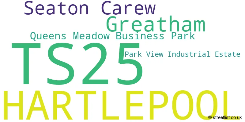
The largest settlement in the TS25 postal code is HARTLEPOOL followed by Greatham, and Seaton Carew.
The postcode area has a boundary with The North Sea.
The TS25 Postcode shares a border with TS22 (Wynyard, BILLINGHAM, Wolviston), TS23 (BILLINGHAM, Belasis Hall Technology Park), TS26 (HARTLEPOOL), TS24 (HARTLEPOOL) and TS2 (MIDDLESBROUGH, Seal Sands, Port Clarence).
The primary settlement in the TS25 postcode district is Hartlepool, located in the county of Durham, England. The most significant post town in this district is also Hartlepool. Other significant settlements include Park View Industrial Estate, Seaton Carew, and Greatham.
For the district TS25, we have data on 5 postcode sectors. Here's a breakdown: The sector TS25 1, covers Hartlepool in Durham. The sector TS25 2, covers Hartlepool and Greatham in Durham. The sector TS25 3, covers Hartlepool in Durham. The sector TS25 4, covers Hartlepool in Durham. The sector TS25 5, covers Hartlepool in Durham.

Map of the TS25 Postcode District
Explore the TS25 postcode district by using our free interactive map.

When it comes to local government, postal geography often disregards political borders. However, for a breakdown in the TS25 District: the district mostly encompasses the Hartlepool (B) area with a total of 1054 postcodes.
Recent House Sales in TS25
| Date | Price | Address |
|---|---|---|
| 13/10/2023 | £205,000 | Torquay Avenue, Hartlepool, TS25 3DP |
| 10/10/2023 | £149,000 | Elizabeth Way, Hartlepool, TS25 2AD |
| 10/10/2023 | £35,000 | Harrow Street, Hartlepool, TS25 5SE |
| 09/10/2023 | £230,000 | Brierton Lane, Hartlepool, TS25 5DW |
| 06/10/2023 | £75,000 | Caledonian Road, Hartlepool, TS25 5LB |
| 05/10/2023 | £83,500 | Catcote Road, Hartlepool, TS25 2LT |
| 05/10/2023 | £160,000 | Vickers Lane, Hartlepool, TS25 2BF |
| 29/09/2023 | £75,000 | Owton Manor Lane, Hartlepool, TS25 3HB |
| 29/09/2023 | £84,000 | Whitfield Drive, Hartlepool, TS25 5BH |
| 29/09/2023 | £77,000 | Alverstone Avenue, Hartlepool, TS25 5AG |
Weather Forecast for TS25
Press Button to Show Forecast for Seaton Carew - North Gare (Beach)
| Time Period | Icon | Description | Temperature | Rain Probability | Wind |
|---|---|---|---|---|---|
| 09:00 to 12:00 | Cloudy | 8.0°C (feels like 5.0°C) | 6.00% | ENE 9 mph | |
| 12:00 to 15:00 | Cloudy | 8.0°C (feels like 5.0°C) | 9.00% | ENE 11 mph | |
| 15:00 to 18:00 | Cloudy | 8.0°C (feels like 6.0°C) | 7.00% | ENE 11 mph | |
| 18:00 to 21:00 | Partly cloudy (day) | 8.0°C (feels like 5.0°C) | 5.00% | ENE 11 mph | |
| 21:00 to 00:00 | Cloudy | 7.0°C (feels like 5.0°C) | 7.00% | ENE 11 mph |
Press Button to Show Forecast for Seaton Carew - North Gare (Beach)
| Time Period | Icon | Description | Temperature | Rain Probability | Wind |
|---|---|---|---|---|---|
| 00:00 to 03:00 | Cloudy | 7.0°C (feels like 4.0°C) | 7.00% | NE 11 mph | |
| 03:00 to 06:00 | Cloudy | 7.0°C (feels like 3.0°C) | 7.00% | NNE 13 mph | |
| 06:00 to 09:00 | Cloudy | 7.0°C (feels like 3.0°C) | 20.00% | N 16 mph | |
| 09:00 to 12:00 | Light rain | 7.0°C (feels like 3.0°C) | 50.00% | N 18 mph | |
| 12:00 to 15:00 | Light rain | 8.0°C (feels like 4.0°C) | 50.00% | NNW 16 mph | |
| 15:00 to 18:00 | Light rain | 8.0°C (feels like 5.0°C) | 43.00% | NNW 13 mph | |
| 18:00 to 21:00 | Partly cloudy (day) | 9.0°C (feels like 7.0°C) | 9.00% | NW 9 mph | |
| 21:00 to 00:00 | Clear night | 8.0°C (feels like 5.0°C) | 3.00% | SW 11 mph |
Press Button to Show Forecast for Seaton Carew - North Gare (Beach)
| Time Period | Icon | Description | Temperature | Rain Probability | Wind |
|---|---|---|---|---|---|
| 00:00 to 03:00 | Clear night | 6.0°C (feels like 4.0°C) | 1.00% | SW 9 mph | |
| 03:00 to 06:00 | Clear night | 6.0°C (feels like 3.0°C) | 0.00% | SSW 11 mph | |
| 06:00 to 09:00 | Sunny day | 7.0°C (feels like 3.0°C) | 1.00% | SSW 11 mph | |
| 09:00 to 12:00 | Sunny day | 10.0°C (feels like 8.0°C) | 1.00% | S 13 mph | |
| 12:00 to 15:00 | Cloudy | 13.0°C (feels like 10.0°C) | 6.00% | S 13 mph | |
| 15:00 to 18:00 | Cloudy | 14.0°C (feels like 11.0°C) | 6.00% | S 16 mph | |
| 18:00 to 21:00 | Cloudy | 13.0°C (feels like 10.0°C) | 5.00% | SSE 13 mph | |
| 21:00 to 00:00 | Clear night | 11.0°C (feels like 8.0°C) | 2.00% | SE 13 mph |
Press Button to Show Forecast for Seaton Carew - North Gare (Beach)
| Time Period | Icon | Description | Temperature | Rain Probability | Wind |
|---|---|---|---|---|---|
| 00:00 to 03:00 | Clear night | 9.0°C (feels like 7.0°C) | 1.00% | SSE 13 mph | |
| 03:00 to 06:00 | Clear night | 8.0°C (feels like 5.0°C) | 1.00% | SE 11 mph | |
| 06:00 to 09:00 | Sunny day | 9.0°C (feels like 6.0°C) | 2.00% | SE 11 mph | |
| 09:00 to 12:00 | Cloudy | 11.0°C (feels like 9.0°C) | 7.00% | ESE 11 mph | |
| 12:00 to 15:00 | Cloudy | 12.0°C (feels like 9.0°C) | 12.00% | E 13 mph | |
| 15:00 to 18:00 | Cloudy | 12.0°C (feels like 9.0°C) | 13.00% | E 13 mph | |
| 18:00 to 21:00 | Overcast | 11.0°C (feels like 8.0°C) | 15.00% | E 11 mph | |
| 21:00 to 00:00 | Cloudy | 10.0°C (feels like 8.0°C) | 10.00% | E 9 mph |
Where is the TS25 Postcode District?
The postcode district TS25 is located in Hartlepool. It is a district town in the North East of England. Hartlepool is situated near several nearby towns. To the South West is Billingham, which is approximately 3.47 miles away. Middlesbrough is located to the South and is about 5.85 miles from Hartlepool. Wingate is situated to the North West and is around 7.41 miles away. Redcar is positioned to the South East and is approximately 7.65 miles from Hartlepool. Additionally, the postcode district TS25 is located around 222.05 miles from the centre of London.
The district is within the post town of HARTLEPOOL.
The sector has postcodes within the nation of England.
The TS25 Postcode District is in the Hartlepool and Stockton-on-Tees region of Tees Valley and Durham within the North East (England).
| Postcode Sector | Delivery Office |
|---|---|
| TS25 1 | Hartlepool Delivery Office |
| TS25 2 | Hartlepool Delivery Office |
| TS25 3 | Hartlepool Delivery Office |
| TS25 4 | Hartlepool Delivery Office |
| TS25 5 | Hartlepool Delivery Office |
| T | S | 2 | 5 | - | X | X | X |
| T | S | 2 | 5 | Space | Numeric | Letter | Letter |
Current Monthly Rental Prices
| # Bedrooms | Min Price | Max Price | Avg Price |
|---|---|---|---|
| 1 | £450 | £589 | £520 |
| 2 | £350 | £700 | £455 |
| 3 | £425 | £800 | £619 |
| 4 | £695 | £695 | £695 |
Current House Prices
| # Bedrooms | Min Price | Max Price | Avg Price |
|---|---|---|---|
| £30,000 | £60,000 | £45,000 | |
| 1 | £45,000 | £47,000 | £46,000 |
| 2 | £5,000 | £265,000 | £84,861 |
| 3 | £10,000 | £280,000 | £133,427 |
| 4 | £75,000 | £549,950 | £264,069 |
| 5 | £270,000 | £425,000 | £341,667 |
| 6 | £475,000 | £475,000 | £475,000 |
Estate Agents who Operate in the TS25 District
| Logo | Name | Brand Name | Address | Contact Number | Total Properties |
|---|---|---|---|---|---|
 | Hartlepool | Manners & Harrison | Shrewsbury House, 129 York Road, Hartlepool, TS26 9DW | 01429 806952 | 40 |
 | Hartlepool | igomove | Unit 36, Hartlepool Enterprise Centre, Brouham Terrace, Hartlepool, TS24 8EY | 01429 801165 | 37 |
 | Hartlepool | Robinsons Tees Valley | 106, York Road, Hartlepool, TS26 9DE | 01429 802945 | 34 |
 | Hartlepool | Dowen | 6 York Road, Hartlepool, TS26 9EN | 01429 807928 | 26 |
 | Hartlepool | Holbrook & Co | 19 Victoria Road, Hartlepool, TS24 7SE | 01429 801160 | 8 |
| Type of Property | 2018 Average | 2018 Sales | 2017 Average | 2017 Sales | 2016 Average | 2016 Sales | 2015 Average | 2015 Sales |
|---|---|---|---|---|---|---|---|---|
| Detached | £190,396 | 89 | £186,258 | 91 | £187,353 | 92 | £180,361 | 152 |
| Semi-Detached | £124,357 | 248 | £118,553 | 231 | £117,443 | 204 | £118,415 | 219 |
| Terraced | £66,167 | 238 | £64,112 | 223 | £66,090 | 209 | £68,654 | 237 |
| Flats | £57,995 | 10 | £64,997 | 17 | £53,026 | 19 | £59,287 | 19 |