The TS11 postcode district is a postal district located in the TS Teeside postcode area with a population of 11,134 residents according to the 2021 England and Wales Census.
The area of the TS11 postcode district is 7.01 square miles which is 18.16 square kilometres or 4,488.66 acres.
Currently, the TS11 district has about 351 postcode units spread across 3 geographic postcode sectors.
Given that each sector allows for 400 unique postcode combinations, the district has a capacity of 1,200 postcodes. With 351 postcodes already in use, this leaves 849 units available.
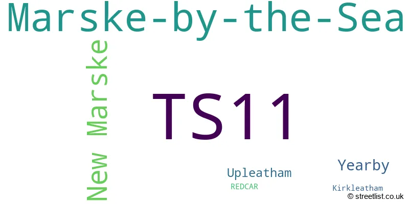
The largest settlement in the TS11 postal code is Marske-by-the-Sea followed by New Marske, and Yearby.
The postcode area has a boundary with The North Sea.
The TS11 Postcode shares a border with TS10 (REDCAR, Wilton) and TS12 (SALTBURN-BY-THE-SEA, Skelton-in-Cleveland, Brotton).
The primary settlement in the TS11 postcode district is Marske-by-the-Sea, located in the county of North Yorkshire, England. Other significant settlements in the district include Redcar, Kirkleatham, New Marske, Upleatham, and Yearby. The main post town for this postcode district is Redcar.
For the district TS11, we have data on 3 postcode sectors. Here's a breakdown: The sector TS11 6, covers Marske-By-The-Sea in North Yorkshire. The sector TS11 7, covers Marske-By-The-Sea in North Yorkshire. The sector TS11 8, covers New Marske in North Yorkshire.

Map of the TS11 Postcode District
Explore the TS11 postcode district by using our free interactive map.

When it comes to local government, postal geography often disregards political borders. However, for a breakdown in the TS11 District: the district mostly encompasses the Redcar and Cleveland (B) area with a total of 351 postcodes.
Recent House Sales in TS11
| Date | Price | Address |
|---|---|---|
| 27/10/2023 | £165,000 | Southfield Road, Marske By The Sea, Redcar, TS11 7BP |
| 03/10/2023 | £190,000 | Churchill Drive, Marske By The Sea, Redcar, TS11 6BE |
| 02/10/2023 | £174,000 | Cleveland View, Marske By The Sea, Redcar, TS11 6ET |
| 29/09/2023 | £175,000 | Howard Drive, Marske By The Sea, Redcar, TS11 7JE |
| 27/09/2023 | £140,000 | Chapel Street, Marske By The Sea, Redcar, TS11 6JJ |
| 22/09/2023 | £220,000 | Meadow Road, Marske By The Sea, Redcar, TS11 7DB |
| 15/09/2023 | £85,000 | Dale Street, New Marske, Redcar, TS11 8EN |
| 08/09/2023 | £212,500 | Hummershill Lane, Marske By The Sea, Redcar, TS11 7DJ |
| 05/09/2023 | £250,000 | High Street, Marske By The Sea, Redcar, TS11 7BE |
| 04/09/2023 | £118,000 | Limes Crescent, Marske By The Sea, Redcar, TS11 7BX |
Weather Forecast for TS11
Press Button to Show Forecast for Marske-By-The-Sea
| Time Period | Icon | Description | Temperature | Rain Probability | Wind |
|---|---|---|---|---|---|
| 06:00 to 09:00 | Partly cloudy (day) | 5.0°C (feels like 3.0°C) | 2.00% | NW 4 mph | |
| 09:00 to 12:00 | Cloudy | 8.0°C (feels like 5.0°C) | 8.00% | ENE 9 mph | |
| 12:00 to 15:00 | Cloudy | 8.0°C (feels like 5.0°C) | 7.00% | ENE 11 mph | |
| 15:00 to 18:00 | Cloudy | 8.0°C (feels like 5.0°C) | 8.00% | ENE 11 mph | |
| 18:00 to 21:00 | Cloudy | 8.0°C (feels like 5.0°C) | 8.00% | ENE 11 mph | |
| 21:00 to 00:00 | Cloudy | 7.0°C (feels like 4.0°C) | 6.00% | ENE 9 mph |
Press Button to Show Forecast for Marske-By-The-Sea
| Time Period | Icon | Description | Temperature | Rain Probability | Wind |
|---|---|---|---|---|---|
| 00:00 to 03:00 | Cloudy | 7.0°C (feels like 4.0°C) | 8.00% | NE 11 mph | |
| 03:00 to 06:00 | Cloudy | 7.0°C (feels like 3.0°C) | 6.00% | NNE 13 mph | |
| 06:00 to 09:00 | Cloudy | 7.0°C (feels like 3.0°C) | 20.00% | NNE 16 mph | |
| 09:00 to 12:00 | Light rain | 7.0°C (feels like 3.0°C) | 50.00% | N 18 mph | |
| 12:00 to 15:00 | Light rain | 7.0°C (feels like 4.0°C) | 50.00% | NNW 18 mph | |
| 15:00 to 18:00 | Light rain | 8.0°C (feels like 5.0°C) | 45.00% | NNW 13 mph | |
| 18:00 to 21:00 | Partly cloudy (day) | 9.0°C (feels like 7.0°C) | 9.00% | WSW 9 mph | |
| 21:00 to 00:00 | Clear night | 8.0°C (feels like 5.0°C) | 3.00% | SW 11 mph |
Press Button to Show Forecast for Marske-By-The-Sea
| Time Period | Icon | Description | Temperature | Rain Probability | Wind |
|---|---|---|---|---|---|
| 00:00 to 03:00 | Clear night | 6.0°C (feels like 3.0°C) | 1.00% | SW 9 mph | |
| 03:00 to 06:00 | Clear night | 6.0°C (feels like 2.0°C) | 0.00% | SSW 9 mph | |
| 06:00 to 09:00 | Sunny day | 6.0°C (feels like 3.0°C) | 1.00% | S 11 mph | |
| 09:00 to 12:00 | Sunny day | 11.0°C (feels like 8.0°C) | 1.00% | S 13 mph | |
| 12:00 to 15:00 | Cloudy | 14.0°C (feels like 11.0°C) | 6.00% | S 13 mph | |
| 15:00 to 18:00 | Cloudy | 14.0°C (feels like 11.0°C) | 6.00% | S 13 mph | |
| 18:00 to 21:00 | Cloudy | 13.0°C (feels like 11.0°C) | 5.00% | SSE 13 mph | |
| 21:00 to 00:00 | Clear night | 11.0°C (feels like 8.0°C) | 2.00% | SSE 11 mph |
Press Button to Show Forecast for Marske-By-The-Sea
| Time Period | Icon | Description | Temperature | Rain Probability | Wind |
|---|---|---|---|---|---|
| 00:00 to 03:00 | Clear night | 10.0°C (feels like 7.0°C) | 1.00% | SSE 11 mph | |
| 03:00 to 06:00 | Clear night | 8.0°C (feels like 6.0°C) | 1.00% | SE 9 mph | |
| 06:00 to 09:00 | Sunny day | 8.0°C (feels like 6.0°C) | 2.00% | SE 9 mph | |
| 09:00 to 12:00 | Cloudy | 11.0°C (feels like 9.0°C) | 7.00% | ESE 11 mph | |
| 12:00 to 15:00 | Cloudy | 12.0°C (feels like 10.0°C) | 12.00% | E 13 mph | |
| 15:00 to 18:00 | Cloudy | 12.0°C (feels like 9.0°C) | 13.00% | E 11 mph | |
| 18:00 to 21:00 | Overcast | 11.0°C (feels like 9.0°C) | 15.00% | E 11 mph | |
| 21:00 to 00:00 | Cloudy | 10.0°C (feels like 8.0°C) | 10.00% | E 9 mph |
Where is the TS11 Postcode District?
The postcode district TS11 is located in the town of Redcar. It is in close proximity to several neighboring towns. To the south, there is Guisborough, which is approximately 3.5 miles away. To the southeast, there is Saltburn-by-the-Sea, which is around 3.6 miles away. Middlesbrough is located to the west, approximately 6.5 miles away. Moving northwest, there is Hartlepool, which is about 10.2 miles away. Additionally, Yarm is situated to the southwest, at a distance of around 13.6 miles. In relation to London, Redcar is approximately 215.8 miles away.
The district is within the post town of REDCAR.
The sector has postcodes within the nation of England.
The TS11 Postcode District is covers the following regions.
- South Teesside - Tees Valley and Durham - North East (England)
- Darlington - Tees Valley and Durham - North East (England)
| Postcode Sector | Delivery Office |
|---|---|
| TS11 6 | Redcar Delivery Office |
| TS11 7 | Redcar Delivery Office |
| TS11 8 | Redcar Delivery Office |
| T | S | 1 | 1 | - | X | X | X |
| T | S | 1 | 1 | Space | Numeric | Letter | Letter |
Current Monthly Rental Prices
| # Bedrooms | Min Price | Max Price | Avg Price |
|---|
Current House Prices
| # Bedrooms | Min Price | Max Price | Avg Price |
|---|---|---|---|
| 2 | £80,000 | £240,000 | £174,410 |
| 3 | £90,000 | £500,000 | £195,365 |
| 4 | £130,000 | £320,000 | £230,373 |
| 5 | £225,400 | £250,000 | £237,700 |
| 6 | £700,000 | £700,000 | £700,000 |
Estate Agents who Operate in the TS11 District
| Logo | Name | Brand Name | Address | Contact Number | Total Properties |
|---|---|---|---|---|---|
 | Redcar | Kings Estate Agents | 38 Station Road Redcar TS10 1AG | 01642 056943 | 14 |
 | Guisborough | Selectiv Property Sales & Lettings | 101 Westgate, Guisborough, TS14 6AF | 01642 130041 | 13 |
 | Redcar | Selwyn Hedgley | 21 Station Road, Redcar, TS10 1AN | 01642 630524 | 9 |
 | Redcar | Michael Poole | 30-32 Station Road, Redcar, TS10 1AG | 07782 658822 | 8 |
 | Saltburn-By-The-Sea | Inglebys Estate Agents | 4a Station Street, Saltburn-By-The-Sea, TS12 1AE | 01280 733193 | 7 |
| Type of Property | 2018 Average | 2018 Sales | 2017 Average | 2017 Sales | 2016 Average | 2016 Sales | 2015 Average | 2015 Sales |
|---|---|---|---|---|---|---|---|---|
| Detached | £201,397 | 35 | £214,028 | 32 | £211,647 | 32 | £202,664 | 44 |
| Semi-Detached | £140,405 | 110 | £136,100 | 101 | £136,810 | 96 | £126,192 | 100 |
| Terraced | £107,040 | 24 | £102,498 | 23 | £112,673 | 26 | £119,324 | 23 |
| Flats | £98,567 | 3 | £61,500 | 2 | £0 | 0 | £0 | 0 |