This section of the site is all about the DH Postcode area, also known as the Durham Postal Area. Explore links to the next level to learn more about specific postcode districts such as DH1.
The DH postcode area represents a group of postal districts in the Durham area of the United Kingdom. The area code DH stands for the letters d and h in DurHam. DH has a population of 309,211 and covers an area of 680,800 hectares. Fun fact: 0.48% of the population of Great Britain lives in this area.
The postcode area falls within the following counties: Durham (80.43%), Tyne & Wear (18.66%), Northumberland (0.91%).
Post Towns and Postcode Districts for the DH Postcode
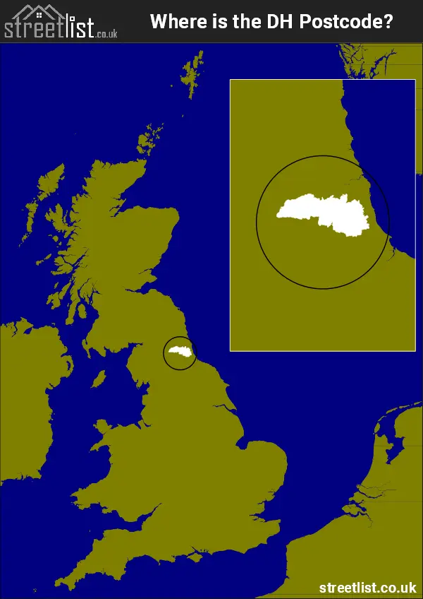
Where is the DH Postcode Area?
The DH Durham Postcode is in the North East of England. The postal area borders the following neighbouring postal areas: SR - Sunderland, NE - Newcastle upon Tyne, TS - Teeside and DL - Darlington, and is located inland.
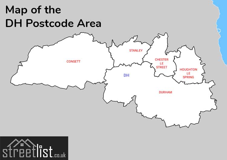
Map of the DH Durham Postcode Area
Explore the DH Durham postcode area by using our interactive map.
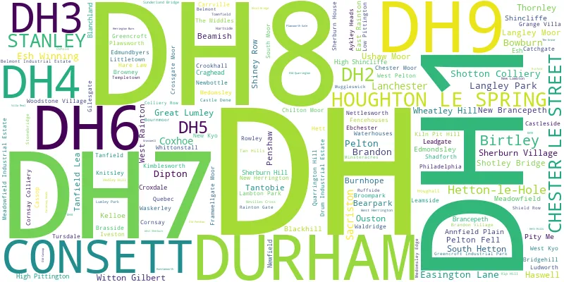
Postcode Districts within the DH Durham Postcode Area
There are 9 postcode districts within the Durham postcode area
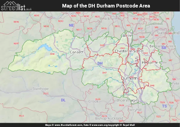
A map showing the boundary of in relation to other areas
There are 9 towns within the Durham postcode area.
| Unit | Area² |
|---|---|
| Hectares | 680,800² |
| Miles | 2,629² |
| Feet | 73,280,631,200² |
| Kilometres | 6,808² |
Postal Delivery Offices serving the DH Durham Postcode Area
- Chester Le Street Delivery Office
- Derwentside Delivery Office
- Durham Delivery Office
- Houghton Le Spring Delivery Office
Councils with Postcodes in DH
Towns and Villages within the DH Durham Postcode Area
- Annfield Plain - town
- Beamish - village
- Bearpark - village
- Birtley - Settlement
- Blanchland - village
- Bournmoor - village
- Bowburn - village
- Brancepeth - village
- Brandon - village
- Broompark - village
- Burnhope - village
- Cassop - village
- Castleside - village
- Chester Moor - village
- Chester-le-Street - town
- Chilton Moor - village
- Consett - town
- Coxhoe - village
- Craghead - village
- Croxdale - village
- Dipton - village
- Durham - city
- Easington Lane - village
- East Law - village
- East Rainton - village
- Ebchester - village
- Edmondbyers - village
- Edmondsley - village
- Esh - village
- Esh Winning - village
- Fence Houses - village
- Gateshead - town
- Grange Villa - village
- Great Lumley - village
- Haswell - village
- Haswell Plough - village
- Hett - village
- Hetton-le-Hole - town
- High Dubmire - village
- High Handenhold - village
- High Pittington - village
- High Shincliffe - village
- Hobson - village
- Holmside - village
- Houghton-le-Spring - town
- Iveston - village
- Kelloe - village
- Kimblesworth - village
- Lanchester - village
- Langley Moor - village
- Langley Park - village
- Leadgate - village
- Littletown - village
- Low Pittington - village
- Ludworth - village
- Maiden Law - village
- Meadowfield - village
- Medomsley - village
- Medomsley Edge - village
- Nettlesworth - village
- New Brancepeth - village
- New Herrington - village
- Newbottle - village
- Newfield - village
- No Place - village
- Ouston - village
- Pelton - village
- Pelton Fell - village
- Penshaw - village
- Peterlee - town
- Philadelphia - village
- Plawsworth - village
- Quaking Houses - village
- Quarrington Hill - village
- Quebec - village
- Sacriston - village
- Shadforth - village
- Sherburn - village
- Sherburn Hill - village
- Sherburn House - village
- Shincliffe - village
- Shiney Row - village
- South Hetton - village
- Stanley - town
- Sunderland Bridge - village
- Tan Hills - village
- Tanfield - village
- Tanfield Lea - otherSettlement
- Tanfield Lea - village
- Tantobie - village
- The Dene - village
- Thornley - village
- Tursdale - village
- Urpeth - village
- Ushaw Moor - village
- Waldridge - village
- Washington - town
- Waterhouses - village
- West Herrington - village
- West Pelton - village
- West Rainton - village
- Wheatley Hill - village
- White-le-Head - village
- Whitehill - village
- Whittonstall - village
- Witton Gilbert - village
- Woodstone Village - village