The TS6 7 postcode sector is within the county of North Yorkshire.
Did you know? According to the 2021 Census, the TS6 7 postcode sector is home to a bustling 4,685 residents!
Given that each sector allows for 400 unique postcode combinations. Letters C, I, K, M, O and V are not allowed in the last two letters of a postcode. With 146 postcodes already in use, this leaves 254 units available.
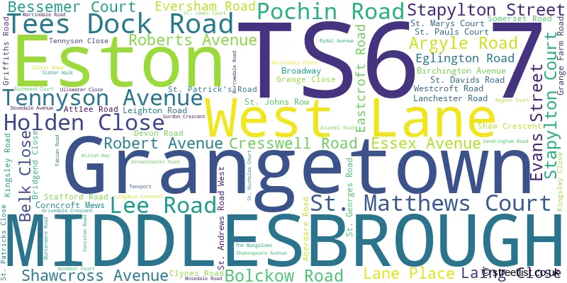
The largest settlement in the TS6 7 postal code is MIDDLESBROUGH followed by Grangetown, and Eston.
The TS6 7 Postcode shares a border with TS6 9 (MIDDLESBROUGH, Eston, Normanby), TS10 4 (REDCAR, Wilton), TS6 6 (MIDDLESBROUGH, South Bank, Skippers Lane Industrial Estate), TS6 8 (MIDDLESBROUGH, Eston, Lazenby) and TS10 5 (REDCAR, Kirkleatham Business Park).
The sector is within the post town of MIDDLESBROUGH.
TS6 7 is a postcode sector within the TS6 postcode district which is within the TS Teeside postcode area.
The Royal Mail delivery office for the TS6 7 postal sector is the South Bank Delivery Office.
The area of the TS6 7 postcode sector is 2.38 square miles which is 6.16 square kilometres or 1,521.44 square acres.
The TS6 7 postcode sector is crossed by the A1053 Major A road.

Map of the TS6 7 Postcode Sector
Explore the TS6 7 postcode sector by using our free interactive map.
| T | S | 6 | - | 7 | X | X |
| T | S | 6 | Space | 7 | Letter | Letter |
Official List of Streets
MIDDLESBROUGH (62 Streets)
Grangetown (16 Streets)
Eston (1 Streets)
Unofficial Streets or Alternative Spellings
MIDDLESBROUGH
CAERNARVON CLOSE CASTLETON ROAD CHEDDAR CLOSE ELLERBY ROAD MONMOUTH ROAD SANDSEND ROAD ST. DAVIDS ROAD ST. PATRICKS ROAD ALEXANDRA ROAD BOLCKLOW ROAD BROADAWAY BURNSVILLE ROAD CHEETHAM STREET DABHOLM ROAD DEEPDALE AVENUE GRANGETOWN STATION ROAD GRANVILLE ROAD GREYSTONE ROAD INSTITUTE TERRACE KINKERDALE ROAD LANCASTER ROAD RAILWAY PLACE ROBERTS STREET SAINT ANDREWS ROAD EAST SAINT ANDREWS ROAD WEST SAINT DAVIDS ROAD SAINT GEORGES ROAD EAST SAINT GEORGES ROAD WEST SAINT PATRICKS CLOSE SAINT PATRICKS ROAD SEA VIEW TERRACE SLAG ROAD ST. ANDREWS ROAD EAST ST. ANDREWS ROAD WEST ST. GEORGES BUNGALOW ST. GEORGES ROAD EAST ST. GEORGES ROAD WEST ST. MATTHEW COURT TEES DOCK ROAD ROUNDABOUT WHITWORTH ROAD WOOD STREETREDCAR
TRUNK ROADGrangetown
ELGIN AVENUE ESTON ROAD TEES DOCK ROADEston
CHURCH LANE TRUNK ROAD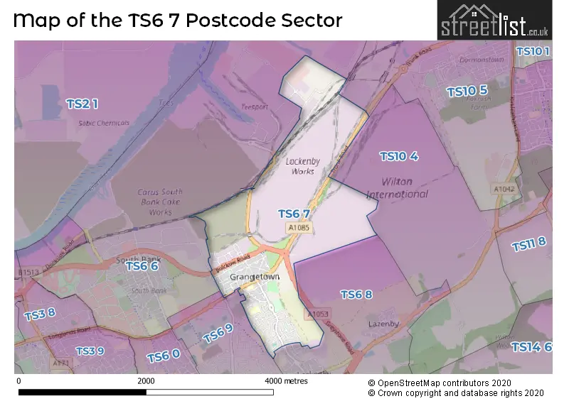
House Prices in the TS6 7 Postcode Sector
| Type of Property | 2018 Average | 2018 Sales | 2017 Average | 2017 Sales | 2016 Average | 2016 Sales | 2015 Average | 2015 Sales |
|---|---|---|---|---|---|---|---|---|
| Detached | £0 | 0 | £0 | 0 | £0 | 0 | £90,000 | 1 |
| Semi-Detached | £49,859 | 16 | £53,524 | 16 | £47,106 | 9 | £57,609 | 11 |
| Terraced | £46,400 | 11 | £44,438 | 16 | £49,791 | 11 | £33,667 | 6 |
| Flats | £0 | 0 | £0 | 0 | £49,000 | 1 | £0 | 0 |
Important Postcodes TS6 7 in the Postcode Sector
TS6 7AD is the postcode for St. Marys CV Primary Academy, Tennyson Avenue, and St Mary's Catholic Primary School, Tennyson Avenue
TS6 7BJ is the postcode for South Tees Skills Centre, Stapylton Street, and GREYSTONES, South Tees Skills Centre, Stapylton Street
TS6 7BS is the postcode for Grangetown Neighbourhood Centre, Bolckow Road
TS6 7HP is the postcode for Grangetown Youth & Community Centre, Grange Farm Road
TS6 7JA is the postcode for Grangetown Primary School, St. Georges Road
TS6 7LP is the postcode for Redcar & Cleveland Borough Council, Grangetown Library, 171 Birchington Avenue
TS6 7NA is the postcode for Caedmon Primary School, Attlee Road
TS6 7NP is the postcode for Mo Mowlam Academy, Tennyson Avenue
| The TS6 7 Sector is within these Local Authorities |
|
|---|---|
| The TS6 7 Sector is within these Counties |
|
| The TS6 7 Sector is within these Water Company Areas |
|