The TS6 8 postcode sector is within the county of North Yorkshire.
Did you know? According to the 2021 Census, the TS6 8 postcode sector is home to a bustling 2,612 residents!
Given that each sector allows for 400 unique postcode combinations. Letters C, I, K, M, O and V are not allowed in the last two letters of a postcode. With 87 postcodes already in use, this leaves 313 units available.
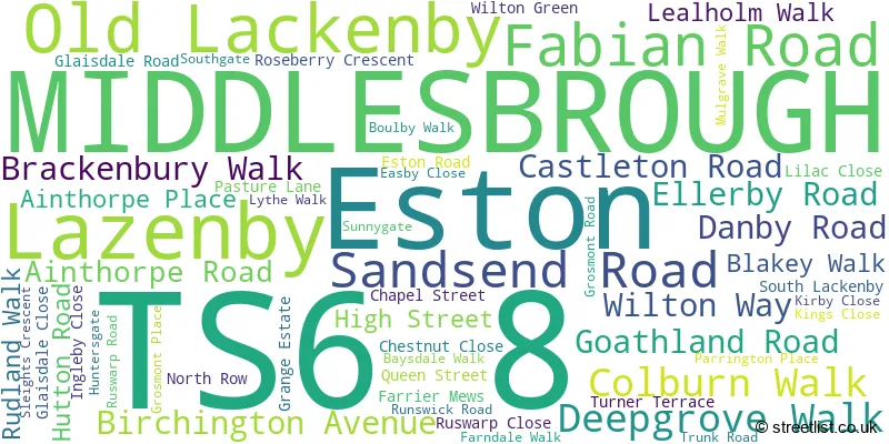
The largest settlement in the TS6 8 postal code is MIDDLESBROUGH followed by Eston, and Lazenby.
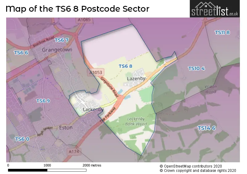
The TS6 8 Postcode shares a border with TS6 7 (MIDDLESBROUGH, Grangetown, Eston), TS6 9 (MIDDLESBROUGH, Eston, Normanby), TS10 4 (REDCAR, Wilton) and TS14 6 (GUISBOROUGH, Dunsdale).
The sector is within the post town of MIDDLESBROUGH.
TS6 8 is a postcode sector within the TS6 postcode district which is within the TS Teeside postcode area.
The Royal Mail delivery office for the TS6 8 postal sector is the South Bank Delivery Office.
The area of the TS6 8 postcode sector is 1.81 square miles which is 4.70 square kilometres or 1,160.97 square acres.
The TS6 8 postcode sector is crossed by the A174 Major A road.
The TS6 8 postcode sector is crossed by the A1053 Major A road.

Map of the TS6 8 Postcode Sector
Explore the TS6 8 postcode sector by using our free interactive map.
| T | S | 6 | - | 8 | X | X |
| T | S | 6 | Space | 8 | Letter | Letter |
Official List of Streets
MIDDLESBROUGH (45 Streets)
Eston (4 Streets)
Unofficial Streets or Alternative Spellings
House Prices in the TS6 8 Postcode Sector
| Type of Property | 2018 Average | 2018 Sales | 2017 Average | 2017 Sales | 2016 Average | 2016 Sales | 2015 Average | 2015 Sales |
|---|---|---|---|---|---|---|---|---|
| Detached | £0 | 0 | £121,000 | 1 | £119,995 | 1 | £123,998 | 8 |
| Semi-Detached | £80,125 | 8 | £76,409 | 11 | £75,545 | 11 | £90,325 | 24 |
| Terraced | £58,962 | 13 | £58,889 | 9 | £55,681 | 8 | £57,391 | 16 |
| Flats | £35,000 | 1 | £0 | 0 | £0 | 0 | £20,000 | 1 |
Important Postcodes TS6 8 in the Postcode Sector
TS6 8AD is the postcode for Whale Hill Primary School, Sandsend Road
TS6 8DY is the postcode for Wilton Primary School, High Street
| The TS6 8 Sector is within these Local Authorities |
|
|---|---|
| The TS6 8 Sector is within these Counties |
|
| The TS6 8 Sector is within these Water Company Areas |
|