UB9 6LT is a postal code used within the United Kingdom for delivering mail.
Postcodes are made up of two parts. The part before the space (UB9) is called the outward code. The part after the space (6LT) is called the inward code. The letters C, I, K, M, O and V are not allowed in the inward code. In addition to the inward and outward code, the postcode can be broken up into four parts:
- Postal Area. In our case UB which means Uxbridge.
- Postal District. In our case UB9.
- Postal Sector. In our case UB10 8.
- Postcode Unit. The last two letters. In our case LT.
The regional mail center for the post area UB is the Princess Royal Distribution Centre, which is located at Blackmore Drive, North Circular, LONDON , NW10 7RH.
The final port of call for any post addressed to the UB9 6LT postcode is the local delivery office (DO) which is . Here the post will be sorted ready for delivery.
The properties in the UB9 6LT postcode have the street address of Breakspear Road South
A close-knit community! The 2021 Census indicates that only 15 individuals call the UB9 6LT postcode their home.
It is situated within the post town of UXBRIDGE within the old postal county of Middlesex.
UB9 6LT is within Ruislip.
Looking at our data the UB9 6LT is mostly residential but does contain some commercial properties.
The UB9 6LT postcode area is composed of 83.33% residential properties, 16.67% commercial properties, and 0% public properties.
According to our data. Most dwellings in UB9 6LT are houses. Of these houses, most are mid-terraced. The remainder are end-terraced.
Most properties in UB9 6LT are privately rented with the rest being owned by the occupiers.
None Domestic Buildings in UB9 6LT fall under these categories: Food And Drink.
Food And Drink include Breakspear Arms, Breakspear Road South.

Interactive Mapping Showing UPRNs within the UB9 6LT Postcode Boundaries
Use the search box to search for other postcodes or places.
Map of the UB9 6LT Postcode

UB9 6LT: Points of Interest
Breakspear Arms
Breakspear Arms is a social venue where you can enjoy drinks, meals, and entertainment located at Breakspear Arms, Breakspear Road South, Ickenham, UB9 6LT.
| Property Type | Percentage |
|---|---|
| Residential | 83.33% |
| Commercial | 16.67% |
| Public | 0% |
Telephone Area Code for UB9 6LT
The telephone area code for UB9 6LT is 01895 Uxbridge.
Map Coordinates for UB9 6LT
| Latitude | 51.5793306458 |
|---|---|
| Longitude | -0.448408093347 |
What are the Broadband Speeds like in the UB9 6LT Postcode?
Download Speeds For UB9 6LT

| Average Mbps | 35.100 |
|---|---|
| Median Mbps | 36.600 |
| Maximum Mbps | 59.820 |
UB9 6LT has an average download speed of 35.1 Megabits per second (Mbps).
934 other postcode units have the same broadband speed.
11% of postcodes (131,468) have slower broadband speeds.
89% of postcodes (1,052,239) have faster broadband speeds.
Upload Speeds For UB9 6LT
| Average Mbps | 7.000 |
|---|---|
| Median Mbps | 7.400 |
| Maximum Mbps | 11.870 |
UB9 6LT has an average upload speed of 7 Megabits per second (Mbps).
3,662 other postcode units have the same upload speed.
12% of postcodes (137,890) have slower upload speeds.
88% of postcodes (1,043,089) have faster upload speeds.
Schools within a five minute drive of UB9 6LT Postcode
England Primary Schools
Bishop Winnington-Ingram CofE Primary School
Address: Bishop Winnington-Ingram CofE Primary School, Southcote Rise, Ruislip, HA4 7LW
Distance: 0.65 miles
Contact: 01895633520
Whiteheath Junior School
Address: Whiteheath Junior School, Whiteheath Avenue, Ruislip, Middlesex, HA4 7PR
Distance: 0.33 miles
Contact: 01895634964
The Breakspear School
Address: The Breakspear School, Bushey Road, Ickenham, UB10 8JA
Distance: 0.66 miles
Contact: 01895462390
Whiteheath Infant & Nursery School
Address: Whiteheath Infant & Nursery School, Ladygate Lane, Whiteheath Infant & Nursery School, Ruislip, Middlesex, HA4 7RF
Distance: 0.34 miles
Contact: 01895630262
Harefield Infant School
Address: Harefield Infant School, High Street, Harefield, UB9 6BT
Distance: 2.21 miles
Contact: 01895462399
England Secondary Schools
Vyners School
Address: Vyners School, Warren Road, Ickenham, Uxbridge, UB10 8AB
Distance: 1.56 miles
Contact: 01895234342
Nearest Dentists
Dentists near UB9 6LT
OAKS DENTAL PRACTICE
Address: 2 MANOR ROAD, RUISLIP, HA4 7LB
Distance: 0.81 miles
Contact: :
SWAKELEYS ROAD (DENTAL SURGERY)
Address: 77 SWAKELEYS ROAD, UXBRIDGE, MIDDLESEX, UB10 8DQ
Distance: 0.96 miles
Contact: :
J&R DENTAL RUISLIP
Address: 44 HIGH STREET, RUISLIP, HA4 7AN
Distance: 0.97 miles
Contact: :
DAMIRA RUISLIP
Address: 33 EASTCOTE ROAD, RUISLIP, MIDDLESEX, HA4 8BE
Distance: 1.03 miles
Contact: :
DENTAL SURGERY
Address: 116 SWAKELEYS ROAD, UXBRIDGE, MIDDLESEX, UB10 8BA
Distance: 1.03 miles
Contact: :
DENTAL SURGERY
Address: 34 KINGSEND, RUISLIP, MIDDLESEX, HA4 7DA
Distance: 1.05 miles
Contact: :
Nearest Chemists
Pharmacies near UB9 6LT
HOWLETTS PHARMACY
Address: 81 HOWLETTS LANE, RUISLIP, HA4 7YG
Distance: 0.55 miles
Contact: tel: 01895 674881
WINCHESTER PHARMACY
Address: 79 SWAKELEYS ROAD, ICKENHAM, UXBRIDGE, MIDDLESEX, UB10 8DQ
Distance: 0.96 miles
Contact: tel: 01895 675750
ASHWORTHS PHARMACY
Address: 64 HIGH STREET, RUISLIP, MIDDLESEX, HA4 7AA
Distance: 1.03 miles
Contact: tel: 01895 632101
GARNERS ICKENHAM
Address: 1 SWAKELEYS, ICKENHAM, UXBRIDGE, MIDDLESEX, UB10 8DF
Distance: 1.04 miles
Contact: tel: 01895 632576
BOOTS
Address: 67 HIGH STREET, RUISLIP, MIDDLESEX, HA4 8JB
Distance: 1.11 miles
Contact: tel: 01895 639991
BOOTS
Address: WOOD LANE MEDICAL CENTRE, 2A WOOD LANE, RUISLIP, MIDDLESEX, HA4 6ER
Distance: 1.14 miles
Contact: tel: 01895 672008
Nearest Opticians
Opticians near UB9 6LT
BOOTS OPTICIANS (RUISLIP)
Address: 33 HIGH STREET, RUISLIP, MIDDLESEX, HA4 7AU
Distance: 0.97 miles
Contact: :
A V K I CARE
Address: 15A SWAKELEYS ROAD, ICKENHAM, UXBRIDGE, MIDDLESEX, UB10 8DF
Distance: 1.04 miles
Contact: :
SPECSAVERS (RUISLIP)
Address: 116-118 HIGH STREET, RUISLIP, HA4 8LS
Distance: 1.09 miles
Contact: :
VISION EXPRESS (RUISLIP)
Address: 112 HIGH STREET, RUISLIP, MIDDLESEX, HA4 8LS
Distance: 1.09 miles
Contact: :
EYE DESIGN OPTICIANS LTD
Address: 170 HIGH STREET, RUISLIP, MIDDLESEX, HA4 8LJ
Distance: 1.18 miles
Contact: :
J DAVIES & PARTNERS (GREENFORD)
Address: 51 VICTORIA ROAD, RUISLIP, MIDDLESEX, HA4 9BH
Distance: 1.66 miles
Contact: :
Nearest GP Surgeries
Doctors near UB9 6LT
LADYGATE LANE MEDICAL PRACTICE
Address: 22 LADYGATE LANE, RUISLIP, MIDDLESEX, HA4 7QU
Distance: 0.52 miles
Contact: tel: 01895 632741
SOUTHCOTE CLINIC
Address: SOUTHCOTE RISE, RUISLIP, MIDDLESEX, HA4 7LJ
Distance: 0.63 miles
Contact: tel: 01895 679800
WALLASEY MEDICAL CENTRE
Address: 1 WALLASEY CRESCENT, ICKENHAM, UXBRIDGE, MIDDLESEX, UB10 8SA
Distance: 0.87 miles
Contact: tel: 01895 674156
KING EDWARDS MEDICAL CENTRE
Address: 19 KING EDWARDS ROAD, RUISLIP, MIDDLESEX, HA4 7AE
Distance: 0.93 miles
Contact: tel: 01895 632021
DR MASHRU & PARTNERS
Address: 93 SWAKELEYS ROAD, ICKENHAM, MIDDLESEX, UB10 8DQ
Distance: 0.96 miles
Contact: tel: 01895632114
DR N RAJ & PARTNERS
Address: 108 AYLSHAM DRIVE, ICKENHAM, MIDDLESEX, UB10 8UD
Distance: 1.00 miles
Contact: tel: 01895 637800
Motorway Junctions near UB9 6LT
Train Stations
Motorway Junctions near UB9 6LT
Distances represent the quickest route by car.
Who are my Elected Representatives in the UB9 6LT Postcode?
| Westminster Constituency | Ruislip, Northwood and Pinner Boro Const |
|---|---|
| Member or Parliament | 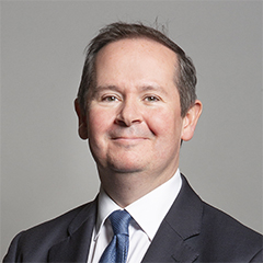 |
| Contact Details | Contact David Simmonds |
| Political Party | Conservative |
What Council is the UB9 6LT Postcode in?
The Local Council for this Postcode is Hillingdon London Boro Council and the County Council is Greater London Authority Council.
Greater London Authority Council is responsible for providing education, libraries and maintaining highways.
Hillingdon London Boro Council is responsible for duties such as council tax, rubbish collection, housing, environmental health and planning.
You can visit the website for Hillingdon London Boro at the following link Hillingdon London Boro.How much is the Council Tax?
Hillingdon London Boro Council is responsible for collecting council tax. This will vary depending on which council tax band the property falls within. You can check the council tax band at the gov.uk website.
Once you know the council tax band you can view how much Hillingdon London Boro charge for that band by visiting the The Council Tax section of their website.
Where can I find out where the nearest Library to the UB9 6LT Postcode is?
Libraries are the responsibility of Hillingdon council
Visit the link for more information. Please note that some councils outsource library services to private companies and community groups ran by volunteers.
Libraries - Hillingdon CouncilPostcodes near the UB9 6LT Postcode
What Popular Supermarkets are near the UB9 6LT Postcode?
| Supermarket | Distance | Directions |
|---|---|---|
| Iceland, High Street, RUISLIP, HA4 8LJ | 1.90 miles | Directions from UB9 6LT to Iceland |
| Waitrose, Kingsend, RUISLIP, HA4 7DS | 1.96 miles | Directions from UB9 6LT to Waitrose |
| Aldi, Field End Road, PINNER, HA5 1QH | 3.40 miles | Directions from UB9 6LT to Aldi |
| Aldi, Victoria Road, RUISLIP, HA4 0EH | 3.86 miles | Directions from UB9 6LT to Aldi |
| Sainsburys, York Road, UXBRIDGE, UB8 1QW | 3.86 miles | Directions from UB9 6LT to Sainsburys |
What Popular Restaurants are near the UB9 6LT Postcode?
| Burger King | Distance | Directions |
|---|---|---|
| 25 Chequers Square, Uxbridge, UB8 1LN | 2.64 miles | Directions from UB9 6LT to 25 Chequers Square |
| Glencoe Road, Yeading, Yeading, UB4 9SN | 4.57 miles | Directions from UB9 6LT to Glencoe Road, Yeading |
| St Annes Centre Food Court, Harrow, HA1 1AT | 4.80 miles | Directions from UB9 6LT to St Annes Centre Food Court |
| Charter Place,, Watford, WD17 2DJ | 5.76 miles | Directions from UB9 6LT to Charter Place, |
| Mcdonald's | Distance | Directions |
|---|---|---|
| McDonald's, High Street, RUISLIP, HA4 8LJ | 1.18 miles | Directions from UB9 6LT to McDonald's, High Street, RUISLIP, HA4 8LJ |
| McDonald's, Oxford Road, Denham, UXBRIDGE, UB9 4DA | 2.52 miles | Directions from UB9 6LT to McDonald's, Oxford Road, Denham, UXBRIDGE, UB9 4DA |
| McDonald's, High Street, UXBRIDGE, UB8 1JT | 2.56 miles | Directions from UB9 6LT to McDonald's, High Street, UXBRIDGE, UB8 1JT |
| McDonald's, The Chimes Shopping Centre, High Street, UXBRIDGE, UB8 1GA | 2.63 miles | Directions from UB9 6LT to McDonald's, The Chimes Shopping Centre, High Street, UXBRIDGE, UB8 1GA |
| Restaurant | Distance | Directions |
|---|---|---|
| KFC, High Street, RUISLIP, HA4 7AA | 1.03 miles | Directions from UB9 6LT to KFC Ruislip - High Street |
| KFC, The Broadway, Joel Street, NORTHWOOD, HA6 1NU | 2.30 miles | Directions from UB9 6LT to KFC Northwood Hills - Noel Street |
| KFC, Oxford Road, Denham, UXBRIDGE, UB9 4DW | 2.37 miles | Directions from UB9 6LT to KFC Uxbridge - Oxford Road |
| KFC, Alexandra Avenue, HARROW, HA2 9SE | 3.32 miles | Directions from UB9 6LT to KFC Rayners Lane - Alexandra Avenue |
| KFC, Whiteleys Parade, Uxbridge Road, Hillingdon, UXBRIDGE, UB10 0PD | 3.42 miles | Directions from UB9 6LT to KFC Hillingdon - Whiteleys Parade |