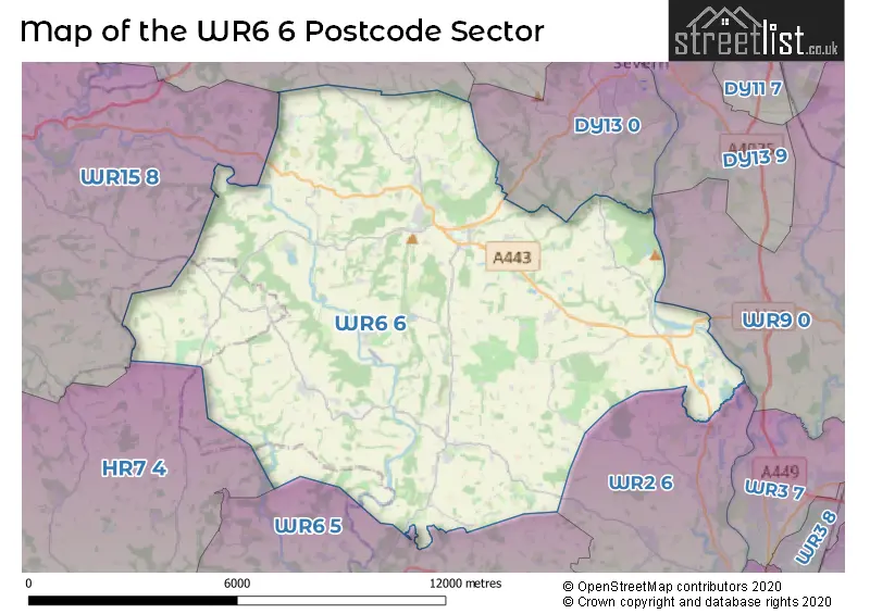
The WR6 6 postcode sector stands on the Herefordshire and Worcestershire border.
Did you know? According to the 2021 Census, the WR6 6 postcode sector is home to a bustling 7,743 residents!
Given that each sector allows for 400 unique postcode combinations. Letters C, I, K, M, O and V are not allowed in the last two letters of a postcode. With 285 postcodes already in use, this leaves 115 units available.
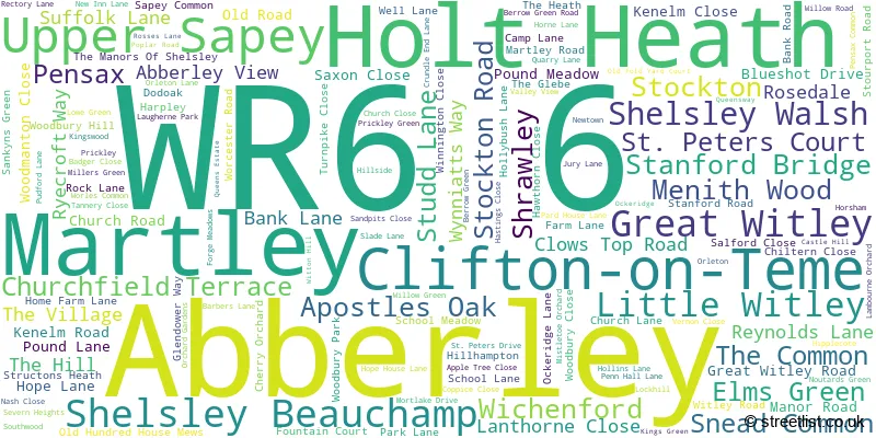
The largest settlement in the WR6 6 postal code is Martley followed by Clifton-on-Teme, and Holt Heath.
The WR6 6 Postcode shares a border with WR9 0 (Ombersley, DROITWICH, Hampton Lovett), DY13 0 (STOURPORT-ON-SEVERN, Astley, Dunley), WR2 6 (WORCESTER, Hallow, Lower Broadheath), WR6 5 (Whitbourne, Bishops Frome, Suckley), WR15 8 (TENBURY WELLS, Burford, Newnham Bridge), DY14 9 (Rock, Far Forest, Clows Top) and HR7 4 (BROMYARD, Tedstone Wafre, Stoke Lacy).
The sector is within the post town of WORCESTER.
WR6 6 is a postcode sector within the WR6 postcode district which is within the WR Worcester postcode area.
The Royal Mail delivery office for the WR6 6 postal sector is the Worcester Apc and Abberley Scale Payment Delivery Office and Clifton-on-teme Scale Payment Delivery Office and Great Witley Scale Payment Delivery Office and Holt Heath Scale Payment Delivery Office.
The area of the WR6 6 postcode sector is 52.47 square miles which is 135.90 square kilometres or 33,582.57 square acres.
Waterways within the WR6 6 postcode sector include the River Severn, River Teme.

Map of the WR6 6 Postcode Sector
Explore the WR6 6 postcode sector by using our free interactive map.
| W | R | 6 | - | 6 | X | X |
| W | R | 6 | Space | 6 | Letter | Letter |
Official List of Streets
Holt Heath (12 Streets)
Abberley (20 Streets)
Martley (34 Streets)
Little Witley (6 Streets)
Clifton-on-Teme (22 Streets)
Great Witley (16 Streets)
Wichenford (8 Streets)
Upper Sapey (4 Streets)
Menith Wood (2 Streets)
Stockton (6 Streets)
Stanford Bridge (4 Streets)
Shrawley (4 Streets)
Unofficial Streets or Alternative Spellings
Ombersley
HOLT FLEET ROADCotheridge
ANKERDINE ROADSTOURPORT-ON-SEVERN
DUNLEY ROADDunley
NETHERTON LANEBroadwas
EASINGHOPE LANERock
PORCHBROOK ROADSchools and Places of Education Within the WR6 6 Postcode Sector
Abberley Parochial VC Primary School
Voluntary controlled school
Apostles Oak, Abberley, Worcestershire, WR6 6AA
Head: Mrs Claire Shelley
Ofsted Rating: Good
Inspection: 2023-10-11 (237 days ago)
Website: Visit Abberley Parochial VC Primary School Website
Phone: 01299896332
Number of Pupils: 117
Clifton upon Teme Primary School
Community school
Pound Lane, Worcester, Worcestershire, WR6 6DE
Head: Miss Karen Crawford
Ofsted Rating: Good
Inspection: 2023-01-31 (490 days ago)
Website: Visit Clifton upon Teme Primary School Website
Phone: 01886812258
Number of Pupils: 78
Great Witley CofE Primary School
Academy converter
Worcester Road, Worcester, Worcestershire, WR6 6HR
Head: Mrs Kate Ramsey
Ofsted Rating: Good
Inspection: 2019-02-05 (1946 days ago)
Website: Visit Great Witley CofE Primary School Website
Phone: 01299896246
Number of Pupils: 192
Martley CofE Primary School
Academy converter
Martley, Worcester, Worcestershire, WR6 6QA
Head: Mrs Lucy Cox
Ofsted Rating: Good
Inspection: 2023-11-22 (195 days ago)
Website: Visit Martley CofE Primary School Website
Phone: 01886888201
Number of Pupils: 139
The Chantry School
Academy converter
Martley, Worcester, Worcestershire, WR6 6QA
Head: Andrew Dickenson
Ofsted Rating: Good
Inspection: 2023-03-14 (448 days ago)
Website: Visit The Chantry School Website
Phone: 01886887100
Number of Pupils: 884
House Prices in the WR6 6 Postcode Sector
| Type of Property | 2018 Average | 2018 Sales | 2017 Average | 2017 Sales | 2016 Average | 2016 Sales | 2015 Average | 2015 Sales |
|---|---|---|---|---|---|---|---|---|
| Detached | £433,050 | 55 | £429,509 | 53 | £418,447 | 91 | £418,120 | 75 |
| Semi-Detached | £269,996 | 21 | £238,125 | 19 | £257,378 | 40 | £230,186 | 24 |
| Terraced | £286,904 | 13 | £263,821 | 14 | £320,429 | 7 | £202,129 | 15 |
| Flats | £267,975 | 2 | £220,000 | 2 | £0 | 0 | £208,333 | 3 |
Important Postcodes WR6 6 in the Postcode Sector
WR6 6AA is the postcode for Abberley Parochial V C Primary School, Apostles Oak
WR6 6DE is the postcode for Clifton upon Teme Primary School, Pound Lane
WR6 6DH is the postcode for Clifton upon Teme Primary School, 8 The Village
WR6 6HR is the postcode for Great Witley C of E Primary School, Worcester Road, and Great Witley C of E Primary School, Worcester Road, Great Witley
WR6 6NH is the postcode for University of Worcester Activity Centre, Top Barn Business Centre, Worcester Road
WR6 6QA is the postcode for DESIGN & TECHNOLOGY, Chantry High School, Martley, HUMANITIES, Chantry High School, Martley, Chantry High School, Martley, Sport Martley, Martley, Martley C E Primary School, Martley, and ICT & LEARNING SUPPORT, Chantry High School, Martley
| The WR6 6 Sector is within these Local Authorities |
|
|---|---|
| The WR6 6 Sector is within these Counties |
|
| The WR6 6 Sector is within these Water Company Areas |
|
Tourist Attractions within the WR6 6 Postcode Area
We found 2 visitor attractions within the WR6 postcode area
| Great Witley Parish Church |
|---|
| Places of Worship |
| Place of Worship (still in use) |
| View Great Witley Parish Church on Google Maps |
| Witley Court & Gardens (English Heritage) |
| Historic Properties |
| Historic House / House and Garden / Palace |
| View Witley Court & Gardens (English Heritage) on Google Maps |