Map of Diamond Lane
| Postcodes | ||
|---|---|---|
| Icon | Postcodes for Diamond Lane | |
| Walking Distances | ||
| Distance Info | Green Circle = 10 Minutes Walk (800 metres) | |
About Diamond Lane
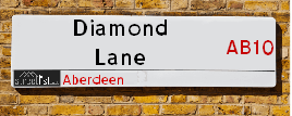
Diamond Lane is a street located in Aberdeen. It uses the postcode AB10 1WB. The street has a length of approximately 72 metres.
Diamond Lane is located within the Aberdeen City Council's jurisdiction. They provide various services, like refuse collection, and manage council tax collection. It's situated in the (pseudo) Scotland region of the UK.
Diamond Lane is located within the county of City of Aberdeen, situated in the (pseudo) Scotland region of the UK. It's 398.51 miles North from central London., 0.36 miles West from Aberdeen, 57.81 miles North East from Dundee and 82.56 miles East from Inverness.
Diamond Lane is within the Post Town of ABERDEEN

Do you know why this road is called Diamond Lane?
What's it like to live here?
Ask the community a question about Diamond Lane.
Do you have any questions, memories to share or know any facts about Diamond Lane? We'd love to know more.
Also on streetlist.co.uk, can you help?
Swing Swang Lane
28th April 2024
I am trying to find out why the lane is named Swing Swang?
It has been known known this since at least 1905 when hedge making contents used to be held here.
Swing Swang is often used to describe a fairground ride. I remember Swing Boats. Were they a bit like this or is Swing Swang another name for swings?
Swing Swangs are also mentioned in connection to orchards. Or were orchards just good places to have swings?
Estate Agents near Diamond Lane
| Name | Address | Website |
|---|---|---|
| Margaret Duffus Leasing | 52 Bon Accord Street Aberdeen AB11 6EL | Visit Website |
| Murray & Currie | 11 Chapel Street, Aberdeen, AB10 1SS | Visit Website |
| AM-PM Leasing | 441 Union Street, Aberdeen, AB11 6DA | Visit Website |
We have found 1 postcode for Diamond Lane
Location Details
| Diamond Lane | |
|---|---|

| |
| Latitude | 57.145523 |
| Longitude | -2.103800 |
| OS Easting (X): | 393719 |
| OS Northing (Y): | 806054 |
| OS Grid Reference: | NJ937061 |
Neighbourhood Policing |
| Police Force: Scotland |
| Find a Local Neighbourhood Watch Scheme |
Frequently asked Questions for Diamond Lane
What Council (Local Authority) is Diamond Lane in?
Diamond Lane is located within the local authority area of Aberdeen City Council which is a Scottish unitary authority.
What Parish Council is Diamond Lane in?
Diamond Lane is in an unparished area.
What Electoral Ward is Diamond Lane in?
Diamond Lane is located within the ward of Midstocket/Rosemount.
What County is Diamond Lane in?
Diamond Lane is located within the ceremonial county of City of Aberdeen.
What Constituency is Diamond Lane in?
Diamond Lane is located within the constituency of Aberdeen South.
What Part of the UK is Diamond Lane in?
Diamond Lane is located within the historic nation of Scotland.
What County Council area is Diamond Lane in?
Diamond Lane is not in a County Council area.
What Police Force area is Diamond Lane in?
Diamond Lane is located within the Scotland Police area.
Roads that have a Junction with Diamond Lane
| Street | Junction Type |
|---|---|
| South Silver Street | junction |
| Diamond Street | junction |
Sunset and Sunrise times for Diamond Lane , AB10 1WB
| Sunrise | 04:55 |
|---|---|
| Sunset | 21:14 |
Latest Weather Conditions for Diamond Lane, AB10 1WB
| Observed at Weather Station: | Aberdeen Airport 10 May 2024 at 21:00 (5.57 miles away) |
|---|---|
| Current Weather: | Partly cloudy (night) |
| Temperature and Humidity: | 16.4°C (63.8%) |
| Wind Direction and Speed: | SW (9 mph) |
Population Statistics
| ONS Area Code | S00090516 |
|---|---|
| ONS Area Name | Multicultural Student Neighbourhoods |
| LSOA Code: | S01006586 |
|---|---|
| LSOA Name: | City Centre West - 05 |
| SOA Code: | 1a |
| SOA Name: | |
| MSOA Code: | S02001249 |
| MSOA Name: | City Centre West |
Nearest Supermarkets
| Sainsburys Aberdeen Union Street Local |
|---|
| 206 Union Street, Aberdeen, Scotland, AB10 1QS |
| 1224635120 |
| Distance: 0.08 Miles |
| Directions from Diamond Lane to Sainsburys Aberdeen Union Street Local |
| Sainsburys Aberdeen Guild Street Local |
|---|
| 54 Guild Street, Aberdeen, Scotland, AB11 6NB |
| 1224211971 |
| Distance: 0.22 Miles |
| Directions from Diamond Lane to Sainsburys Aberdeen Guild Street Local |
| Sainsburys Aberdeen St Nicholas Centre Local |
|---|
| St. Nicholas Centre, Aberdeen, Scotland, AB10 1HW |
| Distance: 0.25 Miles |
| Directions from Diamond Lane to Sainsburys Aberdeen St Nicholas Centre Local |
| Sainsburys Aberdeen St Nicholas Centre Local |
|---|
| St. Nicholas Centre, Aberdeen, Scotland, AB10 1HW |
| 01224 638 914 |
| Distance: 0.25 Miles |
| Directions from Diamond Lane to Sainsburys Aberdeen St Nicholas Centre Local |
Telephone Information
| Area Code |
|---|
| Area Code: 01224 - Aberdeen |
Broadband Information
| Speed | Average Speed | Median Speed | Maximum Speed | Next-generation access (NGA) | Number of Connections |
|---|---|---|---|---|---|
| Less than 2 Mbps | 13.7 | 16.1 | 17.7 | N | 7 |
Local Government
| Local Council Details |
|---|
| Within the area of Aberdeen City |
| Visit the Council's Website |
| Aberdeen City Council Customer Service Centre, Ground Floor, Marischal College, Broad Street, Aberdeen &AB10 1AB |
| Telephone Number: 0845 608 0910 |
| Local Member of Parliament |
|---|
| Within the Westminster Parliamentary Constituency of Aberdeen South |
| The Member of Parliament is Stephen Flynn |
| Details for the MP Stephen Flynn on parliament.uk |
| Details for the MP Stephen Flynn on theyworkforyou.com |
| In the 2019 General Election Stephen Flynn won with a majority of 3,990 the result was SNP gain from Con. The total electorate was 65,719 |
| Wards, Parish Councils and County Councils |
|---|
| Ward: Midstocket/Rosemount Ward |
| Ceremonial County: City of Aberdeen |
Nearest Schools
Scotland Primary Schools
Tullos School
Address: Tullos School, Girdleness Road, Torry, ABERDEEN, AB11 8FJ
Distance: 1.39 miles
Contact: 01224 876621
Walker Road School
Address: Walker Road School, Walker Road, Aberdeen, AB11 8DL
Distance: 0.87 miles
Contact: 01224 879720
Hanover Street School
Address: Hanover Street School, Beach Boulevard, ABERDEEN, AB24 5HN
Distance: 0.62 miles
Contact: 01224 569880
Sunnybank School
Address: Sunnybank School, Sunnybank Road, Aberdeen, AB24 3NJ
Distance: 1.00 miles
Contact: 01224 261700
Ferryhill School
Address: Ferryhill School, 31 Caledonian Place, Aberdeen, AB11 6TT
Distance: 0.48 miles
Contact: 01224 586755
Gilcomstoun School
Address: Gilcomstoun School, Skene Street, Aberdeen, AB10 1PG
Distance: 0.28 miles
Contact: 01224 642722
Skene Square School
Address: Skene Square School, 61 Skene Square, Aberdeen, AB25 2UN
Distance: 0.53 miles
Contact: 01224 630493
Kittybrewster School
Address: Kittybrewster School, Great Northern Road, Aberdeen, AB24 3QG
Distance: 1.37 miles
Contact: 01224 484451
Ashley Road School
Address: Ashley Road School, 45 Ashley Road, Aberdeen, AB10 6RU
Distance: 0.87 miles
Contact: 01224 588732
Mile End School
Address: Mile End School, Mid Stocket Road, ABERDEEN, AB15 5LT
Distance: 1.07 miles
Contact: 01224 498140
Broomhill School
Address: Broomhill School, Gray Street, Aberdeen, AB10 6JF
Distance: 1.20 miles
Contact: 01224 315487
Abbotswell School
Address: Abbotswell School, Faulds Gate, Kincorth, ABERDEEN, AB12 5QX
Distance: 1.57 miles
Contact: 01224 872714
St Joseph's RC School
Address: St Joseph's RC School, 5 Queen's Road, Aberdeen, AB15 4YL
Distance: 1.00 miles
Contact: 01224 322730
Scotland Secondary Schools
Aberdeen Grammar School
Address: Aberdeen Grammar School, Skene Street, Aberdeen, AB10 1HT
Distance: 0.47 miles
Contact: 01224 642299
St Machar Academy
Address: St Machar Academy, St Machar Drive, Aberdeen, AB24 3YZ
Distance: 1.45 miles
Contact: 01224 492855
Harlaw Academy
Address: Harlaw Academy, 18/20 Albyn Place, Aberdeen, AB10 1RG
Distance: 0.56 miles
Contact: 01224 589251
Nearest Hospitals
| Name | Address | Postcode | Distance | Map |
|---|---|---|---|---|
| Woolmanhill Hospital | Skene Street, Aberdeen | AB25 1LD | 0.41 Km | View Directions |
| Aberdeen Community Health And Care Village | 50 Frederick Street, Aberdeen | AB24 5HY | 0.85 Km | View Directions |
| Rehabilitation Hospital | 15 Polmuir Road, Aberdeen | AB11 7RS | 1.16 Km | View Directions |
Nearest Dentists
Dentists near Diamond Lane
| Name | Address | Postcode | Distance | Map |
|---|---|---|---|---|
| ADVANCE DENTAL CENTRE | 17 Crown Street, Aberdeen | AB116HA | 0.12 Km | View Directions |
| BRIDGE STREET AESTHETIC&DENTAL CLINIC | 24-28 Bridge Street, Aberdeen | AB116JJ | 0.14 Km | View Directions |
| SMILE DENTAL CARE | 218 Union Street, Aberdeen | AB101TL | 0.18 Km | View Directions |
Nearest GP Surgeries
Doctors near Diamond Lane
NEWBURN HEALTH CENTRE
Address: ROSEMOUNT VIADUCT, ABERDEEN, ABERDEENSHIRE, AB25 1QB
Distance: 0.25 miles
Contact: tel: 03450 130740
HOLBURN MEDICAL GROUP
Address: 7 ALBYN PLACE, ABERDEEN, ABERDEENSHIRE, AB10 1YE
Distance: 0.45 miles
Contact: tel: 01224 400800
RUBISLAW PLACE MEDICAL GROUP
Address: RUBISLAW MEDICAL GROUP, 7 RUBISLAW PLACE, ABERDEEN, ABERDEENSHIRE, AB10 1QB
Distance: 0.46 miles
Contact: tel: 01224 641968
MARYWELL HEALTHCARE CENTRE
Address: TIMMERMARKET BUILDING, 1 EAST NORTH STREET, ABERDEEN, AB24 5HT
Distance: 0.51 miles
Contact: tel: 01224 651132
OUT OF HOURS URGENT CARE (GMED)
Address: YELLOW ZONE, ABERDEEN COMMUNITY HEALTH AND CARE, 50 FREDERICK STREET, ABERDEEN, AB24 5HY
Distance: 0.53 miles
Contact: tel: 01224 558079
WHINHILL MEDICAL PRACTICE
Address: 20 WHINHILL ROAD, ABERDEEN, AB11 7XH
Distance: 0.67 miles
Contact: :
Nearest Dispensing Chemists
Pharmacies near Diamond Lane
| Name | Address | Postcode | Telephone | Map | Distance in Km |
|---|---|---|---|---|---|
| Charles Michie | 391 Union Street, Aberdeen | AB11 6BX | 01224 585312 | View Directions | |
| Robert Whitelaw Abdn Ltd | 46 Rosemount Viaduct, Aberdeen | AB25 1NT | 01224 642436 | View Directions | |
| Superdrug Stores Plc | Unit E1, St Nicholas Shopping Centre, Aberdeen, | AB10 1HW | 01224 647440 | View Directions |
Nearest Opticians
Opticians near Diamond Lane
OPTIMAX LASER EYE CLINIC
Address: 2 GOLDEN SQUARE, ABERDEEN, ABERDEENSHIRE, AB10 1RD
Distance: 0.03 miles
Contact: :
ABERDEEN DOMICILIARY SPECSAVERS LIMITED
Address: 56-58 UNION STREET, ABERDEEN, ABERDEENSHIRE, AB10 1BB
Distance: 0.28 miles
Contact: :
VISION EXPRESS (ABERDEEN)
Address: UNIT 32, BON ACCORD CENTRE, GEORGE STREET, ABERDEEN, ABERDEENSHIRE, AB25 1HZ
Distance: 0.28 miles
Contact: :
BOOTS OPTICIANS (ABERDEEN - BON ACCORD CENTRE)
Address: BON ACCORD CENTRE, GEORGE STREET, ABERDEEN, ABERDEENSHIRE, AB25 1HZ
Distance: 0.28 miles
Contact: :
ASDA OPTICIANS (BRIDGE OF DEE)
Address: ASDA STORES LTD, GARTHDEE ROAD, BRIDGE OF DEE, ABERDEEN, ABERDEENSHIRE, AB10 7QA
Distance: 1.62 miles
Contact: :
4637 PORTLETHEN
Address: ASDA STORES LTD, MUIREND ROAD, PORTLETHEN, ABERDEEN, ABERDEENSHIRE, AB12 4XP
Distance: 5.74 miles
Contact: :
Transport
Nearest Rail Stations
Aberdeen Station is 0.29 miles away.
Address: Aberdeen station, Guild Street, Union Square, Aberdeen, AB11 6LX
Aberdeen is situated on the Aberdeen to Inverness line|Glasgow to Aberdeen line|Edinburgh to Aberdeen line and is managed by ScotRail.
Aberdeen Station is staffed on a part time basis.
Dyce Station is 5.32 miles away.
Address: Dyce station, Station Road, Dyce, Aberdeenshire, AB21 7EQ
Dyce is situated on the Aberdeen to Inverness line|Edinburgh to Aberdeen line and is managed by ScotRail.
Dyce Station is an unstaffed station.