Map of Watson Lane
| Postcodes | ||
|---|---|---|
| Icon | Postcodes for Watson Lane | |
| Walking Distances | ||
| Distance Info | Green Circle = 10 Minutes Walk (800 metres) | |
About Watson Lane
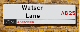
Watson Lane is a street located in Aberdeen. It uses the postcode AB25 2TF. The street has a length of approximately 294 metres.
Watson Lane is located within the Aberdeen City Council's jurisdiction. They provide various services, like refuse collection, and manage council tax collection. It's situated in the (pseudo) Scotland region of the UK.
Watson Lane is located within the county of City of Aberdeen, situated in the (pseudo) Scotland region of the UK. It's 399.01 miles North from central London., 0.99 miles North West from Aberdeen, 57.84 miles North East from Dundee and 81.95 miles East from Inverness.
Watson Lane is within the Post Town of ABERDEEN

Do you know why this road is called Watson Lane?
What's it like to live here?
Ask the community a question about Watson Lane.
Do you have any questions, memories to share or know any facts about Watson Lane? We'd love to know more.
Also on streetlist.co.uk, can you help?
Swing Swang Lane
28th April 2024
I am trying to find out why the lane is named Swing Swang?
It has been known known this since at least 1905 when hedge making contents used to be held here.
Swing Swang is often used to describe a fairground ride. I remember Swing Boats. Were they a bit like this or is Swing Swang another name for swings?
Swing Swangs are also mentioned in connection to orchards. Or were orchards just good places to have swings?
Estate Agents near Watson Lane
| Name | Address | Website |
|---|---|---|
| Aberdeen Property Leasing | 138 - 140 Rosemount Place, Aberdeen, AB25 2YU | Visit Website |
| Martin & Co | 123 Rosemount Place, Aberdeen, AB25 2YH | Visit Website |
| Homeguard Leasing | 115 Rosemount Place, Aberdeen, AB25 2YG | Visit Website |
We have found 1 postcode for Watson Lane
Location Details
| Watson Lane | |
|---|---|

| |
| Latitude | 57.151247 |
| Longitude | -2.117354 |
| OS Easting (X): | 392900 |
| OS Northing (Y): | 806693 |
| OS Grid Reference: | NJ929067 |
Neighbourhood Policing |
| Police Force: Scotland |
| Find a Local Neighbourhood Watch Scheme |
Frequently asked Questions for Watson Lane
What Council (Local Authority) is Watson Lane in?
Watson Lane is located within the local authority area of Aberdeen City Council which is a Scottish unitary authority.
What Parish Council is Watson Lane in?
Watson Lane is in an unparished area.
What Electoral Ward is Watson Lane in?
Watson Lane is located within the ward of Midstocket/Rosemount.
What County is Watson Lane in?
Watson Lane is located within the ceremonial county of City of Aberdeen.
What Constituency is Watson Lane in?
Watson Lane is located within the constituency of Aberdeen North.
What Part of the UK is Watson Lane in?
Watson Lane is located within the historic nation of Scotland.
What County Council area is Watson Lane in?
Watson Lane is not in a County Council area.
What Police Force area is Watson Lane in?
Watson Lane is located within the Scotland Police area.
Roads that have a Junction with Watson Lane
| Street | Junction Type |
|---|---|
| Loanhead Place | junction |
| Rosemount Place | junction |
Sunset and Sunrise times for Watson Lane , AB25 2TF
| Sunrise | 04:53 |
|---|---|
| Sunset | 21:16 |
Latest Weather Conditions for Watson Lane, AB25 2TF
| Observed at Weather Station: | Aberdeen Airport 11 May 2024 at 20:00 (4.94 miles away) |
|---|---|
| Current Weather: | Overcast |
| Temperature and Humidity: | 13.8°C (66.3%) |
| Wind Direction and Speed: | S (16 mph) |
Population Statistics
| ONS Area Code | S00089736 |
|---|---|
| ONS Area Name | Professional Service Cosmopolitans |
| LSOA Code: | S01006566 |
|---|---|
| LSOA Name: | Rosemount - 03 |
| SOA Code: | 1a |
| SOA Name: | |
| MSOA Code: | S02001246 |
| MSOA Name: | Rosemount |
Nearest Supermarkets
| Sainsburys Aberdeen Rosemount Local |
|---|
| 97-99 Rosemount Place, Aberdeen, Scotland, AB25 2YE |
| 1224641571 |
| Distance: 0.13 Miles |
| Directions from Watson Lane to Sainsburys Aberdeen Rosemount Local |
| Sainsburys Aberdeen George Street Local |
|---|
| 313 George Street, Aberdeen, Scotland, AB25 1EP |
| 1224645980 |
| Distance: 0.49 Miles |
| Directions from Watson Lane to Sainsburys Aberdeen George Street Local |
| Sainsburys Berryden Road |
|---|
| Berryden Road, Aberdeen, Scotland, AB25 3SA |
| 01224 631144 |
| Distance: 0.52 Miles |
| Directions from Watson Lane to Sainsburys Berryden Road |
| Sainsburys Aberdeen Alford Place Local |
|---|
| 492-494 Union Street, Aberdeen, Scotland, AB10 1TS |
| 1224642399 |
| Distance: 0.6 Miles |
| Directions from Watson Lane to Sainsburys Aberdeen Alford Place Local |
Telephone Information
| Dialling Code | Telephone Exchange | Telephone Cabinet | Fibre to the Cabinet or Fibre to the Premises |
|---|---|---|---|
| 01289 | ABERDEEN DENBURN - NSDEN | P26 | FTTC |
Local Government
| Local Council Details |
|---|
| Within the area of Aberdeen City |
| Visit the Council's Website |
| Aberdeen City Council Customer Service Centre, Ground Floor, Marischal College, Broad Street, Aberdeen &AB10 1AB |
| Telephone Number: 0845 608 0910 |
| Local Member of Parliament |
|---|
| Within the Westminster Parliamentary Constituency of Aberdeen North |
| The Member of Parliament is Kirsty Blackman |
| Details for the MP Kirsty Blackman on parliament.uk |
| Details for the MP Kirsty Blackman on theyworkforyou.com |
| In the 2019 General Election Kirsty Blackman won with a majority of 12,670 the result was SNP hold. The total electorate was 62,489 |
| Wards, Parish Councils and County Councils |
|---|
| Ward: Midstocket/Rosemount Ward |
| Ceremonial County: City of Aberdeen |
Nearest Schools
Scotland Primary Schools
Walker Road School
Address: Walker Road School, Walker Road, Aberdeen, AB11 8DL
Distance: 1.49 miles
Contact: 01224 879720
Hanover Street School
Address: Hanover Street School, Beach Boulevard, ABERDEEN, AB24 5HN
Distance: 1.07 miles
Contact: 01224 569880
Sunnybank School
Address: Sunnybank School, Sunnybank Road, Aberdeen, AB24 3NJ
Distance: 0.83 miles
Contact: 01224 261700
Ferryhill School
Address: Ferryhill School, 31 Caledonian Place, Aberdeen, AB11 6TT
Distance: 1.01 miles
Contact: 01224 586755
Gilcomstoun School
Address: Gilcomstoun School, Skene Street, Aberdeen, AB10 1PG
Distance: 0.37 miles
Contact: 01224 642722
Skene Square School
Address: Skene Square School, 61 Skene Square, Aberdeen, AB25 2UN
Distance: 0.25 miles
Contact: 01224 630493
Kittybrewster School
Address: Kittybrewster School, Great Northern Road, Aberdeen, AB24 3QG
Distance: 0.89 miles
Contact: 01224 484451
Ashley Road School
Address: Ashley Road School, 45 Ashley Road, Aberdeen, AB10 6RU
Distance: 0.94 miles
Contact: 01224 588732
Mile End School
Address: Mile End School, Mid Stocket Road, ABERDEEN, AB15 5LT
Distance: 0.54 miles
Contact: 01224 498140
Broomhill School
Address: Broomhill School, Gray Street, Aberdeen, AB10 6JF
Distance: 1.35 miles
Contact: 01224 315487
St Joseph's RC School
Address: St Joseph's RC School, 5 Queen's Road, Aberdeen, AB15 4YL
Distance: 0.78 miles
Contact: 01224 322730
Cornhill School
Address: Cornhill School, Cornhill Drive, Aberdeen, AB16 5BL
Distance: 0.91 miles
Contact: 01224 483234
Woodside School
Address: Woodside School, Clifton Road, Aberdeen, AB24 4EA
Distance: 1.43 miles
Contact: 01224 484778
Muirfield School
Address: Muirfield School, Mastrick Drive, Aberdeen, AB16 6UE
Distance: 1.52 miles
Contact: 01224 694958
Holy Family RC School
Address: Holy Family RC School, Summerhill Terrace, Aberdeen, AB15 6HE
Distance: 1.40 miles
Contact: 01224 316446
Fernielea School
Address: Fernielea School, Stronsay Place, Aberdeen, AB15 6HD
Distance: 1.58 miles
Contact: 01224 318533
Scotland Secondary Schools
Aberdeen Grammar School
Address: Aberdeen Grammar School, Skene Street, Aberdeen, AB10 1HT
Distance: 0.30 miles
Contact: 01224 642299
St Machar Academy
Address: St Machar Academy, St Machar Drive, Aberdeen, AB24 3YZ
Distance: 1.05 miles
Contact: 01224 492855
Harlaw Academy
Address: Harlaw Academy, 18/20 Albyn Place, Aberdeen, AB10 1RG
Distance: 0.61 miles
Contact: 01224 589251
Northfield Academy
Address: Northfield Academy, Granitehill Place, Aberdeen, AB16 7AU
Distance: 1.34 miles
Contact: 01224 699715
Nearest Hospitals
| Name | Address | Postcode | Distance | Map |
|---|---|---|---|---|
| Roxburghe House | Cornhill Site, Ashgrove Road, Aberdeen | AB25 2ZH | 0.34 Km | View Directions |
| Royal Cornhill Hospital | Cornhill Road, Aberdeen | AB25 2ZH | 0.34 Km | View Directions |
| Woolmanhill Hospital | Skene Street, Aberdeen | AB25 1LD | 0.75 Km | View Directions |
Nearest Dentists
Dentists near Watson Lane
| Name | Address | Postcode | Distance | Map |
|---|---|---|---|---|
| AB25 DENTISTRY | 116 Rosemount Place, Aberdeen | AB252YW | 0.17 Km | View Directions |
| HUTCHESON JPS & ASSOCIATES | 230 Rosemount Place, Aberdeen | AB252XT | 0.25 Km | View Directions |
| DR CRAWFORD GRAY | 2 Westfield Road, Rosemount, Aberdeen | AB252NG | 0.44 Km | View Directions |
Nearest GP Surgeries
Doctors near Watson Lane
NEWBURN HEALTH CENTRE
Address: ROSEMOUNT VIADUCT, ABERDEEN, ABERDEENSHIRE, AB25 1QB
Distance: 0.42 miles
Contact: tel: 03450 130740
RUBISLAW PLACE MEDICAL GROUP
Address: RUBISLAW MEDICAL GROUP, 7 RUBISLAW PLACE, ABERDEEN, ABERDEENSHIRE, AB10 1QB
Distance: 0.51 miles
Contact: tel: 01224 641968
CALSAYSEAT MEDICAL GROUP
Address: 44 POWIS PLACE, ABERDEEN, ABERDEENSHIRE, AB25 3TX
Distance: 0.55 miles
Contact: tel: 03453 376370
HOLBURN MEDICAL GROUP
Address: 7 ALBYN PLACE, ABERDEEN, ABERDEENSHIRE, AB10 1YE
Distance: 0.61 miles
Contact: tel: 01224 400800
ALBYN MEDICAL PRACTICE
Address: THE ALBYN MEDICAL PRACTICE, 30 ALBYN PLACE, ABERDEEN, ABERDEENSHIRE, AB10 1NW
Distance: 0.62 miles
Contact: tel: 01224 586829
ELMBANK GROUP PRACTICE
Address: FORESTERHILL HEALTH CENTRE, WESTBURN ROAD, ABERDEEN, ABERDEENSHIRE, AB25 2AY
Distance: 0.76 miles
Contact: tel: 03453 370710
Nearest Dispensing Chemists
Pharmacies near Watson Lane
| Name | Address | Postcode | Telephone | Map | Distance in Km |
|---|---|---|---|---|---|
| Mount Street (Aberdeen) Ltd | 1 Mount Street, Rosemount, Aberdeen, | AB25 2RA | 01224 630101 | View Directions | |
| Charles Michie | 287 Rosemount Place, Aberdeen | AB25 2YB | 01224 636593 | View Directions | |
| Robert Whitelaw Abdn Ltd | 46 Rosemount Viaduct, Aberdeen | AB25 1NT | 01224 642436 | View Directions |
Nearest Opticians
Opticians near Watson Lane
OPTIMAX LASER EYE CLINIC
Address: 2 GOLDEN SQUARE, ABERDEEN, ABERDEENSHIRE, AB10 1RD
Distance: 0.62 miles
Contact: :
VISION EXPRESS (ABERDEEN)
Address: UNIT 32, BON ACCORD CENTRE, GEORGE STREET, ABERDEEN, ABERDEENSHIRE, AB25 1HZ
Distance: 0.67 miles
Contact: :
BOOTS OPTICIANS (ABERDEEN - BON ACCORD CENTRE)
Address: BON ACCORD CENTRE, GEORGE STREET, ABERDEEN, ABERDEENSHIRE, AB25 1HZ
Distance: 0.67 miles
Contact: :
ABERDEEN DOMICILIARY SPECSAVERS LIMITED
Address: 56-58 UNION STREET, ABERDEEN, ABERDEENSHIRE, AB10 1BB
Distance: 0.81 miles
Contact: :
ASDA OPTICIANS (BRIDGE OF DEE)
Address: ASDA STORES LTD, GARTHDEE ROAD, BRIDGE OF DEE, ABERDEEN, ABERDEENSHIRE, AB10 7QA
Distance: 1.85 miles
Contact: :
4637 PORTLETHEN
Address: ASDA STORES LTD, MUIREND ROAD, PORTLETHEN, ABERDEEN, ABERDEENSHIRE, AB12 4XP
Distance: 6.04 miles
Contact: :
Transport
Nearest Rail Stations
Aberdeen Station is 0.94 miles away.
Address: Aberdeen station, Guild Street, Union Square, Aberdeen, AB11 6LX
Aberdeen is situated on the Aberdeen to Inverness line|Glasgow to Aberdeen line|Edinburgh to Aberdeen line and is managed by ScotRail.
Aberdeen Station is staffed on a part time basis.
Dyce Station is 4.69 miles away.
Address: Dyce station, Station Road, Dyce, Aberdeenshire, AB21 7EQ
Dyce is situated on the Aberdeen to Inverness line|Edinburgh to Aberdeen line and is managed by ScotRail.
Dyce Station is an unstaffed station.