Map of Murray Terrace
| Postcodes | ||
|---|---|---|
| Icon | Postcodes for Murray Terrace | |
| Walking Distances | ||
| Distance Info | Green Circle = 10 Minutes Walk (800 metres) | |
About Murray Terrace
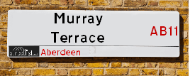
Murray Terrace is a street located in Aberdeen. The street has a length of approximately 346 metres.
Murray Terrace is located within the Aberdeen City Council's jurisdiction. They provide various services, like refuse collection, and manage council tax collection. It's situated in the (pseudo) Scotland region of the UK.
Murray Terrace has the postcodes of AB11 7SD, AB11 7SB and AB11 7SA.
Murray Terrace is located within the county of City of Aberdeen, situated in the (pseudo) Scotland region of the UK. It's 397.69 miles North from central London., 0.85 miles South West from Aberdeen, 57.07 miles North East from Dundee and 82.75 miles East from Inverness.
Murray Terrace is within the Post Town of ABERDEEN.

Do you know why this road is called Murray Terrace?
What's it like to live here?
Ask the community a question about Murray Terrace.
Do you have any questions, memories to share or know any facts about Murray Terrace? We'd love to know more.
Also on streetlist.co.uk, can you help?
Eldroth Road
15th April 2024
I wondered if anyone has any old pictures of Wenning Bank House in the 1940’s and also Lane Side before of the same era .. we visited today with my Mum in law as she used to live at both these properties. Also any photos of the schools around that time .. thank you.
Can You Help?Napps Way
15th April 2024
Why is the road called Napps Way (belonging to Napp, but minus an
apostrophe as is usual with such nomenclature)? Moreover, who or
what is, or was, “Napp” in the respective, possessive case?
Several years ago, I met an elderly man (probably in his late-eighties)
who lives on Bentham Drive, Liverpool 16, and during a conversation
with him whilst in a Northwest Passenger Transport Ambulance on the
way to the former RLUH (Royal Liverpool University Hospital), he told
me that he could remember (when he was a boy, living in Childwall,
Liverpool 16) that, “Where Napps Way is now, during WW2, there was
a two-man gun emplacement on the, then, open land to protect the
railway line passing over Childwall Valley Road - next to the railway
bridge - when suddenly, as they were loading a live “shell” into the gun’s
breach, the aforementioned “shell” accidentally exploded in the gun’s
breach killing both of the two soldiers, that had been manning the gun,
instantly! (Very sad, of course, but could - perhaps - two ghosts relating
to those two, very unfortunately and prematurely-killed soldiers have
haunted that place of their deaths ever since - and have any residents
of Napps Way - formerly and in its latest incarnation - seen two, WW2
(uniformed) soldiers unexpectedly appear in or near their homes?)
Mauritius Road
15th April 2024
Why is Mauritius Road so called, since when and by whom? Does Greenwich have any particular links with Mauritius? Very interested to know. 🤞🏼
Can You Help?Estate Agents near Murray Terrace
| Name | Address | Website |
|---|---|---|
| Margaret Duffus Leasing | 52 Bon Accord Street Aberdeen AB11 6EL | Visit Website |
| McEwan Fraser Legal | 38 Holburn Street, Aberdeen, AB10 6BT | Visit Website |
| AM-PM Leasing | 441 Union Street, Aberdeen, AB11 6DA | Visit Website |
Location Details
| Murray Terrace | |
|---|---|

| |
| Latitude | 57.133125 |
| Longitude | -2.105692 |
| OS Easting (X): | 393602 |
| OS Northing (Y): | 804674 |
| OS Grid Reference: | NJ936047 |
Ordnance Survey Maps for Murray Terrace
If you purchase a map through the links below, we may earn an affiliate commission.
| Map Series | link | Ordnance Survey |
| Explorer 1:25,000 406 Aberdeen & Banchory | Check Price on Amazon | Buy Direct from the Ordnance Survey |
| Landranger 1:50,000 38 Aberdeen | Check Price on Amazon | Buy Direct from the Ordnance Survey |
Neighbourhood Policing |
| Police Force: Scotland |
| Find a Local Neighbourhood Watch Scheme |
Frequently asked Questions for Murray Terrace
What Council (Local Authority) is Murray Terrace in?
Murray Terrace is located within the local authority area of Aberdeen City Council which is a Scottish unitary authority.
What Parish Council is Murray Terrace in?
Murray Terrace is in an unparished area.
What Electoral Ward is Murray Terrace in?
Murray Terrace is located within the ward of Torry/Ferryhill.
What County is Murray Terrace in?
Murray Terrace is located within the ceremonial county of City of Aberdeen.
What Constituency is Murray Terrace in?
Murray Terrace is located within the constituency of Aberdeen South.
What Part of the UK is Murray Terrace in?
Murray Terrace is located within the historic nation of Scotland.
What County Council area is Murray Terrace in?
Murray Terrace is not in a County Council area.
What Police Force area is Murray Terrace in?
Murray Terrace is located within the Scotland Police area.
Roads that have a Junction with Murray Terrace
| Street | Junction Type |
|---|---|
| Great Southern Road (B9077) | junction |
| Bright Street | junction |
| Polmuir Road | junction |
Sunset and Sunrise times for Murray Terrace
| Sunrise | 05:27 |
|---|---|
| Sunset | 20:44 |
Latest Weather Conditions for Murray Terrace
| Observed at Weather Station: | Aberdeen Airport 26 April 2024 at 12:00 (6.19 miles away) |
|---|---|
| Current Weather: | Cloudy |
| Temperature and Humidity: | 7.9°C (65.2%) |
| Wind Direction and Speed: | ESE (7 mph) |
Population Statistics
| ONS Area Code | S00088997 |
|---|---|
| ONS Area Name | White Professionals |
| LSOA Code: | S01006602 |
|---|---|
| LSOA Name: | Ferryhill South - 05 |
| SOA Code: | 3c |
| SOA Name: | |
| MSOA Code: | S02001252 |
| MSOA Name: | Ferryhill South |
Nearest Supermarkets
| Iceland Aberdeen |
|---|
| 306/308 Holborn Street, Aberdeen, Aberdeenshire, AB10 7GX |
| 01224573770 |
| Distance: 0.39 Miles |
| Directions from Murray Terrace to Iceland Aberdeen |
| Tesco Aberdeen Holburn St Express |
|---|
| 207 Holburn St, Aberdeen, AB10 6BL |
| 0345 675 6952 |
| Distance: 0.46 Miles |
| Directions from Murray Terrace to Tesco Aberdeen Holburn St Express |
| Tesco Aberdeen South Superstore |
|---|
| Wellington Rd, Aberdeen, AB12 3DN |
| 0345 671 9348 |
| Distance: 0.48 Miles |
| Directions from Murray Terrace to Tesco Aberdeen South Superstore |
| Sainsburys Aberdeen Holburn Street Local |
|---|
| 124-130 Holburn Street, Aberdeen, Scotland, AB10 6DA |
| 01224 595859 |
| Distance: 0.55 Miles |
| Directions from Murray Terrace to Sainsburys Aberdeen Holburn Street Local |
Telephone Information
| Dialling Code | Telephone Exchange | Telephone Cabinet | Fibre to the Cabinet or Fibre to the Premises |
|---|---|---|---|
| 01289 | ABERDEEN LOCHNAGAR - NSLNG | P47 | FTTC |
Broadband Information
| Speed | Average Speed | Median Speed | Maximum Speed | Next-generation access (NGA) | Number of Connections |
|---|---|---|---|---|---|
| Greater than 2 Mbps | 15.9 | 7.3 | >=30 | Y | 8 |
Local Government
| Local Council Details |
|---|
| Within the area of Aberdeen City |
| Visit the Council's Website |
| Aberdeen City Council Customer Service Centre, Ground Floor, Marischal College, Broad Street, Aberdeen &AB10 1AB |
| Telephone Number: 0845 608 0910 |
| Local Member of Parliament |
|---|
| Within the Westminster Parliamentary Constituency of Aberdeen South |
| The Member of Parliament is Stephen Flynn |
| Details for the MP Stephen Flynn on parliament.uk |
| Details for the MP Stephen Flynn on theyworkforyou.com |
| In the 2019 General Election Stephen Flynn won with a majority of 3,990 the result was SNP gain from Con. The total electorate was 65,719 |
| Wards, Parish Councils and County Councils |
|---|
| Ward: Torry/Ferryhill Ward |
| Ceremonial County: City of Aberdeen |
Nearest Schools
Scotland Primary Schools
Tullos School
Address: Tullos School, Girdleness Road, Torry, ABERDEEN, AB11 8FJ
Distance: 1.07 miles
Contact: 01224 876621
Walker Road School
Address: Walker Road School, Walker Road, Aberdeen, AB11 8DL
Distance: 0.55 miles
Contact: 01224 879720
Hanover Street School
Address: Hanover Street School, Beach Boulevard, ABERDEEN, AB24 5HN
Distance: 1.30 miles
Contact: 01224 569880
Ferryhill School
Address: Ferryhill School, 31 Caledonian Place, Aberdeen, AB11 6TT
Distance: 0.39 miles
Contact: 01224 586755
Kirkhill School
Address: Kirkhill School, Cairngorm Gardens, Kincorth, ABERDEEN, AB12 5BS
Distance: 0.89 miles
Contact: 01224 874439
Gilcomstoun School
Address: Gilcomstoun School, Skene Street, Aberdeen, AB10 1PG
Distance: 1.00 miles
Contact: 01224 642722
Skene Square School
Address: Skene Square School, 61 Skene Square, Aberdeen, AB25 2UN
Distance: 1.33 miles
Contact: 01224 630493
Ashley Road School
Address: Ashley Road School, 45 Ashley Road, Aberdeen, AB10 6RU
Distance: 0.71 miles
Contact: 01224 588732
Kaimhill Primary School
Address: Kaimhill Primary School, Pitmedden Terrace, Aberdeen, AB10 7HR
Distance: 1.05 miles
Contact: 01224 498150
Broomhill School
Address: Broomhill School, Gray Street, Aberdeen, AB10 6JF
Distance: 0.69 miles
Contact: 01224 315487
Abbotswell School
Address: Abbotswell School, Faulds Gate, Kincorth, ABERDEEN, AB12 5QX
Distance: 0.71 miles
Contact: 01224 872714
St Joseph's RC School
Address: St Joseph's RC School, 5 Queen's Road, Aberdeen, AB15 4YL
Distance: 1.09 miles
Contact: 01224 322730
Scotland Secondary Schools
Aberdeen Grammar School
Address: Aberdeen Grammar School, Skene Street, Aberdeen, AB10 1HT
Distance: 1.03 miles
Contact: 01224 642299
Harlaw Academy
Address: Harlaw Academy, 18/20 Albyn Place, Aberdeen, AB10 1RG
Distance: 0.79 miles
Contact: 01224 589251
Nearest Hospitals
| Name | Address | Postcode | Distance | Map |
|---|---|---|---|---|
| Rehabilitation Hospital | 15 Polmuir Road, Aberdeen | AB11 7RS | 0.26 Km | View Directions |
| 375 Great Western Lodge | 375 Great Western Road, Aberdeen | AB10 6NU | 1.37 Km | View Directions |
| Woolmanhill Hospital | Skene Street, Aberdeen | AB25 1LD | 1.77 Km | View Directions |
Nearest Dentists
Dentists near Murray Terrace
| Name | Address | Postcode | Distance | Map |
|---|---|---|---|---|
| GRANITE CITY CLINIC | 147 Holburn Street, Aberdeen | AB106BL | 0.75 Km | View Directions |
| WEST END DENTAL | 189 Great Western Road, Aberdeen | AB106PS | 0.99 Km | View Directions |
| KEVIN SAUNDERS DENTAL SURGERY | 134 Crown Street, Aberdeen | AB116HQ | 0.99 Km | View Directions |
Nearest GP Surgeries
Doctors near Murray Terrace
WHINHILL MEDICAL PRACTICE
Address: 20 WHINHILL ROAD, ABERDEEN, AB11 7XH
Distance: 0.21 miles
Contact: :
TORRY MEDICAL PRACTICE
Address: TORRY NEIGHBOURHOOD CENTRE, OSCAR ROAD, ABERDEEN, AB11 8ER
Distance: 0.65 miles
Contact: :
HOLBURN MEDICAL GROUP
Address: 7 ALBYN PLACE, ABERDEEN, ABERDEENSHIRE, AB10 1YE
Distance: 0.73 miles
Contact: tel: 01224 400800
RUBISLAW PLACE MEDICAL GROUP
Address: RUBISLAW MEDICAL GROUP, 7 RUBISLAW PLACE, ABERDEEN, ABERDEENSHIRE, AB10 1QB
Distance: 0.83 miles
Contact: tel: 01224 641968
KINCORTH MEDICAL PRACTICE
Address: KINCORTH COMMUNITY HEALTH CENTRE, PROVOST WATT DRIVE, ABERDEEN, ABERDEENSHIRE, AB12 5NA
Distance: 0.85 miles
Contact: tel: 03453 371170
ALBYN MEDICAL PRACTICE
Address: THE ALBYN MEDICAL PRACTICE, 30 ALBYN PLACE, ABERDEEN, ABERDEENSHIRE, AB10 1NW
Distance: 0.90 miles
Contact: tel: 01224 586829
Nearest Dispensing Chemists
Pharmacies near Murray Terrace
| Name | Address | Postcode | Telephone | Map | Distance in Km |
|---|---|---|---|---|---|
| RWG Healthcare Ltd | 9 Millburn Street, Aberdeen | AB11 6SS | 01224 580950 | View Directions | |
| Mr & Mrs N Tait | 2 Abbotswell Crescent, Aberdeen | AB12 5AR | 01224 875939 | View Directions | |
| A & L Porter | 560 Holburn Street, Aberdeen | AB10 7LJ | 01224 581685 | View Directions |
Nearest Opticians
Opticians near Murray Terrace
OPTIMAX LASER EYE CLINIC
Address: 2 GOLDEN SQUARE, ABERDEEN, ABERDEENSHIRE, AB10 1RD
Distance: 0.88 miles
Contact: :
ASDA OPTICIANS (BRIDGE OF DEE)
Address: ASDA STORES LTD, GARTHDEE ROAD, BRIDGE OF DEE, ABERDEEN, ABERDEENSHIRE, AB10 7QA
Distance: 0.89 miles
Contact: :
ABERDEEN DOMICILIARY SPECSAVERS LIMITED
Address: 56-58 UNION STREET, ABERDEEN, ABERDEENSHIRE, AB10 1BB
Distance: 1.02 miles
Contact: :
VISION EXPRESS (ABERDEEN)
Address: UNIT 32, BON ACCORD CENTRE, GEORGE STREET, ABERDEEN, ABERDEENSHIRE, AB25 1HZ
Distance: 1.12 miles
Contact: :
BOOTS OPTICIANS (ABERDEEN - BON ACCORD CENTRE)
Address: BON ACCORD CENTRE, GEORGE STREET, ABERDEEN, ABERDEENSHIRE, AB25 1HZ
Distance: 1.12 miles
Contact: :
4637 PORTLETHEN
Address: ASDA STORES LTD, MUIREND ROAD, PORTLETHEN, ABERDEEN, ABERDEENSHIRE, AB12 4XP
Distance: 4.90 miles
Contact: :
Transport
Nearest Rail Stations
Aberdeen Station is 0.75 miles away.
Address: Aberdeen station, Guild Street, Union Square, Aberdeen, AB11 6LX
Aberdeen is situated on the Aberdeen to Inverness line|Glasgow to Aberdeen line|Edinburgh to Aberdeen line and is managed by ScotRail.
Aberdeen Station is staffed on a part time basis.
Portlethen Station is 5.02 miles away.
Address: Portlethen station, Bruntland Road, Portlethen, Aberdeenshire, AB12 4JS
Portlethen is situated on the Glasgow to Aberdeen line|Edinburgh to Aberdeen line and is managed by ScotRail.
Portlethen Station is an unstaffed station.