Map of North View
| Postcodes | ||
|---|---|---|
| Icon | Postcodes for North View | |
| Walking Distances | ||
| Distance Info | Green Circle = 10 Minutes Walk (800 metres) | |
About North View
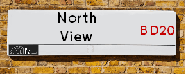
North View is a street located in the village of Eastburn. It uses the postcode BD20 8TY. The street has a length of approximately 72 metres.
North View is located within the Bradford District (B) Council's jurisdiction. They provide various services, like refuse collection, and manage council tax collection. It's situated in the Yorkshire and The Humber region of the UK.
North View has been assigned the Unique Street Reference Number of 7755430 in the National Street Gazetteer.
North View is located within the county of West Yorkshire, situated in the Yorkshire and The Humber region of the UK. It's 183.19 miles North West from central London., 18.76 miles West from Leeds, 30.95 miles North from Manchester and 35.21 miles East from Lancaster.

Do you know why this road is called North View?
What's it like to live here?
Ask the community a question about North View.
Do you have any questions, memories to share or know any facts about North View? We'd love to know more.
Also on streetlist.co.uk, can you help?
Eldroth Road
15th April 2024
I wondered if anyone has any old pictures of Wenning Bank House in the 1940’s and also Lane Side before of the same era .. we visited today with my Mum in law as she used to live at both these properties. Also any photos of the schools around that time .. thank you.
Can You Help?Napps Way
15th April 2024
Why is the road called Napps Way (belonging to Napp, but minus an
apostrophe as is usual with such nomenclature)? Moreover, who or
what is, or was, “Napp” in the respective, possessive case?
Several years ago, I met an elderly man (probably in his late-eighties)
who lives on Bentham Drive, Liverpool 16, and during a conversation
with him whilst in a Northwest Passenger Transport Ambulance on the
way to the former RLUH (Royal Liverpool University Hospital), he told
me that he could remember (when he was a boy, living in Childwall,
Liverpool 16) that, “Where Napps Way is now, during WW2, there was
a two-man gun emplacement on the, then, open land to protect the
railway line passing over Childwall Valley Road - next to the railway
bridge - when suddenly, as they were loading a live “shell” into the gun’s
breach, the aforementioned “shell” accidentally exploded in the gun’s
breach killing both of the two soldiers, that had been manning the gun,
instantly! (Very sad, of course, but could - perhaps - two ghosts relating
to those two, very unfortunately and prematurely-killed soldiers have
haunted that place of their deaths ever since - and have any residents
of Napps Way - formerly and in its latest incarnation - seen two, WW2
(uniformed) soldiers unexpectedly appear in or near their homes?)
Mauritius Road
15th April 2024
Why is Mauritius Road so called, since when and by whom? Does Greenwich have any particular links with Mauritius? Very interested to know. 🤞🏼
Can You Help?Estate Agents near North View
| Name | Address | Website |
|---|---|---|
| Wilman & Wilman | 8 Main Street Cross Hills Keighley BD20 8TB | Visit Website |
| Leightons | 31 Main Street, Cross Hills, Keighley, BD20 8TA | Visit Website |
| Wilman & Lodge | 77 Main Street, Cross Hills, Keighley, BD20 8PH | Visit Website |
We have found 1 postcode for North View
Location Details
| North View | |
|---|---|

| |
| Latitude | 53.896657 |
| Longitude | -1.971108 |
| OS Easting (X): | 401898 |
| OS Northing (Y): | 444521 |
| OS Grid Reference: | SE019445 |
Ordnance Survey Maps for North View
If you purchase a map through the links below, we may earn an affiliate commission.
| Map Series | link | Ordnance Survey |
| Explorer 1:25,000 ol21 South Pennines | Check Price on Amazon | Buy Direct from the Ordnance Survey |
| Landranger 1:50,000 104 Leeds & Bradford | Check Price on Amazon | Buy Direct from the Ordnance Survey |
Neighbourhood Policing |
| Police Force: West Yorkshire |
 View Neighbourhood Crime and Policing View Neighbourhood Crime and Policing |
| Find a Local Neighbourhood Watch Scheme |
Frequently asked Questions for North View
What Council (Local Authority) is North View in?
North View is located within the local authority area of Bradford Council which is a Metropolitan District.
What Parish Council is North View in?
North View is located within the area of Steeton with Eastburn Parish Council.
What Electoral Ward is North View in?
North View is located within the ward of Craven.
What County is North View in?
North View is located within the ceremonial county of West Yorkshire.
What Constituency is North View in?
North View is located within the constituency of Keighley.
What Part of the UK is North View in?
North View is located within the Yorkshire and The Humber region of the United Kingdom.
What County Council area is North View in?
North View is located within the West Yorkshire Council area.
What Police Force area is North View in?
North View is located within the West Yorkshire Police area.
Roads that have a Junction with North View
| Street | Junction Type |
|---|---|
| Main Road (B6265) | junction |
| Green Lane | junction |
Sunset and Sunrise times for North View , BD20 8TY
| Sunrise | 05:38 |
|---|---|
| Sunset | 20:32 |
Latest Weather Conditions for North View, BD20 8TY
| Observed at Weather Station: | Bingley Samos 26 April 2024 at 20:00 (7.33 miles away) |
|---|---|
| Current Weather: | Overcast |
| Temperature and Humidity: | 4.4°C (85.4%) |
| Wind Direction and Speed: | ESE (5 mph) |
Population Statistics
| ONS Area Code | E00053736 |
|---|---|
| ONS Area Name | Communal Retirement |
| Average Age | 41.64 |
| Area Population | 1614.00 |
| Male Population | 766.00 (47%) |
| Female Population | 848.00 (53%) |
| Benefit Claimants | 5 (0%) |
| LSOA Code: | E01010644 |
|---|---|
| LSOA Name: | Bradford 004G |
| SOA Code: | 5a |
| SOA Name: | |
| MSOA Code: | E02002186 |
| MSOA Name: | Bradford 004 |
Nearest Supermarkets
| Sainsburys Keighley |
|---|
| 1 Sainsburys Centre, Cavendish Street, Keighley, England, BD21 3RU |
| 01535 603117 |
| Distance: 3.32 Miles |
| Directions from North View to Sainsburys Keighley |
| Asda Keighley |
|---|
| Bingley Street, Keighley, BD21 3ER |
| 01535 613900 |
| Distance: 3.4 Miles |
| Directions from North View to Asda Keighley |
| Morrisons Keighley |
|---|
| Worth Way, Keighley BD21 5AE |
| 01535 607554 |
| Distance: 3.43 Miles |
| Directions from North View to Morrisons Keighley |
| Iceland Keighley |
|---|
| Gresley Road, Keighley, West Yorkshire, BD21 5JG |
| 01535691096 |
| Distance: 3.47 Miles |
| Directions from North View to Iceland Keighley |
Telephone Information
| Area Code |
|---|
| Area Code: 01535 - Keighley |
| Area Code: 01756 - Skipton |
Broadband Information
| Speed | Average Speed | Median Speed | Maximum Speed | Next-generation access (NGA) | Number of Connections |
|---|---|---|---|---|---|
| Greater than 2 Mbps | 4.6 | 4.7 | 5.5 | Y | 4 |
Local Government
| Local Council Details |
|---|
| Within the area of Bradford |
| Visit the Council's Website |
| City Hall, Centenary Square, Bradford &BD1 1HY |
| Telephone Number: 01274 432111 |
| Local Member of Parliament |
|---|
| Within the Westminster Parliamentary Constituency of Keighley |
| The Member of Parliament is Robbie Moore |
| Details for the MP Robbie Moore on parliament.uk |
| Details for the MP Robbie Moore on theyworkforyou.com |
| In the 2019 General Election Robbie Moore won with a majority of 2,218 the result was Con gain from Lab. The total electorate was 72,778 |
| Wards, Parish Councils and County Councils |
|---|
| Ward: Craven Ward |
| Ceremonial County: West Yorkshire |
Nearest Schools
England Primary Schools
Steeton Primary School
Address: Steeton Primary School, Market Street, Steeton, Keighley, West Yorkshire, BD20 6NN
Distance: 0.95 miles
Contact: 01535653315
Eastburn Junior and Infant School
Address: Eastburn Junior and Infant School, Green Close, Eastburn, Keighley, West Yorkshire, BD20 8UX
Distance: 0.11 miles
Contact: 01535653293
Kildwick Church of England Voluntary Controlled Primary School
Address: Kildwick Church of England Voluntary Controlled Primary School, Priest Bank Road, Kildwick, Keighley, West Yorkshire, BD20 9BH
Distance: 0.97 miles
Contact: 01535633682
Sutton in Craven Church of England Voluntary Controlled Primary School
Address: Sutton in Craven Church of England Voluntary Controlled Primary School, Main Street, Sutton-in-Craven, Keighley, West Yorkshire, BD20 7JS
Distance: 0.84 miles
Contact: 01535632181
Sutton-in-Craven Community Primary School
Address: Sutton-in-Craven Community Primary School, Bridge Road, Sutton-in-Craven, Keighley, West Yorkshire, BD20 7ES
Distance: 0.80 miles
Contact: 01535633064
Glusburn Community Primary School
Address: Glusburn Community Primary School, Colne Road, Glusburn, Keighley, West Yorkshire, BD20 8PJ
Distance: 1.03 miles
Contact: 01535632145
England Secondary Schools
South Craven School
Address: South Craven School, Holme Lane, Cross Hills, Keighley, West Yorkshire, BD20 7RL
Distance: 0.75 miles
Contact: 01535632861
Nearest Hospitals
| Name | Address | Postcode | Distance | Map |
|---|
Nearest Dentists
Dentists near North View
| Name | Address | Postcode | Distance | Map |
|---|
Nearest GP Surgeries
Doctors near North View
DR FONTANA AND PARTNERS
Address: CHAPEL ROAD, STEETON, KEIGHLEY, BD20 6NU
Distance: 0.72 miles
Contact: :
CROSS HILLS GROUP PRACTICE
Address: HOLME LANE, CROSS HILLS, KEIGHLEY, BD20 7LG
Distance: 0.85 miles
Contact: :
SILSDEN & STEETON MEDICAL PRACTICE
Address: ELLIOTT STREET, SILSDEN, KEIGHLEY, BD20 0DG
Distance: 1.52 miles
Contact: :
SILSDEN SURGERY - COVID LOCAL VACCINATION SERVICE 2
Address: ELLIOTT STREET, SILSDEN, KEIGHLEY, BD20 0DG
Distance: 1.52 miles
Contact: :
FARFIELD GROUP PRACTICE
Address: ST. ANDREW'S SURGERIES, WEST LANE, KEIGHLEY, BD21 2LD
Distance: 3.15 miles
Contact: :
LING HOUSE MEDICAL CENTRE
Address: 49 SCOTT STREET, KEIGHLEY, WEST YORKSHIRE, BD21 2JH
Distance: 3.15 miles
Contact: tel: 01535 605747
Nearest Dispensing Chemists
Pharmacies near North View
| Name | Address | Postcode | Telephone | Map | Distance in Km |
|---|
Nearest Opticians
Opticians near North View
AIREDALE EYE CARE
Address: 37 MAIN STREET, CROSS HILLS, KEIGHLEY, WEST YORKSHIRE, BD20 8TA
Distance: 0.87 miles
Contact: :
BRADFORD 2 DOMICILIARY SPECSAVERS LIMITED
Address: KIRK HILL HOUSE, KIRK HILL FOLD, GLUSBURN, KEIGHLEY, BD20 8RD
Distance: 1.40 miles
Contact: :
SILSDEN OPTICIANS
Address: 17 BRIGGATE, SILSDEN, KEIGHLEY, WEST YORKSHIRE, BD20 9JS
Distance: 1.82 miles
Contact: tel: 01535 658330
KNOWLE PARK OPTICIANS
Address: 42 DEVONSHIRE STREET, KEIGHLEY, WEST YORKSHIRE, BD21 2AU
Distance: 3.14 miles
Contact: :
AIREDALE OPTICIANS
Address: 50 TOWNGATE, KEIGHLEY, WEST YORKSHIRE, BD21 3QE
Distance: 3.29 miles
Contact: :
VISION EXPRESS (KEIGHLEY)
Address: 25 COLLEGE WALK, AIREDALE CENTRE, KEIGHLEY, WEST YORKSHIRE, BD21 3QA
Distance: 3.29 miles
Contact: :
Transport
Nearest Rail Stations
Steeton & Silsden Station is 1.13 miles away.
Address: Steeton & Silsden station, Station Road, Steeton, West Yorkshire, BD20 6RY
Steeton & Silsden is situated on the Leeds to Morecambe line and is managed by Northern.
Steeton & Silsden Station is an unstaffed station.
Directions from North View to Steeton & Silsden Rail Station
Cononley Station is 2.17 miles away.
Address: Cononley station, Cononley Lane, Cononley, West Yorkshire, BD20 8HY
Cononley is situated on the Leeds to Morecambe line and is managed by Northern.
Cononley Station is an unstaffed station.