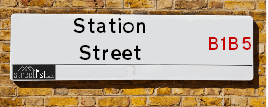
Map of Station Street
| Postcodes | ||
|---|---|---|
| Icon | Postcodes for Station Street | |
| Walking Distances | ||
| Distance Info | Green Circle = 10 Minutes Walk (800 metres) | |
About Station Street
Station Street is a street located in the city of Birmingham. The street has a length of approximately 203 metres.
Station Street is located within the Birmingham District (B) Council's jurisdiction. They provide various services, like refuse collection, and manage council tax collection. It's situated in the West Midlands region of the UK.
Station Street has been assigned the Unique Street Reference Number of 2702331 and 2759197 in the National Street Gazetteer.
Station Street is located within the county of West Midlands, situated in the West Midlands region of the UK. It's 101.97 miles North West from central London., 0.21 miles South from Birmingham, 17.16 miles West from Coventry and 23.86 miles North East from Worcester.

Do you know why this road is called Station Street?
What's it like to live here?
Ask the community a question about Station Street.
Do you have any questions, memories to share or know any facts about Station Street? We'd love to know more.
Also on streetlist.co.uk, can you help?
Swing Swang Lane
28th April 2024
I am trying to find out why the lane is named Swing Swang?
It has been known known this since at least 1905 when hedge making contents used to be held here.
Swing Swang is often used to describe a fairground ride. I remember Swing Boats. Were they a bit like this or is Swing Swang another name for swings?
Swing Swangs are also mentioned in connection to orchards. Or were orchards just good places to have swings?
Estate Agents near Station Street
| Name | Address | Website |
|---|---|---|
| Accord Lets | West 2 Suffolk Street Queensway Birmingham B1 1LW | Visit Website |
| Dixons | West 2 20 Suffolk Street Queensway, Birmingham, B1 1LW | |
| Ark Lettings | Queens gate, 121 Suffolk Street, Queensway, Birmingham, B1 1LX | Visit Website |
Location Details
| Station Street | |
|---|---|

| |
| Latitude | 52.476499 |
| Longitude | -1.899402 |
| OS Easting (X): | 406831 |
| OS Northing (Y): | 286553 |
| OS Grid Reference: | SP068866 |
Neighbourhood Policing |
| Police Force: West Midlands |
 View Neighbourhood Crime and Policing View Neighbourhood Crime and Policing |
| Find a Local Neighbourhood Watch Scheme |
Frequently asked Questions for Station Street
What Council (Local Authority) is Station Street in?
Station Street is located within the local authority area of Birmingham Council which is a Metropolitan District.
What Parish Council is Station Street in?
Station Street is in an unparished area.
What Electoral Ward is Station Street in?
Station Street is located within the ward of Ladywood.
What County is Station Street in?
Station Street is located within the ceremonial county of West Midlands.
What Constituency is Station Street in?
Station Street is located within the constituency of Birmingham &Ladywood.
What Part of the UK is Station Street in?
Station Street is located within the West Midlands (England) region of the United Kingdom.
What County Council area is Station Street in?
Station Street is located within the West Midlands Council area.
What Police Force area is Station Street in?
Station Street is located within the West Midlands Police area.
Roads that have a Junction with Station Street
| Street | Junction Type |
|---|---|
| John Bright Street | pseudo node |
| St Jude's Passage | junction |
| Hill Street | junction |
| Hill Street | junction |
| Dudley Street | pseudo node |
Sunset and Sunrise times for Station Street
| Sunrise | 05:16 |
|---|---|
| Sunset | 20:51 |
Latest Weather Conditions for Station Street
| Observed at Weather Station: | Coleshill 10 May 2024 at 20:00 (8.86 miles away) |
|---|---|
| Current Weather: | Clear night |
| Temperature and Humidity: | 17.7°C (67.2%) |
| Wind Direction and Speed: | ESE (3 mph) |
Population Statistics
| ONS Area Code | E00175627 & E00175657 |
|---|---|
| ONS Area Name | Multicultural Student Neighbourhoods |
| LSOA Code: | E01033615 &E01033620 |
|---|---|
| LSOA Name: | Birmingham 135C &Birmingham 138A |
| SOA Code: | 1a |
| SOA Name: | |
| MSOA Code: | E02006896 &E02006899 |
| MSOA Name: | Birmingham 135 &Birmingham 138 |
Nearest Supermarkets
| Tesco Grand Central Express |
|---|
| Shopping Centre, Birmingham, B2 4XJ |
| 0345 610 6718 |
| Distance: 0.09 Miles |
| Directions from Station Street to Tesco Grand Central Express |
| Sainsburys Birmingham Navigation Street Local |
|---|
| 89 Navigation Street, Birmingham, England, B5 4AX |
| 0121 632 6156 |
| Distance: 0.14 Miles |
| Directions from Station Street to Sainsburys Birmingham Navigation Street Local |
| Tesco Caxton Metro |
|---|
| Caxton Gate, New St, Birmingham, B2 5AE |
| 0345 677 9850 |
| Distance: 0.2 Miles |
| Directions from Station Street to Tesco Caxton Metro |
| Tesco Birmingham Hurst St Express |
|---|
| Hurst St, Birmingham, B5 4TP |
| 0345 675 7021 |
| Distance: 0.24 Miles |
| Directions from Station Street to Tesco Birmingham Hurst St Express |
Telephone Information
| Area Code |
|---|
| Area Code: 0121 - Birmingham |
| Area Code: 01384 - Dudley |
| Area Code: 01922 - Walsall |
| Area Code: 01675 - Coleshill |
Broadband Information
| Speed | Average Speed | Median Speed | Maximum Speed | Next-generation access (NGA) | Number of Connections |
|---|---|---|---|---|---|
| Greater than 2 Mbps | 15.7 | 17.8 | 24 | N | 22 |
Local Government
| Local Council Details |
|---|
| Within the area of Birmingham |
| Visit the Council's Website |
| Council House, Victoria Square, Birmingham &B1 1BB |
| Send email |
| Telephone Number: 0121 303 1111 |
| Local Member of Parliament |
|---|
| Within the Westminster Parliamentary Constituency of Birmingham &Ladywood |
| The Member of Parliament is Shabana Mahmood |
| Details for the MP Shabana Mahmood on parliament.uk |
| Details for the MP Shabana Mahmood on theyworkforyou.com |
| In the 2019 General Election Shabana Mahmood won with a majority of 28,582 the result was Lab hold. The total electorate was 74,912 |
| Wards, Parish Councils and County Councils |
|---|
| Ward: Ladywood Ward |
| Ceremonial County: West Midlands |
Nearest Schools
England Primary Schools
Ladypool Primary School
Address: Ladypool Primary School, Stratford Road, Sparkbrook, Birmingham, West Midlands, B11 1QT
Distance: 1.54 miles
Contact: 01214647002
St Anne's Catholic Primary School
Address: St Anne's Catholic Primary School, Lowe Street, Camp Hill, Birmingham, West Midlands, B12 0ER
Distance: 0.96 miles
Contact: 01216755037
Park Hill Primary School
Address: Park Hill Primary School, Alcester Road, Birmingham, West Midlands, B13 8BB
Distance: 1.79 miles
Contact: 01214493004
Heath Mount Primary School
Address: Heath Mount Primary School, Knutsford Street, Balsall Heath, BIRMINGHAM, West Midlands, B12 9SR
Distance: 1.19 miles
Contact:
Chandos Primary School
Address: Chandos Primary School, Vaughton Street South, Highgate, Birmingham, West Midlands, B12 0YN
Distance: 0.66 miles
Contact:
St Chad's Catholic Primary School
Address: St Chad's Catholic Primary School, Hospital Street, Newtown, Birmingham, West Midlands, B19 3XD
Distance: 1.11 miles
Contact:
St Catherine of Siena Catholic Primary School
Address: St Catherine of Siena Catholic Primary School, Great Colmore Street, Lee Bank, Birmingham, West Midlands, B15 2AY
Distance: 0.36 miles
Contact: 01216921051
St Thomas' Church of England VA Primary School
Address: St Thomas' Church of England VA Primary School, Great Colmore Street, Birmingham, West Midlands, B15 2AT
Distance: 0.39 miles
Contact:
Brookfields Primary School
Address: Brookfields Primary School, 2 Hingeston Street, Hockley, Birmingham, West Midlands, B18 6PU
Distance: 1.23 miles
Contact:
Nelson Junior and Infant School
Address: Nelson Junior and Infant School, King Edward's Road, Ladywood, Birmingham, West Midlands, B1 2PJ
Distance: 0.79 miles
Contact: 01214642201
The Oratory Roman Catholic Primary School
Address: The Oratory Roman Catholic Primary School, Oliver Road, Ladywood, Birmingham, West Midlands, B16 9ER
Distance: 1.27 miles
Contact: 01214540600
St Edmund's Catholic Primary School
Address: St Edmund's Catholic Primary School, Rosebery Street, Springhill, Birmingham, West Midlands, B18 7PA
Distance: 1.24 miles
Contact:
St Patrick and St Edmund's Catholic Primary School
Address: St Patrick and St Edmund's Catholic Primary School, Dudley Road, Birmingham, West Midlands, B18 7QW
Distance: 1.51 miles
Contact: 01212473947
Ark Tindal Primary Academy
Address: Ark Tindal Primary Academy, Tindal Street, Balsall Heath, Birmingham, West Midlands, B12 9QS
Distance: 1.50 miles
Contact: 01214643049
Chandos Primary School
Address: Chandos Primary School, Vaughton Street South, Highgate, Birmingham, West Midlands, B12 0YN
Distance: 0.66 miles
Contact: 01214643881
St George's Church of England Academy, Newtown
Address: St George's Church of England Academy, Newtown, St George's Street, Birmingham, B19 3QY
Distance: 0.97 miles
Contact: 01218182139
Chilwell Croft Academy
Address: Chilwell Croft Academy, Chilwell Croft, Newtown, Birmingham, West Midlands, B19 2QH
Distance: 1.25 miles
Contact: 01214643402
Percy Shurmer Academy
Address: Percy Shurmer Academy, Longmore Street, Balsall Heath, Birmingham, West Midlands, B12 9ED
Distance: 0.93 miles
Contact: 01214643431
Oasis Academy Woodview
Address: Oasis Academy Woodview, Woodview Drive, Edgbaston, Birmingham, West Midlands, B15 2HU
Distance: 0.71 miles
Contact: 01214404202
St John's & St Peter's CofE Academy
Address: St John's & St Peter's CofE Academy, St Vincent Street West, Ladywood, Birmingham, West Midlands, B16 8RN
Distance: 0.97 miles
Contact: 01216751398
St George's Church of England Primary School
Address: St George's Church of England Primary School, Beaufort Road, Edgbaston, Birmingham, West Midlands, B16 8HY
Distance: 1.23 miles
Contact: 01214642789
England Secondary Schools
St Paul's School for Girls
Address: St Paul's School for Girls, Vernon Road, Edgbaston, Birmingham, West Midlands, B16 9SL
Distance: 1.75 miles
Contact: 01214540895
Aston University Engineering Academy
Address: Aston University Engineering Academy, 1 Lister Street, Birmingham, West Midlands, B7 4AG
Distance: 1.01 miles
Contact: 01213800570
Ark St Alban's Academy
Address: Ark St Alban's Academy, Conybere Street, Birmingham, West Midlands, B12 0YH
Distance: 0.92 miles
Contact: 01214461300
Central Academy
Address: Central Academy, Newhall Street, Ladywood, Birmingham, West Midlands, B3 1SJ
Distance: 0.63 miles
Contact:
City Academy Birmingham
Address: City Academy Birmingham, 23 Langley Walk, Ladywood, Birmingham, West Midlands, B15 2EF
Distance: 0.48 miles
Contact:
Jewellery Quarter Academy
Address: Jewellery Quarter Academy, St George's Court, 1 Albion Street, Birmingham, West Midlands, B1 3AA
Distance: 0.82 miles
Contact: 01217297220
England Higher Schools
The National College for Advanced Transport and Infrastructure
Address: The National College for Advanced Transport and Infrastructure, 2 Lister Street, Birmingham, West Midlands, B7 4AG
Distance: 1.01 miles
Contact:
Joseph Chamberlain Sixth Form College
Address: Joseph Chamberlain Sixth Form College, Belgrave Road, Highgate, Birmingham, West Midlands, B12 9FF
Distance: 1.14 miles
Contact: 01214462223
Nearest Hospitals
| Name | Address | Postcode | Distance | Map |
|---|
Nearest Dentists
Dentists near Station Street
| Name | Address | Postcode | Distance | Map |
|---|
Nearest GP Surgeries
Doctors near Station Street
HALCYON MEDICAL
Address: UNIT 8, 24 MARTINEAU PLACE, BIRMINGHAM, B2 4UH
Distance: 0.32 miles
Contact: tel: 01212 039999
MODALITY ATTWOOD GREEN
Address: ATTWOOD GREEN HEALTH CENTRE, 30 BATH ROW, BIRMINGHAM, WEST MIDLANDS, B15 1LZ
Distance: 0.47 miles
Contact: :
BATH ROW MEDICAL PRACTICE - COVID LOCAL VACCINATION SERVICE 2
Address: 30 BATH ROW, BIRMINGHAM, B15 1LZ
Distance: 0.47 miles
Contact: :
BATH ROW MEDICAL PRACTICE
Address: FIRST FLOOR, COLSTON SUITE, ATTWOOD GREENN HC, 30 BATH ROW, EDGBASTON, BIRMINGHAM, WEST MIDLANDS, B15 1LZ
Distance: 0.47 miles
Contact: tel: 0121 6224846
THE HEALTH XCHANGE
Address: WILLIAM BOOTH LANE, BIRMINGHAM, WEST MIDLANDS, B4 6HJ
Distance: 0.64 miles
Contact: tel: 0121 4653965
BELLEVUE MEDICAL CENTRE
Address: 6 BELLEVUE, EDGBASTON, BIRMINGHAM, WEST MIDLANDS, B5 7LX
Distance: 0.77 miles
Contact: tel: 0121 4462000
Nearest Dispensing Chemists
Pharmacies near Station Street
| Name | Address | Postcode | Telephone | Map | Distance in Km |
|---|
Nearest Opticians
Opticians near Station Street
VISION EXPRESS (BIRMINGHAM)
Address: UNIT 5/6, THE PALLASADES, BIRMINGHAM, WEST MIDLANDS, B2 4XA
Distance: 0.12 miles
Contact: :
THE CONTACT LENS PRACTICE
Address: 5 LOWER TEMPLE STREET, BIRMINGHAM, WEST MIDLANDS, B2 4JD
Distance: 0.16 miles
Contact: :
PICCADILLY OPTICIANS
Address: 13 PICCADILLY ARCADE, BIRMINGHAM, WEST MIDLANDS, B2 4HD
Distance: 0.17 miles
Contact: :
SPECSAVERS (NEW STREET, BIRMINGHAM)
Address: 14-15 NEW STREET, BIRMINGHAM, WEST MIDLANDS, B2 4RQ
Distance: 0.20 miles
Contact: :
VISION EXPRESS (BULL RING, BIRMINGHAM)
Address: SU522, MIDDLE MALL, BULLRING, BIRMINGHAM, WEST MIDLANDS, B5 4BE
Distance: 0.21 miles
Contact: :
OPTICAL EXPRESS (BIRMINGHAM)
Address: IMPERIAL HOUSE, 31 TEMPLE STREET, BIRMINGHAM, B2 5DB
Distance: 0.22 miles
Contact: :
Transport
Nearest Rail Stations
Birmingham New Street Station is 0.13 miles away.
Address: Birmingham New Street station, Station Street, Birmingham, West Midlands, B2 4QA
Birmingham New Street is situated on the Chiltern Main Line|Birmingham to Peterborough Line|Bristol to Brimingham Line|Chase Line|Rugby�Birmingham�Stafford line|West Coast Main Line.
Birmingham New Street Station is staffed on a full time basis.
Directions from Station Street to Birmingham New Street Rail Station
Birmingham Moor Street Station is 0.34 miles away.
Address: Birmingham Moor Street station, Queensway, Birmingham, West Midlands, B4 7UL
Birmingham Moor Street is situated on the Chiltern Main Line|Birmingham to Peterborough Line|Chase Line|Bristol to Brimingham Line|North Warwickshire (Shakespeare Line) Line|Rugby�Birmingham�Stafford line|West Coast Main Line and is managed by Chiltern Railway.
Birmingham Moor Street Station is staffed on a part time basis.
Directions from Station Street to Birmingham Moor Street Rail Station