Map of Cartland Road
| Street Crime (updated 04/05/2024) | ||
|---|---|---|
| Location Note | Central Point of Street - Not Actual Location | |
| MSOA Info | For MSOA E02001903 (Statistical Neighbourhood) | |
| Click Hint | Click on a Circle for a detailed breakdown below map. | |
| Crime Levels |
Green = Very Low Yellow = Low Orange = High Red = Very High |
|
| Postcodes | ||
| Icon | Postcodes for Cartland Road | |
| Walking Distances | ||
| Distance Info | Green Circle = 10 Minutes Walk (800 metres) | |
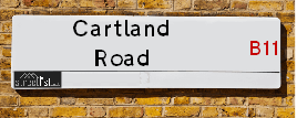
About Cartland Road
Cartland Road is a street located in the city of Birmingham. It uses the postcode B11 1EQ. The street has a length of approximately 223 metres.
The street is publicly maintained which means that the road is adopted and Birmingham is responsible for the repair and upkeep of the highway.
Cartland Road is located within the Birmingham District (B) Council's jurisdiction. They provide various services, like refuse collection, and manage council tax collection. It's situated in the West Midlands region of the UK.
Cartland Road has been assigned the Unique Street Reference Number of 2701444 in the National Street Gazetteer.
Cartland Road is located within the county of West Midlands, situated in the West Midlands region of the UK. It's 100.35 miles North West from central London., 1.8 miles South East from Birmingham, 15.64 miles West from Coventry and 23.89 miles North East from Worcester.
Cartland Road is within the Post Town of BIRMINGHAM

Do you know why this road is called Cartland Road?
What's it like to live here?
Ask the community a question about Cartland Road.
Do you have any questions, memories to share or know any facts about Cartland Road? We'd love to know more.
Also on streetlist.co.uk, can you help?
Swing Swang Lane
28th April 2024
I am trying to find out why the lane is named Swing Swang?
It has been known known this since at least 1905 when hedge making contents used to be held here.
Swing Swang is often used to describe a fairground ride. I remember Swing Boats. Were they a bit like this or is Swing Swang another name for swings?
Swing Swangs are also mentioned in connection to orchards. Or were orchards just good places to have swings?
Estate Agents near Cartland Road
| Name | Address | Website |
|---|---|---|
| Midland Housing Ltd | 81 Stoney Lane, Birmingham, B12 8EQ | Visit Website |
| John Parr | 458 Stratford Road, Sparkhill, Birmingham,B11 4AE | |
| Universal Properties | 482 Stratford Road, Sparkhill, Birmingham,B11 4AE |
We have found 1 postcode for Cartland Road
Location Details
| Cartland Road | |
|---|---|

| |
| Latitude | 52.462846 |
| Longitude | -1.868118 |
| OS Easting (X): | 408959 |
| OS Northing (Y): | 285038 |
| OS Grid Reference: | SP090850 |
Neighbourhood Policing |
| Police Force: West Midlands |
 View Neighbourhood Crime and Policing View Neighbourhood Crime and Policing |
| Find a Local Neighbourhood Watch Scheme |
Frequently asked Questions for Cartland Road
What Council (Local Authority) is Cartland Road in?
Cartland Road is located within the local authority area of Birmingham Council which is a Metropolitan District.
What Parish Council is Cartland Road in?
Cartland Road is in an unparished area.
What Electoral Ward is Cartland Road in?
Cartland Road is located within the ward of Sparkbrook & Balsall Heath East.
What County is Cartland Road in?
Cartland Road is located within the ceremonial county of West Midlands.
What Constituency is Cartland Road in?
Cartland Road is located within the constituency of Birmingham &Hall Green.
What Part of the UK is Cartland Road in?
Cartland Road is located within the West Midlands (England) region of the United Kingdom.
What County Council area is Cartland Road in?
Cartland Road is located within the West Midlands Council area.
What Police Force area is Cartland Road in?
Cartland Road is located within the West Midlands Police area.
Roads that have a Junction with Cartland Road
| Street | Junction Type |
|---|---|
| White Road | junction |
| Hickman Road | junction |
| Grace Road | junction |
| Medlicott Road | junction |
Sunset and Sunrise times for Cartland Road , B11 1EQ
| Sunrise | 05:13 |
|---|---|
| Sunset | 20:54 |
Latest Weather Conditions for Cartland Road, B11 1EQ
| Observed at Weather Station: | Coleshill 11 May 2024 at 23:00 (7.63 miles away) |
|---|---|
| Current Weather: | Clear night |
| Temperature and Humidity: | 14.6°C (79.9%) |
| Wind Direction and Speed: | ESE (3 mph) |
Population Statistics
| ONS Area Code | E00047451 |
|---|---|
| ONS Area Name | Pakistani Communities |
| LSOA Code: | E01033650 |
|---|---|
| LSOA Name: | Birmingham 077F |
| SOA Code: | 7b |
| SOA Name: | |
| MSOA Code: | E02001903 |
| MSOA Name: | Birmingham 077 |
Nearest Supermarkets
| Iceland Birmingham St Andrews |
|---|
| Unit 5 St Andrews Shp Prk, 270 Coventry Road, Birmingham, B10 0XA |
| 01217738537 |
| Distance: 0.78 Miles |
| Directions from Cartland Road to Iceland Birmingham St Andrews |
| Morrisons Birmingham - Small Heath |
|---|
| 280 Coventry Road, Small Heath, Birmingham B10 0XA |
| 0121 771 2224 |
| Distance: 0.8 Miles |
| Directions from Cartland Road to Morrisons Birmingham - Small Heath |
| Asda Small Heath |
|---|
| 859 Coventry Road, Small Heath, B10 0HH |
| 0121 766 7374 |
| Distance: 1.08 Miles |
| Directions from Cartland Road to Asda Small Heath |
| Asda Bordesley Green |
|---|
| 271 Bordesley Green, Birmingham, B9 5EY |
| 0121 480 1800 |
| Distance: 1.27 Miles |
| Directions from Cartland Road to Asda Bordesley Green |
Telephone Information
| Area Code |
|---|
| Area Code: 0121 - Birmingham |
| Area Code: 01675 - Coleshill |
Broadband Information
| Speed | Average Speed | Median Speed | Maximum Speed | Next-generation access (NGA) | Number of Connections |
|---|---|---|---|---|---|
| Less than 2 Mbps | 17.9 | 11.6 | >=30 | Y | 12 |
Local Government
| Local Council Details |
|---|
| Within the area of Birmingham |
| Visit the Council's Website |
| Council House, Victoria Square, Birmingham &B1 1BB |
| Send email |
| Telephone Number: 0121 303 1111 |
| Local Member of Parliament |
|---|
| Within the Westminster Parliamentary Constituency of Birmingham &Hall Green |
| The Member of Parliament is Tahir Ali |
| Details for the MP Tahir Ali on parliament.uk |
| Details for the MP Tahir Ali on theyworkforyou.com |
| In the 2019 General Election Tahir Ali won with a majority of 28,508 the result was Lab hold. The total electorate was 80,283 |
| Wards, Parish Councils and County Councils |
|---|
| Ward: Sparkbrook & Balsall Heath East Ward |
| Parish: Unparished area |
| Ceremonial County: West Midlands |
Nearest Schools
England Primary Schools
St Bernadette's Catholic Primary School
Address: St Bernadette's Catholic Primary School, Hobmoor Road, Yardley, Birmingham, West Midlands, B25 8QL
Distance: 1.82 miles
Contact: 01217837232
St Benedict's Primary School
Address: St Benedict's Primary School, St Benedict's Road, Birmingham, West Midlands, B10 9DP
Distance: 1.00 miles
Contact: 01214646420
Redhill Primary School
Address: Redhill Primary School, Redhill Road, Hay Mills, Birmingham, West Midlands, B25 8HQ
Distance: 1.47 miles
Contact: 01214646322
Holy Family Catholic Primary School
Address: Holy Family Catholic Primary School, Coventry Road, Small Heath, Birmingham, West Midlands, B10 0HT
Distance: 0.94 miles
Contact: 01216752670
Somerville Primary (NC) School
Address: Somerville Primary (NC) School, Somerville Road, Small Heath, Birmingham, West Midlands, B10 9EN
Distance: 0.80 miles
Contact: 01216750956
Greet Primary School
Address: Greet Primary School, Percy Road, Sparkhill, Birmingham, West Midlands, B11 3ND
Distance: 0.80 miles
Contact:
Marlborough Junior School
Address: Marlborough Junior School, Green Lane, Small Heath, Birmingham, West Midlands, B10 9NY
Distance: 1.06 miles
Contact:
Marlborough Infant School
Address: Marlborough Infant School, Marlborough Road, Small Heath, Birmingham, West Midlands, B10 9NY
Distance: 1.06 miles
Contact:
English Martyrs' Catholic Primary School
Address: English Martyrs' Catholic Primary School, Evelyn Road, Sparkhill, English Martyrs Rc Junior & Infant School, Birmingham, West Midlands, B11 3JW
Distance: 0.84 miles
Contact: 01214643150
Anderton Park Primary School
Address: Anderton Park Primary School, Dennis Road, Sparkhill, Birmingham, West Midlands, B12 8BL
Distance: 0.87 miles
Contact: 01214641581
Bordesley Village Primary School
Address: Bordesley Village Primary School, Emmeline Street, Bordesley Village, Birmingham, West Midlands, B9 4NG
Distance: 0.94 miles
Contact:
Arden Primary School
Address: Arden Primary School, Baker Street, Sparkhill, Birmingham, West Midlands, B11 4SF
Distance: 0.54 miles
Contact: 01216757702
Regents Park Community Primary School
Address: Regents Park Community Primary School, Arthur Street, Small Heath, Birmingham, West Midlands, B10 0NJ
Distance: 0.65 miles
Contact: 01214646746
Conway Primary School
Address: Conway Primary School, Conway Road, Sparkbrook, Birmingham, West Midlands, B11 1NS
Distance: 0.20 miles
Contact:
Christ Church CofE Controlled Primary School and Nursery
Address: Christ Church CofE Controlled Primary School and Nursery, Claremont Road, Sparkbrook, Birmingham, West Midlands, B11 1LF
Distance: 0.27 miles
Contact: 01216755121
St Martin de Porres Catholic Primary School
Address: St Martin de Porres Catholic Primary School, Oakland Road, Moseley, Birmingham, West Midlands, B13 9DN
Distance: 1.17 miles
Contact: 01214645500
Nelson Mandela School
Address: Nelson Mandela School, Colville Road, Sparkbrook, Nelson Mandela Community School, Birmingham, West Midlands, B12 8EH
Distance: 0.50 miles
Contact: 01217723055
Ladypool Primary School
Address: Ladypool Primary School, Stratford Road, Sparkbrook, Birmingham, West Midlands, B11 1QT
Distance: 0.27 miles
Contact: 01214647002
St Anne's Catholic Primary School
Address: St Anne's Catholic Primary School, Lowe Street, Camp Hill, Birmingham, West Midlands, B12 0ER
Distance: 0.68 miles
Contact: 01216755037
Park Hill Primary School
Address: Park Hill Primary School, Alcester Road, Birmingham, West Midlands, B13 8BB
Distance: 1.13 miles
Contact: 01214493004
Chandos Primary School
Address: Chandos Primary School, Vaughton Street South, Highgate, Birmingham, West Midlands, B12 0YN
Distance: 1.08 miles
Contact:
Oasis Academy Hobmoor
Address: Oasis Academy Hobmoor, Wash Lane, Yardley, Birmingham, West Midlands, B25 8FD
Distance: 2.06 miles
Contact: 01216753269
Wyndcliffe Primary School
Address: Wyndcliffe Primary School, Little Green Lane, Bordesley Green, Birmingham, West Midlands, B9 5BG
Distance: 0.96 miles
Contact: 01214644241
Montgomery Primary Academy
Address: Montgomery Primary Academy, White Road, Sparkbrook, Birmingham, West Midlands, B11 1EH
Distance: 0.07 miles
Contact: 01214649115
Bordesley Village Primary School
Address: Bordesley Village Primary School, Emmeline Street, Bordesley Village, Birmingham, West Midlands, B9 4NG
Distance: 0.94 miles
Contact: 01216751392
Harper Bell Seventh-day Adventist School
Address: Harper Bell Seventh-day Adventist School, 29 Ravenhurst Street, Camp Hill, Birmingham, West Midlands, B12 0EJ
Distance: 0.68 miles
Contact: 01216937742
Conway Primary School
Address: Conway Primary School, Conway Road, Sparkbrook, Birmingham, West Midlands, B11 1NS
Distance: 0.20 miles
Contact: 01216750622
Ark Tindal Primary Academy
Address: Ark Tindal Primary Academy, Tindal Street, Balsall Heath, Birmingham, West Midlands, B12 9QS
Distance: 1.02 miles
Contact: 01214643049
Chandos Primary School
Address: Chandos Primary School, Vaughton Street South, Highgate, Birmingham, West Midlands, B12 0YN
Distance: 1.08 miles
Contact: 01214643881
Percy Shurmer Academy
Address: Percy Shurmer Academy, Longmore Street, Balsall Heath, Birmingham, West Midlands, B12 9ED
Distance: 0.99 miles
Contact: 01214643431
The Olive School, Birmingham
Address: The Olive School, Birmingham, 215 Reddings Lane, Birmingham, West Midlands, B11 3EY
Distance: 1.28 miles
Contact: 01216577100
Al-Furqan Primary School
Address: Al-Furqan Primary School, Reddings Lane, Tyseley, Birmingham, West Midlands, B11 3EY
Distance: 1.28 miles
Contact: 01217772222
Greet Primary School
Address: Greet Primary School, Percy Road, Sparkhill, Birmingham, West Midlands, B11 3ND
Distance: 0.80 miles
Contact: 01214643360
St John's CofE Primary School
Address: St John's CofE Primary School, Stratford Road, Sparkhill, Birmingham, West Midlands, B11 4EA
Distance: 0.93 miles
Contact: 01216751469
Springfield Primary Academy
Address: Springfield Primary Academy, Springfield Road, Moseley, Birmingham, West Midlands, B13 9NY
Distance: 1.35 miles
Contact: 01214643618
Springfield Primary School
Address: Springfield Primary School, Springfield Road, Moseley, Birmingham, West Midlands, B13 9NY
Distance: 1.35 miles
Contact:
Clifton Primary School
Address: Clifton Primary School, Brunswick Road, Balsall Heath, Birmingham, West Midlands, B12 8NX
Distance: 0.60 miles
Contact: 01214642926
England Secondary Schools
Starbank School
Address: Starbank School, Starbank Road, Birmingham, West Midlands, B10 9LR
Distance: 1.57 miles
Contact:
Yardleys School
Address: Yardleys School, Reddings Lane, Tyseley, Birmingham, West Midlands, B11 3EY
Distance: 1.28 miles
Contact:
Holy Trinity Catholic School
Address: Holy Trinity Catholic School, Oakley Road, Small Heath, Birmingham, West Midlands, B10 0AX
Distance: 0.36 miles
Contact:
Small Heath School
Address: Small Heath School, Muntz Street, Small Heath, Birmingham, West Midlands, B10 9RX
Distance: 0.89 miles
Contact:
Bordesley Green Girls' School & Sixth Form
Address: Bordesley Green Girls' School & Sixth Form, Bordesley Green Road, Birmingham, B9 4TR
Distance: 1.16 miles
Contact: 01214641881
Moseley School and Sixth Form
Address: Moseley School and Sixth Form, Wake Green Road, Moseley, Birmingham, West Midlands, B13 9UU
Distance: 1.62 miles
Contact: 01215666444
Ark Victoria Academy
Address: Ark Victoria Academy, Talbot Way, Small Heath, Birmingham, West Midlands, B10 0HJ
Distance: 0.96 miles
Contact: 01213934459
Holy Trinity Catholic School
Address: Holy Trinity Catholic School, Oakley Road, Small Heath, Birmingham, West Midlands, B10 0AX
Distance: 0.36 miles
Contact: 01217720184
Al-Hijrah School
Address: Al-Hijrah School, Burbidge Road, Bordesley Green, Birmingham, West Midlands, B9 4US
Distance: 1.36 miles
Contact:
Small Heath Leadership Academy
Address: Small Heath Leadership Academy, Muntz Street, Small Heath, Birmingham, West Midlands, B10 9RX
Distance: 0.89 miles
Contact: 01214647997
Ark Boulton Academy
Address: Ark Boulton Academy, Golden Hillock Road, Sparkhill, Birmingham, West Midlands, B11 2QG
Distance: 0.44 miles
Contact: 01217738156
Ark St Alban's Academy
Address: Ark St Alban's Academy, Conybere Street, Birmingham, West Midlands, B12 0YH
Distance: 0.82 miles
Contact: 01214461300
Yardleys School
Address: Yardleys School, Reddings Lane, Tyseley, Birmingham, West Midlands, B11 3EY
Distance: 1.28 miles
Contact: 01214646821
England Higher Schools
Joseph Chamberlain Sixth Form College
Address: Joseph Chamberlain Sixth Form College, Belgrave Road, Highgate, Birmingham, West Midlands, B12 9FF
Distance: 0.75 miles
Contact: 01214462223
Nearest Hospitals
| Zinnia Centre |
|---|
| Address: 100 Showell Green Lane, Birmingham, B11 4HL, |
| NHS Sector |
| Birmingham and Solihull Mental Health NHS Foundation Trust |
| Telephone: 0121 301 5300 |
| Visit Hospital Website |
| Distance: 1.54 (miles) |
| Directions from to Zinnia Centre |
| Tamarind Centre |
|---|
| Address: 165 Yardley Green Road, Bordesley Green, Birmingham, |
| NHS Sector |
| Birmingham and Solihull Mental Health NHS Foundation Trust |
| Telephone: 0121 301 0500 |
| Visit Hospital Website |
| Distance: 2.43 (miles) |
| Directions from to Tamarind Centre |
| Juniper Centre |
|---|
| Address: Moseley Hall Hospital site, Alcester Road, Moseley, Birmingham, |
| NHS Sector |
| Birmingham and Solihull Mental Health NHS Foundation Trust |
| Telephone: 0121 301 5700 |
| Visit Hospital Website |
| Distance: 2.52 (miles) |
| Directions from to Juniper Centre |
Nearest Dentists
Dentists near Cartland Road
GRANTHAM ROAD (DENTAL SURGERY)
Address: 34 GRANTHAM ROAD, BIRMINGHAM, WEST MIDLANDS, B11 1LU
Distance: 0.14 miles
Contact: :
DENTAL SURGERY
Address: 1 POPLAR ROAD, SPARKHILL, BIRMINGHAM, WEST MIDLANDS, B11 1UH
Distance: 0.34 miles
Contact: :
DENTAL SURGERY
Address: 103A GOLDEN HILLOCK ROAD, SMALL HEATH, BIRMINGHAM, WEST MIDLANDS, B10 0DP
Distance: 0.45 miles
Contact: :
DENTAL SURGERY
Address: 115 LADYPOOL ROAD, BIRMINGHAM, WEST MIDLANDS, B12 8LH
Distance: 0.49 miles
Contact: :
DENTAL SURGERY
Address: 410 COVENTRY ROAD, SMALL HEATH, BIRMINGHAM, WEST MIDLANDS, B10 0UF
Distance: 0.64 miles
Contact: :
DENTAL SURGERY
Address: 286 LADYPOOL ROAD, BIRMINGHAM, WEST MIDLANDS, B12 8JU
Distance: 0.64 miles
Contact: :
Nearest GP Surgeries
Doctors near Cartland Road
THE BROOK SURGERY
Address: 34 GRANTHAM ROAD, SPARKBROOK, BIRMINGHAM, WEST MIDLANDS, B11 1LU
Distance: 0.14 miles
Contact: tel: 0121 3340174
THE BALAJI SURGERY, THE SPARKBROOK CHC
Address: 34 GRANTHAM ROAD, SPARKBROOK, BIRMINGHAM, WEST MIDLANDS, B11 1LU
Distance: 0.14 miles
Contact: tel: 0121 3340200
NEWPORT MEDICAL GROUP
Address: 34 GRANTHAM ROAD, BIRMINGHAM, WEST MIDLANDS, B11 1LU
Distance: 0.14 miles
Contact: :
THE KHATTAK MEMORIAL SURGERY
Address: 309 BOLTON ROAD, SMALL HEATH, BIRMINGHAM, B10 0AU
Distance: 0.35 miles
Contact: tel: 0121 7734622
KHATTAK HUB - COVID LOCAL VACCINATION SERVICE 3
Address: 309 BOLTON ROAD, SMALL HEATH, BIRMINGHAM, B10 0AU
Distance: 0.35 miles
Contact: :
THE LIMES MEDICAL CENTRE
Address: COOKSEY ROAD, SMALL HEATH, BIRMINGHAM, WEST MIDLANDS, B10 0BS
Distance: 0.38 miles
Contact: tel: 0121 7720067
Nearest Dispensing Chemists
Pharmacies near Cartland Road
SPARKBROOK HEALTH CENTRE PHARMACY
Address: GRANTHAM ROAD, SPARKBROOK, BIRMINGHAM, WEST MIDLANDS, B11 1LU
Distance: 0.14 miles
Contact: tel: 0121 7726351
THE PHARMACY PRACTICE
Address: 282 STRATFORD ROAD, SPARKHILL, BIRMINGHAM, WEST MIDLANDS, B11 1AA
Distance: 0.27 miles
Contact: tel: 01217 712978
EXPRESS PHARMACY SERVICES
Address: FIRST FLOOR, 4 POPLAR ROAD, BIRMINGHAM, WEST MIDLANDS, B11 1UW
Distance: 0.32 miles
Contact: tel: 01217 077996
TWILIGHT PHARMACY
Address: THE MEMORIAL HEALTH CENTR, 309 BOLTON RD, SMALL HEATH, BIRMINGHAM, B10 0AU
Distance: 0.35 miles
Contact: tel: 0121 7725955
SPARKBROOK PHARMACY
Address: 153A STRATFORD ROAD, SPARKHILL, BIRMINGHAM, WEST MIDLANDS, B11 1RD
Distance: 0.39 miles
Contact: tel: 01217 720165
NOOR PHARMACY
Address: 72 GOLDEN HILLOCK ROAD, SMALL HEATH, BIRMINGHAM, WEST MIDLANDS, B10 0LG
Distance: 0.53 miles
Contact: tel: 0121 4482598
Nearest Opticians
Opticians near Cartland Road
EYE CLINIC (STARKBROOK)
Address: FIRST FLOOR STARBROOK, COMMINITY AND HEALTH CENTRE, GRANTHAN ROAD, BIRMINGHAM, WEST MIDLANDS, B11 1LU
Distance: 0.14 miles
Contact: :
TWILIGHT UK LTD
Address: 309 BOLTON ROAD, BIRMINGHAM, B10 0AU
Distance: 0.35 miles
Contact: :
THE VISION CLINIC
Address: 145 STRATFORD ROAD, BIRMINGHAM, WEST MIDLANDS, B11 1RD
Distance: 0.39 miles
Contact: :
OPTICARE (SPARKBROOK)
Address: 150A LADYPOOL ROAD, SPARKBROOK, BIRMINGHAM, WEST MIDLANDS, B12 8JS
Distance: 0.50 miles
Contact: :
NOOR EYE CLINIC
Address: 72 GOLDEN HILLOCK ROAD, SMALL HEATH, BIRMINGHAM, WEST MIDLANDS, B10 0LG
Distance: 0.53 miles
Contact: :
BANKS OPTICIANS (SPARKHILL)
Address: 467 STRATFORD ROAD, SPARKHILL, BIRMINGHAM, WEST MIDLANDS, B11 4LD
Distance: 0.54 miles
Contact: :
Transport
Nearest Rail Stations
Small Heath Station is 0.37 miles away.
Address: Small Heath station, Golden Hillock Road, Small Heath, West Midlands, B10 0DP
Small Heath is situated on the Chiltern Main Line|North Warwickshire (Shakespeare Line) Line.
Small Heath Station is staffed on a part time basis.
Bordesley Station is 0.74 miles away.
Address: Bordesley station, Coventry Road, Camp Hill, Birmingham, B9 4HF
Bordesley is situated on the Chiltern Main Line|North Warwickshire (Shakespeare Line) Line.
Bordesley Station is an unstaffed station.