Map of Tyseley Wharf
| Street Crime (updated 04/05/2024) | ||
|---|---|---|
| Location Note | Central Point of Street - Not Actual Location | |
| MSOA Info | For MSOA E02001904 (Statistical Neighbourhood) | |
| Click Hint | Click on a Circle for a detailed breakdown below map. | |
| Crime Levels |
Green = Very Low Yellow = Low Orange = High Red = Very High |
|
| Postcodes | ||
| Icon | Postcodes for Tyseley Wharf | |
| Walking Distances | ||
| Distance Info | Green Circle = 10 Minutes Walk (800 metres) | |
About Tyseley Wharf
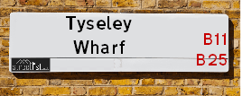
Tyseley Wharf is a street located in the city of Birmingham. It uses the postcode B11 2FE. The street has a length of approximately 621 metres.
The street is not publicly maintained and is unadopted which means that a private body or even the householder could be responsible for the repair and upkeep of the highway. Check the status with your local council or enquire if the street is covered by a PUSWA (public utilities street works act).
Tyseley Wharf is located within the Birmingham District (B) Council's jurisdiction. They provide various services, like refuse collection, and manage council tax collection. It's situated in the West Midlands region of the UK.
Tyseley Wharf has been assigned the Unique Street Reference Number of 2753501 in the National Street Gazetteer.
Tyseley Wharf is located within the county of West Midlands, situated in the West Midlands region of the UK. It's 98.94 miles North West from central London., 3.31 miles South East from Birmingham, 14.05 miles West from Coventry and 24.6 miles North East from Worcester.
Tyseley Wharf is within the Post Town of BIRMINGHAM

Do you know why this road is called Tyseley Wharf?
What's it like to live here?
Ask the community a question about Tyseley Wharf.
Do you have any questions, memories to share or know any facts about Tyseley Wharf? We'd love to know more.
Also on streetlist.co.uk, can you help?
Swing Swang Lane
28th April 2024
I am trying to find out why the lane is named Swing Swang?
It has been known known this since at least 1905 when hedge making contents used to be held here.
Swing Swang is often used to describe a fairground ride. I remember Swing Boats. Were they a bit like this or is Swing Swang another name for swings?
Swing Swangs are also mentioned in connection to orchards. Or were orchards just good places to have swings?
Estate Agents near Tyseley Wharf
| Name | Address | Website |
|---|---|---|
| Elite Sales & Lettings | 1182 Coventry Road, Yardley, Birmingham,B25 8DA | Visit Website |
| Nationwide Lettings Services Ltd | 459-461 Warwick Road, Tyseley, Birmingham,B11 2JP | Visit Website |
| Cityends Limited | 1620 Coventry Road, Yardley, Birmingham,B26 1AL | Visit Website |
We have found 1 postcode for Tyseley Wharf
Location Details
| Tyseley Wharf | |
|---|---|

| |
| Latitude | 52.457398 |
| Longitude | -1.831527 |
| OS Easting (X): | 411446 |
| OS Northing (Y): | 284437 |
| OS Grid Reference: | SP114844 |
Neighbourhood Policing |
| Police Force: West Midlands |
 View Neighbourhood Crime and Policing View Neighbourhood Crime and Policing |
| Find a Local Neighbourhood Watch Scheme |
Frequently asked Questions for Tyseley Wharf
What Council (Local Authority) is Tyseley Wharf in?
Tyseley Wharf is located within the local authority area of Birmingham Council which is a Metropolitan District.
What Parish Council is Tyseley Wharf in?
Tyseley Wharf is in an unparished area.
What Electoral Ward is Tyseley Wharf in?
Tyseley Wharf is located within the ward of Tyseley & Hay Mills.
What County is Tyseley Wharf in?
Tyseley Wharf is located within the ceremonial county of West Midlands.
What Constituency is Tyseley Wharf in?
Tyseley Wharf is located within the constituency of Birmingham &Yardley.
What Part of the UK is Tyseley Wharf in?
Tyseley Wharf is located within the West Midlands (England) region of the United Kingdom.
What County Council area is Tyseley Wharf in?
Tyseley Wharf is located within the West Midlands Council area.
What Police Force area is Tyseley Wharf in?
Tyseley Wharf is located within the West Midlands Police area.
Roads that have a Junction with Tyseley Wharf
| Street | Junction Type |
|---|---|
| Redfern Park Way | pseudo node |
| Wharfdale Road (B4146) | junction |
Sunset and Sunrise times for Tyseley Wharf , B11 2FE
| Sunrise | 05:09 |
|---|---|
| Sunset | 20:57 |
Latest Weather Conditions for Tyseley Wharf, B11 2FE
| Observed at Weather Station: | Coleshill 14 May 2024 at 21:00 (6.20 miles away) |
|---|---|
| Current Weather: | Clear night |
| Temperature and Humidity: | 13.8°C (78.8%) |
| Wind Direction and Speed: | SE (9 mph) |
Population Statistics
| ONS Area Code | E00045145 |
|---|---|
| ONS Area Name | Pakistani Communities |
| Average Age | 37.28 |
| Area Population | 1775.00 |
| Male Population | 916.00 (52%) |
| Female Population | 859.00 (48%) |
| Benefit Claimants | 60 (3%) |
| LSOA Code: | E01008889 |
|---|---|
| LSOA Name: | Birmingham 078D |
| SOA Code: | 7a |
| SOA Name: | |
| MSOA Code: | E02001904 |
| MSOA Name: | Birmingham 078 |
Nearest Supermarkets
| Asda Small Heath |
|---|
| 859 Coventry Road, Small Heath, B10 0HH |
| 0121 766 7374 |
| Distance: 0.66 Miles |
| Directions from Tyseley Wharf to Asda Small Heath |
| Tesco Yardley Extra |
|---|
| Swan Shopping Centre, Coventry Rd, Birmingham, B26 1AD |
| 0345 671 9465 |
| Distance: 0.81 Miles |
| Directions from Tyseley Wharf to Tesco Yardley Extra |
| Iceland Acocks Green |
|---|
| 1133 Warwick Road, Acocks Green, Birmingham, B27 6RA |
| 01217077977 |
| Distance: 0.86 Miles |
| Directions from Tyseley Wharf to Iceland Acocks Green |
| Iceland Yardley |
|---|
| 128 Church Road, Yardley, Birmingham, B25 8UT |
| 01217840079 |
| Distance: 1.25 Miles |
| Directions from Tyseley Wharf to Iceland Yardley |
Telephone Information
| Area Code |
|---|
| Area Code: 0121 - Birmingham |
| Area Code: 01675 - Coleshill |
| Area Code: 01676 - Meriden |
| Area Code: 01564 - Lapworth |
Local Government
| Local Council Details |
|---|
| Within the area of Birmingham |
| Visit the Council's Website |
| Council House, Victoria Square, Birmingham &B1 1BB |
| Send email |
| Telephone Number: 0121 303 1111 |
| Local Member of Parliament |
|---|
| Within the Westminster Parliamentary Constituency of Birmingham &Yardley |
| The Member of Parliament is Jess Phillips |
| Details for the MP Jess Phillips on parliament.uk |
| Details for the MP Jess Phillips on theyworkforyou.com |
| In the 2019 General Election Jess Phillips won with a majority of 10,659 the result was Lab hold. The total electorate was 74,704 |
| Wards, Parish Councils and County Councils |
|---|
| Ward: Tyseley & Hay Mills Ward |
| Parish: Unparished area |
| Ceremonial County: West Midlands |
Nearest Schools
England Primary Schools
Lyndon Green Junior School
Address: Lyndon Green Junior School, Wensley Road, Sheldon, Birmingham, West Midlands, B26 1LU
Distance: 1.62 miles
Contact: 01216752983
Lyndon Green Infant School
Address: Lyndon Green Infant School, Wychwood Cresent, Sheldon, Birmingham, West Midlands, B26 1LZ
Distance: 1.60 miles
Contact: 01216753543
Gilbertstone Primary School
Address: Gilbertstone Primary School, Clay Lane, Birmingham, West Midlands, B26 1EH
Distance: 0.97 miles
Contact: 01214644664
Cottesbrooke Junior School
Address: Cottesbrooke Junior School, Cedars Avenue, Birmingham, West Midlands, B27 6JL
Distance: 0.55 miles
Contact:
Holy Souls Catholic Primary School
Address: Holy Souls Catholic Primary School, Mallard Close, Acocks Green, Birmingham, West Midlands, B27 6BN
Distance: 0.84 miles
Contact:
Blakesley Hall Primary School
Address: Blakesley Hall Primary School, Yardley Green Road, Stechford, Birmingham, West Midlands, B33 8TH
Distance: 1.41 miles
Contact: 01217832148
St Bernadette's Catholic Primary School
Address: St Bernadette's Catholic Primary School, Hobmoor Road, Yardley, Birmingham, West Midlands, B25 8QL
Distance: 0.86 miles
Contact: 01217837232
St Benedict's Primary School
Address: St Benedict's Primary School, St Benedict's Road, Birmingham, West Midlands, B10 9DP
Distance: 0.85 miles
Contact: 01214646420
Redhill Primary School
Address: Redhill Primary School, Redhill Road, Hay Mills, Birmingham, West Midlands, B25 8HQ
Distance: 0.29 miles
Contact: 01214646322
Holy Family Catholic Primary School
Address: Holy Family Catholic Primary School, Coventry Road, Small Heath, Birmingham, West Midlands, B10 0HT
Distance: 0.83 miles
Contact: 01216752670
Greet Primary School
Address: Greet Primary School, Percy Road, Sparkhill, Birmingham, West Midlands, B11 3ND
Distance: 1.14 miles
Contact:
Yorkmead Junior and Infant School
Address: Yorkmead Junior and Infant School, York Road, Hall Green, Birmingham, West Midlands, B28 8BB
Distance: 1.29 miles
Contact: 01214644215
Arden Primary School
Address: Arden Primary School, Baker Street, Sparkhill, Birmingham, West Midlands, B11 4SF
Distance: 1.35 miles
Contact: 01216757702
Yardley Primary School
Address: Yardley Primary School, Harvey Road, Yardley, Birmingham, West Midlands, B26 1TD
Distance: 0.99 miles
Contact: 01214643235
Cottesbrooke Infant and Nursery School
Address: Cottesbrooke Infant and Nursery School, Yardley Road, Acocks Green, Birmingham, West Midlands, B27 6LG
Distance: 0.68 miles
Contact: 01217062742
Oasis Academy Hobmoor
Address: Oasis Academy Hobmoor, Wash Lane, Yardley, Birmingham, West Midlands, B25 8FD
Distance: 0.85 miles
Contact: 01216753269
Cedars Academy
Address: Cedars Academy, Cedars Avenue, Birmingham, West Midlands, B27 6JL
Distance: 0.55 miles
Contact: 01214643178
The Oaklands Primary School
Address: The Oaklands Primary School, Dolphin Lane, Acocks Green, Birmingham, West Midlands, B27 7BT
Distance: 1.27 miles
Contact: 01217062168
Acocks Green Primary School
Address: Acocks Green Primary School, Westley Road, Acocks Green, Birmingham, West Midlands, B27 7UQ
Distance: 0.82 miles
Contact:
Yarnfield Primary School
Address: Yarnfield Primary School, Yarnfield Road, Tyseley, Birmingham, West Midlands, B11 3PJ
Distance: 0.78 miles
Contact: 01216930362
The Olive School, Birmingham
Address: The Olive School, Birmingham, 215 Reddings Lane, Birmingham, West Midlands, B11 3EY
Distance: 0.81 miles
Contact: 01216577100
Al-Furqan Primary School
Address: Al-Furqan Primary School, Reddings Lane, Tyseley, Birmingham, West Midlands, B11 3EY
Distance: 0.81 miles
Contact: 01217772222
Greet Primary School
Address: Greet Primary School, Percy Road, Sparkhill, Birmingham, West Midlands, B11 3ND
Distance: 1.14 miles
Contact: 01214643360
England Secondary Schools
Archbishop Ilsley Catholic School
Address: Archbishop Ilsley Catholic School, Victoria Road, Acocks Green, Birmingham, West Midlands, B27 7XY
Distance: 0.96 miles
Contact:
Starbank School
Address: Starbank School, Starbank Road, Birmingham, West Midlands, B10 9LR
Distance: 0.87 miles
Contact:
Yardleys School
Address: Yardleys School, Reddings Lane, Tyseley, Birmingham, West Midlands, B11 3EY
Distance: 0.81 miles
Contact:
Starbank School
Address: Starbank School, Hob Moor Road, Birmingham, B10 9BT
Distance: 1.01 miles
Contact: 01214642638
Ark Victoria Academy
Address: Ark Victoria Academy, Talbot Way, Small Heath, Birmingham, West Midlands, B10 0HJ
Distance: 0.69 miles
Contact: 01213934459
Ark Boulton Academy
Address: Ark Boulton Academy, Golden Hillock Road, Sparkhill, Birmingham, West Midlands, B11 2QG
Distance: 1.23 miles
Contact: 01217738156
Ninestiles, an Academy
Address: Ninestiles, an Academy, Hartfield Crescent, Acocks Green, Birmingham, West Midlands, B27 7QG
Distance: 1.25 miles
Contact: 01216281311
Yardleys School
Address: Yardleys School, Reddings Lane, Tyseley, Birmingham, West Midlands, B11 3EY
Distance: 0.81 miles
Contact: 01214646821
Nearest Hospitals
| Tamarind Centre |
|---|
| Address: 165 Yardley Green Road, Bordesley Green, Birmingham, |
| NHS Sector |
| Birmingham and Solihull Mental Health NHS Foundation Trust |
| Telephone: 0121 301 0500 |
| Visit Hospital Website |
| Distance: 2.1 (miles) |
| Directions from to Tamarind Centre |
| Heartlands Hospital |
|---|
| Address: Bordesley Green East, Bordesley Green, Birmingham, B9 5SS, |
| Independent Sector |
| University Hospitals Birmingham NHS Foundation Trust |
| Telephone: 0121 424 2000 |
| Visit Hospital Website |
| Distance: 2.54 (miles) |
| Directions from to Heartlands Hospital |
| Zinnia Centre |
|---|
| Address: 100 Showell Green Lane, Birmingham, B11 4HL, |
| NHS Sector |
| Birmingham and Solihull Mental Health NHS Foundation Trust |
| Telephone: 0121 301 5300 |
| Visit Hospital Website |
| Distance: 2.61 (miles) |
| Directions from to Zinnia Centre |
Nearest Dentists
Dentists near Tyseley Wharf
DENTAL SURGERY
Address: 1A HENRY ROAD, BIRMINGHAM, WEST MIDLANDS, B25 8AH
Distance: 0.64 miles
Contact: :
VILLAGE DENTAL SURGERY
Address: 28 STATION ROAD, ACOCKS GREEN, BIRMINGHAM, WEST MIDLANDS, B27 6DN
Distance: 0.78 miles
Contact: :
DENTAL SURGERY
Address: 28 STATION ROAD, ACOCKS GREEN, BIRMINGHAM, WEST MIDLANDS, B27 6DN
Distance: 0.78 miles
Contact: :
DENTAL SURGERY
Address: 576 WARWICK ROAD, TYSELEY, BIRMINGHAM, WEST MIDLANDS, B11 2HR
Distance: 0.79 miles
Contact: :
DENTAL SURGERY
Address: 109 WESTLEY ROAD, BIRMINGHAM, WEST MIDLANDS, B27 7UW
Distance: 0.81 miles
Contact: :
DENTAL SURGERY
Address: 63 WESTLEY ROAD, BIRMINGHAM, WEST MIDLANDS, B27 7UQ
Distance: 0.82 miles
Contact: :
Nearest GP Surgeries
Doctors near Tyseley Wharf
YARDLEY MEDICAL CENTRE
Address: 1222 COVENTRY ROAD, YARDLEY, BIRMINGHAM, WEST MIDLANDS, B25 8BY
Distance: 0.42 miles
Contact: tel: 0121 7721898
ACOCKS GREEN MEDICAL CENTRE
Address: 999 WARWICK ROAD, ACOCKS GREEN, BIRMINGHAM, WEST MIDLANDS, B27 6QJ
Distance: 0.55 miles
Contact: tel: 0121 7060501
THE SWAN MEDICAL CENTRE
Address: 4 WILLARD RD, SOUTH YARDLEY, BIRMINGHAM, WEST MIDLANDS, B25 8AA
Distance: 0.69 miles
Contact: tel: 0121 7060337
DUDLEY PARK MEDICAL CENTRE
Address: 28 DUDLEY PARK ROAD, BIRMINGHAM, WEST MIDLANDS, B27 6QR
Distance: 0.71 miles
Contact: :
AUBREY ROAD MEDICAL CENTRE
Address: 726-728 COVENTRY ROAD, SMALL HEATH, BIRMINGHAM, B10 0TU
Distance: 0.88 miles
Contact: tel: 0121 7732094
THE PARK MEDICAL CENTRE
Address: 691 COVENTRY ROAD, SMALL HEATH, BIRMINGHAM, WEST MIDLANDS, B10 0JL
Distance: 0.94 miles
Contact: tel: 0121 7964111
Nearest Dispensing Chemists
Pharmacies near Tyseley Wharf
NATIONWIDE CARE PHARMACY
Address: AMINGTON HOUSE, 95 AMINGTON ROAD, TYSELEY, BIRMINGHAM, WEST MIDLANDS, B25 8EP
Distance: 0.20 miles
Contact: tel: 01217 070121
QUANTUM PHARMACY
Address: FAIRGATE HOUSE SUITE G14, 205 KINGS ROAD, TYSELEY, BIRMINGHAM, WEST MIDLANDS, B11 2AA
Distance: 0.33 miles
Contact: tel: 0121 7072786
HAY MILLS PHARMACY
Address: 1222 COVENTRY ROAD, HAY MILLS, BIRMINGHAM, B25 8BY
Distance: 0.42 miles
Contact: tel: 0121 6241413
JHOOTS PHARMACY
Address: ACOCKS GREEN MEDICAL CTR., 999 WARWICK ROAD, BIRMINGHAM, WEST MIDLANDS, B27 6QJ
Distance: 0.55 miles
Contact: tel: 01217 071844
ASDA PHARMACY
Address: 859 COVENTRY ROAD, SMALL HEATH, BIRMINGHAM, WEST MIDLANDS, B10 0HH
Distance: 0.64 miles
Contact: tel: 0121 7664819
YARDLEY PHARMACY
Address: 2 WILLARD ROAD, SOUTH YARDLEY, BIRMINGHAM, WEST MIDLANDS, B25 8AA
Distance: 0.69 miles
Contact: tel: 0121 7062723
Nearest Opticians
Opticians near Tyseley Wharf
HOMECARE OPTICAL
Address: UNIT C2, BIZSPACE BUSINESS PARK, KINGS ROAD, BIRMINGHAM, B11 2AL
Distance: 0.35 miles
Contact: :
BOOTS OPTICIANS (YARDLEY)
Address: 1321-1323 COVENTRY ROAD, YARDLEY, BIRMINGHAM, WEST MIDLANDS, B25 8LP
Distance: 0.48 miles
Contact: :
4667 SMALL HEATH
Address: ASDA STORES LTD, 859 COVENTRY ROAD, SMALL HEATH, BIRMINGHAM, WEST MIDLANDS, B10 0HH
Distance: 0.64 miles
Contact: :
SPECSAVERS (YARDLEY)
Address: 3 SWAN CENTRE, 20 CHURCH ROAD, YARDLEY, BIRMINGHAM, WEST MIDLANDS, B25 8UJ
Distance: 0.84 miles
Contact: :
SPECSAVERS (ACOCKS GREEN)
Address: SPECSAVERS OPTICIANS, 1086 WARWICK ROAD, ACOCKS GREEN, BIRMINGHAM, WEST MIDLANDS, B27 6BH
Distance: 0.84 miles
Contact: :
BOOTS OPTICIANS (ACOCKS GREEN)
Address: 1082 WARWICK ROAD, ACOCKS GREEN, BIRMINGHAM, WEST MIDLANDS, B27 6BH
Distance: 0.84 miles
Contact: :
Transport
Nearest Rail Stations
Tyseley Station is 0.39 miles away.
Address: Tyseley station, Wharfedale Road, Tyseley, West Midlands, B11 2HH
Tyseley is situated on the Chiltern Main Line|North Warwickshire (Shakespeare Line) Line.
Tyseley Station is staffed on a part time basis.
Acocks Green Station is 0.77 miles away.
Address: Acocks Green station, Yardley Road, Acocks Green, West Midlands, B27 6EB
Acocks Green is situated on the Chiltern Main Line.
Acocks Green Station is staffed on a part time basis.