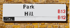
Map of Park Hill
| Postcodes | ||
|---|---|---|
| Icon | Postcodes for Park Hill | |
| Walking Distances | ||
| Distance Info | Green Circle = 10 Minutes Walk (800 metres) | |
About Park Hill
Park Hill is a street located in the city of Birmingham. The street has a length of approximately 587 metres.
Park Hill is located within the Birmingham District (B) Council's jurisdiction. They provide various services, like refuse collection, and manage council tax collection. It's situated in the West Midlands region of the UK.
Park Hill has been assigned the Unique Street Reference Number of 2703475 in the National Street Gazetteer.
Park Hill is located within the county of West Midlands, situated in the West Midlands region of the UK. It's 100.62 miles North West from central London., 1.95 miles South from Birmingham, 16.48 miles West from Coventry and 22.64 miles North East from Worcester.

Do you know why this road is called Park Hill?
What's it like to live here?
Ask the community a question about Park Hill.
Do you have any questions, memories to share or know any facts about Park Hill? We'd love to know more.
Also on streetlist.co.uk, can you help?
Swing Swang Lane
28th April 2024
I am trying to find out why the lane is named Swing Swang?
It has been known known this since at least 1905 when hedge making contents used to be held here.
Swing Swang is often used to describe a fairground ride. I remember Swing Boats. Were they a bit like this or is Swing Swang another name for swings?
Swing Swangs are also mentioned in connection to orchards. Or were orchards just good places to have swings?
Estate Agents near Park Hill
| Name | Address | Website |
|---|---|---|
| Robert Aston & Co | 87 Alcester Road, Moseley, Birmingham,B13 8EB | Visit Website |
| Profectus Estates | 128 Alcester Rd, Moseley, Birmingham,B13 8EE | Visit Website |
| Robert Oulsnam & Company | 142 Alcester Road, Moseley, Birmingham, B13 8HS |
Location Details
| Park Hill | |
|---|---|

| |
| Latitude | 52.451491 |
| Longitude | -1.892458 |
| OS Easting (X): | 407307 |
| OS Northing (Y): | 283772 |
| OS Grid Reference: | SP073838 |
Neighbourhood Policing |
| Police Force: West Midlands |
 View Neighbourhood Crime and Policing View Neighbourhood Crime and Policing |
| Find a Local Neighbourhood Watch Scheme |
Frequently asked Questions for Park Hill
What Council (Local Authority) is Park Hill in?
Park Hill is located within the local authority area of Birmingham Council which is a Metropolitan District.
What Parish Council is Park Hill in?
Park Hill is in an unparished area.
What Electoral Ward is Park Hill in?
Park Hill is located within the ward of Moseley &Balsall Heath West.
What County is Park Hill in?
Park Hill is located within the ceremonial county of West Midlands.
What Constituency is Park Hill in?
Park Hill is located within the constituency of Birmingham &Hall Green.
What Part of the UK is Park Hill in?
Park Hill is located within the West Midlands (England) region of the United Kingdom.
What County Council area is Park Hill in?
Park Hill is located within the West Midlands Council area.
What Police Force area is Park Hill in?
Park Hill is located within the West Midlands Police area.
Roads that have a Junction with Park Hill
| Street | Junction Type |
|---|---|
| Augusta Road | junction |
| St Anne's Court | junction |
Sunset and Sunrise times for Park Hill
| Sunrise | 05:14 |
|---|---|
| Sunset | 20:52 |
Latest Weather Conditions for Park Hill
| Observed at Weather Station: | Coleshill 11 May 2024 at 12:00 (8.79 miles away) |
|---|---|
| Current Weather: | Partly cloudy (day) |
| Temperature and Humidity: | 21.2°C (58.8%) |
| Wind Direction and Speed: | SE (10 mph) |
Population Statistics
| ONS Area Code | E00046560, E00046556 & E00046563 |
|---|---|
| ONS Area Name | Established Tech Workers, Asian Terraces and Flats & Constrained Neighbourhoods |
| Average Age | 36.96, & 39.49 |
| Area Population | 1624.00, & 1606.00 |
| Male Population | 867.00, & 869.00 (54%) |
| Female Population | 757.00, & 737.00 (46%) |
| Benefit Claimants | 96, & 42 (4%) |
| LSOA Code: | E01009182, E01033645 &E01009184 |
|---|---|
| LSOA Name: | Birmingham 092A, Birmingham 088E &Birmingham 092B |
| SOA Code: | 7b &3c |
| SOA Name: | |
| MSOA Code: | E02001918 &E02001914 |
| MSOA Name: | Birmingham 092 &Birmingham 088 |
Nearest Supermarkets
| Sainsburys Alcester Road Local |
|---|
| 158-162 Alcester Road, Birmingham, England, B13 8HS |
| 1214496499 |
| Distance: 0.34 Miles |
| Directions from Park Hill to Sainsburys Alcester Road Local |
| Asda Kings Heath |
|---|
| 99 High Street, Kings Heath, Birmingham, B14 7BW |
| 0121 483 4410 |
| Distance: 1.12 Miles |
| Directions from Park Hill to Asda Kings Heath |
| Iceland Kings Heath |
|---|
| Unit 10 Institutes Road, Kings Heath, Birmingham, B14 7EG |
| 01214441862 |
| Distance: 1.23 Miles |
| Directions from Park Hill to Iceland Kings Heath |
| Sainsburys Kings Heath |
|---|
| 38-54 Alcester Road South, Birmingham, England, B14 7PT |
| 0121 444 3251 |
| Distance: 1.4 Miles |
| Directions from Park Hill to Sainsburys Kings Heath |
Telephone Information
| Area Code |
|---|
| Area Code: 0121 - Birmingham |
| Area Code: 01675 - Coleshill |
| Area Code: 01384 - Dudley |
Broadband Information
| Speed | Average Speed | Median Speed | Maximum Speed | Next-generation access (NGA) | Number of Connections |
|---|---|---|---|---|---|
| Greater than 2 Mbps | 20.2 | 19.4 | >=30 | Y | 32 |
Local Government
| Local Council Details |
|---|
| Within the area of Birmingham |
| Visit the Council's Website |
| Council House, Victoria Square, Birmingham &B1 1BB |
| Send email |
| Telephone Number: 0121 303 1111 |
| Local Member of Parliament |
|---|
| Within the Westminster Parliamentary Constituency of Birmingham &Hall Green |
| The Member of Parliament is Tahir Ali |
| Details for the MP Tahir Ali on parliament.uk |
| Details for the MP Tahir Ali on theyworkforyou.com |
| In the 2019 General Election Tahir Ali won with a majority of 28,508 the result was Lab hold. The total electorate was 80,283 |
| Wards, Parish Councils and County Councils |
|---|
| Ward: Moseley &Balsall Heath West Ward |
| Ceremonial County: West Midlands |
Nearest Schools
England Primary Schools
St Bernard's Catholic Primary School
Address: St Bernard's Catholic Primary School, Wake Green Road, Moseley, Birmingham, West Midlands, B13 9QE
Distance: 1.56 miles
Contact: 01214643795
Anderton Park Primary School
Address: Anderton Park Primary School, Dennis Road, Sparkhill, Birmingham, West Midlands, B12 8BL
Distance: 0.74 miles
Contact: 01214641581
Christ Church CofE Controlled Primary School and Nursery
Address: Christ Church CofE Controlled Primary School and Nursery, Claremont Road, Sparkbrook, Birmingham, West Midlands, B11 1LF
Distance: 1.15 miles
Contact: 01216755121
St John and Monica Catholic Primary School
Address: St John and Monica Catholic Primary School, Chantry Road, Moseley, Birmingham, West Midlands, B13 8DW
Distance: 0.08 miles
Contact: 01214645868
St Martin de Porres Catholic Primary School
Address: St Martin de Porres Catholic Primary School, Oakland Road, Moseley, Birmingham, West Midlands, B13 9DN
Distance: 0.57 miles
Contact: 01214645500
Moseley Church of England Primary School
Address: Moseley Church of England Primary School, Oxford Road, Moseley, Birmingham, West Midlands, B13 9EH
Distance: 0.64 miles
Contact: 01214490441
Nelson Mandela School
Address: Nelson Mandela School, Colville Road, Sparkbrook, Nelson Mandela Community School, Birmingham, West Midlands, B12 8EH
Distance: 0.83 miles
Contact: 01217723055
Ladypool Primary School
Address: Ladypool Primary School, Stratford Road, Sparkbrook, Birmingham, West Midlands, B11 1QT
Distance: 1.02 miles
Contact: 01214647002
King David Primary School
Address: King David Primary School, Alcester Road, Moseley, Birmingham, West Midlands, B13 8EY
Distance: 0.47 miles
Contact: 01214493364
St Dunstan's Catholic Primary School
Address: St Dunstan's Catholic Primary School, Drayton Road, Kings Heath, Birmingham, West Midlands, B14 7LP
Distance: 1.33 miles
Contact: 01214644648
St Anne's Catholic Primary School
Address: St Anne's Catholic Primary School, Lowe Street, Camp Hill, Birmingham, West Midlands, B12 0ER
Distance: 1.39 miles
Contact: 01216755037
Park Hill Primary School
Address: Park Hill Primary School, Alcester Road, Birmingham, West Midlands, B13 8BB
Distance: 0.21 miles
Contact: 01214493004
Heath Mount Primary School
Address: Heath Mount Primary School, Knutsford Street, Balsall Heath, BIRMINGHAM, West Midlands, B12 9SR
Distance: 0.61 miles
Contact:
Chandos Primary School
Address: Chandos Primary School, Vaughton Street South, Highgate, Birmingham, West Midlands, B12 0YN
Distance: 1.14 miles
Contact:
Harper Bell Seventh-day Adventist School
Address: Harper Bell Seventh-day Adventist School, 29 Ravenhurst Street, Camp Hill, Birmingham, West Midlands, B12 0EJ
Distance: 1.35 miles
Contact: 01216937742
Ark Tindal Primary Academy
Address: Ark Tindal Primary Academy, Tindal Street, Balsall Heath, Birmingham, West Midlands, B12 9QS
Distance: 0.32 miles
Contact: 01214643049
Chandos Primary School
Address: Chandos Primary School, Vaughton Street South, Highgate, Birmingham, West Midlands, B12 0YN
Distance: 1.14 miles
Contact: 01214643881
Percy Shurmer Academy
Address: Percy Shurmer Academy, Longmore Street, Balsall Heath, Birmingham, West Midlands, B12 9ED
Distance: 0.86 miles
Contact: 01214643431
Springfield Primary Academy
Address: Springfield Primary Academy, Springfield Road, Moseley, Birmingham, West Midlands, B13 9NY
Distance: 1.48 miles
Contact: 01214643618
Springfield Primary School
Address: Springfield Primary School, Springfield Road, Moseley, Birmingham, West Midlands, B13 9NY
Distance: 1.48 miles
Contact:
Clifton Primary School
Address: Clifton Primary School, Brunswick Road, Balsall Heath, Birmingham, West Midlands, B12 8NX
Distance: 0.71 miles
Contact: 01214642926
Kings Heath Primary School
Address: Kings Heath Primary School, Valentine Road, Kings Heath, Birmingham, West Midlands, B14 7AJ
Distance: 0.95 miles
Contact: 01214649202
England Secondary Schools
Moseley School and Sixth Form
Address: Moseley School and Sixth Form, Wake Green Road, Moseley, Birmingham, West Midlands, B13 9UU
Distance: 1.46 miles
Contact: 01215666444
Queensbridge School
Address: Queensbridge School, Queensbridge Road, Moseley, Birmingham, West Midlands, B13 8QB
Distance: 0.81 miles
Contact: 01214645566
Bishop Challoner Catholic College
Address: Bishop Challoner Catholic College, Institute Road, Kings Heath, Birmingham, West Midlands, B14 7EG
Distance: 1.23 miles
Contact: 01214444161
Ark St Alban's Academy
Address: Ark St Alban's Academy, Conybere Street, Birmingham, West Midlands, B12 0YH
Distance: 1.00 miles
Contact: 01214461300
England Higher Schools
Joseph Chamberlain Sixth Form College
Address: Joseph Chamberlain Sixth Form College, Belgrave Road, Highgate, Birmingham, West Midlands, B12 9FF
Distance: 0.79 miles
Contact: 01214462223
Nearest Hospitals
| Name | Address | Postcode | Distance | Map |
|---|
Nearest Dentists
Dentists near Park Hill
| Name | Address | Postcode | Distance | Map |
|---|
Nearest GP Surgeries
Doctors near Park Hill
STRENSHAM ROAD SURGERY
Address: 4 STRENSHAM ROAD, BALSALL HEATH, BIRMINGHAM, WEST MIDLANDS, B12 9RR
Distance: 0.16 miles
Contact: tel: 0845 0730396
MOSELEY MEDICAL CENTRE
Address: 21 SALISBURY ROAD, MOSELEY, BIRMINGHAM, WEST MIDLANDS, B13 8JS
Distance: 0.37 miles
Contact: tel: 0121 4490122
FIRSTCARE PRACTICE
Address: BALSALL HEATH HEALTH CENTRE, 43 EDWARD ROAD, BALSALL HEATH, BIRMINGHAM, B12 9LP
Distance: 0.45 miles
Contact: tel: 0121 4404666
DR WALJI AND COLLEAGUES
Address: BALSALL HEATH HEALTH CTR, 43 EDWARD ROAD, BIRMINGHAM, WEST MIDLANDS, B12 9LP
Distance: 0.45 miles
Contact: tel: 0121 2893037
BALSALL HEATH HEALTH CENTRE (S)
Address: BALSALL HEATH HEALTH CENTRE, 43 EDWARD ROAD, BALSALL HEATH, BIRMINGHAM, WEST MIDLANDS, B12 9LP
Distance: 0.45 miles
Contact: tel: 0121 4110345
WAKE GREEN SURGERY
Address: 7 WAKE GREEN ROAD, MOSELEY, BIRMINGHAM, WEST MIDLANDS, B13 9HD
Distance: 0.53 miles
Contact: tel: 0121 4490300
Nearest Dispensing Chemists
Pharmacies near Park Hill
| Name | Address | Postcode | Telephone | Map | Distance in Km |
|---|
Nearest Opticians
Opticians near Park Hill
BIRMINGHAM OPTICAL GROUP LTD
Address: 583 MOSELEY ROAD, BIRMINGHAM, WEST MIDLANDS, B12 9BL
Distance: 0.28 miles
Contact: :
ONKAR EYE SOCIETY OPTICIANS
Address: 5 ST. MARYS ROW, MOSELEY, BIRMINGHAM, WEST MIDLANDS, B13 8HW
Distance: 0.39 miles
Contact: :
URBAN OPTICIAN
Address: 563 MOSELEY ROAD, BALSALL HEATH, BIRMINGHAM, WEST MIDLANDS, B12 9AE
Distance: 0.42 miles
Contact: :
URBAN OPTICALS
Address: 536 MOSELEY ROAD, BIRMINGHAM, B12 9AE
Distance: 0.42 miles
Contact: :
PABARI OPTICIANS LTD [MOSELEY]
Address: 14 ST. MARYS ROW, MOSELEY, BIRMINGHAM, WEST MIDLANDS, B13 8JG
Distance: 0.43 miles
Contact: :
SHIFA EYE CLINIC LIMITED
Address: 512 - 514 MOSELEY ROAD, BIRMINGHAM, WEST MIDLANDS, B12 9AH
Distance: 0.48 miles
Contact: :
Transport
Nearest Rail Stations
Bordesley Station is 1.54 miles away.
Address: Bordesley station, Coventry Road, Camp Hill, Birmingham, B9 4HF
Bordesley is situated on the Chiltern Main Line|North Warwickshire (Shakespeare Line) Line.
Bordesley Station is an unstaffed station.
Five Ways Station is 1.61 miles away.
Address: Five Ways station, Islington Row, Edgbaston, West Midlands, B15 1SF
Five Ways is situated on the Bristol to Brimingham Line.
Five Ways Station is staffed on a part time basis.