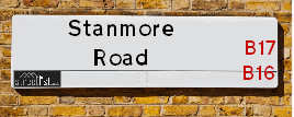
Map of Stanmore Road
| Street Crime (updated 04/05/2024) | ||
|---|---|---|
| Location Note | Central Point of Street - Not Actual Location | |
| MSOA Info | For MSOA E02001886 (Statistical Neighbourhood) | |
| Click Hint | Click on a Circle for a detailed breakdown below map. | |
| Crime Levels |
Green = Very Low Yellow = Low Orange = High Red = Very High |
|
| Postcodes | ||
| Icon | Postcodes for Stanmore Road | |
| Walking Distances | ||
| Distance Info | Green Circle = 10 Minutes Walk (800 metres) | |
About Stanmore Road
Stanmore Road is a street located in the city of Birmingham. The street has a length of approximately 768 metres.
The street is publicly maintained which means that the road is adopted and Birmingham is responsible for the repair and upkeep of the highway.
Stanmore Road is located within the Birmingham District (B) Council's jurisdiction. They provide various services, like refuse collection, and manage council tax collection. It's situated in the West Midlands region of the UK.
Stanmore Road has been assigned the Unique Street Reference Number of 2751564 and 2702890 in the National Street Gazetteer.
Stanmore Road is located within the county of West Midlands, situated in the West Midlands region of the UK. It's 103.64 miles North West from central London., 2.18 miles West from Birmingham, 19.31 miles West from Coventry and 22.6 miles North East from Worcester.
Stanmore Road is within the Post Town of BIRMINGHAM

Do you know why this road is called Stanmore Road?
What's it like to live here?
Ask the community a question about Stanmore Road.
Do you have any questions, memories to share or know any facts about Stanmore Road? We'd love to know more.
Also on streetlist.co.uk, can you help?
Swing Swang Lane
28th April 2024
I am trying to find out why the lane is named Swing Swang?
It has been known known this since at least 1905 when hedge making contents used to be held here.
Swing Swang is often used to describe a fairground ride. I remember Swing Boats. Were they a bit like this or is Swing Swang another name for swings?
Swing Swangs are also mentioned in connection to orchards. Or were orchards just good places to have swings?
Eldroth Road
15th April 2024
I wondered if anyone has any old pictures of Wenning Bank House in the 1940’s and also Lane Side before of the same era .. we visited today with my Mum in law as she used to live at both these properties. Also any photos of the schools around that time .. thank you.
Can You Help?Napps Way
15th April 2024
Why is the road called Napps Way (belonging to Napp, but minus an
apostrophe as is usual with such nomenclature)? Moreover, who or
what is, or was, “Napp” in the respective, possessive case?
Several years ago, I met an elderly man (probably in his late-eighties)
who lives on Bentham Drive, Liverpool 16, and during a conversation
with him whilst in a Northwest Passenger Transport Ambulance on the
way to the former RLUH (Royal Liverpool University Hospital), he told
me that he could remember (when he was a boy, living in Childwall,
Liverpool 16) that, “Where Napps Way is now, during WW2, there was
a two-man gun emplacement on the, then, open land to protect the
railway line passing over Childwall Valley Road - next to the railway
bridge - when suddenly, as they were loading a live “shell” into the gun’s
breach, the aforementioned “shell” accidentally exploded in the gun’s
breach killing both of the two soldiers, that had been manning the gun,
instantly! (Very sad, of course, but could - perhaps - two ghosts relating
to those two, very unfortunately and prematurely-killed soldiers have
haunted that place of their deaths ever since - and have any residents
of Napps Way - formerly and in its latest incarnation - seen two, WW2
(uniformed) soldiers unexpectedly appear in or near their homes?)
House Sales in Stanmore Road
| Year | High | Low | Average | Sales |
|---|---|---|---|---|
| 2010 | £155,000 | £135,000 | £145,000 | 2 |
| 2011 | £180,000 | £180,000 | £180,000 | 1 |
| 2012 | £200,000 | £130,000 | £143,538 | 3 |
| 2013 | £244,000 | £244,000 | £244,000 | 1 |
| 2014 | £230,000 | £325,000 | £248,750 | 4 |
| 2015 | £300,000 | £294,000 | £294,125 | 4 |
| 2016 | £300,000 | £285,000 | £292,500 | 2 |
| 2017 | £80,000 | £258,000 | £169,000 | 2 |
| 2018 | £331,000 | £280,000 | £335,250 | 4 |
| 2019 | £100,000 | £100,000 | £100,000 | 1 |
| 2020 | £363,000 | £340,000 | £360,167 | 3 |
| 2021 | £80,540 | £340,000 | £291,385 | 4 |
| 2022 | £325,000 | £450,000 | £306,000 | 5 |
Contains HM Land Registry data © Crown copyright and database right 2024. This data is licensed under the Open Government Licence v3.0.
Estate Agents near Stanmore Road
| Name | Address | Website |
|---|---|---|
| Cottons | Cavendish House, 359-361 Hagley Road, Edgbaston, Birmingham, B17 8DL | Visit Website |
| Hunters | 169 Knightlow Road, Harborne, Birmingham, B17 8PY | Visit Website |
| Connells Lettings | 122 Poplar Road, Edgbaston, Smethwick, B66 4AP | Visit Website |
Location Details
| Stanmore Road | |
|---|---|

| |
| Latitude | 52.475649 |
| Longitude | -1.952553 |
| OS Easting (X): | 403222 |
| OS Northing (Y): | 286455 |
| OS Grid Reference: | SP032865 |
Neighbourhood Policing |
| Police Force: West Midlands |
 View Neighbourhood Crime and Policing View Neighbourhood Crime and Policing |
| Find a Local Neighbourhood Watch Scheme |
Frequently asked Questions for Stanmore Road
What Council (Local Authority) is Stanmore Road in?
Stanmore Road is located within the local authority area of Birmingham Council which is a Metropolitan District.
What Parish Council is Stanmore Road in?
Stanmore Road is in an unparished area.
What Electoral Ward is Stanmore Road in?
Stanmore Road is located within the ward of North Edgbaston.
What County is Stanmore Road in?
Stanmore Road is located within the ceremonial county of West Midlands.
What Constituency is Stanmore Road in?
Stanmore Road is located within the constituency of Birmingham, Ladywood, Birmingham &Edgbaston.
What Part of the UK is Stanmore Road in?
Stanmore Road is located within the West Midlands (England) region of the United Kingdom.
What County Council area is Stanmore Road in?
Stanmore Road is located within the West Midlands Council area.
What Police Force area is Stanmore Road in?
Stanmore Road is located within the West Midlands Police area.
Roads that have a Junction with Stanmore Road
| Street | Junction Type |
|---|---|
| Portland Road (B4125) | junction |
| Percival Road | junction |
| Fountain Road | junction |
| Ravenshaw Road | pseudo node |
| Newnham Road | junction |
Sunset and Sunrise times for Stanmore Road
| Sunrise | 05:20 |
|---|---|
| Sunset | 20:48 |
Latest Weather Conditions for Stanmore Road
| Observed at Weather Station: | Coleshill 8 May 2024 at 17:00 (11.10 miles away) |
|---|---|
| Current Weather: | Partly cloudy (day) |
| Temperature and Humidity: | 20.6°C (50.8%) |
| Wind Direction and Speed: | SSW (7 mph) |
Population Statistics
| ONS Area Code | E00046373, E00046403 & E00046382 |
|---|---|
| ONS Area Name | Achieving Minorities & Young Families and Students |
| Average Age | 34.09 |
| Area Population | 1981.00 |
| Male Population | 1031.00 (52%) |
| Female Population | 950.00 (48%) |
| Benefit Claimants | 64 (3%) |
| LSOA Code: | E01009145 |
|---|---|
| LSOA Name: | Birmingham 060D |
| SOA Code: | 7b |
| SOA Name: | |
| MSOA Code: | E02001886 |
| MSOA Name: | Birmingham 060 |
Nearest Supermarkets
| Tesco Edgbaston Hagley Rd Express |
|---|
| Hagley Rd, Birmingham, B17 8DJ |
| 0345 675 7057 |
| Distance: 0.26 Miles |
| Directions from Stanmore Road to Tesco Edgbaston Hagley Rd Express |
| Iceland Bearwood |
|---|
| 548/552 Bearwood Road, Smethwick, Warley West Midlands, B66 4BT |
| 01214203345 |
| Distance: 0.72 Miles |
| Directions from Stanmore Road to Iceland Bearwood |
| Iceland Smethwick |
|---|
| Unit3 Windmill Shpng Prk, Smethwick, Birmingham, B66 3PR |
| 01215652477 |
| Distance: 0.93 Miles |
| Directions from Stanmore Road to Iceland Smethwick |
| Asda Cape Hill |
|---|
| Off Windmill Lane - Smethwick, Birmingham, B66 3EN |
| 0121 555 1520 |
| Distance: 0.97 Miles |
| Directions from Stanmore Road to Asda Cape Hill |
Telephone Information
| Area Code |
|---|
| Area Code: 0121 - Birmingham |
| Area Code: 01384 - Dudley |
| Area Code: 01922 - Walsall |
Broadband Information
| Speed | Average Speed | Median Speed | Maximum Speed | Next-generation access (NGA) | Number of Connections |
|---|---|---|---|---|---|
| Greater than 2 Mbps | >=30 | 25.1 | >=30 | Y | 22 |
Local Government
| Local Council Details |
|---|
| Within the area of Birmingham |
| Visit the Council's Website |
| Council House, Victoria Square, Birmingham &B1 1BB |
| Send email |
| Telephone Number: 0121 303 1111 |
| Local Member of Parliament |
|---|
| Within the Westminster Parliamentary Constituency of Birmingham, Ladywood, Birmingham &Edgbaston |
| The Member of Parliament is Shabana Mahmood &Preet Kaur Gill |
| Details for the MP Shabana Mahmood &Preet Kaur Gill on parliament.uk |
| Details for the MP Shabana Mahmood &Preet Kaur Gill on theyworkforyou.com |
| In the 2019 General Election Shabana Mahmood &Preet Kaur Gill won with a majority of 28,582 the result was Lab hold. The total electorate was 74,912 |
| Wards, Parish Councils and County Councils |
|---|
| Ward: North Edgbaston Ward |
| Parish: Unparished area |
| Ceremonial County: West Midlands |
Nearest Schools
England Primary Schools
The Oratory Roman Catholic Primary School
Address: The Oratory Roman Catholic Primary School, Oliver Road, Ladywood, Birmingham, West Midlands, B16 9ER
Distance: 0.97 miles
Contact: 01214540600
St Edmund's Catholic Primary School
Address: St Edmund's Catholic Primary School, Rosebery Street, Springhill, Birmingham, West Midlands, B18 7PA
Distance: 1.46 miles
Contact:
Chad Vale Primary School
Address: Chad Vale Primary School, Nursery Road, Edgbaston, Birmingham, West Midlands, B15 3JU
Distance: 0.90 miles
Contact: 01214647329
St Patrick and St Edmund's Catholic Primary School
Address: St Patrick and St Edmund's Catholic Primary School, Dudley Road, Birmingham, West Midlands, B18 7QW
Distance: 1.15 miles
Contact: 01212473947
Barford Primary School
Address: Barford Primary School, Barford Road, Ladywood, Birmingham, West Midlands, B16 0EF
Distance: 0.95 miles
Contact: 01214643765
Summerfield Primary School
Address: Summerfield Primary School, Cuthbert Road, Winson Green, Birmingham, West Midlands, B18 4AH
Distance: 1.01 miles
Contact: 01216752355
Cape Primary School
Address: Cape Primary School, Cape Hill, Smethwick, West Midlands, B66 4SH
Distance: 0.82 miles
Contact: 01215581667
Victoria Park Primary
Address: Victoria Park Primary, Ballot Street, Smethwick, West Midlands, B66 3HH
Distance: 1.12 miles
Contact:
St Matthew's CofE Primary School
Address: St Matthew's CofE Primary School, Windmill Lane, Smethwick, West Midlands, B66 3LX
Distance: 1.07 miles
Contact: 01215581651
George Dixon Primary School
Address: George Dixon Primary School, City Road, Edgbaston, Birmingham, West Midlands, B17 8LE
Distance: 0.20 miles
Contact: 01216752775
Crocketts Community Primary School
Address: Crocketts Community Primary School, Coopers Lane, Smethwick, West Midlands, B67 7DW
Distance: 1.35 miles
Contact: 01215581659
Bearwood Primary School
Address: Bearwood Primary School, Bearwood Road, Smethwick, West Midlands, B66 4HB
Distance: 0.75 miles
Contact: 01214344499
Annie Lennard Primary School
Address: Annie Lennard Primary School, The Oval, Smethwick, West Midlands, B67 6LE
Distance: 1.45 miles
Contact: 01214294284
Devonshire Infant School
Address: Devonshire Infant School, Auckland Road, Smethwick, West Midlands, B67 7AT
Distance: 1.66 miles
Contact:
Abbey Junior School
Address: Abbey Junior School, Barclay Road, Smethwick, West Midlands, B67 5LT
Distance: 1.17 miles
Contact: 01214292700
Abbey Infant School
Address: Abbey Infant School, Maurice Road, Smethwick, West Midlands, B67 5LR
Distance: 1.18 miles
Contact: 01214291689
Our Lady of Fatima Catholic Primary School
Address: Our Lady of Fatima Catholic Primary School, Winchfield Drive, Harborne, Birmingham, West Midlands, B17 8TR
Distance: 1.12 miles
Contact:
Lightwoods Primary School
Address: Lightwoods Primary School, Castle Road East, Oldbury, West Midlands, B68 9BG
Distance: 1.61 miles
Contact:
St John's & St Peter's CofE Academy
Address: St John's & St Peter's CofE Academy, St Vincent Street West, Ladywood, Birmingham, West Midlands, B16 8RN
Distance: 1.28 miles
Contact: 01216751398
St George's Church of England Primary School
Address: St George's Church of England Primary School, Beaufort Road, Edgbaston, Birmingham, West Midlands, B16 8HY
Distance: 1.03 miles
Contact: 01214642789
Oasis Academy Foundry
Address: Oasis Academy Foundry, Foundry Road, Birmingham, West Midlands, B18 4LP
Distance: 1.36 miles
Contact: 01212508850
Oasis Academy Boulton
Address: Oasis Academy Boulton, Boulton Road, Handsworth, Birmingham, West Midlands, B21 0RE
Distance: 1.82 miles
Contact: 01214644228
James Watt Primary School
Address: James Watt Primary School, Boulton Road, Soho, Birmingham, West Midlands, B21 0RE
Distance: 1.82 miles
Contact: 01214644736
City Road Primary School
Address: City Road Primary School, Cavendish Road, Rotton Park, Birmingham, West Midlands, B16 0HL
Distance: 0.71 miles
Contact:
Shireland Hall Primary Academy
Address: Shireland Hall Primary Academy, Montague Road, Smethwick, West Midlands, B66 4PW
Distance: 0.66 miles
Contact: 01215586331
St Philip's Catholic Primary School
Address: St Philip's Catholic Primary School, Messenger Road, Smethwick, West Midlands, B66 3DU
Distance: 1.36 miles
Contact: 01215581643
Harborne Primary School
Address: Harborne Primary School, Station Road, Harborne, Birmingham, West Midlands, B17 9LU
Distance: 1.17 miles
Contact: 01214642705
Our Lady of Fatima Catholic Primary School
Address: Our Lady of Fatima Catholic Primary School, Winchfield Drive, Harborne, Birmingham, West Midlands, B17 8TR
Distance: 1.12 miles
Contact: 01214292900
Woodhouse Primary Academy
Address: Woodhouse Primary Academy, Woodhouse Road, Quinton, Birmingham, West Midlands, B32 2DL
Distance: 1.73 miles
Contact: 01214641769
St Hubert's Catholic Primary School
Address: St Hubert's Catholic Primary School, Wolverhampton Road, Oldbury, West Midlands, B68 0LP
Distance: 1.86 miles
Contact:
Warley Infant School
Address: Warley Infant School, Bleakhouse Road, Oldbury, West Midlands, B68 9DS
Distance: 1.93 miles
Contact:
Bleakhouse Primary School
Address: Bleakhouse Primary School, Bleakhouse Road, Oldbury, West Midlands, B68 9DS
Distance: 1.93 miles
Contact: 01214222841
Victoria Park Primary
Address: Victoria Park Primary, Ballot Street, Smethwick, West Midlands, B66 3HH
Distance: 1.12 miles
Contact: 01215588701
Uplands Manor Primary School and Nursery
Address: Uplands Manor Primary School and Nursery, Addenbrooke Road, Smethwick, West Midlands, B67 6HT
Distance: 1.19 miles
Contact: 01215581602
Galton Valley Primary School
Address: Galton Valley Primary School, Brasshouse Lane, Smethwick, West Midlands, B66 1BA
Distance: 1.85 miles
Contact: 01215581690
St Gregory's Catholic Primary School
Address: St Gregory's Catholic Primary School, Park Road, Bearwood, Smethwick, West Midlands, B67 5HX
Distance: 1.03 miles
Contact: 01214294609
Devonshire Junior Academy
Address: Devonshire Junior Academy, Auckland Road, Smethwick, West Midlands, B67 7AT
Distance: 1.66 miles
Contact: 01215581654
England Secondary Schools
St Paul's School for Girls
Address: St Paul's School for Girls, Vernon Road, Edgbaston, Birmingham, West Midlands, B16 9SL
Distance: 0.48 miles
Contact: 01214540895
Lordswood Girls' School and The Sixth Form Centre, Harborne A Specialist Media Arts College
Address: Lordswood Girls' School and The Sixth Form Centre, Harborne A Specialist Media Arts College, Knightlow Road, Harborne, Birmingham, West Midlands, B17 8QB
Distance: 0.65 miles
Contact:
City Academy Birmingham
Address: City Academy Birmingham, 23 Langley Walk, Ladywood, Birmingham, West Midlands, B15 2EF
Distance: 1.92 miles
Contact:
Harborne Academy
Address: Harborne Academy, Harborne Road, Edgbaston, Birmingham, West Midlands, B15 3JL
Distance: 1.13 miles
Contact: 01214642737
George Dixon Academy
Address: George Dixon Academy, Portland Road, Edgbaston, Birmingham, West Midlands, B16 9GD
Distance: 0.18 miles
Contact: 01215666565
King Edward VI Lordswood School for Girls
Address: King Edward VI Lordswood School for Girls, Knightlow Road, Harborne, Birmingham, West Midlands, B17 8QB
Distance: 0.65 miles
Contact: 01214292838
Lordswood Boys' School
Address: Lordswood Boys' School, Hagley Road, Birmingham, West Midlands, B17 8BJ
Distance: 0.62 miles
Contact:
Shireland Collegiate Academy
Address: Shireland Collegiate Academy, Waterloo Road, Smethwick, West Midlands, B66 4ND
Distance: 0.70 miles
Contact: 01215588086
Bristnall Hall Academy
Address: Bristnall Hall Academy, Bristnall Hall Lane, Oldbury, West Midlands, B68 9PA
Distance: 1.74 miles
Contact: 01215525425
Nearest Hospitals
| Woodbourne Priory Hospital |
|---|
| Address: 21 Woodbourne Road, Edgbaston, Birmingham, B17 8BY, |
| Independent Sector |
| Priory Group Limited |
| Telephone: 0121 434 4343 |
| Visit Hospital Website |
| Distance: 0.49 (miles) |
| Directions from to Woodbourne Priory Hospital |
| Beverley House |
|---|
| Address: 527 - 529 City Road, Edgbaston, Birmingham, B17 8LL, |
| NHS Sector |
| Partnerships In Care Ltd |
| Telephone: 01214 203 701 |
| Visit Hospital Website |
| Distance: 0.56 (miles) |
| Directions from to Beverley House |
| City Hospital |
|---|
| Address: Dudley Road, Dudley Road, Birmingham, B18 7QH, |
| NHS Sector |
| Sandwell and West Birmingham Hospitals NHS Trust |
| Telephone: 0121 554 3801 |
| Visit Hospital Website |
| Distance: 1.98 (miles) |
| Directions from to City Hospital |
Nearest Dentists
Dentists near Stanmore Road
KNIGHTLOW ROAD (DENTAL SURGERY)
Address: 177 KNIGHTLOW ROAD, BIRMINGHAM, WEST MIDLANDS, B17 8PY
Distance: 0.56 miles
Contact: :
DENTAL SURGERY
Address: 17 PORTLAND ROAD, BIRMINGHAM, WEST MIDLANDS, B16 9HN
Distance: 0.62 miles
Contact: :
EDGBASTON ORTHODONTICS
Address: 17 PORTLAND ROAD, BIRMINGHAM, WEST MIDLANDS, B16 9HN
Distance: 0.62 miles
Contact: :
T MOODLEY
Address: 80 SANDON ROAD, SMETHWICK, WEST MIDLANDS, B66 4AG
Distance: 0.62 miles
Contact: :
DENTAL SURGERY
Address: 621-623 BEARWOOD ROAD, SMETHWICK, WEST MIDLANDS, B66 4BL
Distance: 0.69 miles
Contact: :
CENTRAL ORTHODONTICS
Address: 341 BEARWOOD ROAD, SMETHWICK, WEST MIDLANDS, B66 4DB
Distance: 0.78 miles
Contact: :
Nearest GP Surgeries
Doctors near Stanmore Road
CITY HEALTH CENTRE
Address: 449 CITY ROAD, EDGBASTON, BIRMINGHAM, WEST MIDLANDS, B17 8LG
Distance: 0.25 miles
Contact: tel: 0845 0730394
SHERWOOD HOUSE MEDICAL PRACTICE
Address: 9 SANDON ROAD, EDGBASTON, BIRMINGHAM, WEST MIDLANDS, B17 8DP
Distance: 0.31 miles
Contact: tel: 0121 4200100
ROTTON PARK MEDICAL CENTRE
Address: 264 ROTTON PARK ROAD, EDGBASTON, BIRMINGHAM, WEST MIDLANDS, B16 0LU
Distance: 0.51 miles
Contact: tel: 0121 4292683
DRUID GROUP - EMC SURGERY
Address: 2A CAVENDISH ROAD, EDGBASTON, BIRMINGHAM, B16 0HZ
Distance: 0.79 miles
Contact: tel: 0121 4556170
CITY ROAD MEDICAL CENTRE
Address: 5 CITY ROAD, EDGBASTON, BIRMINGHAM, WEST MIDLANDS, B16 0HH
Distance: 0.82 miles
Contact: tel: 0121 4563322
BEARWOOD ROAD SURGERY
Address: 348 BEARWOOD ROAD, WARLEY, SMETHWICK, WEST MIDLANDS, B66 4ES
Distance: 0.84 miles
Contact: tel: 0121 4291345
Nearest Dispensing Chemists
Pharmacies near Stanmore Road
SHERWOOD HOUSE PHARMACY
Address: SHERWOOD HOUSE MEDICAL CENTRE, 9 SANDON ROAD, EDGBASTON, BIRMINGHAM, B17 8DP
Distance: 0.31 miles
Contact: tel: 01214 344687
THE BEAR PHARMACY
Address: BEARWOOD SHOPPING CENTRE, 581 BEARWOOD ROAD, SMETHWICK, B66 4BH
Distance: 0.70 miles
Contact: tel: 01214 291360
D R DALVAIR PHARMACY
Address: 479 BEARWOOD ROAD, SMETHWICK, WEST MIDLANDS, B66 4DH
Distance: 0.74 miles
Contact: tel: 0121 4299150
AL-SHAFA
Address: 93 SHIRELAND ROAD, SMETHWICK, B66 4QJ
Distance: 0.75 miles
Contact: tel: 01214 488665
BEARWOOD PHARMACY
Address: 348A BEARWOOD ROAD, SMETHWICK, WEST MIDLANDS, B66 4ES
Distance: 0.84 miles
Contact: tel: 0121 4344022
DUDLEY ROAD LATE NIGHT PHARMACY
Address: 328-330 DUDLEY ROAD, WINSON GREEN, BIRMINGHAM, B18 4HJ
Distance: 0.84 miles
Contact: tel: 01214 544466
Nearest Opticians
Opticians near Stanmore Road
BOOTS OPTICIANS T/A AB OPTICAL
Address: 235-237 HAGLEY ROAD, EDGBASTON, BIRMINGHAM, WEST MIDLANDS, B16 9RR
Distance: 0.59 miles
Contact: :
OCEAN OPTICAL (BEARWOOD)
Address: 641 BEARWOOD ROAD, BEARWOOD, SMETHWICK, WEST MIDLANDS, B66 4BL
Distance: 0.69 miles
Contact: :
SPECSAVERS (BEARWOOD)
Address: 599 BEARWOOD ROAD, SMETHWICK, WEST MIDLANDS, B66 4BJ
Distance: 0.69 miles
Contact: :
SCRIVENS OPTICIANS (BEARWOOD)
Address: BEARWOOD SHOPPING CENTRE, 575 BEARWOOD ROAD, SMETHWICK, WEST MIDLANDS, B66 4BH
Distance: 0.70 miles
Contact: :
BAINBRIDGE OPTOMETRISTS (SMETHWICK)
Address: 502 BEARWOOD ROAD, SMETHWICK, WEST MIDLANDS, B66 4BX
Distance: 0.74 miles
Contact: :
ARISTO OPTICIANS
Address: 6-7 THREE SHIRES OAK ROAD, SMETHWICK, WEST MIDLANDS, B67 5BA
Distance: 0.79 miles
Contact: :
Transport
Nearest Rail Stations
Smethwick Rolfe Street Station is 1.62 miles away.
Address: Smethwick Rolfe Street station, Rolfe Street, Smethwick, West Midlands, B66 2AF
Smethwick Rolfe Street is situated on the Rugby�Birmingham�Stafford line|West Coast Main Line.
Smethwick Rolfe Street Station is staffed on a part time basis.
Directions from Stanmore Road to Smethwick Rolfe Street Rail Station
Five Ways Station is 1.70 miles away.
Address: Five Ways station, Islington Row, Edgbaston, West Midlands, B15 1SF
Five Ways is situated on the Bristol to Brimingham Line.
Five Ways Station is staffed on a part time basis.