Map of Deers Way
| Postcodes | ||
|---|---|---|
| Icon | Postcodes for Deers Way | |
| Walking Distances | ||
| Distance Info | Green Circle = 10 Minutes Walk (800 metres) | |
About Deers Way
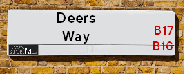
Deers Way is a street located in the city of Birmingham. It uses the postcode B16 0QQ. The street has a length of approximately 94 metres.
Deers Way is located within the Birmingham District (B) Council's jurisdiction. They provide various services, like refuse collection, and manage council tax collection. It's situated in the West Midlands region of the UK.
Deers Way has been assigned the Unique Street Reference Number of 2752037 in the National Street Gazetteer.
Deers Way is located within the county of West Midlands, situated in the West Midlands region of the UK. It's 103.95 miles North West from central London., 2.22 miles West from Birmingham, 19.47 miles West from Coventry and 22.93 miles North East from Worcester.

Do you know why this road is called Deers Way?
What's it like to live here?
Ask the community a question about Deers Way.
Do you have any questions, memories to share or know any facts about Deers Way? We'd love to know more.
Also on streetlist.co.uk, can you help?
Swing Swang Lane
28th April 2024
I am trying to find out why the lane is named Swing Swang?
It has been known known this since at least 1905 when hedge making contents used to be held here.
Swing Swang is often used to describe a fairground ride. I remember Swing Boats. Were they a bit like this or is Swing Swang another name for swings?
Swing Swangs are also mentioned in connection to orchards. Or were orchards just good places to have swings?
Estate Agents near Deers Way
| Name | Address | Website |
|---|---|---|
| Ansars Estate Agents | 72 Capehill, Smethwick,B66 4PB | |
| Meridian Estates | 16 Waterloo Road, Edgbaston, Smethwick, B66 4JW | Visit Website |
| Cottons | Cavendish House, 359-361 Hagley Road, Edgbaston, Birmingham, B17 8DL | Visit Website |
We have found 1 postcode for Deers Way
Location Details
| Deers Way | |
|---|---|

| |
| Latitude | 52.481629 |
| Longitude | -1.953836 |
| OS Easting (X): | 403134 |
| OS Northing (Y): | 287120 |
| OS Grid Reference: | SP031871 |
Neighbourhood Policing |
| Police Force: West Midlands |
 View Neighbourhood Crime and Policing View Neighbourhood Crime and Policing |
| Find a Local Neighbourhood Watch Scheme |
Frequently asked Questions for Deers Way
What Council (Local Authority) is Deers Way in?
Deers Way is located within the local authority area of Birmingham Council which is a Metropolitan District.
What Parish Council is Deers Way in?
Deers Way is in an unparished area.
What Electoral Ward is Deers Way in?
Deers Way is located within the ward of North Edgbaston.
What County is Deers Way in?
Deers Way is located within the ceremonial county of West Midlands.
What Constituency is Deers Way in?
Deers Way is located within the constituency of Birmingham &Ladywood.
What Part of the UK is Deers Way in?
Deers Way is located within the West Midlands (England) region of the United Kingdom.
What County Council area is Deers Way in?
Deers Way is located within the West Midlands Council area.
What Police Force area is Deers Way in?
Deers Way is located within the West Midlands Police area.
Roads that have a Junction with Deers Way
| Street | Junction Type |
|---|---|
| Brook Way | junction |
| Avery Avenue | junction |
| Roebuck Road | junction |
Sunset and Sunrise times for Deers Way , B16 0QQ
| Sunrise | 05:13 |
|---|---|
| Sunset | 20:54 |
Latest Weather Conditions for Deers Way, B16 0QQ
| Observed at Weather Station: | Coleshill 11 May 2024 at 23:00 (11.15 miles away) |
|---|---|
| Current Weather: | Clear night |
| Temperature and Humidity: | 14.6°C (79.9%) |
| Wind Direction and Speed: | ESE (3 mph) |
Population Statistics
| ONS Area Code | E00175796 |
|---|---|
| ONS Area Name | Achieving Minorities |
| Average Age | 34.09 |
| Area Population | 1981.00 |
| Male Population | 1031.00 (52%) |
| Female Population | 950.00 (48%) |
| Benefit Claimants | 64 (3%) |
| LSOA Code: | E01009145 |
|---|---|
| LSOA Name: | Birmingham 060D |
| SOA Code: | 7b |
| SOA Name: | |
| MSOA Code: | E02001886 |
| MSOA Name: | Birmingham 060 |
Nearest Supermarkets
| Iceland Smethwick |
|---|
| Unit3 Windmill Shpng Prk, Smethwick, Birmingham, B66 3PR |
| 01215652477 |
| Distance: 0.54 Miles |
| Directions from Deers Way to Iceland Smethwick |
| Asda Cape Hill |
|---|
| Off Windmill Lane - Smethwick, Birmingham, B66 3EN |
| 0121 555 1520 |
| Distance: 0.57 Miles |
| Directions from Deers Way to Asda Cape Hill |
| Tesco Edgbaston Hagley Rd Express |
|---|
| Hagley Rd, Birmingham, B17 8DJ |
| 0345 675 7057 |
| Distance: 0.61 Miles |
| Directions from Deers Way to Tesco Edgbaston Hagley Rd Express |
| Iceland Bearwood |
|---|
| 548/552 Bearwood Road, Smethwick, Warley West Midlands, B66 4BT |
| 01214203345 |
| Distance: 0.81 Miles |
| Directions from Deers Way to Iceland Bearwood |
Telephone Information
| Area Code |
|---|
| Area Code: 0121 - Birmingham |
| Area Code: 01384 - Dudley |
| Area Code: 01922 - Walsall |
Local Government
| Local Council Details |
|---|
| Within the area of Birmingham |
| Visit the Council's Website |
| Council House, Victoria Square, Birmingham &B1 1BB |
| Send email |
| Telephone Number: 0121 303 1111 |
| Local Member of Parliament |
|---|
| Within the Westminster Parliamentary Constituency of Birmingham &Ladywood |
| The Member of Parliament is Shabana Mahmood |
| Details for the MP Shabana Mahmood on parliament.uk |
| Details for the MP Shabana Mahmood on theyworkforyou.com |
| In the 2019 General Election Shabana Mahmood won with a majority of 28,582 the result was Lab hold. The total electorate was 74,912 |
| Wards, Parish Councils and County Councils |
|---|
| Ward: North Edgbaston Ward |
| Ceremonial County: West Midlands |
Nearest Schools
England Primary Schools
Nelson Junior and Infant School
Address: Nelson Junior and Infant School, King Edward's Road, Ladywood, Birmingham, West Midlands, B1 2PJ
Distance: 1.56 miles
Contact: 01214642201
Benson Community School
Address: Benson Community School, Benson Road, Hockley, Birmingham, West Midlands, B18 5TD
Distance: 1.53 miles
Contact: 01215544913
The Oratory Roman Catholic Primary School
Address: The Oratory Roman Catholic Primary School, Oliver Road, Ladywood, Birmingham, West Midlands, B16 9ER
Distance: 1.07 miles
Contact: 01214540600
St Edmund's Catholic Primary School
Address: St Edmund's Catholic Primary School, Rosebery Street, Springhill, Birmingham, West Midlands, B18 7PA
Distance: 1.34 miles
Contact:
Chad Vale Primary School
Address: Chad Vale Primary School, Nursery Road, Edgbaston, Birmingham, West Midlands, B15 3JU
Distance: 1.31 miles
Contact: 01214647329
St Patrick and St Edmund's Catholic Primary School
Address: St Patrick and St Edmund's Catholic Primary School, Dudley Road, Birmingham, West Midlands, B18 7QW
Distance: 0.99 miles
Contact: 01212473947
Barford Primary School
Address: Barford Primary School, Barford Road, Ladywood, Birmingham, West Midlands, B16 0EF
Distance: 0.83 miles
Contact: 01214643765
Summerfield Primary School
Address: Summerfield Primary School, Cuthbert Road, Winson Green, Birmingham, West Midlands, B18 4AH
Distance: 0.72 miles
Contact: 01216752355
Cape Primary School
Address: Cape Primary School, Cape Hill, Smethwick, West Midlands, B66 4SH
Distance: 0.40 miles
Contact: 01215581667
Victoria Park Primary
Address: Victoria Park Primary, Ballot Street, Smethwick, West Midlands, B66 3HH
Distance: 0.71 miles
Contact:
St Matthew's CofE Primary School
Address: St Matthew's CofE Primary School, Windmill Lane, Smethwick, West Midlands, B66 3LX
Distance: 0.66 miles
Contact: 01215581651
George Dixon Primary School
Address: George Dixon Primary School, City Road, Edgbaston, Birmingham, West Midlands, B17 8LE
Distance: 0.34 miles
Contact: 01216752775
Crocketts Community Primary School
Address: Crocketts Community Primary School, Coopers Lane, Smethwick, West Midlands, B67 7DW
Distance: 1.00 miles
Contact: 01215581659
Bearwood Primary School
Address: Bearwood Primary School, Bearwood Road, Smethwick, West Midlands, B66 4HB
Distance: 0.75 miles
Contact: 01214344499
Annie Lennard Primary School
Address: Annie Lennard Primary School, The Oval, Smethwick, West Midlands, B67 6LE
Distance: 1.33 miles
Contact: 01214294284
Devonshire Infant School
Address: Devonshire Infant School, Auckland Road, Smethwick, West Midlands, B67 7AT
Distance: 1.34 miles
Contact:
Abbey Junior School
Address: Abbey Junior School, Barclay Road, Smethwick, West Midlands, B67 5LT
Distance: 1.17 miles
Contact: 01214292700
Abbey Infant School
Address: Abbey Infant School, Maurice Road, Smethwick, West Midlands, B67 5LR
Distance: 1.16 miles
Contact: 01214291689
Our Lady of Fatima Catholic Primary School
Address: Our Lady of Fatima Catholic Primary School, Winchfield Drive, Harborne, Birmingham, West Midlands, B17 8TR
Distance: 1.35 miles
Contact:
Lightwoods Primary School
Address: Lightwoods Primary School, Castle Road East, Oldbury, West Midlands, B68 9BG
Distance: 1.73 miles
Contact:
St John's & St Peter's CofE Academy
Address: St John's & St Peter's CofE Academy, St Vincent Street West, Ladywood, Birmingham, West Midlands, B16 8RN
Distance: 1.35 miles
Contact: 01216751398
St George's Church of England Primary School
Address: St George's Church of England Primary School, Beaufort Road, Edgbaston, Birmingham, West Midlands, B16 8HY
Distance: 1.21 miles
Contact: 01214642789
Oasis Academy Foundry
Address: Oasis Academy Foundry, Foundry Road, Birmingham, West Midlands, B18 4LP
Distance: 1.01 miles
Contact: 01212508850
Oasis Academy Boulton
Address: Oasis Academy Boulton, Boulton Road, Handsworth, Birmingham, West Midlands, B21 0RE
Distance: 1.46 miles
Contact: 01214644228
James Watt Primary School
Address: James Watt Primary School, Boulton Road, Soho, Birmingham, West Midlands, B21 0RE
Distance: 1.46 miles
Contact: 01214644736
City Road Primary School
Address: City Road Primary School, Cavendish Road, Rotton Park, Birmingham, West Midlands, B16 0HL
Distance: 0.46 miles
Contact:
Shireland Hall Primary Academy
Address: Shireland Hall Primary Academy, Montague Road, Smethwick, West Midlands, B66 4PW
Distance: 0.25 miles
Contact: 01215586331
Wattville Primary School
Address: Wattville Primary School, Wattville Road, Handsworth, Birmingham, West Midlands, B21 0DP
Distance: 1.61 miles
Contact: 01215542768
St Philip's Catholic Primary School
Address: St Philip's Catholic Primary School, Messenger Road, Smethwick, West Midlands, B66 3DU
Distance: 0.94 miles
Contact: 01215581643
Our Lady of Fatima Catholic Primary School
Address: Our Lady of Fatima Catholic Primary School, Winchfield Drive, Harborne, Birmingham, West Midlands, B17 8TR
Distance: 1.35 miles
Contact: 01214292900
Victoria Park Primary
Address: Victoria Park Primary, Ballot Street, Smethwick, West Midlands, B66 3HH
Distance: 0.71 miles
Contact: 01215588701
Uplands Manor Primary School and Nursery
Address: Uplands Manor Primary School and Nursery, Addenbrooke Road, Smethwick, West Midlands, B67 6HT
Distance: 1.01 miles
Contact: 01215581602
Galton Valley Primary School
Address: Galton Valley Primary School, Brasshouse Lane, Smethwick, West Midlands, B66 1BA
Distance: 1.46 miles
Contact: 01215581690
St Gregory's Catholic Primary School
Address: St Gregory's Catholic Primary School, Park Road, Bearwood, Smethwick, West Midlands, B67 5HX
Distance: 1.03 miles
Contact: 01214294609
Devonshire Junior Academy
Address: Devonshire Junior Academy, Auckland Road, Smethwick, West Midlands, B67 7AT
Distance: 1.34 miles
Contact: 01215581654
England Secondary Schools
St Paul's School for Girls
Address: St Paul's School for Girls, Vernon Road, Edgbaston, Birmingham, West Midlands, B16 9SL
Distance: 0.69 miles
Contact: 01214540895
Lordswood Girls' School and The Sixth Form Centre, Harborne A Specialist Media Arts College
Address: Lordswood Girls' School and The Sixth Form Centre, Harborne A Specialist Media Arts College, Knightlow Road, Harborne, Birmingham, West Midlands, B17 8QB
Distance: 0.97 miles
Contact:
Holly Lodge High School College of Science
Address: Holly Lodge High School College of Science, Holly Lane, Smethwick, West Midlands, B67 7JG
Distance: 1.79 miles
Contact: 01215580691
Harborne Academy
Address: Harborne Academy, Harborne Road, Edgbaston, Birmingham, West Midlands, B15 3JL
Distance: 1.52 miles
Contact: 01214642737
Holyhead School
Address: Holyhead School, Milestone Lane, Handsworth, Birmingham, West Midlands, B21 0HN
Distance: 1.65 miles
Contact: 01215231960
George Dixon Academy
Address: George Dixon Academy, Portland Road, Edgbaston, Birmingham, West Midlands, B16 9GD
Distance: 0.28 miles
Contact: 01215666565
King Edward VI Lordswood School for Girls
Address: King Edward VI Lordswood School for Girls, Knightlow Road, Harborne, Birmingham, West Midlands, B17 8QB
Distance: 0.97 miles
Contact: 01214292838
Lordswood Boys' School
Address: Lordswood Boys' School, Hagley Road, Birmingham, West Midlands, B17 8BJ
Distance: 0.82 miles
Contact:
Shireland Collegiate Academy
Address: Shireland Collegiate Academy, Waterloo Road, Smethwick, West Midlands, B66 4ND
Distance: 0.43 miles
Contact: 01215588086
Nearest Hospitals
| Name | Address | Postcode | Distance | Map |
|---|
Nearest Dentists
Dentists near Deers Way
| Name | Address | Postcode | Distance | Map |
|---|
Nearest GP Surgeries
Doctors near Deers Way
ROTTON PARK MEDICAL CENTRE
Address: 264 ROTTON PARK ROAD, EDGBASTON, BIRMINGHAM, WEST MIDLANDS, B16 0LU
Distance: 0.29 miles
Contact: tel: 0121 4292683
CITY HEALTH CENTRE
Address: 449 CITY ROAD, EDGBASTON, BIRMINGHAM, WEST MIDLANDS, B17 8LG
Distance: 0.39 miles
Contact: tel: 0845 0730394
CAPE HILL MEDICAL CENTRE
Address: RAGLAN ROAD, SMETHWICK, WEST MIDLANDS, B66 3NR
Distance: 0.47 miles
Contact: tel: 0121 5582613
DRUID GROUP - EMC SURGERY
Address: 2A CAVENDISH ROAD, EDGBASTON, BIRMINGHAM, B16 0HZ
Distance: 0.51 miles
Contact: tel: 0121 4556170
CITY ROAD MEDICAL CENTRE
Address: 5 CITY ROAD, EDGBASTON, BIRMINGHAM, WEST MIDLANDS, B16 0HH
Distance: 0.57 miles
Contact: tel: 0121 4563322
SHERWOOD HOUSE MEDICAL PRACTICE
Address: 9 SANDON ROAD, EDGBASTON, BIRMINGHAM, WEST MIDLANDS, B17 8DP
Distance: 0.59 miles
Contact: tel: 0121 4200100
Nearest Dispensing Chemists
Pharmacies near Deers Way
| Name | Address | Postcode | Telephone | Map | Distance in Km |
|---|
Nearest Opticians
Opticians near Deers Way
CAPE OPTICIANS
Address: 79 CAPE HILL, SMETHWICK, WEST MIDLANDS, B66 4SG
Distance: 0.40 miles
Contact: :
SPECTRUM OPTICIANS
Address: 14 WATERLOO ROAD, SMETHWICK, B66 4JW
Distance: 0.47 miles
Contact: :
MANJOT OPTICAL
Address: 387 DUDLEY ROAD, BIRMINGHAM, B18 4HD
Distance: 0.52 miles
Contact: :
LATE NITE PHARMACY & OPTICIANS
Address: 328-330 DUDLEY ROAD, BIRMINGHAM, WEST MIDLANDS, B18 4HJ
Distance: 0.53 miles
Contact: :
CLEAR VISION CAPE LTD (SMETHWICK)
Address: 434 HIGH STREET, SMETHWICK, B66 3PJ
Distance: 0.55 miles
Contact: :
EYE CENTRE OPTICIANS
Address: 289 DUDLEY ROAD, BIRMINGHAM, WEST MIDLANDS, B18 4HA
Distance: 0.62 miles
Contact: :
Transport
Nearest Rail Stations
Smethwick Rolfe Street Station is 1.24 miles away.
Address: Smethwick Rolfe Street station, Rolfe Street, Smethwick, West Midlands, B66 2AF
Smethwick Rolfe Street is situated on the Rugby�Birmingham�Stafford line|West Coast Main Line.
Smethwick Rolfe Street Station is staffed on a part time basis.
Directions from Deers Way to Smethwick Rolfe Street Rail Station
The Hawthorns Station is 1.70 miles away.
Address: The Hawthorns station, Halfords Lane, West Bromwich, West Midlands, B66 2HB
The Hawthorns is situated on the Birmingham to Worcester via Kidderminster line.
The Hawthorns Station is staffed on a part time basis.