Map of Queen's Park Road
| Postcodes | ||
|---|---|---|
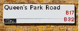
| Icon | Postcodes for Queen's Park Road | |
| Walking Distances | ||
| Distance Info | Green Circle = 10 Minutes Walk (800 metres) | |
About Queen's Park Road
Queen's Park Road is a street located in the city of Birmingham. The street has a length of approximately 446 metres.
Queen's Park Road is located within the Birmingham District (B) Council's jurisdiction. They provide various services, like refuse collection, and manage council tax collection. It's situated in the West Midlands region of the UK.
Queen's Park Road has been assigned the Unique Street Reference Number of 2704251 and 2759205 in the National Street Gazetteer.
Queen's Park Road is located within the county of West Midlands, situated in the West Midlands region of the UK. It's 103.54 miles North West from central London., 3.32 miles South West from Birmingham, 19.89 miles West from Coventry and 21.17 miles North East from Worcester.

Do you know why this road is called Queen's Park Road?
What's it like to live here?
Ask the community a question about Queen's Park Road.
Do you have any questions, memories to share or know any facts about Queen's Park Road? We'd love to know more.
Also on streetlist.co.uk, can you help?
Swing Swang Lane
28th April 2024
I am trying to find out why the lane is named Swing Swang?
It has been known known this since at least 1905 when hedge making contents used to be held here.
Swing Swang is often used to describe a fairground ride. I remember Swing Boats. Were they a bit like this or is Swing Swang another name for swings?
Swing Swangs are also mentioned in connection to orchards. Or were orchards just good places to have swings?
Estate Agents near Queen's Park Road
| Name | Address | Website |
|---|---|---|
| MECS Sales & Lettings | 2-4 Lonsdale Road, Harborne, Birmingham,B17 9RA | Visit Website |
| Trueman Estates | 33 Lordswood Road, Harborne, Birmingham,B17 9RP | Visit Website |
| Douglas Smart Move | 364-366 High Street, Harborne, Birmingham,B17 9PY | Visit Website |
Location Details
| Queen's Park Road | |
|---|---|

| |
| Latitude | 52.458773 |
| Longitude | -1.972342 |
| OS Easting (X): | 401879 |
| OS Northing (Y): | 284577 |
| OS Grid Reference: | SP019846 |
Neighbourhood Policing |
| Police Force: West Midlands |
 View Neighbourhood Crime and Policing View Neighbourhood Crime and Policing |
| Find a Local Neighbourhood Watch Scheme |
Frequently asked Questions for Queen's Park Road
What Council (Local Authority) is Queen's Park Road in?
Queen's Park Road is located within the local authority area of Birmingham Council which is a Metropolitan District.
What Parish Council is Queen's Park Road in?
Queen's Park Road is in an unparished area.
What Electoral Ward is Queen's Park Road in?
Queen's Park Road is located within the ward of Harborne.
What County is Queen's Park Road in?
Queen's Park Road is located within the ceremonial county of West Midlands.
What Constituency is Queen's Park Road in?
Queen's Park Road is located within the constituency of Birmingham &Edgbaston.
What Part of the UK is Queen's Park Road in?
Queen's Park Road is located within the West Midlands (England) region of the United Kingdom.
What County Council area is Queen's Park Road in?
Queen's Park Road is located within the West Midlands Council area.
What Police Force area is Queen's Park Road in?
Queen's Park Road is located within the West Midlands Police area.
Roads that have a Junction with Queen's Park Road
| Street | Junction Type |
|---|---|
| Court Oak Road (A4123) | junction |
| Queens Court | junction |
| Tennal Road | junction |
Sunset and Sunrise times for Queen's Park Road
| Sunrise | 05:11 |
|---|---|
| Sunset | 20:56 |
Latest Weather Conditions for Queen's Park Road
| Observed at Weather Station: | Coleshill 13 May 2024 at 07:00 (12.02 miles away) |
|---|---|
| Current Weather: | Overcast |
| Temperature and Humidity: | 12.4°C (83.0%) |
| Wind Direction and Speed: | S (11 mph) |
Population Statistics
| ONS Area Code | E00045972 & E00045984 |
|---|---|
| ONS Area Name | Delayed Retirement & Communal Retirement |
| Average Age | 40.95 |
| Area Population | 1678.00 |
| Male Population | 763.00 (45%) |
| Female Population | 915.00 (55%) |
| Benefit Claimants | 20 (1%) |
| LSOA Code: | E01009070 |
|---|---|
| LSOA Name: | Birmingham 073B |
| SOA Code: | 3c |
| SOA Name: | |
| MSOA Code: | E02001899 |
| MSOA Name: | Birmingham 073 |
Nearest Supermarkets
| Waitrose Harborne |
|---|
| 210 High Street, Harborne, Birmingham, West Midlands, B17 9PP |
| 0121 428 4044 |
| Distance: 0.95 Miles |
| Directions from Queen's Park Road to Waitrose Harborne |
| Tesco Quinton Superstore |
|---|
| Ridgacre Rd, Quinton, Birmingham, B32 1EG |
| 0345 026 9520 |
| Distance: 1.1 Miles |
| Directions from Queen's Park Road to Tesco Quinton Superstore |
| Sainsburys Harborne High Street Local |
|---|
| 77a-79a High Street, Harborne, Birmingham, England, B17 9NS |
| 0121 428 2876 |
| Distance: 1.11 Miles |
| Directions from Queen's Park Road to Sainsburys Harborne High Street Local |
| Iceland Bearwood |
|---|
| 548/552 Bearwood Road, Smethwick, Warley West Midlands, B66 4BT |
| 01214203345 |
| Distance: 1.13 Miles |
| Directions from Queen's Park Road to Iceland Bearwood |
Telephone Information
| Area Code |
|---|
| Area Code: 0121 - Birmingham |
| Area Code: 01384 - Dudley |
| Area Code: 01922 - Walsall |
Broadband Information
| Speed | Average Speed | Median Speed | Maximum Speed | Next-generation access (NGA) | Number of Connections |
|---|---|---|---|---|---|
| Less than 2 Mbps | 16.5 | 12.3 | >=30 | Y | 36 |
Local Government
| Local Council Details |
|---|
| Within the area of Birmingham |
| Visit the Council's Website |
| Council House, Victoria Square, Birmingham &B1 1BB |
| Send email |
| Telephone Number: 0121 303 1111 |
| Local Member of Parliament |
|---|
| Within the Westminster Parliamentary Constituency of Birmingham &Edgbaston |
| The Member of Parliament is Preet Kaur Gill |
| Details for the MP Preet Kaur Gill on parliament.uk |
| Details for the MP Preet Kaur Gill on theyworkforyou.com |
| In the 2019 General Election Preet Kaur Gill won with a majority of 5,614 the result was Lab hold. The total electorate was 68,828 |
| Wards, Parish Councils and County Councils |
|---|
| Ward: Harborne Ward |
| Ceremonial County: West Midlands |
Nearest Schools
England Primary Schools
Chad Vale Primary School
Address: Chad Vale Primary School, Nursery Road, Edgbaston, Birmingham, West Midlands, B15 3JU
Distance: 1.23 miles
Contact: 01214647329
St Mary's Catholic Primary School
Address: St Mary's Catholic Primary School, Vivian Road, Harborne, Birmingham, West Midlands, B17 0DN
Distance: 0.80 miles
Contact: 01214642141
George Dixon Primary School
Address: George Dixon Primary School, City Road, Edgbaston, Birmingham, West Midlands, B17 8LE
Distance: 1.43 miles
Contact: 01216752775
Welsh House Farm Community School and Special Needs Resources Base
Address: Welsh House Farm Community School and Special Needs Resources Base, Welsh House Farm Road, Quinton, Birmingham, West Midlands, B32 2NG
Distance: 0.46 miles
Contact: 01214644355
Bearwood Primary School
Address: Bearwood Primary School, Bearwood Road, Smethwick, West Midlands, B66 4HB
Distance: 1.28 miles
Contact: 01214344499
World's End Infant and Nursery School
Address: World's End Infant and Nursery School, Worlds End Lane, Quinton, Birmingham, West Midlands, B32 2SA
Distance: 0.69 miles
Contact: 01214220453
World's End Junior School
Address: World's End Junior School, Worlds End Lane, Quinton, Birmingham, West Midlands, B32 2SA
Distance: 0.69 miles
Contact: 01214645913
Abbey Junior School
Address: Abbey Junior School, Barclay Road, Smethwick, West Midlands, B67 5LT
Distance: 1.26 miles
Contact: 01214292700
Abbey Infant School
Address: Abbey Infant School, Maurice Road, Smethwick, West Midlands, B67 5LR
Distance: 1.32 miles
Contact: 01214291689
Our Lady of Fatima Catholic Primary School
Address: Our Lady of Fatima Catholic Primary School, Winchfield Drive, Harborne, Birmingham, West Midlands, B17 8TR
Distance: 0.59 miles
Contact:
Lightwoods Primary School
Address: Lightwoods Primary School, Castle Road East, Oldbury, West Midlands, B68 9BG
Distance: 0.98 miles
Contact:
Harborne Primary School
Address: Harborne Primary School, Station Road, Harborne, Birmingham, West Midlands, B17 9LU
Distance: 0.80 miles
Contact: 01214642705
St Peters CofE Primary School
Address: St Peters CofE Primary School, Old Church Road, Harborne, Birmingham, West Midlands, B17 0BE
Distance: 0.66 miles
Contact: 01214642128
Paganel Primary School
Address: Paganel Primary School, Swinford Road, Selly Oak, Birmingham, West Midlands, B29 5TG
Distance: 1.02 miles
Contact: 01214645040
Nonsuch Primary School
Address: Nonsuch Primary School, Wood Leasow, Woodgate Valley, Birmingham, West Midlands, B32 3SE
Distance: 1.28 miles
Contact: 01214642064
Our Lady of Fatima Catholic Primary School
Address: Our Lady of Fatima Catholic Primary School, Winchfield Drive, Harborne, Birmingham, West Midlands, B17 8TR
Distance: 0.59 miles
Contact: 01214292900
Woodhouse Primary Academy
Address: Woodhouse Primary Academy, Woodhouse Road, Quinton, Birmingham, West Midlands, B32 2DL
Distance: 0.46 miles
Contact: 01214641769
St Hubert's Catholic Primary School
Address: St Hubert's Catholic Primary School, Wolverhampton Road, Oldbury, West Midlands, B68 0LP
Distance: 1.32 miles
Contact:
Warley Infant School
Address: Warley Infant School, Bleakhouse Road, Oldbury, West Midlands, B68 9DS
Distance: 1.57 miles
Contact:
Bleakhouse Primary School
Address: Bleakhouse Primary School, Bleakhouse Road, Oldbury, West Midlands, B68 9DS
Distance: 1.57 miles
Contact: 01214222841
Brandhall Primary School
Address: Brandhall Primary School, Brennand Road, Oldbury, West Midlands, B68 0SH
Distance: 1.69 miles
Contact: 01214225336
Four Dwellings Primary Academy
Address: Four Dwellings Primary Academy, Quinton Road West, Quinton, Birmingham, West Midlands, B32 1PJ
Distance: 1.27 miles
Contact: 01215666666
Perryfields Primary School
Address: Perryfields Primary School, Apsley Road, Oldbury, West Midlands, B68 0QY
Distance: 1.62 miles
Contact: 01214222848
Quinton Church Primary School
Address: Quinton Church Primary School, Hagley Road West, Quinton, Birmingham, West Midlands, B32 1AJ
Distance: 1.59 miles
Contact: 01216754422
Quinton Church Primary School
Address: Quinton Church Primary School, Hagley Road West, Quinton, Birmingham, West Midlands, B32 1AJ
Distance: 1.59 miles
Contact:
Uplands Manor Primary School and Nursery
Address: Uplands Manor Primary School and Nursery, Addenbrooke Road, Smethwick, West Midlands, B67 6HT
Distance: 1.73 miles
Contact: 01215581602
St Gregory's Catholic Primary School
Address: St Gregory's Catholic Primary School, Park Road, Bearwood, Smethwick, West Midlands, B67 5HX
Distance: 1.26 miles
Contact: 01214294609
England Secondary Schools
Lordswood Girls' School and The Sixth Form Centre, Harborne A Specialist Media Arts College
Address: Lordswood Girls' School and The Sixth Form Centre, Harborne A Specialist Media Arts College, Knightlow Road, Harborne, Birmingham, West Midlands, B17 8QB
Distance: 0.79 miles
Contact:
George Dixon Academy
Address: George Dixon Academy, Portland Road, Edgbaston, Birmingham, West Midlands, B16 9GD
Distance: 1.50 miles
Contact: 01215666565
King Edward VI Lordswood School for Girls
Address: King Edward VI Lordswood School for Girls, Knightlow Road, Harborne, Birmingham, West Midlands, B17 8QB
Distance: 0.79 miles
Contact: 01214292838
Hillcrest School and Sixth Form Centre
Address: Hillcrest School and Sixth Form Centre, Stonehouse Lane, Birmingham, West Midlands, B32 3AE
Distance: 1.00 miles
Contact: 01214643172
Lordswood Boys' School
Address: Lordswood Boys' School, Hagley Road, Birmingham, West Midlands, B17 8BJ
Distance: 0.98 miles
Contact:
Four Dwellings Academy
Address: Four Dwellings Academy, Dwellings Lane, Quinton, Birmingham, B32 1RJ
Distance: 1.30 miles
Contact: 01215666666
Shireland Collegiate Academy
Address: Shireland Collegiate Academy, Waterloo Road, Smethwick, West Midlands, B66 4ND
Distance: 1.72 miles
Contact: 01215588086
Nearest Hospitals
| Name | Address | Postcode | Distance | Map |
|---|
Nearest Dentists
Dentists near Queen's Park Road
| Name | Address | Postcode | Distance | Map |
|---|
Nearest GP Surgeries
Doctors near Queen's Park Road
QUINBORNE MEDICAL PRACTICE
Address: SELCROFT AVENUE, QUINTON, BIRMINGHAM, WEST MIDLANDS, B32 2BX
Distance: 0.33 miles
Contact: :
LORDSWOOD HOUSE GROUP MEDICAL PRACTICE
Address: 54 LORDSWOOD ROAD, HARBORNE, BIRMINGHAM, WEST MIDLANDS, B17 9DB
Distance: 0.47 miles
Contact: tel: 0121 4262030
RIDGACRE ANNEX
Address: 127 WHITE ROAD, QUINTON, BIRMINGHAM, WEST MIDLANDS, B32 2SX
Distance: 0.66 miles
Contact: :
RIDGACRE HOUSE SURGERY
Address: 83 RIDGACRE ROAD, QUINTON, BIRMINGHAM, WEST MIDLANDS, B32 2TJ
Distance: 0.76 miles
Contact: tel: 0121 4223111
HOLLY BUSH
Address: THE HOLLY BUSH MEDICAL CENTRE, 435 HAGLEY ROAD WEST, QUINTON, BIRMINGHAM, WEST MIDLANDS, B32 2AD
Distance: 0.82 miles
Contact: tel: 01214231205
THE DOVECOTE SURGERY
Address: 464 HAGLEY ROAD WEST, OLDBURY, B68 0DJ
Distance: 1.02 miles
Contact: :
Nearest Dispensing Chemists
Pharmacies near Queen's Park Road
| Name | Address | Postcode | Telephone | Map | Distance in Km |
|---|
Nearest Opticians
Opticians near Queen's Park Road
LOW VISION CENTRE
Address: BIRMINGHAM FOCUS ON BLINDNESS, 48-62 WOODVILLE ROAD, HARBORNE, BIRMINGHAM, WEST MIDLANDS, B17 9AT
Distance: 0.35 miles
Contact: :
EYEPOD OPTICIANS LIMITED
Address: 2 HAZELEY CLOSE, HARBORNE, BIRMINGHAM, WEST MIDLANDS, B17 8AY
Distance: 0.42 miles
Contact: :
QUINTON LANE CARE CENTRE
Address: 27 QUINTON LANE, BIRMINGHAM, WEST MIDLANDS, B32 2TR
Distance: 0.57 miles
Contact: :
JAMES EARNEST OPTOMETRY
Address: 26 THE CIRCLE, BIRMINGHAM, WEST MIDLANDS, B17 9DY
Distance: 0.72 miles
Contact: :
EYECARE MOBILE OPTICIANS LTD
Address: 31 ST. MARYS ROAD, HARBORNE, BIRMINGHAM, WEST MIDLANDS, B17 0EY
Distance: 0.88 miles
Contact: :
VISION EXPRESS (HARBORNE, BIRMINGHAM)
Address: 144 HIGH STREET, HARBORNE, BIRMINGHAM, WEST MIDLANDS, B17 9NP
Distance: 1.00 miles
Contact: :
Transport
Nearest Rail Stations
University (Birmingham) Station is 1.59 miles away.
Address: University station, University Road West, Edgbaston, West Midlands, B15 2FB
University (Birmingham) is situated on the Bristol to Brimingham Line.
University (Birmingham) Station is staffed on a part time basis.
Directions from Queen's Park Road to University (Birmingham) Rail Station
Selly Oak Station is 1.93 miles away.
Address: Selly Oak station, Bristol Road, Selly Oak, West Midlands, B29 6DW
Selly Oak is situated on the Bristol to Brimingham Line.
Selly Oak Station is staffed on a part time basis.