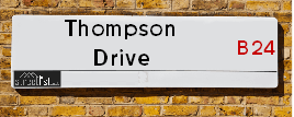
Map of Thompson Drive
| Street Crime (updated 04/05/2024) | ||
|---|---|---|
| Location Note | Central Point of Street - Not Actual Location | |
| MSOA Info | For MSOA E02001857 (Statistical Neighbourhood) | |
| Click Hint | Click on a Circle for a detailed breakdown below map. | |
| Crime Levels |
Green = Very Low Yellow = Low Orange = High Red = Very High |
|
| Postcodes | ||
| Icon | Postcodes for Thompson Drive | |
| Walking Distances | ||
| Distance Info | Green Circle = 10 Minutes Walk (800 metres) | |
About Thompson Drive
Thompson Drive is a street located in Birmingham. The street has a length of approximately 299 metres.
Thompson Drive is located within the Birmingham District (B) Council's jurisdiction. They provide various services, like refuse collection, and manage council tax collection. It's situated in the West Midlands region of the UK.
Thompson Drive has been assigned the Unique Street Reference Number of 2706438 in the National Street Gazetteer.
Thompson Drive is located within the county of West Midlands, situated in the West Midlands region of the UK. It's 101.59 miles North West from central London., 3.04 miles North East from Birmingham, 15.7 miles North West from Coventry and 26.88 miles North East from Worcester.

Do you know why this road is called Thompson Drive?
What's it like to live here?
Ask the community a question about Thompson Drive.
Do you have any questions, memories to share or know any facts about Thompson Drive? We'd love to know more.
Also on streetlist.co.uk, can you help?
Swing Swang Lane
28th April 2024
I am trying to find out why the lane is named Swing Swang?
It has been known known this since at least 1905 when hedge making contents used to be held here.
Swing Swang is often used to describe a fairground ride. I remember Swing Boats. Were they a bit like this or is Swing Swang another name for swings?
Swing Swangs are also mentioned in connection to orchards. Or were orchards just good places to have swings?
Estate Agents near Thompson Drive
| Name | Address | Website |
|---|---|---|
| Burchell Edwards | Unit 3 Queens Court Gravelly Hill North Stockland Green Birmingham B23 6BJ | Visit Website |
| Property People | 666 Washwood Heath Road, Birmingham,B8 2HQ | Visit Website |
| Dixons | 1 Sutton New Road, Erdington, Birmingham, W Midlands, B23 6TJ |
Location Details
| Thompson Drive | |
|---|---|

| |
| Latitude | 52.506161 |
| Longitude | -1.844235 |
| OS Easting (X): | 410571 |
| OS Northing (Y): | 289859 |
| OS Grid Reference: | SP106899 |
Neighbourhood Policing |
| Police Force: West Midlands |
| Find a Local Neighbourhood Watch Scheme |
Frequently asked Questions for Thompson Drive
What Council (Local Authority) is Thompson Drive in?
Thompson Drive is located within the local authority area of Birmingham Council which is a Metropolitan District.
What Parish Council is Thompson Drive in?
Thompson Drive is in an unparished area.
What Electoral Ward is Thompson Drive in?
Thompson Drive is located within the ward of Gravelly Hill.
What County is Thompson Drive in?
Thompson Drive is located within the ceremonial county of West Midlands.
What Constituency is Thompson Drive in?
Thompson Drive is located within the constituency of Birmingham &Erdington.
What Part of the UK is Thompson Drive in?
Thompson Drive is located within the West Midlands (England) region of the United Kingdom.
What County Council area is Thompson Drive in?
Thompson Drive is located within the West Midlands Council area.
What Police Force area is Thompson Drive in?
Thompson Drive is located within the West Midlands Police area.
Roads that have a Junction with Thompson Drive
| Street | Junction Type |
|---|---|
| Standard Way | junction |
Sunset and Sunrise times for Thompson Drive
| Sunrise | 05:11 |
|---|---|
| Sunset | 20:56 |
Latest Weather Conditions for Thompson Drive
| Observed at Weather Station: | Coleshill 13 May 2024 at 09:00 (6.78 miles away) |
|---|---|
| Current Weather: | Cloudy |
| Temperature and Humidity: | 14.1°C (72.8%) |
| Wind Direction and Speed: | S (13 mph) |
Population Statistics
| ONS Area Code | E00047647 |
|---|---|
| ONS Area Name | Pakistani Communities |
| Average Age | 36.54 |
| Area Population | 1452.00 |
| Male Population | 702.00 (48%) |
| Female Population | 750.00 (52%) |
| Benefit Claimants | 79 (5%) |
| LSOA Code: | E01009400 |
|---|---|
| LSOA Name: | Birmingham 031E |
| SOA Code: | 7a |
| SOA Name: | |
| MSOA Code: | E02001857 |
| MSOA Name: | Birmingham 031 |
Nearest Supermarkets
| Tesco Erdington Six Ways Express |
|---|
| Gravelly Hill, Erdington, Birmingham, B23 7NR |
| 0345 675 7081 |
| Distance: 1.08 Miles |
| Directions from Thompson Drive to Tesco Erdington Six Ways Express |
| Iceland Erdington High St |
|---|
| 194/198 High Street, Erdington, Birmingham, B23 6SJ |
| 01213828515 |
| Distance: 1.15 Miles |
| Directions from Thompson Drive to Iceland Erdington High St |
| Iceland Washwood Heath |
|---|
| 52 The Fox Goose Centre, Birmingham, B8 2EP |
| 01217837468 |
| Distance: 1.33 Miles |
| Directions from Thompson Drive to Iceland Washwood Heath |
| Tesco Birmingham Hodge Hill Superstore |
|---|
| Coleshill Rd, Hodge Hill, B36 8DT |
| 0345 671 9451 |
| Distance: 1.36 Miles |
| Directions from Thompson Drive to Tesco Birmingham Hodge Hill Superstore |
Telephone Information
| Area Code |
|---|
| Area Code: 0121 - Birmingham |
| Area Code: 01675 - Coleshill |
| Area Code: 01922 - Walsall |
Local Government
| Local Council Details |
|---|
| Within the area of Birmingham |
| Visit the Council's Website |
| Council House, Victoria Square, Birmingham &B1 1BB |
| Send email |
| Telephone Number: 0121 303 1111 |
| Local Member of Parliament |
|---|
| Within the Westminster Parliamentary Constituency of Birmingham &Erdington |
| The Member of Parliament is Jack Dromey |
| Details for the MP Jack Dromey on parliament.uk |
| Details for the MP Jack Dromey on theyworkforyou.com |
| In the 2019 General Election Jack Dromey won with a majority of 3,601 the result was Lab hold. The total electorate was 66,148 |
| Wards, Parish Councils and County Councils |
|---|
| Ward: Gravelly Hill Ward |
| Parish: Unparished area |
| Ceremonial County: West Midlands |
Nearest Schools
England Primary Schools
Gunter Primary School
Address: Gunter Primary School, Gunter Road, Birmingham, West Midlands, B24 0RU
Distance: 1.87 miles
Contact: 01214642367
Ward End Primary School
Address: Ward End Primary School, Ingleton Road, Birmingham, West Midlands, B8 2RA
Distance: 0.78 miles
Contact: 01214645424
St Peter and St Paul RC Junior and Infant School
Address: St Peter and St Paul RC Junior and Infant School, Kingsbury Road, Erdington, Birmingham, West Midlands, B24 9ND
Distance: 1.17 miles
Contact:
Saint Barnabas Church of England Primary School
Address: Saint Barnabas Church of England Primary School, Spring Lane, Erdington, Birmingham, West Midlands, B24 9BY
Distance: 1.15 miles
Contact:
Birches Green Infant School
Address: Birches Green Infant School, Birches Green Road, Erdington, Birmingham, West Midlands, B24 9SR
Distance: 1.00 miles
Contact:
Birches Green Junior School
Address: Birches Green Junior School, Birches Green Road, Erdington, Birmingham, West Midlands, B24 9SR
Distance: 1.00 miles
Contact:
St Mary and St John Junior and Infant School
Address: St Mary and St John Junior and Infant School, Beaufort Road, Erdington, Birmingham, West Midlands, B23 7NB
Distance: 0.76 miles
Contact:
St Saviour's C of E Primary School
Address: St Saviour's C of E Primary School, Alum Rock Road, Saltley, Birmingham, West Midlands, B8 1JB
Distance: 1.18 miles
Contact: 01214646923
Manor Park Primary School
Address: Manor Park Primary School, Church Lane, Aston, Birmingham, West Midlands, B6 5UQ
Distance: 1.41 miles
Contact:
St Joseph's Catholic Primary School
Address: St Joseph's Catholic Primary School, Rocky Lane, Nechells, Birmingham, West Midlands, B7 5HA
Distance: 1.38 miles
Contact:
Aston Tower Community Primary School
Address: Aston Tower Community Primary School, Upper Sutton Street, Aston, Birmingham, West Midlands, B6 5BE
Distance: 1.87 miles
Contact:
Prince Albert Junior and Infant School
Address: Prince Albert Junior and Infant School, Albert Road, Aston, Birmingham, West Midlands, B6 5NH
Distance: 2.11 miles
Contact:
Erdington Hall Primary School
Address: Erdington Hall Primary School, Ryland Road, Erdington, Birmingham, West Midlands, B24 8JJ
Distance: 0.43 miles
Contact: 01214643122
Leigh Primary School
Address: Leigh Primary School, Leigh Road, Washwood Heath, Birmingham, West Midlands, B8 2YH
Distance: 0.61 miles
Contact: 01214642621
Slade Primary School
Address: Slade Primary School, Slade Road, Erdington, Birmingham, West Midlands, B23 7PX
Distance: 0.79 miles
Contact: 01216750618
E-ACT Nechells Academy
Address: E-ACT Nechells Academy, Eliot Street, Nechells, Birmingham, West Midlands, B7 5LB
Distance: 0.81 miles
Contact: 01214642102
St Clement's Church of England Academy
Address: St Clement's Church of England Academy, Butlin Street, Nechells, Birmingham, West Midlands, B7 5NS
Distance: 1.06 miles
Contact: 01214644652
Manor Park Primary Academy
Address: Manor Park Primary Academy, Church Lane, Aston, Birmingham, West Midlands, B6 5UQ
Distance: 1.41 miles
Contact: 01213271023
Aston Tower Community Primary School
Address: Aston Tower Community Primary School, Upper Sutton Street, Aston, Birmingham, West Midlands, B6 5BE
Distance: 1.87 miles
Contact: 01213270339
Mansfield Green E-ACT Academy
Address: Mansfield Green E-ACT Academy, Albert Road, Aston, Birmingham, West Midlands, B6 5NH
Distance: 2.11 miles
Contact: 01214646590
England Secondary Schools
Hodge Hill College
Address: Hodge Hill College, Bromford Road, Hodge Hill, Birmingham, West Midlands, B36 8HB
Distance: 1.05 miles
Contact: 01217837807
Kingsbury School and Sports College
Address: Kingsbury School and Sports College, Kingsbury Road, Erdington, Birmingham, West Midlands, B24 8RE
Distance: 0.63 miles
Contact:
King Edward VI Aston School
Address: King Edward VI Aston School, Frederick Road, Aston, Birmingham, West Midlands, B6 6DJ
Distance: 1.75 miles
Contact:
Erdington Academy
Address: Erdington Academy, Kingsbury Road, Erdington, Birmingham, West Midlands, B24 8RE
Distance: 0.63 miles
Contact: 01213731080
Stockland Green School
Address: Stockland Green School, Slade Road, Erdington, Birmingham, West Midlands, B23 7JH
Distance: 1.33 miles
Contact: 01215664300
King Edward VI Aston School
Address: King Edward VI Aston School, Frederick Road, Aston, Birmingham, West Midlands, B6 6DJ
Distance: 1.75 miles
Contact: 01213271130
Nearest Hospitals
| Ardenleigh |
|---|
| Address: 385 Kingsbury Road, Erdington, Birmingham, B24 9SA, |
| NHS Sector |
| Birmingham and Solihull Mental Health NHS Foundation Trust |
| Telephone: 0121 301 4411 |
| Visit Hospital Website |
| Distance: 1.41 (miles) |
| Directions from to Ardenleigh |
| Eden Unit |
|---|
| Address: Fentham Road, 355 Slade Road, Erdington, Birmingham, B23 6AL, |
| Independent Sector |
| Birmingham and Solihull Mental Health NHS Foundation Trust |
| Telephone: 0121 301 7369 |
| Visit Hospital Website |
| Distance: 1.65 (miles) |
| Directions from to Eden Unit |
| Forward House |
|---|
| Address: Entrance D, 71 Fentham Road, Erdington, Birmingham, B23 6AL, |
| NHS Sector |
| Birmingham and Solihull Mental Health NHS Foundation Trust |
| Telephone: 0121 301 5922 |
| Visit Hospital Website |
| Distance: 1.65 (miles) |
| Directions from to Forward House |
Nearest Dentists
Dentists near Thompson Drive
SMILES 4 U
Address: 62 GRAVELLY HILL, BIRMINGHAM, WEST MIDLANDS, B23 7PF
Distance: 0.53 miles
Contact: :
DENTAL SURGERY
Address: 554 WASHWOOD HEATH ROAD, BIRMINGHAM, WEST MIDLANDS, B8 2HF
Distance: 0.87 miles
Contact: :
DENTAL SURGERY
Address: 129 GRAVELLY HILL NORTH, ERDINGTON, BIRMINGHAM, WEST MIDLANDS, B23 6BJ
Distance: 1.01 miles
Contact: :
DENTAL SURGERY
Address: 32 SUMMER ROAD, ERDINGTON, BIRMINGHAM, WEST MIDLANDS, B23 6XA
Distance: 1.15 miles
Contact: :
DENTAL SURGERY
Address: 820 WASHWOOD HEATH ROAD, BIRMINGHAM, WEST MIDLANDS, B8 2NW
Distance: 1.23 miles
Contact: :
DENTAL SURGERY
Address: 2A BOWYER ROAD, BIRMINGHAM, WEST MIDLANDS, B8 1ET
Distance: 1.32 miles
Contact: :
Nearest GP Surgeries
Doctors near Thompson Drive
KINGSBURY ROAD MEDICAL CENTRE
Address: 273 KINGSBURY ROAD, ERDINGTON, BIRMINGHAM, WEST MIDLANDS, B24 8RD
Distance: 0.67 miles
Contact: tel: 01213 827539
MMP - ERDINGTON MEDICAL CENTRE
Address: 103 WOOD END ROAD, BIRMINGHAM, B24 8NT
Distance: 0.84 miles
Contact: :
ERDINGTON MEDICAL CENTRE - COVID LOCAL VACCINATION SERVICE
Address: 103 WOOD END ROAD, ERDINGTON, BIRMINGHAM, B24 8NT
Distance: 0.84 miles
Contact: :
ERDINGTON MEDICAL CENTRE - COVID LOCAL VACCINATION SERVICE 2
Address: 103 WOOD END ROAD, ERDINGTON, BIRMINGHAM, B24 8NT
Distance: 0.84 miles
Contact: :
PEARL MEDICAL CENTRE
Address: 619/621 WASHWOOD HEATH ROAD, WARD END, BIRMINGHAM, WEST MIDLANDS, B8 2HB
Distance: 0.94 miles
Contact: tel: 0121 3280999
GATE MEDICAL CENTRE
Address: 120 WASHWOOD HEATH ROAD, BIRMINGHAM, WEST MIDLANDS, B8 1RE
Distance: 0.96 miles
Contact: tel: 0121 3275417
Nearest Dispensing Chemists
Pharmacies near Thompson Drive
YOUR LOCAL PHARMACY
Address: 238 WHEELWRIGHT ROAD, BIRMINGHAM, B24 8EH
Distance: 0.37 miles
Contact: tel: 01213 734445
MW PHILLIPS (SUTTON COLDFIELD) LTD
Address: 273 KINGSBURY ROAD, ERDINGTON, BIRMINGHAM, WEST MIDLANDS, B24 8RD
Distance: 0.67 miles
Contact: tel: 0121 3776042
WOOD END PHARMACY
Address: 103 WOOD END ROAD, BIRMINGHAM, WEST MIDLANDS, B24 8NT
Distance: 0.84 miles
Contact: tel: 0121 3500614
BOOTS
Address: FORT DUNLOP RETAIL PARK, 20 FORT PARKWAY, BIRMINGHAM, B24 9FP
Distance: 0.88 miles
Contact: tel: 0121 3829868
IPHARM (UK) LTD
Address: UNIT 4A, 11 JAMESON ROAD, ASTON, BIRMINGHAM, WEST MIDLANDS, B6 7SJ
Distance: 0.90 miles
Contact: tel: 0121 3287138
WARD END PHARMACY
Address: 617 WASHWOOD HEATH ROAD, BIRMINGHAM, WEST MIDLANDS, B8 2HB
Distance: 0.94 miles
Contact: tel: 0121 3287680
Nearest Opticians
Opticians near Thompson Drive
COSTCO WHOLSALE UK LTD
Address: 100 WATSON ROAD, NECHELLS, BIRMINGHAM, WEST MIDLANDS, B7 5SA
Distance: 0.52 miles
Contact: :
TAHA INVESTMENT LTD T/A IDEAL EYES OPTICIANS
Address: 16 POWICK ROAD, BIRMINGHAM, WEST MIDLANDS, B23 7NY
Distance: 0.67 miles
Contact: :
SPECS DIRECT ERDINGTON
Address: 184 SLADE ROAD, BIRMINGHAM, WEST MIDLANDS, B23 7RJ
Distance: 0.82 miles
Contact: :
VISION EXPRESS - BIRMINGHAM FORT
Address: THE FORT SHOPPING PARK, 20 FORT PARKWAY, BIRMINGHAM, B24 9FP
Distance: 0.88 miles
Contact: :
BOOTS OPTICIANS (BIRMINGHAM - ERDINGTON FORT)
Address: UNIT 8 FORT RETAIL PARK, 20 FORT PARKWAY, BIRMINGHAM, WEST MIDLANDS, B24 9FP
Distance: 0.88 miles
Contact: :
VISION EXPRESS (FORT PARKWAY, BIRMINGHAM)
Address: UNIT 9A, THE FORT SHOPPING PARK, 20 FORT PARKWAY, BIRMINGHAM, WEST MIDLANDS, B24 9FP
Distance: 0.88 miles
Contact: :
Transport
Nearest Rail Stations
Gravelly Hill Station is 0.71 miles away.
Address: Gravelly Hill station, Hunton Hill, Gravelly Hill, West Midlands, B23 7NH
Gravelly Hill is situated on the Bristol to Brimingham Line.
Gravelly Hill Station is staffed on a full time basis.
Directions from Thompson Drive to Gravelly Hill Rail Station
Aston Station is 1.16 miles away.
Address: Aston station, Lichfield Road, Aston, West Midlands, B6 7PR
Aston is situated on the Chase Line|Bristol to Brimingham Line.
Aston Station is staffed on a part time basis.