Map of Sprig Croft
| Street Crime (updated 04/05/2024) | ||
|---|---|---|
| Location Note | Central Point of Street - Not Actual Location | |
| MSOA Info | For MSOA E02001870 (Statistical Neighbourhood) | |
| Click Hint | Click on a Circle for a detailed breakdown below map. | |
| Crime Levels |
Green = Very Low Yellow = Low Orange = High Red = Very High |
|
| Postcodes | ||
| Icon | Postcodes for Sprig Croft | |
| Walking Distances | ||
| Distance Info | Green Circle = 10 Minutes Walk (800 metres) | |
About Sprig Croft
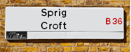
Sprig Croft is a street located in the city of Birmingham. It uses the postcode B36 8UT. The street has a length of approximately 47 metres.
The street is publicly maintained which means that the road is adopted and Birmingham is responsible for the repair and upkeep of the highway.
Sprig Croft is located within the Birmingham District (B) Council's jurisdiction. They provide various services, like refuse collection, and manage council tax collection. It's situated in the West Midlands region of the UK.
Sprig Croft has been assigned the Unique Street Reference Number of 2706387 in the National Street Gazetteer.
Sprig Croft is located within the county of West Midlands, situated in the West Midlands region of the UK. It's 100.89 miles North West from central London., 3.68 miles North East from Birmingham, 14.89 miles North West from Coventry and 27.29 miles North East from Worcester.
Sprig Croft is within the Post Town of BIRMINGHAM

Do you know why this road is called Sprig Croft?
What's it like to live here?
Ask the community a question about Sprig Croft.
Do you have any questions, memories to share or know any facts about Sprig Croft? We'd love to know more.
Also on streetlist.co.uk, can you help?
Swing Swang Lane
28th April 2024
I am trying to find out why the lane is named Swing Swang?
It has been known known this since at least 1905 when hedge making contents used to be held here.
Swing Swang is often used to describe a fairground ride. I remember Swing Boats. Were they a bit like this or is Swing Swang another name for swings?
Swing Swangs are also mentioned in connection to orchards. Or were orchards just good places to have swings?
House Sales in Sprig Croft
| Year | High | Low | Average | Sales |
|---|---|---|---|---|
| 2011 | £89,000 | £89,000 | £89,000 | 1 |
| 2014 | £95,000 | £95,000 | £95,000 | 1 |
| 2015 | £110,000 | £110,000 | £110,000 | 1 |
| 2016 | £91,000 | £91,000 | £91,000 | 1 |
Contains HM Land Registry data © Crown copyright and database right 2024. This data is licensed under the Open Government Licence v3.0.
Estate Agents near Sprig Croft
| Name | Address | Website |
|---|---|---|
| Edwards and Gray | Fort Dunlop Fort Parkway, Birmingham, B24 9FE | Visit Website |
| Taylor James Auctions LTD | Fort Dunlop Fort Parkway, Birmingham, B24 9FE | Visit Website |
| Alex Smith & Company | 23 Coleshill Road, Hodge Hill, Birmingham, B36 8DT | Visit Website |
We have found 1 postcode for Sprig Croft
Location Details
| Sprig Croft | |
|---|---|

| |
| Latitude | 52.504363 |
| Longitude | -1.824285 |
| OS Easting (X): | 411925 |
| OS Northing (Y): | 289662 |
| OS Grid Reference: | SP119897 |
Neighbourhood Policing |
| Police Force: West Midlands |
 View Neighbourhood Crime and Policing View Neighbourhood Crime and Policing |
| Find a Local Neighbourhood Watch Scheme |
Frequently asked Questions for Sprig Croft
What Council (Local Authority) is Sprig Croft in?
Sprig Croft is located within the local authority area of Birmingham Council which is a Metropolitan District.
What Parish Council is Sprig Croft in?
Sprig Croft is in an unparished area.
What Electoral Ward is Sprig Croft in?
Sprig Croft is located within the ward of Bromford & Hodge Hill.
What County is Sprig Croft in?
Sprig Croft is located within the ceremonial county of West Midlands.
What Constituency is Sprig Croft in?
Sprig Croft is located within the constituency of Birmingham &Hodge Hill.
What Part of the UK is Sprig Croft in?
Sprig Croft is located within the West Midlands (England) region of the United Kingdom.
What County Council area is Sprig Croft in?
Sprig Croft is located within the West Midlands Council area.
What Police Force area is Sprig Croft in?
Sprig Croft is located within the West Midlands Police area.
Roads that have a Junction with Sprig Croft
| Street | Junction Type |
|---|---|
| Reynoldstown Road | junction |
Sunset and Sunrise times for Sprig Croft , B36 8UT
| Sunrise | 05:16 |
|---|---|
| Sunset | 20:51 |
Latest Weather Conditions for Sprig Croft, B36 8UT
| Observed at Weather Station: | Coleshill 10 May 2024 at 18:00 (5.94 miles away) |
|---|---|
| Current Weather: | Partly cloudy (day) |
| Temperature and Humidity: | 22.0°C (54.9%) |
| Wind Direction and Speed: | ESE (1 mph) |
Population Statistics
| ONS Area Code | E00046086 |
|---|---|
| ONS Area Name | Private Renting Young Families |
| Average Age | 36.13 |
| Area Population | 1411.00 |
| Male Population | 672.00 (48%) |
| Female Population | 739.00 (52%) |
| Benefit Claimants | 42 (3%) |
| LSOA Code: | E01009082 |
|---|---|
| LSOA Name: | Birmingham 044A |
| SOA Code: | 7a |
| SOA Name: | |
| MSOA Code: | E02001870 |
| MSOA Name: | Birmingham 044 |
Nearest Supermarkets
| Tesco Birmingham Hodge Hill Superstore |
|---|
| Coleshill Rd, Hodge Hill, B36 8DT |
| 0345 671 9451 |
| Distance: 0.72 Miles |
| Directions from Sprig Croft to Tesco Birmingham Hodge Hill Superstore |
| Iceland Washwood Heath |
|---|
| 52 The Fox Goose Centre, Birmingham, B8 2EP |
| 01217837468 |
| Distance: 0.75 Miles |
| Directions from Sprig Croft to Iceland Washwood Heath |
| Tesco Castle Bromwich Express |
|---|
| 32-36 Chipperfield Rd Bromford, Castle Bromwich, Birmingham, B36 8BL |
| 0345 026 9706 |
| Distance: 0.92 Miles |
| Directions from Sprig Croft to Tesco Castle Bromwich Express |
| Iceland Stechford Food Warehouse |
|---|
| Unit E, Stechford Retail Park, Birmingham, B33 9AN |
| 01217842668 |
| Distance: 1.41 Miles |
| Directions from Sprig Croft to Iceland Stechford Food Warehouse |
Telephone Information
| Area Code |
|---|
| Area Code: 0121 - Birmingham |
| Area Code: 01675 - Coleshill |
| Area Code: 01922 - Walsall |
| Area Code: 01676 - Meriden |
Broadband Information
| Speed | Average Speed | Median Speed | Maximum Speed | Next-generation access (NGA) | Number of Connections |
|---|---|---|---|---|---|
| Less than 2 Mbps | 23.2 | 12.7 | >=30 | Y | 8 |
Local Government
| Local Council Details |
|---|
| Within the area of Birmingham |
| Visit the Council's Website |
| Council House, Victoria Square, Birmingham &B1 1BB |
| Send email |
| Telephone Number: 0121 303 1111 |
| Local Member of Parliament |
|---|
| Within the Westminster Parliamentary Constituency of Birmingham &Hodge Hill |
| The Member of Parliament is Liam Byrne |
| Details for the MP Liam Byrne on parliament.uk |
| Details for the MP Liam Byrne on theyworkforyou.com |
| In the 2019 General Election Liam Byrne won with a majority of 28,655 the result was Lab hold. The total electorate was 78,295 |
| Wards, Parish Councils and County Councils |
|---|
| Ward: Bromford & Hodge Hill Ward |
| Parish: Unparished area |
| Ceremonial County: West Midlands |
Nearest Schools
England Primary Schools
St Wilfrid's Catholic Junior and Infant School
Address: St Wilfrid's Catholic Junior and Infant School, Shawsdale Road, Birmingham, West Midlands, B36 8LY
Distance: 1.00 miles
Contact:
Gunter Primary School
Address: Gunter Primary School, Gunter Road, Birmingham, West Midlands, B24 0RU
Distance: 1.36 miles
Contact: 01214642367
Colebourne Primary School
Address: Colebourne Primary School, Stechford Road, Hodge Hill, Birmingham, West Midlands, B34 6BJ
Distance: 1.03 miles
Contact: 01216758500
St Cuthbert's RC Junior and Infant (NC) School
Address: St Cuthbert's RC Junior and Infant (NC) School, Gumbleberrys Close, Off Cotterills Lane, Stechford, Birmingham, West Midlands, B8 2PS
Distance: 1.23 miles
Contact: 01216752205
Thornton Primary School
Address: Thornton Primary School, Thornton Road, Ward End, Birmingham, West Midlands, B8 2LQ
Distance: 0.91 miles
Contact: 01213270824
Sladefield Infant School
Address: Sladefield Infant School, Bamville Road, Ward End, Birmingham, West Midlands, B8 2TJ
Distance: 0.95 miles
Contact: 01213270662
Ward End Primary School
Address: Ward End Primary School, Ingleton Road, Birmingham, West Midlands, B8 2RA
Distance: 0.52 miles
Contact: 01214645424
St Peter and St Paul RC Junior and Infant School
Address: St Peter and St Paul RC Junior and Infant School, Kingsbury Road, Erdington, Birmingham, West Midlands, B24 9ND
Distance: 0.92 miles
Contact:
Saint Barnabas Church of England Primary School
Address: Saint Barnabas Church of England Primary School, Spring Lane, Erdington, Birmingham, West Midlands, B24 9BY
Distance: 1.24 miles
Contact:
Birches Green Infant School
Address: Birches Green Infant School, Birches Green Road, Erdington, Birmingham, West Midlands, B24 9SR
Distance: 0.87 miles
Contact:
Birches Green Junior School
Address: Birches Green Junior School, Birches Green Road, Erdington, Birmingham, West Midlands, B24 9SR
Distance: 0.87 miles
Contact:
Highfield Junior and Infant School
Address: Highfield Junior and Infant School, Highfield Road, Saltley, Birmingham, West Midlands, B8 3QF
Distance: 1.28 miles
Contact:
St Mary and St John Junior and Infant School
Address: St Mary and St John Junior and Infant School, Beaufort Road, Erdington, Birmingham, West Midlands, B23 7NB
Distance: 1.40 miles
Contact:
Firs Primary School
Address: Firs Primary School, Dreghorn Road, Castle Bromwich, Firs Primary School, Birmingham, West Midlands, B36 8LL
Distance: 0.93 miles
Contact: 01214643792
Firs Primary School
Address: Firs Primary School, Dreghorn Road, Castle Bromwich, Birmingham, West Midlands, B36 8LL
Distance: 0.93 miles
Contact:
Heathlands Primary Academy
Address: Heathlands Primary Academy, Heath Way, Castle Bromwich, Birmingham, West Midlands, B34 6NB
Distance: 1.19 miles
Contact: 01217472705
Chivenor Primary School
Address: Chivenor Primary School, Farnborough Road, Castle Vale, Birmingham, West Midlands, B35 7JA
Distance: 1.58 miles
Contact: 01216759833
Hodge Hill Primary School
Address: Hodge Hill Primary School, 76 Twycross Grove, Hodge Hill, Birmingham, West Midlands, B36 8LD
Distance: 0.45 miles
Contact: 01214642189
Hodge Hill Primary School
Address: Hodge Hill Primary School, 76 Twycross Grove, Hodge Hill, Birmingham, West Midlands, B36 8LD
Distance: 0.45 miles
Contact:
Tame Valley Academy
Address: Tame Valley Academy, Chillinghome Road, Birmingham, B36 8QJ
Distance: 0.58 miles
Contact: 01214644497
Highfield Junior and Infant School
Address: Highfield Junior and Infant School, Highfield Road, Saltley, Birmingham, West Midlands, B8 3QF
Distance: 1.28 miles
Contact: 01216471708
Erdington Hall Primary School
Address: Erdington Hall Primary School, Ryland Road, Erdington, Birmingham, West Midlands, B24 8JJ
Distance: 0.93 miles
Contact: 01214643122
Leigh Primary School
Address: Leigh Primary School, Leigh Road, Washwood Heath, Birmingham, West Midlands, B8 2YH
Distance: 1.10 miles
Contact: 01214642621
Slade Primary School
Address: Slade Primary School, Slade Road, Erdington, Birmingham, West Midlands, B23 7PX
Distance: 1.56 miles
Contact: 01216750618
E-ACT Nechells Academy
Address: E-ACT Nechells Academy, Eliot Street, Nechells, Birmingham, West Midlands, B7 5LB
Distance: 1.64 miles
Contact: 01214642102
St Clement's Church of England Academy
Address: St Clement's Church of England Academy, Butlin Street, Nechells, Birmingham, West Midlands, B7 5NS
Distance: 1.84 miles
Contact: 01214644652
England Secondary Schools
Hodge Hill Girls' School
Address: Hodge Hill Girls' School, Bromford Road, Hodge Hill, Birmingham, West Midlands, B36 8EY
Distance: 0.30 miles
Contact: 01214643094
Hodge Hill College
Address: Hodge Hill College, Bromford Road, Hodge Hill, Birmingham, West Midlands, B36 8HB
Distance: 0.25 miles
Contact: 01217837807
Kingsbury School and Sports College
Address: Kingsbury School and Sports College, Kingsbury Road, Erdington, Birmingham, West Midlands, B24 8RE
Distance: 0.91 miles
Contact:
Washwood Heath Academy
Address: Washwood Heath Academy, Burney Lane, Stechford, Birmingham, West Midlands, B8 2AS
Distance: 0.99 miles
Contact: 01216757272
Erdington Academy
Address: Erdington Academy, Kingsbury Road, Erdington, Birmingham, West Midlands, B24 8RE
Distance: 0.91 miles
Contact: 01213731080
Nearest Hospitals
| Ardenleigh |
|---|
| Address: 385 Kingsbury Road, Erdington, Birmingham, B24 9SA, |
| NHS Sector |
| Birmingham and Solihull Mental Health NHS Foundation Trust |
| Telephone: 0121 301 4411 |
| Visit Hospital Website |
| Distance: 1.61 (miles) |
| Directions from to Ardenleigh |
| Eden Unit |
|---|
| Address: Fentham Road, 355 Slade Road, Erdington, Birmingham, B23 6AL, |
| Independent Sector |
| Birmingham and Solihull Mental Health NHS Foundation Trust |
| Telephone: 0121 301 7369 |
| Visit Hospital Website |
| Distance: 2.68 (miles) |
| Directions from to Eden Unit |
| Forward House |
|---|
| Address: Entrance D, 71 Fentham Road, Erdington, Birmingham, B23 6AL, |
| NHS Sector |
| Birmingham and Solihull Mental Health NHS Foundation Trust |
| Telephone: 0121 301 5922 |
| Visit Hospital Website |
| Distance: 2.68 (miles) |
| Directions from to Forward House |
Nearest Dentists
Dentists near Sprig Croft
DENTAL SURGERY
Address: 820 WASHWOOD HEATH ROAD, BIRMINGHAM, WEST MIDLANDS, B8 2NW
Distance: 0.79 miles
Contact: :
DENTAL SURGERY
Address: 554 WASHWOOD HEATH ROAD, BIRMINGHAM, WEST MIDLANDS, B8 2HF
Distance: 0.81 miles
Contact: :
DENTAL SURGERY
Address: 5 STECHFORD LANE, BIRMINGHAM, WEST MIDLANDS, B8 2AW
Distance: 0.89 miles
Contact: :
ROUGHLEA AVENUE (DENTAL SURGERY)
Address: ROUGHLEA AVENUE, BIRMINGHAM, WEST MIDLANDS, B36 8GH
Distance: 0.98 miles
Contact: :
DENTAL SURGERY
Address: 694 ALUM ROCK ROAD, BIRMINGHAM, WEST MIDLANDS, B8 3NU
Distance: 1.23 miles
Contact: :
DENTAL SURGERY
Address: 711 ALUM ROCK ROAD, BIRMINGHAM, WEST MIDLANDS, B8 3JA
Distance: 1.27 miles
Contact: :
Nearest GP Surgeries
Doctors near Sprig Croft
WARD END MEDICAL CENTRE
Address: 794A WASHWOOD HEATH ROAD, WARD END, BIRMINGHAM, WEST MIDLANDS, B8 2JN
Distance: 0.78 miles
Contact: tel: 0121 3271049
PEARL MEDICAL CENTRE
Address: 619/621 WASHWOOD HEATH ROAD, WARD END, BIRMINGHAM, WEST MIDLANDS, B8 2HB
Distance: 0.85 miles
Contact: tel: 0121 3280999
FIRS SURGERY
Address: 87 KEMPSON ROAD, BIRMINGHAM, WEST MIDLANDS, B36 8LR
Distance: 0.97 miles
Contact: tel: 0121 7473586
KINGSBURY ROAD MEDICAL CENTRE
Address: 273 KINGSBURY ROAD, ERDINGTON, BIRMINGHAM, WEST MIDLANDS, B24 8RD
Distance: 0.97 miles
Contact: tel: 01213 827539
HODGE HILL FAMILY PRACTICE
Address: 1ST FLOOR HODGE HILL PCC, ROUGHLEA AVENUE, HODGE HILL, BIRMINGHAM, WEST MIDLANDS, B36 8GH
Distance: 0.98 miles
Contact: tel: 0121 6616961
BUCKLANDS END LANE SURGERY
Address: 36 BUCKLANDS END LANE, BIRMINGHAM, WEST MIDLANDS, B34 6BP
Distance: 1.12 miles
Contact: tel: 0845 6750588
Nearest Dispensing Chemists
Pharmacies near Sprig Croft
BOOTS
Address: FORT DUNLOP RETAIL PARK, 20 FORT PARKWAY, BIRMINGHAM, B24 9FP
Distance: 0.30 miles
Contact: tel: 0121 3829868
JHOOTS PHARMACY
Address: 150 BROMFORD DRIVE, BIRMINGHAM, WEST MIDLANDS, B36 8TY
Distance: 0.32 miles
Contact: tel: 0121 7472442
YOUR LOCAL PHARMACY
Address: 238 WHEELWRIGHT ROAD, BIRMINGHAM, B24 8EH
Distance: 0.67 miles
Contact: tel: 01213 734445
JHOOTS PHARMACY
Address: FOX & GOOSE SHOPPING CTR, 898-902 WASHWOOD HEATH RD, WARD END, BIRMINGHAM, B8 2NB
Distance: 0.78 miles
Contact: tel: 01217 838680
IPHARM PHARMACY
Address: 794 WASHWOOD HEATH ROAD, WARD END, BIRMINGHAM, B8 2JL
Distance: 0.79 miles
Contact: tel: 01213 270347
WASHWOOD HEATH PHARMACY
Address: 881 WASHWOOD HEATH ROAD, WASHWOOD HEATH, BIRMINGHAM, WEST MIDLANDS, B8 2NA
Distance: 0.82 miles
Contact: tel: 0121 7832042
Nearest Opticians
Opticians near Sprig Croft
VISION EXPRESS - BIRMINGHAM FORT
Address: THE FORT SHOPPING PARK, 20 FORT PARKWAY, BIRMINGHAM, B24 9FP
Distance: 0.30 miles
Contact: :
BOOTS OPTICIANS (BIRMINGHAM - ERDINGTON FORT)
Address: UNIT 8 FORT RETAIL PARK, 20 FORT PARKWAY, BIRMINGHAM, WEST MIDLANDS, B24 9FP
Distance: 0.30 miles
Contact: :
VISION EXPRESS (FORT PARKWAY, BIRMINGHAM)
Address: UNIT 9A, THE FORT SHOPPING PARK, 20 FORT PARKWAY, BIRMINGHAM, WEST MIDLANDS, B24 9FP
Distance: 0.30 miles
Contact: :
SW OPTICS LTD
Address: 140 BROMFORD DRIVE, BIRMINGHAM, WEST MIDLANDS, B36 8TY
Distance: 0.32 miles
Contact: :
RYTE DIRECT LTD
Address: 52 RADSTOCK AVENUE, BIRMINGHAM, WEST MIDLANDS, B36 8HD
Distance: 0.33 miles
Contact: :
COLIN LEE OPTICIANS (WARD END)
Address: FOX & GOOSE SHOPPING CENTRE, WASHWOOD HEALTH ROAD, WARD END, BIRMINGHAM, WEST MIDLANDS, B8 2EP
Distance: 0.76 miles
Contact: :
Transport
Nearest Rail Stations
Gravelly Hill Station is 1.40 miles away.
Address: Gravelly Hill station, Hunton Hill, Gravelly Hill, West Midlands, B23 7NH
Gravelly Hill is situated on the Bristol to Brimingham Line.
Gravelly Hill Station is staffed on a full time basis.
Stechford Station is 1.46 miles away.
Address: Stechford station, Victoria Road, Stechford, West Midlands, B33 8AJ
Stechford is situated on the Rugby�Birmingham�Stafford line|West Coast Main Line.
Stechford Station is staffed on a part time basis.