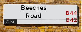
Map of Beeches Road
| Postcodes | ||
|---|---|---|
| Icon | Postcodes for Beeches Road | |
| Walking Distances | ||
| Distance Info | Green Circle = 10 Minutes Walk (800 metres) | |
About Beeches Road
Beeches Road is a street located in the city of Birmingham. The street has a length of approximately 1,789 metres.
Beeches Road is located within the Birmingham District (B) Council's jurisdiction. They provide various services, like refuse collection, and manage council tax collection. It's situated in the West Midlands region of the UK.
Beeches Road has been assigned the Unique Street Reference Numbers of 2704681, 2751652 and 2705183 in the National Street Gazetteer.
Beeches Road is located within the county of West Midlands, situated in the West Midlands region of the UK. It's 105.08 miles North West from central London., 4.09 miles North from Birmingham, 19.12 miles North West from Coventry and 27.28 miles North East from Worcester.

Do you know why this road is called Beeches Road?
What's it like to live here?
Ask the community a question about Beeches Road.
Do you have any questions, memories to share or know any facts about Beeches Road? We'd love to know more.
Also on streetlist.co.uk, can you help?
Eldroth Road
15th April 2024
I wondered if anyone has any old pictures of Wenning Bank House in the 1940’s and also Lane Side before of the same era .. we visited today with my Mum in law as she used to live at both these properties. Also any photos of the schools around that time .. thank you.
Can You Help?Napps Way
15th April 2024
Why is the road called Napps Way (belonging to Napp, but minus an
apostrophe as is usual with such nomenclature)? Moreover, who or
what is, or was, “Napp” in the respective, possessive case?
Several years ago, I met an elderly man (probably in his late-eighties)
who lives on Bentham Drive, Liverpool 16, and during a conversation
with him whilst in a Northwest Passenger Transport Ambulance on the
way to the former RLUH (Royal Liverpool University Hospital), he told
me that he could remember (when he was a boy, living in Childwall,
Liverpool 16) that, “Where Napps Way is now, during WW2, there was
a two-man gun emplacement on the, then, open land to protect the
railway line passing over Childwall Valley Road - next to the railway
bridge - when suddenly, as they were loading a live “shell” into the gun’s
breach, the aforementioned “shell” accidentally exploded in the gun’s
breach killing both of the two soldiers, that had been manning the gun,
instantly! (Very sad, of course, but could - perhaps - two ghosts relating
to those two, very unfortunately and prematurely-killed soldiers have
haunted that place of their deaths ever since - and have any residents
of Napps Way - formerly and in its latest incarnation - seen two, WW2
(uniformed) soldiers unexpectedly appear in or near their homes?)
Mauritius Road
15th April 2024
Why is Mauritius Road so called, since when and by whom? Does Greenwich have any particular links with Mauritius? Very interested to know. 🤞🏼
Can You Help?Estate Agents near Beeches Road
| Name | Address | Website |
|---|---|---|
| Principal Homes | 562 Walsall Road, Great Barr, Birmingham, B42 1LR | |
| Apple Property Solutions | Apple House, 613 Walsall Road, Great Barr, Birmingham, B42 1EH | Visit Website |
| WeSellPropertiesForFree.com | 392 Walsall Road, Birmingham,B42 2LX |
We have found 18 postcodes for Beeches Road
Location Details
| Beeches Road | |
|---|---|

| |
| Latitude | 52.538232 |
| Longitude | -1.908451 |
| OS Easting (X): | 406208 |
| OS Northing (Y): | 293418 |
| OS Grid Reference: | SP062934 |
Ordnance Survey Maps for Beeches Road
If you purchase a map through the links below, we may earn an affiliate commission.
| Map Series | link | Ordnance Survey |
| Explorer 1:25,000 220 Birmingham, Walsall, Solihull and Redditch | Check Price on Amazon | |
| Landranger 1:50,000 139 Birmingham and Wolverhampton | Check Price on Amazon |
Neighbourhood Policing |
| Police Force: West Midlands |
 View Neighbourhood Crime and Policing View Neighbourhood Crime and Policing |
| Find a Local Neighbourhood Watch Scheme |
Frequently asked Questions for Beeches Road
What Council (Local Authority) is Beeches Road in?
Beeches Road is located within the local authority area of Birmingham Council which is a Metropolitan District.
What Parish Council is Beeches Road in?
Beeches Road is in an unparished area.
What Electoral Ward is Beeches Road in?
Beeches Road is located within the ward of Perry Barr &Oscott.
What County is Beeches Road in?
Beeches Road is located within the ceremonial county of West Midlands.
What Constituency is Beeches Road in?
Beeches Road is located within the constituency of Birmingham &Perry Barr.
What Part of the UK is Beeches Road in?
Beeches Road is located within the West Midlands (England) region of the United Kingdom.
What County Council area is Beeches Road in?
Beeches Road is located within the West Midlands Council area.
What Police Force area is Beeches Road in?
Beeches Road is located within the West Midlands Police area.
Roads that have a Junction with Beeches Road
| Street | Junction Type |
|---|---|
| Walsall Road (A34) | junction |
| Homelands | junction |
| Foden Road | junction |
| Poplar Rise | junction |
| Turnberry Road | junction |
| Thornbridge Avenue | junction |
| Trehurst Avenue | junction |
| Desford Avenue | junction |
| Chelmorton Road | junction |
| Wingfield Road | junction |
| Sandy Lane | pseudo node |
| Brushfield Road | junction |
| Scarsdale Road | junction |
| Hassop Road | junction |
| Vicarage Close | junction |
| Castleton Road | junction |
| Somercotes Road | junction |
| Old Oscott Lane | junction |
Sunset and Sunrise times for Beeches Road
| Sunrise | 05:42 |
|---|---|
| Sunset | 20:27 |
Latest Weather Conditions for Beeches Road
| Observed at Weather Station: | Coleshill 26 April 2024 at 07:00 (10.07 miles away) |
|---|---|
| Current Weather: | Sunny day |
| Temperature and Humidity: | 3.4°C (95.1%) |
| Wind Direction and Speed: | N (3 mph) |
Population Statistics
| ONS Area Code | E00046903, E00046896, E00046890, E00046832, E00046882, E00046886, E00046901, E00046900 & E00046891 |
|---|---|
| ONS Area Name | Achieving Minorities, Private Renting Young Families, Multi-Ethnic Professionals with Families & Families in Terraces and Flats |
| Average Age | 42.93, 38.40, 39.03, 37.88 & 36.60 |
| Area Population | 1632.00, 1504.00, 1551.00, 1436.00 & 1767.00 |
| Male Population | 790.00, 719.00, 748.00, 678.00 & 845.00 (48%) |
| Female Population | 842.00, 785.00, 803.00, 758.00 & 922.00 (52%) |
| Benefit Claimants | 31, 26, 27, 30 & 28 (2%) |
| LSOA Code: | E01009238, E01009247, E01009236, E01009244 &E01009248 |
|---|---|
| LSOA Name: | Birmingham 024B, Birmingham 016E, Birmingham 019B, Birmingham 019C &Birmingham 019D |
| SOA Code: | 7b, 3b &3d |
| SOA Name: | |
| MSOA Code: | E02001850, E02001842 &E02001845 |
| MSOA Name: | Birmingham 024, Birmingham 016 &Birmingham 019 |
Nearest Supermarkets
| Asda Queslett |
|---|
| 6 Old Horns Crescent Off Queslet Road, Great Barr, Birmingham, B43 7HA |
| 0121 360 0238 |
| Distance: 0.9 Miles |
| Directions from Beeches Road to Asda Queslett |
| Tesco Kingstanding Birmingham Express |
|---|
| 236 Hawthorn Rd, Kingstanding, B44 8PP |
| 0345 675 7467 |
| Distance: 1 Miles |
| Directions from Beeches Road to Tesco Kingstanding Birmingham Express |
| Iceland Great Barr |
|---|
| 936 Scotts Arms Centre, Walsall Road, Birmingham, B42 1TQ |
| 01213582642 |
| Distance: 1.14 Miles |
| Directions from Beeches Road to Iceland Great Barr |
| Tesco Great Barr Express |
|---|
| Hamstead Rd, Great Barr, B43 5EL |
| 0345 674 6459 |
| Distance: 1.33 Miles |
| Directions from Beeches Road to Tesco Great Barr Express |
Telephone Information
| Area Code |
|---|
| Area Code: 0121 - Birmingham |
| Area Code: 01922 - Walsall |
| Area Code: 01384 - Dudley |
| Area Code: 01675 - Coleshill |
Broadband Information
| Speed | Average Speed | Median Speed | Maximum Speed | Next-generation access (NGA) | Number of Connections |
|---|---|---|---|---|---|
| Less than 2 Mbps | 11.3 | 5.7 | >=30 | Y | 11 |
Local Government
| Local Council Details |
|---|
| Within the area of Birmingham |
| Visit the Council's Website |
| Council House, Victoria Square, Birmingham &B1 1BB |
| Send email |
| Telephone Number: 0121 303 1111 |
| Local Member of Parliament |
|---|
| Within the Westminster Parliamentary Constituency of Birmingham &Perry Barr |
| The Member of Parliament is Khalid Mahmood |
| Details for the MP Khalid Mahmood on parliament.uk |
| Details for the MP Khalid Mahmood on theyworkforyou.com |
| In the 2019 General Election Khalid Mahmood won with a majority of 15,317 the result was Lab hold. The total electorate was 72,006 |
| Wards, Parish Councils and County Councils |
|---|
| Ward: Perry Barr &Oscott Ward |
| Ceremonial County: West Midlands |
Nearest Schools
England Primary Schools
Christ The King Catholic Primary School
Address: Christ The King Catholic Primary School, Warren Farm Road, Kingstanding, Birmingham, West Midlands, B44 0QN
Distance: 1.28 miles
Contact: 01214649800
Hawthorn Primary School
Address: Hawthorn Primary School, Hawthorn Road, Kingstanding, Birmingham, West Midlands, B44 8QR
Distance: 1.30 miles
Contact: 01214643891
Kingsthorne Primary School
Address: Kingsthorne Primary School, Cranbourne Road, Kingstanding, Birmingham, West Midlands, B44 0BX
Distance: 1.23 miles
Contact: 01216753897
Maryvale Catholic Primary School
Address: Maryvale Catholic Primary School, Old Oscott Hill, Kingstanding, Birmingham, West Midlands, B44 9AG
Distance: 1.00 miles
Contact: 01216751434
Glenmead Primary School
Address: Glenmead Primary School, Glenmead Road, Birmingham, West Midlands, B44 8UQ
Distance: 0.44 miles
Contact: 01214643173
Kingsland Primary School (NC)
Address: Kingsland Primary School (NC), Bandywood Crescent, Birmingham, B44 9NA
Distance: 1.57 miles
Contact: 01214647707
Beeches Infant School
Address: Beeches Infant School, Beeches Road, Birmingham, West Midlands, B42 2PY
Distance: 0.17 miles
Contact: 01213604222
Beeches Junior School
Address: Beeches Junior School, Beeches Junior School, Beeches Road, Great Barr, Birmingham, West Midlands, B42 2PY
Distance: 0.17 miles
Contact: 01212725888
Sundridge Primary School
Address: Sundridge Primary School, Sundridge Road, Kingstanding, Birmingham, West Midlands, B44 9NY
Distance: 1.47 miles
Contact: 01214647720
Calshot Primary School
Address: Calshot Primary School, Calshot Road, Great Barr, Birmingham, West Midlands, B42 2BY
Distance: 0.62 miles
Contact: 01216751059
Holy Name Catholic Primary School
Address: Holy Name Catholic Primary School, Cross Lane, Great Barr, Birmingham, West Midlands, B43 6LN
Distance: 1.32 miles
Contact: 01213573216
Ferndale Primary School
Address: Ferndale Primary School, Ferndale Avenue, Great Barr, Birmingham, West Midlands, B43 5QF
Distance: 1.10 miles
Contact: 01213573326
St Mark's Catholic Primary School
Address: St Mark's Catholic Primary School, Almond Croft, Old Walsall Road, Great Barr, Birmingham, West Midlands, B42 1NU
Distance: 0.90 miles
Contact:
Grove Vale Primary School
Address: Grove Vale Primary School, Monksfield Avenue, Great Barr, Birmingham, West Midlands, B43 6AL
Distance: 1.66 miles
Contact: 01213574319
Warren Farm Primary School
Address: Warren Farm Primary School, Aylesbury Crescent, Kingstanding, Birmingham, West Midlands, B44 0DT
Distance: 1.37 miles
Contact: 01213733885
Greenholm Primary School
Address: Greenholm Primary School, Greenholm Road, Great Barr, Birmingham, West Midlands, B44 8HS
Distance: 0.64 miles
Contact: 01214646321
Barr View Primary & Nursery Academy
Address: Barr View Primary & Nursery Academy, Aldridge Road, Great Barr, Birmingham, West Midlands, B44 8NT
Distance: 0.49 miles
Contact: 01214642251
Dorrington Academy
Address: Dorrington Academy, Dorrington Road, Perry Barr, Birmingham, West Midlands, B42 1QR
Distance: 0.84 miles
Contact: 01214645330
Pheasey Park Farm Primary School
Address: Pheasey Park Farm Primary School, Wimperis Way, Great Barr, Birmingham, West Midlands, B43 7DH
Distance: 1.56 miles
Contact:
England Secondary Schools
Cardinal Wiseman Catholic School
Address: Cardinal Wiseman Catholic School, Old Oscott Hill, Kingstanding, Birmingham, West Midlands, B44 9SR
Distance: 1.20 miles
Contact: 01213606383
Great Barr School
Address: Great Barr School, Aldridge Road, Great Barr, Birmingham, West Midlands, B44 8NU
Distance: 0.59 miles
Contact:
North Birmingham Academy
Address: North Birmingham Academy, 395 College Road, Erdington, Birmingham, West Midlands, B44 0HF
Distance: 1.30 miles
Contact: 01213731647
Eden Boys' School, Birmingham
Address: Eden Boys' School, Birmingham, 150 Wellhead Lane, Perry Barr, Birmingham, West Midlands, B42 2SY
Distance: 1.57 miles
Contact: 01216577070
Barr Beacon School
Address: Barr Beacon School, Old Hall Lane, Aldridge, Walsall, West Midlands, WS9 0RF
Distance: 1.71 miles
Contact: 01213666600
Arena Academy
Address: Arena Academy, Beeches Road, Birmingham, West Midlands, B42 2PY
Distance: 0.17 miles
Contact:
Fortis Academy
Address: Fortis Academy, Aldridge Road, Great Barr, Birmingham, West Midlands, B44 8NU
Distance: 0.59 miles
Contact: 01213666611
Nearest Hospitals
| Name | Address | Postcode | Distance | Map |
|---|
Nearest Dentists
Dentists near Beeches Road
| Name | Address | Postcode | Distance | Map |
|---|
Nearest GP Surgeries
Doctors near Beeches Road
TOWER HILL PARTNERSHIP
Address: 433 WALSALL ROAD, PERRY BARR, BIRMINGHAM, WEST MIDLANDS, B42 1BT
Distance: 0.57 miles
Contact: tel: 0121 4110487
COTMORE SURGERY
Address: 169 OLD OSCOTT LANE, GREAT BARR, BIRMINGHAM, WEST MIDLANDS, B44 8TU
Distance: 0.65 miles
Contact: tel: 0121 3605409
GREAT BARR PRACTICE
Address: 379 QUESLETT ROAD, GREAT BARR, BIRMINGHAM, WEST MIDLANDS, B43 7HB
Distance: 0.80 miles
Contact: tel: 0121 3571250
PERRY PARK SURGERY
Address: 291-293 WALSALL ROAD, PERRY BARR, BIRMINGHAM, WEST MIDLANDS, B42 1TY
Distance: 0.88 miles
Contact: tel: 0121 3564131
SCOTT ARMS MEDICAL CENTRE
Address: WHITECREST, GREAT BARR, BIRMINGHAM, B43 6EE
Distance: 0.93 miles
Contact: tel: 0121 3572670
HILLCREST SURGERY
Address: DYAS ROAD SURGERY, 6 DYAS ROAD, KINGSTANDING, BIRMINGHAM, WEST MIDLANDS, B44 8SF
Distance: 0.95 miles
Contact: tel: 01213731885
Nearest Dispensing Chemists
Pharmacies near Beeches Road
| Name | Address | Postcode | Telephone | Map | Distance in Km |
|---|
Nearest Opticians
Opticians near Beeches Road
I M HADFIELD OPTOMETRISTS - GREAT BARR
Address: 162 BEECHES ROAD, GREAT BARR, BIRMINGHAM, WEST MIDLANDS, B42 2HN
Distance: 0.12 miles
Contact: :
ADOS SIGHTCARE LTD
Address: 1 RIDGEWOOD GARDENS, GREAT BARR, BIRMINGHAM, WEST MIDLANDS, B44 8JG
Distance: 0.81 miles
Contact: :
SCRIVENS OPTICIANS (HAMSTEAD)
Address: 2 INTERNATIONAL HOUSE, OLD WALSALL ROAD, HAMSTEAD, BIRMINGHAM, WEST MIDLANDS, B42 1NN
Distance: 1.01 miles
Contact: :
HAMSTEAD EYE CARE (BIRMINGHAM)
Address: 4 INTERNATIONAL HOUSE, OLD WALSALL ROAD, HAMSTEAD, BIRMINGHAM, WEST MIDLANDS, B42 1NN
Distance: 1.01 miles
Contact: :
R J OWEN OPTICIANS
Address: 10 WARREN FARM ROAD, BIRMINGHAM, WEST MIDLANDS, B44 0QU
Distance: 1.04 miles
Contact: :
ANWAR S
Address: 10 WARREN FARM ROAD, BIRMINGHAM, WEST MIDLANDS, B44 0QU
Distance: 1.04 miles
Contact: :
Transport
Nearest Rail Stations
Hamstead (Birmingham) Station is 0.99 miles away.
Address: Hamstead station, Old Walsall Road, Hamstead, West Midlands, B42 1NJ
Hamstead (Birmingham) is situated on the Chase Line.
Hamstead (Birmingham) Station is staffed on a part time basis.
Directions from Beeches Road to Hamstead (Birmingham) Rail Station
Perry Barr Station is 1.53 miles away.
Address: Perry Barr station, Birchfield Road, Perry Barr, West Midlands, B20 3JE
Perry Barr is situated on the Chase Line.
Perry Barr Station is staffed on a part time basis.