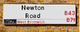
Map of Newton Road
| Postcodes | ||
|---|---|---|
| Icon | Postcodes for Newton Road | |
| Walking Distances | ||
| Distance Info | Green Circle = 10 Minutes Walk (800 metres) | |
About Newton Road
Newton Road is a street located in the town of West Bromwich. The street has a length of approximately 4,026 metres.
Newton Road is located within the Sandwell District (B) Council's jurisdiction. They provide various services, like refuse collection, and manage council tax collection. It's situated in the West Midlands region of the UK.
Newton Road has been assigned the Unique Street Reference Numbers of 33634540, 33680007 and 33634541 in the National Street Gazetteer.
Newton Road is located within the county of West Midlands, situated in the West Midlands region of the UK. It's 106.77 miles North West from central London., 4.88 miles North West from Birmingham, 21.09 miles North West from Coventry and 26.45 miles North East from Worcester.

Do you know why this road is called Newton Road?
What's it like to live here?
Ask the community a question about Newton Road.
Do you have any questions, memories to share or know any facts about Newton Road? We'd love to know more.
Also on streetlist.co.uk, can you help?
Swing Swang Lane
28th April 2024
I am trying to find out why the lane is named Swing Swang?
It has been known known this since at least 1905 when hedge making contents used to be held here.
Swing Swang is often used to describe a fairground ride. I remember Swing Boats. Were they a bit like this or is Swing Swang another name for swings?
Swing Swangs are also mentioned in connection to orchards. Or were orchards just good places to have swings?
Eldroth Road
15th April 2024
I wondered if anyone has any old pictures of Wenning Bank House in the 1940’s and also Lane Side before of the same era .. we visited today with my Mum in law as she used to live at both these properties. Also any photos of the schools around that time .. thank you.
Can You Help?Napps Way
15th April 2024
Why is the road called Napps Way (belonging to Napp, but minus an
apostrophe as is usual with such nomenclature)? Moreover, who or
what is, or was, “Napp” in the respective, possessive case?
Several years ago, I met an elderly man (probably in his late-eighties)
who lives on Bentham Drive, Liverpool 16, and during a conversation
with him whilst in a Northwest Passenger Transport Ambulance on the
way to the former RLUH (Royal Liverpool University Hospital), he told
me that he could remember (when he was a boy, living in Childwall,
Liverpool 16) that, “Where Napps Way is now, during WW2, there was
a two-man gun emplacement on the, then, open land to protect the
railway line passing over Childwall Valley Road - next to the railway
bridge - when suddenly, as they were loading a live “shell” into the gun’s
breach, the aforementioned “shell” accidentally exploded in the gun’s
breach killing both of the two soldiers, that had been manning the gun,
instantly! (Very sad, of course, but could - perhaps - two ghosts relating
to those two, very unfortunately and prematurely-killed soldiers have
haunted that place of their deaths ever since - and have any residents
of Napps Way - formerly and in its latest incarnation - seen two, WW2
(uniformed) soldiers unexpectedly appear in or near their homes?)
Estate Agents near Newton Road
| Name | Address | Website |
|---|---|---|
| Crescent Properties | 7 Newton Road, Great Barr, Birmingham,B43 6AA | Visit Website |
| Just Move Estate Agents & Lettings | 30 Newton Road Great Barr Birmingham B43 6BW | Visit Website |
| Jacobs Real Estate | 4 Cross Lane, Great Barr, Birmingham,B43 6LN |
We have found 21 postcodes for Newton Road
Location Details
| Newton Road | |
|---|---|

| |
| Latitude | 52.540415 |
| Longitude | -1.959000 |
| OS Easting (X): | 402780 |
| OS Northing (Y): | 293658 |
| OS Grid Reference: | SP028937 |
Neighbourhood Policing |
| Police Force: West Midlands |
 View Neighbourhood Crime and Policing View Neighbourhood Crime and Policing |
| Find a Local Neighbourhood Watch Scheme |
Frequently asked Questions for Newton Road
What Council (Local Authority) is Newton Road in?
Newton Road is located within the local authority area of Sandwell Council which is a Metropolitan District.
What Parish Council is Newton Road in?
Newton Road is in an unparished area.
What Electoral Ward is Newton Road in?
Newton Road is located within the ward of Great Barr with Yew Tree, Charlemont with Grove Vale &Newton.
What County is Newton Road in?
Newton Road is located within the ceremonial county of West Midlands.
What Constituency is Newton Road in?
Newton Road is located within the constituency of West Bromwich East.
What Part of the UK is Newton Road in?
Newton Road is located within the West Midlands (England) region of the United Kingdom.
What County Council area is Newton Road in?
Newton Road is located within the West Midlands Council area.
What Police Force area is Newton Road in?
Newton Road is located within the West Midlands Police area.
Roads that have a Junction with Newton Road
| Street | Junction Type |
|---|---|
| All Saints Way (A4031) | junction |
| Hollyhedge Road (A4031) | junction |
| Forge Lane | junction |
| Wigmore Lane | junction |
| Ray Hall Lane | junction |
| Pear Tree Drive | junction |
| Bowstoke Road | junction |
| Hamstead Road (B4167) | junction |
| Grove Vale Avenue | junction |
| Arlen Drive | junction |
| Monksfield Avenue | junction |
| High Beeches | junction |
| Green Lane | junction |
| Fairyfield Avenue | junction |
| Jayshaw Avenue | junction |
| Waddington Avenue | junction |
| Pages Lane | junction |
| Meadowside Close | junction |
| Newton Park Mews | junction |
| Hailwood Drive | junction |
| Newton Square | junction |
| Birmingham Road (A34) | junction |
Sunset and Sunrise times for Newton Road
| Sunrise | 05:20 |
|---|---|
| Sunset | 20:48 |
Latest Weather Conditions for Newton Road
| Observed at Weather Station: | Coleshill 8 May 2024 at 16:00 (12.10 miles away) |
|---|---|
| Current Weather: | Partly cloudy (day) |
| Temperature and Humidity: | 20.9°C (52.7%) |
| Wind Direction and Speed: | SSW (7 mph) |
Population Statistics
| ONS Area Code | E00050440, E00050430, E00050438, E00050308, E00050630, E00050629, E00050631, E00050621, E00050333 & E00050639 |
|---|---|
| ONS Area Name | Indian Tech Achievers, Delayed Retirement, Multi-Ethnic Suburbia & Inner City Ethnic Mix |
| Average Age | 45.93, 44.92, 43.62, 43.33, 41.52 & 44.51 |
| Area Population | 1492.00, 1471.00, 1563.00, 1400.00, 1645.00 & 1632.00 |
| Male Population | 717.00, 730.00, 765.00, 680.00, 824.00 & 780.00 (49%) |
| Female Population | 775.00, 741.00, 798.00, 720.00, 821.00 & 852.00 (51%) |
| Benefit Claimants | 23, 20, 9, 24, 19 & 22 (1%) |
| LSOA Code: | E01009974, E01009968, E01009949, E01010012, E01010011 &E01010014 |
|---|---|
| LSOA Name: | Sandwell 006C, Sandwell 006A, Sandwell 039C, Sandwell 011D, Sandwell 011C &Sandwell 012D |
| SOA Code: | 3b &8a |
| SOA Name: | |
| MSOA Code: | E02002048, E02006810, E02002053 &E02002054 |
| MSOA Name: | Sandwell 006, Sandwell 039, Sandwell 011 &Sandwell 012 |
Nearest Supermarkets
| Tesco Great Barr Express |
|---|
| Hamstead Rd, Great Barr, B43 5EL |
| 0345 674 6459 |
| Distance: 0.89 Miles |
| Directions from Newton Road to Tesco Great Barr Express |
| Tesco Sandwell Stone Cross Express |
|---|
| 247-249 Walsall Rd, Sandwell, West Bromwich, B71 3HS |
| 0345 026 9705 |
| Distance: 1.05 Miles |
| Directions from Newton Road to Tesco Sandwell Stone Cross Express |
| Iceland Great Barr |
|---|
| 936 Scotts Arms Centre, Walsall Road, Birmingham, B42 1TQ |
| 01213582642 |
| Distance: 1.14 Miles |
| Directions from Newton Road to Iceland Great Barr |
| Tesco West Bromwich Extra |
|---|
| 46 New Square, West Bromwich, B70 7PR |
| 0345 610 2894 |
| Distance: 1.91 Miles |
| Directions from Newton Road to Tesco West Bromwich Extra |
Telephone Information
| Area Code |
|---|
| Area Code: 01922 - Walsall |
| Area Code: 0121 - Birmingham |
| Area Code: 01384 - Dudley |
| Area Code: 01902 - Wolverhampton |
Broadband Information
| Speed | Average Speed | Median Speed | Maximum Speed | Next-generation access (NGA) | Number of Connections |
|---|---|---|---|---|---|
| Less than 2 Mbps | 12.7 | 9 | >=30 | Y | 11 |
Local Government
| Local Council Details |
|---|
| Within the area of Sandwell |
| Visit the Council's Website |
| Sandwell Council House, PO Box 2374, Oldbury, West Midlands &B69 3DE |
| Send email |
| Telephone Number: 0845 358 2200 |
| Local Member of Parliament |
|---|
| Within the Westminster Parliamentary Constituency of West Bromwich East |
| The Member of Parliament is Nicola Richards |
| Details for the MP Nicola Richards on parliament.uk |
| Details for the MP Nicola Richards on theyworkforyou.com |
| In the 2019 General Election Nicola Richards won with a majority of 1,593 the result was Con gain from Lab. The total electorate was 62,046 |
| Wards, Parish Councils and County Councils |
|---|
| Ward: Great Barr with Yew Tree, Charlemont with Grove Vale &Newton Ward |
| Ceremonial County: West Midlands |
Nearest Schools
England Primary Schools
St Margaret's CofE Primary School
Address: St Margaret's CofE Primary School, Birmingham Road, Great Barr, Birmingham, West Midlands, B43 7AP
Distance: 1.56 miles
Contact: 01213572758
Calshot Primary School
Address: Calshot Primary School, Calshot Road, Great Barr, Birmingham, West Midlands, B42 2BY
Distance: 1.62 miles
Contact: 01216751059
Whitecrest Primary School
Address: Whitecrest Primary School, Whitecrest, Great Barr, Birmingham, West Midlands, B43 6HQ
Distance: 1.59 miles
Contact: 01213586348
Holy Name Catholic Primary School
Address: Holy Name Catholic Primary School, Cross Lane, Great Barr, Birmingham, West Midlands, B43 6LN
Distance: 1.07 miles
Contact: 01213573216
Hamstead Infant School
Address: Hamstead Infant School, Tanhouse Avenue, Great Barr, Birmingham, West Midlands, B43 5AS
Distance: 0.53 miles
Contact: 01213571603
Ferndale Primary School
Address: Ferndale Primary School, Ferndale Avenue, Great Barr, Birmingham, West Midlands, B43 5QF
Distance: 1.04 miles
Contact: 01213573326
St Mark's Catholic Primary School
Address: St Mark's Catholic Primary School, Almond Croft, Old Walsall Road, Great Barr, Birmingham, West Midlands, B42 1NU
Distance: 1.32 miles
Contact:
Hamstead Primary School
Address: Hamstead Primary School, Hamstead Road, Great Barr, Birmingham, West Midlands, B43 5BE
Distance: 0.74 miles
Contact: 01213571557
Grove Vale Primary School
Address: Grove Vale Primary School, Monksfield Avenue, Great Barr, Birmingham, West Midlands, B43 6AL
Distance: 0.63 miles
Contact: 01213574319
Eaton Valley Primary School
Address: Eaton Valley Primary School, Dagger Lane, West Bromwich, West Midlands, B71 4BU
Distance: 1.39 miles
Contact: 01215531593
St Mary Magdalene CofE Voluntary Controlled Primary School
Address: St Mary Magdalene CofE Voluntary Controlled Primary School, Stanway Road, West Bromwich, West Midlands, B71 1RP
Distance: 1.26 miles
Contact: 01215882371
Dorrington Academy
Address: Dorrington Academy, Dorrington Road, Perry Barr, Birmingham, West Midlands, B42 1QR
Distance: 1.74 miles
Contact: 01214645330
Pennyhill Primary School
Address: Pennyhill Primary School, Hollyhedge Road, Pennyhill Primary School, West Bromwich, West Midlands, B71 3BU
Distance: 0.93 miles
Contact: 01215882230
All Saints CofE Primary School
Address: All Saints CofE Primary School, Wilford Road, West Bromwich, West Midlands, B71 1QN
Distance: 1.56 miles
Contact: 01215670033
Nearest Hospitals
| Name | Address | Postcode | Distance | Map |
|---|
Nearest Dentists
Dentists near Newton Road
| Name | Address | Postcode | Distance | Map |
|---|
Nearest GP Surgeries
Doctors near Newton Road
TANHOUSE NHS CLINIC
Address: HAMSTEAD ROAD, GREAT BARR, BIRMINGHAM, WEST MIDLANDS, B43 5EL
Distance: 0.86 miles
Contact: tel: 0121 3579009
CLIFTON LANE MEDICAL CENTRE
Address: CLIFTON LANE, WEST BROMWICH, WEST MIDLANDS, B71 3AS
Distance: 1.00 miles
Contact: tel: 0121 5887989
STONE CROSS MEDICAL CENTRE
Address: 291 WALSALL ROAD, WEST BROMWICH, WEST MIDLANDS, B71 3LN
Distance: 1.05 miles
Contact: tel: 0121 5882286
DR MANIVASAGAM BRANCH
Address: 295 WALSALL ROAD, WEST BROMWICH, WEST MIDLANDS, B71 3LN
Distance: 1.05 miles
Contact: :
YEW TREE SURGERY
Address: REDWOOD ROAD, WALSALL, WEST MIDLANDS, WS5 4LB
Distance: 1.31 miles
Contact: :
MALLING HEALTH CENTRE SANDWELL
Address: PARSONAGE STREET, WEST BROMWICH, B71 4DL
Distance: 1.37 miles
Contact: :
Nearest Dispensing Chemists
Pharmacies near Newton Road
| Name | Address | Postcode | Telephone | Map | Distance in Km |
|---|
Nearest Opticians
Opticians near Newton Road
DEREK GREW OPTICIAN
Address: 99 APPLETON AVENUE, GREAT BARR, BIRMINGHAM, WEST MIDLANDS, B43 5LX
Distance: 0.75 miles
Contact: :
ATTEWELL AND HARDWICK EYECARE
Address: 96 WALSALL ROAD, STONE CROSS, WEST BROMWICH, WEST MIDLANDS, B71 3HN
Distance: 1.08 miles
Contact: :
COLIN LEE OPTICIANS (GREAT BARR)
Address: 14 NEWTON ROAD, GREAT BARR, BIRMINGHAM, WEST MIDLANDS, B43 6BN
Distance: 1.09 miles
Contact: :
PREETI EYES CLINIC (STONE CROSS)
Address: 136 WALSALL ROAD, STONE CROSS, WEST BROMWICH, WEST MIDLANDS, B71 3HP
Distance: 1.09 miles
Contact: :
CRYSTAL CLEAR VISION (WEST BROMWICH)
Address: 136 WALSALL ROAD, WEST BROMWICH, B71 3HP
Distance: 1.09 miles
Contact: :
EYE EXPRESS (BAL DHINSA)
Address: 909 WALSALL ROAD, GREAT BARR, BIRMINGHAM, WEST MIDLANDS, B42 1TN
Distance: 1.19 miles
Contact: :
Transport
Nearest Rail Stations
Tame Bridge Parkway Station is 1.13 miles away.
Address: Tame Bridge Parkway station, Walsall Road, Friar Park, Wednesbury, WS10 0LD
Tame Bridge Parkway is situated on the Chase Line.
Tame Bridge Parkway Station is staffed on a part time basis.
Directions from Newton Road to Tame Bridge Parkway Rail Station
Hamstead (Birmingham) Station is 1.42 miles away.
Address: Hamstead station, Old Walsall Road, Hamstead, West Midlands, B42 1NJ
Hamstead (Birmingham) is situated on the Chase Line.
Hamstead (Birmingham) Station is staffed on a part time basis.
Directions from Newton Road to Hamstead (Birmingham) Rail Station