Map of Newtown Lane
| Postcodes | ||
|---|---|---|
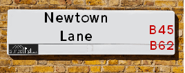
| Icon | Postcodes for Newtown Lane | |
| Walking Distances | ||
| Distance Info | Green Circle = 10 Minutes Walk (800 metres) | |
About Newtown Lane
Newtown Lane is a street located near the city of Birmingham. It uses the postcode B62 0EJ. The street has a length of approximately 1,334 metres.
Newtown Lane is located within the Bromsgrove District Council's jurisdiction. They provide various services, like refuse collection, and manage council tax collection. It's situated in the West Midlands region of the UK.
Newtown Lane has been assigned the Unique Street Reference Number of 4700770 in the National Street Gazetteer.
Newtown Lane is located within the county of Worcestershire, situated in the West Midlands region of the UK. It's 103.56 miles North West from central London., 7.65 miles South West from Birmingham, 16.69 miles North East from Worcester and 22.38 miles West from Coventry.

Do you know why this road is called Newtown Lane?
What's it like to live here?
Ask the community a question about Newtown Lane.
Do you have any questions, memories to share or know any facts about Newtown Lane? We'd love to know more.
Also on streetlist.co.uk, can you help?
Swing Swang Lane
28th April 2024
I am trying to find out why the lane is named Swing Swang?
It has been known known this since at least 1905 when hedge making contents used to be held here.
Swing Swang is often used to describe a fairground ride. I remember Swing Boats. Were they a bit like this or is Swing Swang another name for swings?
Swing Swangs are also mentioned in connection to orchards. Or were orchards just good places to have swings?
Estate Agents near Newtown Lane
| Name | Address | Website |
|---|---|---|
| Gordon Jones | 137 New Road, Rubery, Birmingham, B45 9JR | Visit Website |
| Arden Estates | 112-114 New Road, Rubery, Rednal, Birmingham, B45 9HY | Visit Website |
| Robert Oulsnam & Company | 189 New Road, Rubery, Birmingham, B45 9JP |
We have found 1 postcode for Newtown Lane
Location Details
| Newtown Lane | |
|---|---|

| |
| Latitude | 52.406909 |
| Longitude | -2.038470 |
| OS Easting (X): | 397383 |
| OS Northing (Y): | 278809 |
| OS Grid Reference: | SO974788 |
Neighbourhood Policing |
| Police Force: West Mercia |
 View Neighbourhood Crime and Policing View Neighbourhood Crime and Policing |
| Find a Local Neighbourhood Watch Scheme |
Frequently asked Questions for Newtown Lane
What Council (Local Authority) is Newtown Lane in?
Newtown Lane is located within the local authority area of Bromsgrove Council which is a District Council.
What Parish Council is Newtown Lane in?
Newtown Lane is located within the area of Romsley Parish Council.
What Electoral Ward is Newtown Lane in?
Newtown Lane is located within the ward of Belbroughton & Romsley.
What County is Newtown Lane in?
Newtown Lane is located within the ceremonial county of Worcestershire.
What Constituency is Newtown Lane in?
Newtown Lane is located within the constituency of Bromsgrove.
What Part of the UK is Newtown Lane in?
Newtown Lane is located within the West Midlands (England) region of the United Kingdom.
What County Council area is Newtown Lane in?
Newtown Lane is located within the Worcestershire Council area.
What Police Force area is Newtown Lane in?
Newtown Lane is located within the West Mercia Police area.
Roads that have a Junction with Newtown Lane
| Street | Junction Type |
|---|---|
| Old House Lane | junction |
| Yew Tree Lane | junction |
Sunset and Sunrise times for Newtown Lane , B62 0EJ
| Sunrise | 05:12 |
|---|---|
| Sunset | 20:56 |
Latest Weather Conditions for Newtown Lane, B62 0EJ
| Observed at Weather Station: | Coleshill 13 May 2024 at 18:00 (15.56 miles away) |
|---|---|
| Current Weather: | Light rain |
| Temperature and Humidity: | 14.6°C (89.5%) |
| Wind Direction and Speed: | SSE (9 mph) |
Population Statistics
| ONS Area Code | E00164080 |
|---|---|
| ONS Area Name | Rural White-Collar Workers |
| Average Age | 49.87 |
| Area Population | 1119.00 |
| Male Population | 552.00 (49%) |
| Female Population | 567.00 (51%) |
| Benefit Claimants | 6 (1%) |
| LSOA Code: | E01032169 |
|---|---|
| LSOA Name: | Bromsgrove 002D |
| SOA Code: | 2a |
| SOA Name: | |
| MSOA Code: | E02006697 |
| MSOA Name: | Bromsgrove 002 |
Nearest Supermarkets
| Morrisons Birmingham - Rubery |
|---|
| Rubery, Birmingham B45 9AH |
| 0121 460 1940 |
| Distance: 1.49 Miles |
| Directions from Newtown Lane to Morrisons Birmingham - Rubery |
| Tesco Birmingham Frankley Express |
|---|
| 414 Frankley Beeches Rd, Birmingham, B31 5NJ |
| 0345 675 7182 |
| Distance: 1.81 Miles |
| Directions from Newtown Lane to Tesco Birmingham Frankley Express |
| Sainsburys Longbridge |
|---|
| Longbridge Lane, Birmingham, England, B31 2TW |
| 0121 623 7030 |
| Distance: 2.44 Miles |
| Directions from Newtown Lane to Sainsburys Longbridge |
| Sainsburys Northfield |
|---|
| Frankley Beeches Road, Birmingham, England, B31 5AA |
| 0121 476 9133 |
| Distance: 2.73 Miles |
| Directions from Newtown Lane to Sainsburys Northfield |
Telephone Information
| Area Code |
|---|
| Area Code: 01384 - Dudley |
| Area Code: 01527 - Redditch |
| Area Code: 0121 - Birmingham |
| Area Code: 01562 - Kidderminster |
Broadband Information
| Speed | Average Speed | Median Speed | Maximum Speed | Next-generation access (NGA) | Number of Connections |
|---|---|---|---|---|---|
| Less than 2 Mbps | 2.4 | 2.6 | 2.7 | N | 3 |
Local Government
| Local Council Details |
|---|
| Within the area of Bromsgrove |
| Visit the Council's Website |
| The Council House, Burcot Lane, Bromsgrove, Worcestershire &B60 1AA |
| Send email |
| Telephone Number: 01527 873 232 |
| Local Member of Parliament |
|---|
| Within the Westminster Parliamentary Constituency of Bromsgrove |
| The Member of Parliament is Sajid Javid |
| Details for the MP Sajid Javid on parliament.uk |
| Details for the MP Sajid Javid on theyworkforyou.com |
| In the 2019 General Election Sajid Javid won with a majority of 23,106 the result was Con hold. The total electorate was 75,078 |
| Wards, Parish Councils and County Councils |
|---|
| Ward: Belbroughton & Romsley Ward |
| Ceremonial County: Worcestershire |
Nearest Schools
England Secondary Schools
Balaam Wood School
Address: Balaam Wood School, New Street, Frankley, Birmingham, West Midlands, B45 0EU
Distance: 0.93 miles
Contact:
Waseley Hills High School
Address: Waseley Hills High School, School Road, Rubery, Birmingham, West Midlands, B45 9EL
Distance: 1.16 miles
Contact: 01214535211
England Primary Schools
Holly Hill Methodist CofE Infant School
Address: Holly Hill Methodist CofE Infant School, New Street, Rubery, Rednal, Birmingham, West Midlands, B45 0EU
Distance: 0.93 miles
Contact: 01216758700
Reaside Academy
Address: Reaside Academy, Tresco Close, Frankley, Rubery, Birmingham, B45 0HY
Distance: 0.68 miles
Contact: 01216757235
St James Catholic Primary School
Address: St James Catholic Primary School, Leach Heath Lane, Rednal, Birmingham, West Midlands, B45 9BN
Distance: 1.51 miles
Contact: 01214649700
St James Catholic Primary School
Address: St James Catholic Primary School, Leach Heath Lane, Rednal, Birmingham, West Midlands, B45 9BN
Distance: 1.51 miles
Contact:
Romsley St Kenelm's CofE Primary School
Address: Romsley St Kenelm's CofE Primary School, Bromsgrove Road, Romsley, Halesowen, West Midlands, B62 0LF
Distance: 0.98 miles
Contact: 01562710214
Nearest Hospitals
| Name | Address | Postcode | Distance | Map |
|---|
Nearest Dentists
Dentists near Newtown Lane
| Name | Address | Postcode | Distance | Map |
|---|
Nearest GP Surgeries
Doctors near Newtown Lane
FRANKLEY HEALTH CENTRE
Address: 125 NEW STREET, RUBERY, REDNAL, BIRMINGHAM, WEST MIDLANDS, B45 0EU
Distance: 0.93 miles
Contact: tel: 0121 4538211
CORNHILL SURGERY
Address: 65 NEW ROAD, RUBERY, REDNAL, BIRMINGHAM, WEST MIDLANDS, B45 9JT
Distance: 1.20 miles
Contact: tel: 0121 4533591
NEW ROAD SURGERY
Address: 104-106 NEW ROAD, RUBERY, RUBERY, REDNAL, BIRMINGHAM, WEST MIDLANDS, B45 9HY
Distance: 1.22 miles
Contact: tel: 0121 4533584
LEACH HEATH MEDICAL CENTRE
Address: 32 LEACH HEATH LANE, RUBERY, REDNAL, BIRMINGHAM, WEST MIDLANDS, B45 9BU
Distance: 1.48 miles
Contact: tel: 0121 4533516
HOLLYMOOR MEDICAL CENTRE
Address: MANOR PARK GROVE, NORTHFIELD, BIRMINGHAM, WEST MIDLANDS, B31 5ER
Distance: 1.68 miles
Contact: tel: 0121 4769191
BARTLEY GREEN MEDICAL PRACTICE
Address: 71 ROMSLEY ROAD, BARTLEY GREEN, BIRMINGHAM, WEST MIDLANDS, B32 3PR
Distance: 2.52 miles
Contact: tel: 0121 4774300
Nearest Dispensing Chemists
Pharmacies near Newtown Lane
| Name | Address | Postcode | Telephone | Map | Distance in Km |
|---|
Nearest Opticians
Opticians near Newtown Lane
ROBINSON OPTICS LTD
Address: 135 NEW ROAD, RUBERY, REDNAL, BIRMINGHAM, WEST MIDLANDS, B45 9JR
Distance: 1.21 miles
Contact: :
THE EYE COLLECTIVE - RUBERY
Address: 161 NEW ROAD, RUBERY, REDNAL, BIRMINGHAM, WEST MIDLANDS, B45 9JW
Distance: 1.23 miles
Contact: :
SPEX4U
Address: 174 NEW ROAD, RUBERY, REDNAL, BIRMINGHAM, WEST MIDLANDS, B45 9JA
Distance: 1.29 miles
Contact: :
MOEC LTD
Address: 14 CURDALE ROAD, BIRMINGHAM, B32 4HB
Distance: 2.31 miles
Contact: :
M&S OPTICIANS - LONGBRIDGE
Address: 20 HIGH STREET, NORTHFIELD, BIRMINGHAM, B31 2UQ
Distance: 2.40 miles
Contact: :
SPECSAVERS OPTICIANS (LONGBRIDGE)
Address: LONGBRIDGE TOWN CENTRE, 11 HIGH STREET, NORTHFIELD, BIRMINGHAM, WEST MIDLANDS, B31 2UQ
Distance: 2.40 miles
Contact: :
Transport
Nearest Rail Stations
Longbridge Station is 2.52 miles away.
Address: Longbridge station, Longbridge Lane, Birmingham, West Midlands, B31 2TW
Longbridge is situated on the Bristol to Brimingham Line.
Longbridge Station is staffed on a part time basis.
Northfield Station is 3.06 miles away.
Address: Northfield station, Quarry Lane, Northfield, West Midlands, B31 2PY
Northfield is situated on the Bristol to Brimingham Line.
Northfield Station is staffed on a part time basis.