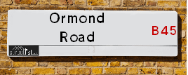
Map of Ormond Road
| Postcodes | ||
|---|---|---|
| Icon | Postcodes for Ormond Road | |
| Walking Distances | ||
| Distance Info | Green Circle = 10 Minutes Walk (800 metres) | |
About Ormond Road
Ormond Road is a street located in the city of Birmingham. The street has a length of approximately 1,147 metres.
Ormond Road is located within the Birmingham District (B) Council's jurisdiction. They provide various services, like refuse collection, and manage council tax collection. It's situated in the West Midlands region of the UK.
Ormond Road has been assigned the Unique Street Reference Number of 2700126 in the National Street Gazetteer.
Ormond Road is located within the county of West Midlands, situated in the West Midlands region of the UK. It's 102.75 miles North West from central London., 7.33 miles South West from Birmingham, 16.77 miles North East from Worcester and 21.62 miles West from Coventry.

Do you know why this road is called Ormond Road?
What's it like to live here?
Ask the community a question about Ormond Road.
Do you have any questions, memories to share or know any facts about Ormond Road? We'd love to know more.
Also on streetlist.co.uk, can you help?
Swing Swang Lane
28th April 2024
I am trying to find out why the lane is named Swing Swang?
It has been known known this since at least 1905 when hedge making contents used to be held here.
Swing Swang is often used to describe a fairground ride. I remember Swing Boats. Were they a bit like this or is Swing Swang another name for swings?
Swing Swangs are also mentioned in connection to orchards. Or were orchards just good places to have swings?
Estate Agents near Ormond Road
| Name | Address | Website |
|---|---|---|
| Robert Oulsnam & Company | 189 New Road, Rubery, Birmingham, B45 9JP | |
| Dunedin Sales & Lettings | 2046 - 2048 Bristol Road South, Rubery, Rednal, Birmingham, B45 9JL | Visit Website |
| Gordon Jones | 137 New Road, Rubery, Birmingham, B45 9JR | Visit Website |
Location Details
| Ormond Road | |
|---|---|

| |
| Latitude | 52.402207 |
| Longitude | -2.020399 |
| OS Easting (X): | 398612 |
| OS Northing (Y): | 278286 |
| OS Grid Reference: | SO986783 |
Neighbourhood Policing |
| Police Force: West Midlands |
 View Neighbourhood Crime and Policing View Neighbourhood Crime and Policing |
| Find a Local Neighbourhood Watch Scheme |
Frequently asked Questions for Ormond Road
What Council (Local Authority) is Ormond Road in?
Ormond Road is located within the local authority area of Birmingham Council which is a Metropolitan District.
What Parish Council is Ormond Road in?
Ormond Road is located within the area of New Frankley in Birmingham Parish Council.
What Electoral Ward is Ormond Road in?
Ormond Road is located within the ward of Frankley Great Park.
What County is Ormond Road in?
Ormond Road is located within the ceremonial county of West Midlands.
What Constituency is Ormond Road in?
Ormond Road is located within the constituency of Birmingham &Northfield.
What Part of the UK is Ormond Road in?
Ormond Road is located within the West Midlands (England) region of the United Kingdom.
What County Council area is Ormond Road in?
Ormond Road is located within the West Midlands Council area.
What Police Force area is Ormond Road in?
Ormond Road is located within the West Midlands Police area.
Roads that have a Junction with Ormond Road
| Street | Junction Type |
|---|---|
| Rubery Lane | junction |
| Mitten Avenue | junction |
| Arden Road | junction |
| Rea Fordway | junction |
| Wide Acres | junction |
| Quarry House Close | junction |
| Old Stone Close | junction |
| Hayling Close | junction |
| Shapinsay Drive | junction |
| Kintyre Close | junction |
| Tresco Close | junction |
| Lismore Close | junction |
| Boleyn Road | junction |
Sunset and Sunrise times for Ormond Road
| Sunrise | 05:15 |
|---|---|
| Sunset | 20:53 |
Latest Weather Conditions for Ormond Road
| Observed at Weather Station: | Coleshill 11 May 2024 at 07:00 (14.96 miles away) |
|---|---|
| Current Weather: | Sunny day |
| Temperature and Humidity: | 14.7°C (76.2%) |
| Wind Direction and Speed: | E (3 mph) |
Population Statistics
| ONS Area Code | E00046508, E00046527, E00046526 & E00046522 |
|---|---|
| ONS Area Name | Hard-Pressed Ethnic Mix |
| Average Age | 33.77, & 41.02 |
| Area Population | 1586.00, & 1412.00 |
| Male Population | 774.00, & 683.00 (49%) |
| Female Population | 812.00, & 729.00 (51%) |
| Benefit Claimants | 125, & 46 (6%) |
| LSOA Code: | E01009160, E01033633 &E01009161 |
|---|---|
| LSOA Name: | Birmingham 125E, Birmingham 125G &Birmingham 125F |
| SOA Code: | 4c |
| SOA Name: | |
| MSOA Code: | E02001951 |
| MSOA Name: | Birmingham 125 |
Nearest Supermarkets
| Morrisons Birmingham - Rubery |
|---|
| Rubery, Birmingham B45 9AH |
| 0121 460 1940 |
| Distance: 0.68 Miles |
| Directions from Ormond Road to Morrisons Birmingham - Rubery |
| Tesco Birmingham Frankley Express |
|---|
| 414 Frankley Beeches Rd, Birmingham, B31 5NJ |
| 0345 675 7182 |
| Distance: 1.12 Miles |
| Directions from Ormond Road to Tesco Birmingham Frankley Express |
| Sainsburys Longbridge |
|---|
| Longbridge Lane, Birmingham, England, B31 2TW |
| 0121 623 7030 |
| Distance: 1.62 Miles |
| Directions from Ormond Road to Sainsburys Longbridge |
| Sainsburys Northfield |
|---|
| Frankley Beeches Road, Birmingham, England, B31 5AA |
| 0121 476 9133 |
| Distance: 2.07 Miles |
| Directions from Ormond Road to Sainsburys Northfield |
Telephone Information
| Area Code |
|---|
| Area Code: 01527 - Redditch |
| Area Code: 0121 - Birmingham |
| Area Code: 01384 - Dudley |
| Area Code: 01562 - Kidderminster |
Local Government
| Local Council Details |
|---|
| Within the area of Birmingham |
| Visit the Council's Website |
| Council House, Victoria Square, Birmingham &B1 1BB |
| Send email |
| Telephone Number: 0121 303 1111 |
| Local Member of Parliament |
|---|
| Within the Westminster Parliamentary Constituency of Birmingham &Northfield |
| The Member of Parliament is Gary Sambrook |
| Details for the MP Gary Sambrook on parliament.uk |
| Details for the MP Gary Sambrook on theyworkforyou.com |
| In the 2019 General Election Gary Sambrook won with a majority of 1,640 the result was Con gain from Lab. The total electorate was 73,694 |
| Wards, Parish Councils and County Councils |
|---|
| Ward: Frankley Great Park Ward |
| Ceremonial County: West Midlands |
Nearest Schools
England Primary Schools
Rednal Hill Infant School
Address: Rednal Hill Infant School, Irwin Avenue, Rednal, Birmingham, West Midlands, B45 8QY
Distance: 1.14 miles
Contact: 01214532636
Rednal Hill Junior School
Address: Rednal Hill Junior School, Irwin Avenue, Rednal, Birmingham, West Midlands, B45 8QY
Distance: 1.14 miles
Contact: 01214532520
Beaconside Primary and Nursery School
Address: Beaconside Primary and Nursery School, Hazel Road, Rubery, Birmingham, West Midlands, B45 9DX
Distance: 0.83 miles
Contact: 01214533801
St Brigid's Catholic Primary School
Address: St Brigid's Catholic Primary School, Frankley Beeches Road, Northfield, Birmingham, West Midlands, B31 5AB
Distance: 1.97 miles
Contact: 01214642364
St Columba's Catholic Primary School
Address: St Columba's Catholic Primary School, Lickey Road, Rednal, Birmingham, West Midlands, B45 8TD
Distance: 1.35 miles
Contact: 01216754841
Merritts Brook Primary E-ACT Academy
Address: Merritts Brook Primary E-ACT Academy, Trescott Road, Northfield, Birmingham, B31 5QD
Distance: 1.38 miles
Contact: 01216751299
Forestdale Primary School
Address: Forestdale Primary School, Wareham Road, Frankley, Birmingham, West Midlands, B45 0JS
Distance: 0.82 miles
Contact: 01214648659
Colmers Farm Primary School
Address: Colmers Farm Primary School, Leybrook Road, Birmingham, West Midlands, B45 9PB
Distance: 0.79 miles
Contact:
Holly Hill Methodist CofE Infant School
Address: Holly Hill Methodist CofE Infant School, New Street, Rubery, Rednal, Birmingham, West Midlands, B45 0EU
Distance: 0.24 miles
Contact: 01216758700
Reaside Academy
Address: Reaside Academy, Tresco Close, Frankley, Rubery, Birmingham, B45 0HY
Distance: 0.20 miles
Contact: 01216757235
Holywell Primary and Nursery School
Address: Holywell Primary and Nursery School, School Road, Rubery, Rednal, Birmingham, West Midlands, B45 9EY
Distance: 0.78 miles
Contact: 01214537829
St James Catholic Primary School
Address: St James Catholic Primary School, Leach Heath Lane, Rednal, Birmingham, West Midlands, B45 9BN
Distance: 0.77 miles
Contact: 01214649700
St James Catholic Primary School
Address: St James Catholic Primary School, Leach Heath Lane, Rednal, Birmingham, West Midlands, B45 9BN
Distance: 0.77 miles
Contact:
England Secondary Schools
Balaam Wood School
Address: Balaam Wood School, New Street, Frankley, Birmingham, West Midlands, B45 0EU
Distance: 0.24 miles
Contact:
Colmers School and Sixth Form College
Address: Colmers School and Sixth Form College, Bristol Road South, Rednal, Birmingham, West Midlands, B45 9NY
Distance: 0.83 miles
Contact: 01214531778
Waseley Hills High School
Address: Waseley Hills High School, School Road, Rubery, Birmingham, West Midlands, B45 9EL
Distance: 0.90 miles
Contact: 01214535211
Nearest Hospitals
| Name | Address | Postcode | Distance | Map |
|---|
Nearest Dentists
Dentists near Ormond Road
| Name | Address | Postcode | Distance | Map |
|---|
Nearest GP Surgeries
Doctors near Ormond Road
FRANKLEY HEALTH CENTRE
Address: 125 NEW STREET, RUBERY, REDNAL, BIRMINGHAM, WEST MIDLANDS, B45 0EU
Distance: 0.24 miles
Contact: tel: 0121 4538211
NEW ROAD SURGERY
Address: 104-106 NEW ROAD, RUBERY, RUBERY, REDNAL, BIRMINGHAM, WEST MIDLANDS, B45 9HY
Distance: 0.69 miles
Contact: tel: 0121 4533584
CORNHILL SURGERY
Address: 65 NEW ROAD, RUBERY, REDNAL, BIRMINGHAM, WEST MIDLANDS, B45 9JT
Distance: 0.69 miles
Contact: tel: 0121 4533591
LEACH HEATH MEDICAL CENTRE
Address: 32 LEACH HEATH LANE, RUBERY, REDNAL, BIRMINGHAM, WEST MIDLANDS, B45 9BU
Distance: 0.76 miles
Contact: tel: 0121 4533516
HOLLYMOOR MEDICAL CENTRE
Address: MANOR PARK GROVE, NORTHFIELD, BIRMINGHAM, WEST MIDLANDS, B31 5ER
Distance: 0.92 miles
Contact: tel: 0121 4769191
ST HELIERS MEDICAL PRACTICE
Address: 15 ST. HELIERS ROAD, BIRMINGHAM, B31 1QT
Distance: 2.02 miles
Contact: tel: 0121 4781850
Nearest Dispensing Chemists
Pharmacies near Ormond Road
| Name | Address | Postcode | Telephone | Map | Distance in Km |
|---|
Nearest Opticians
Opticians near Ormond Road
THE EYE COLLECTIVE - RUBERY
Address: 161 NEW ROAD, RUBERY, REDNAL, BIRMINGHAM, WEST MIDLANDS, B45 9JW
Distance: 0.60 miles
Contact: :
SPEX4U
Address: 174 NEW ROAD, RUBERY, REDNAL, BIRMINGHAM, WEST MIDLANDS, B45 9JA
Distance: 0.63 miles
Contact: :
ROBINSON OPTICS LTD
Address: 135 NEW ROAD, RUBERY, REDNAL, BIRMINGHAM, WEST MIDLANDS, B45 9JR
Distance: 0.64 miles
Contact: :
M&S OPTICIANS - LONGBRIDGE
Address: 20 HIGH STREET, NORTHFIELD, BIRMINGHAM, B31 2UQ
Distance: 1.57 miles
Contact: :
SPECSAVERS OPTICIANS (LONGBRIDGE)
Address: LONGBRIDGE TOWN CENTRE, 11 HIGH STREET, NORTHFIELD, BIRMINGHAM, WEST MIDLANDS, B31 2UQ
Distance: 1.57 miles
Contact: :
MATTOO DAVINDER (HELIERS ROAD)
Address: NORTHFIELD HEALTH CENTRE, 15 ST. HELIERS ROAD, BIRMINGHAM, WEST MIDLANDS, B31 1QT
Distance: 2.02 miles
Contact: :
Transport
Nearest Rail Stations
Longbridge Station is 1.70 miles away.
Address: Longbridge station, Longbridge Lane, Birmingham, West Midlands, B31 2TW
Longbridge is situated on the Bristol to Brimingham Line.
Longbridge Station is staffed on a part time basis.
Northfield Station is 2.34 miles away.
Address: Northfield station, Quarry Lane, Northfield, West Midlands, B31 2PY
Northfield is situated on the Bristol to Brimingham Line.
Northfield Station is staffed on a part time basis.