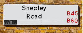
Map of Shepley Road
| Postcodes | ||
|---|---|---|
| Icon | Postcodes for Shepley Road | |
| Walking Distances | ||
| Distance Info | Green Circle = 10 Minutes Walk (800 metres) | |
About Shepley Road
Shepley Road is a street located in the village of Barnt Green. The street has a length of approximately 936 metres.
Shepley Road is located within the Bromsgrove District Council's jurisdiction. They provide various services, like refuse collection, and manage council tax collection. It's situated in the West Midlands region of the UK.
Shepley Road has been assigned the Unique Street Reference Number of 4700964 in the National Street Gazetteer.
Shepley Road is located within the county of Worcestershire, situated in the West Midlands region of the UK. It's 100.69 miles North West from central London., 9.46 miles South West from Birmingham, 14.57 miles North East from Worcester and 21.46 miles West from Coventry.

Do you know why this road is called Shepley Road?
What's it like to live here?
Ask the community a question about Shepley Road.
Do you have any questions, memories to share or know any facts about Shepley Road? We'd love to know more.
Also on streetlist.co.uk, can you help?
Eldroth Road
15th April 2024
I wondered if anyone has any old pictures of Wenning Bank House in the 1940’s and also Lane Side before of the same era .. we visited today with my Mum in law as she used to live at both these properties. Also any photos of the schools around that time .. thank you.
Can You Help?Napps Way
15th April 2024
Why is the road called Napps Way (belonging to Napp, but minus an
apostrophe as is usual with such nomenclature)? Moreover, who or
what is, or was, “Napp” in the respective, possessive case?
Several years ago, I met an elderly man (probably in his late-eighties)
who lives on Bentham Drive, Liverpool 16, and during a conversation
with him whilst in a Northwest Passenger Transport Ambulance on the
way to the former RLUH (Royal Liverpool University Hospital), he told
me that he could remember (when he was a boy, living in Childwall,
Liverpool 16) that, “Where Napps Way is now, during WW2, there was
a two-man gun emplacement on the, then, open land to protect the
railway line passing over Childwall Valley Road - next to the railway
bridge - when suddenly, as they were loading a live “shell” into the gun’s
breach, the aforementioned “shell” accidentally exploded in the gun’s
breach killing both of the two soldiers, that had been manning the gun,
instantly! (Very sad, of course, but could - perhaps - two ghosts relating
to those two, very unfortunately and prematurely-killed soldiers have
haunted that place of their deaths ever since - and have any residents
of Napps Way - formerly and in its latest incarnation - seen two, WW2
(uniformed) soldiers unexpectedly appear in or near their homes?)
Mauritius Road
15th April 2024
Why is Mauritius Road so called, since when and by whom? Does Greenwich have any particular links with Mauritius? Very interested to know. 🤞🏼
Can You Help?Estate Agents near Shepley Road
| Name | Address | Website |
|---|---|---|
| Arden Estates | 67 Hewell Road, Barnt Green, B45 8NL | Visit Website |
| Robert Oulsnam & Company | 79 Hewell Road, Barnt Green, B45 8NL | |
| Robert Oulsnam & Company New Homes | 79 Hewell Road, Barnt Green, B45 8NL |
Location Details
| Shepley Road | |
|---|---|

| |
| Latitude | 52.359733 |
| Longitude | -2.010493 |
| OS Easting (X): | 399285 |
| OS Northing (Y): | 273562 |
| OS Grid Reference: | SO993736 |
Ordnance Survey Maps for Shepley Road
If you purchase a map through the links below, we may earn an affiliate commission.
| Map Series | link | Ordnance Survey |
| Explorer 1:25,000 219 Wolverhampton and Dudley, Stourbridge and Kidderminster | Check Price on Amazon | |
| Landranger 1:50,000 139 Birmingham and Wolverhampton | Check Price on Amazon |
Neighbourhood Policing |
| Police Force: West Mercia |
 View Neighbourhood Crime and Policing View Neighbourhood Crime and Policing |
| Find a Local Neighbourhood Watch Scheme |
Frequently asked Questions for Shepley Road
What Council (Local Authority) is Shepley Road in?
Shepley Road is located within the local authority area of Bromsgrove Council which is a District Council.
What Parish Council is Shepley Road in?
Shepley Road is located within the area of Lickey and Blackwell Parish Council.
What Electoral Ward is Shepley Road in?
Shepley Road is located within the ward of Lickey Hills.
What County is Shepley Road in?
Shepley Road is located within the ceremonial county of Worcestershire.
What Constituency is Shepley Road in?
Shepley Road is located within the constituency of Bromsgrove.
What Part of the UK is Shepley Road in?
Shepley Road is located within the West Midlands (England) region of the United Kingdom.
What County Council area is Shepley Road in?
Shepley Road is located within the Worcestershire Council area.
What Police Force area is Shepley Road in?
Shepley Road is located within the West Mercia Police area.
Roads that have a Junction with Shepley Road
| Street | Junction Type |
|---|---|
| Linthurst Road | junction |
| Billy Lane | junction |
| Shepley Meadow | junction |
| Woodside Drive | junction |
| Brookhouse Road | junction |
| Pumphouse Lane | junction |
Sunset and Sunrise times for Shepley Road
| Sunrise | 05:43 |
|---|---|
| Sunset | 20:27 |
Latest Weather Conditions for Shepley Road
| Observed at Weather Station: | Pershore 26 April 2024 at 03:00 (14.68 miles away) |
|---|---|
| Current Weather: | Mist |
| Temperature and Humidity: | 1.3°C (96.4%) |
| Wind Direction and Speed: | NE (1 mph) |
Population Statistics
| ONS Area Code | E00163980 & E00163979 |
|---|---|
| ONS Area Name | Indian Tech Achievers & Ageing in Suburbia |
| Average Age | 44.06 & 45.38 |
| Area Population | 1232.00 & 1100.00 |
| Male Population | 613.00 & 528.00 (49%) |
| Female Population | 619.00 & 572.00 (51%) |
| Benefit Claimants | 8 & 3 (0%) |
| LSOA Code: | E01032149 &E01032148 |
|---|---|
| LSOA Name: | Bromsgrove 006D &Bromsgrove 008A |
| SOA Code: | 8a |
| SOA Name: | |
| MSOA Code: | E02006701 &E02006703 |
| MSOA Name: | Bromsgrove 006 &Bromsgrove 008 |
Nearest Supermarkets
| Tesco Barnt Green Express |
|---|
| 30 Hewell Rd, Barnt Green, Birmingham, B45 8NE |
| 0345 026 9233 |
| Distance: 0.83 Miles |
| Directions from Shepley Road to Tesco Barnt Green Express |
| Tesco Marlbrook Express |
|---|
| 199 Old Birmingham Rd, Marlbrook, Bromsgrove, B60 1DL |
| 0345 026 9283 |
| Distance: 1.27 Miles |
| Directions from Shepley Road to Tesco Marlbrook Express |
| Sainsburys Bromsgrove Stourbridge Road Local |
|---|
| 189 Stourbridge Road, Bromsgrove, England, B61 0AR |
| 1527575374 |
| Distance: 2.3 Miles |
| Directions from Shepley Road to Sainsburys Bromsgrove Stourbridge Road Local |
| Iceland Bromsgrove Food Warehous |
|---|
| Unit 2, Bromsgrove Retail Park, Bromsgrove, B61 0DD |
| 01527871208 |
| Distance: 2.37 Miles |
| Directions from Shepley Road to Iceland Bromsgrove Food Warehous |
Telephone Information
| Dialling Code | Telephone Exchange | Telephone Cabinet | Fibre to the Cabinet or Fibre to the Premises |
|---|---|---|---|
| 0121 | HILLSIDE; HEREFORD & WORCESTER - CMHILL | P10 | FTTC |
Broadband Information
| Speed | Average Speed | Median Speed | Maximum Speed | Next-generation access (NGA) | Number of Connections |
|---|---|---|---|---|---|
| Greater than 2 Mbps | 7 | 4.9 | 18.5 | Y | 11 |
Local Government
| Local Council Details |
|---|
| Within the area of Bromsgrove |
| Visit the Council's Website |
| The Council House, Burcot Lane, Bromsgrove, Worcestershire &B60 1AA |
| Send email |
| Telephone Number: 01527 873 232 |
| Local Member of Parliament |
|---|
| Within the Westminster Parliamentary Constituency of Bromsgrove |
| The Member of Parliament is Sajid Javid |
| Details for the MP Sajid Javid on parliament.uk |
| Details for the MP Sajid Javid on theyworkforyou.com |
| In the 2019 General Election Sajid Javid won with a majority of 23,106 the result was Con hold. The total electorate was 75,078 |
| Wards, Parish Councils and County Councils |
|---|
| Ward: Lickey Hills Ward |
| Ceremonial County: Worcestershire |
Nearest Schools
England Primary Schools
Blackwell First School
Address: Blackwell First School, St Catherine's Road, Blackwell, Bromsgrove, Worcestershire, B60 1BN
Distance: 0.65 miles
Contact: 01214451622
Lickey End First School
Address: Lickey End First School, School Lane, Lickey End, Bromsgrove, Worcestershire, B60 1JG
Distance: 1.55 miles
Contact: 01527872360
Lickey Hills Primary School and Nursery
Address: Lickey Hills Primary School and Nursery, Old Birmingham Road, Lickey, Birmingham, West Midlands, B45 8EU
Distance: 0.90 miles
Contact: 01214451992
St Andrew's CofE First School
Address: St Andrew's CofE First School, Hewell Road, Barnt Green, Birmingham, West Midlands, B45 8NG
Distance: 0.94 miles
Contact: 01214451410
Nearest Hospitals
| Name | Address | Postcode | Distance | Map |
|---|
Nearest Dentists
Dentists near Shepley Road
| Name | Address | Postcode | Distance | Map |
|---|
Nearest GP Surgeries
Doctors near Shepley Road
BARNT GREEN SURGERY
Address: 82 HEWELL ROAD, BARNT GREEN, BIRMINGHAM, WEST MIDLANDS, B45 8NF
Distance: 0.82 miles
Contact: tel: 0121 4451704
CATSHILL VILLAGE SURGERY
Address: 36 WOODROW LANE, CATSHILL, BROMSGROVE, WORCESTERSHIRE, B61 0PU
Distance: 1.91 miles
Contact: tel: 01527 872426
DR SMART CJ
Address: ALVECHURCH MEDICAL CENTRE, 5 THE SQUARE, ALVECHURCH, BIRMINGHAM, WEST MIDLANDS, B48 7LA
Distance: 2.22 miles
Contact: tel: 01214581342
LEACH HEATH MEDICAL CENTRE
Address: 32 LEACH HEATH LANE, RUBERY, REDNAL, BIRMINGHAM, WEST MIDLANDS, B45 9BU
Distance: 2.24 miles
Contact: tel: 0121 4533516
NEW ROAD SURGERY
Address: 104-106 NEW ROAD, RUBERY, RUBERY, REDNAL, BIRMINGHAM, WEST MIDLANDS, B45 9HY
Distance: 2.30 miles
Contact: tel: 0121 4533584
CORNHILL SURGERY
Address: 65 NEW ROAD, RUBERY, REDNAL, BIRMINGHAM, WEST MIDLANDS, B45 9JT
Distance: 2.32 miles
Contact: tel: 0121 4533591
Nearest Dispensing Chemists
Pharmacies near Shepley Road
| Name | Address | Postcode | Telephone | Map | Distance in Km |
|---|
Nearest Opticians
Opticians near Shepley Road
JIVA BANGAY - BARNT GREEN OPTICIANS
Address: 12 HEWELL ROAD, BARNT GREEN, BIRMINGHAM, B45 8NE
Distance: 0.85 miles
Contact: :
EYE OPTICIANS - BARNT GREEN
Address: 28 HEWELL ROAD, BARNT GREEN, BIRMINGHAM, WEST MIDLANDS, B45 8NE
Distance: 0.85 miles
Contact: :
J & D MASON OPTICIANS (ALVECHURCH)
Address: 23 THE SQUARE, ALVECHURCH, BIRMINGHAM, WEST MIDLANDS, B48 7LA
Distance: 2.22 miles
Contact: tel: 0121 447 8682, fax: 01214478682
SPEX4U
Address: 174 NEW ROAD, RUBERY, REDNAL, BIRMINGHAM, WEST MIDLANDS, B45 9JA
Distance: 2.34 miles
Contact: :
ROBINSON OPTICS LTD
Address: 135 NEW ROAD, RUBERY, REDNAL, BIRMINGHAM, WEST MIDLANDS, B45 9JR
Distance: 2.34 miles
Contact: :
THE EYE COLLECTIVE - RUBERY
Address: 161 NEW ROAD, RUBERY, REDNAL, BIRMINGHAM, WEST MIDLANDS, B45 9JW
Distance: 2.37 miles
Contact: :
Transport
Nearest Rail Stations
Barnt Green Station is 0.77 miles away.
Address: Barnt Green station, Fiery Hill Road, Barnt Green, West Midlands, B45 8PA
Barnt Green is situated on the Bristol to Brimingham Line.
Barnt Green Station is an unstaffed station.
Alvechurch Station is 2.04 miles away.
Address: Alvechurch station, Station Road, Alvechurch, Worcestershire, B48 7SE
Alvechurch is situated on the Bristol to Brimingham Line.
Alvechurch Station is an unstaffed station.