The B64 7 postcode sector is within the county of West Midlands.
Did you know? According to the 2021 Census, the B64 7 postcode sector is home to a bustling 6,297 residents!
Given that each sector allows for 400 unique postcode combinations. Letters C, I, K, M, O and V are not allowed in the last two letters of a postcode. With 156 postcodes already in use, this leaves 244 units available.
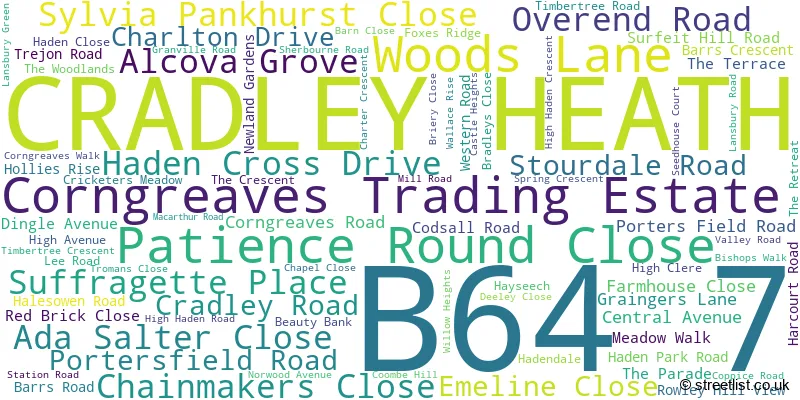
The largest settlements in the B64 7 postal code are CRADLEY HEATH and Corngreaves Trading Estate.
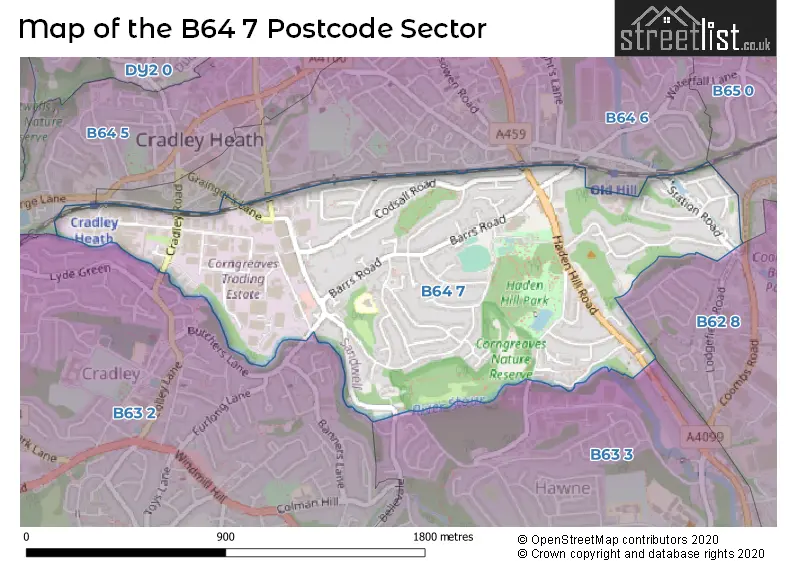
The B64 7 Postcode shares a border with B63 3 (HALESOWEN), B64 5 (CRADLEY HEATH), B64 6 (CRADLEY HEATH), B62 8 (HALESOWEN), B63 2 (HALESOWEN) and B65 0 (ROWLEY REGIS).
The sector is within the post town of CRADLEY HEATH.
B64 7 is a postcode sector within the B64 postcode district which is within the B Birmingham postcode area.
The Royal Mail delivery office for the B64 7 postal sector is the Coombs Wood Delivery Office.
The area of the B64 7 postcode sector is 0.80 square miles which is 2.07 square kilometres or 511.45 square acres.
Waterways within the B64 7 postcode sector include the Dudley No.2 Canal, Gorsty Hill Tunnel, River Stour.

Map of the B64 7 Postcode Sector
Explore the B64 7 postcode sector by using our free interactive map.
| B | 6 | 4 | - | 7 | X | X |
| B | 6 | 4 | Space | 7 | Letter | Letter |
Official List of Streets
CRADLEY HEATH (75 Streets)
Corngreaves Trading Estate (2 Streets)
Unofficial Streets or Alternative Spellings
Weather Forecast for B64 7
Press Button to Show Forecast for Cradley Heath
| Time Period | Icon | Description | Temperature | Rain Probability | Wind |
|---|---|---|---|---|---|
| 09:00 to 12:00 | Cloudy | 7.0°C (feels like 4.0°C) | 6.00% | E 7 mph | |
| 12:00 to 15:00 | Overcast | 9.0°C (feels like 7.0°C) | 12.00% | ENE 7 mph | |
| 15:00 to 18:00 | Cloudy | 10.0°C (feels like 9.0°C) | 9.00% | ENE 4 mph | |
| 18:00 to 21:00 | Cloudy | 9.0°C (feels like 8.0°C) | 10.00% | ENE 7 mph | |
| 21:00 to 00:00 | Cloudy | 7.0°C (feels like 5.0°C) | 12.00% | ENE 7 mph |
Press Button to Show Forecast for Cradley Heath
| Time Period | Icon | Description | Temperature | Rain Probability | Wind |
|---|---|---|---|---|---|
| 00:00 to 03:00 | Cloudy | 5.0°C (feels like 3.0°C) | 11.00% | ENE 7 mph | |
| 03:00 to 06:00 | Cloudy | 5.0°C (feels like 2.0°C) | 12.00% | ENE 7 mph | |
| 06:00 to 09:00 | Cloudy | 5.0°C (feels like 2.0°C) | 13.00% | ENE 7 mph | |
| 09:00 to 12:00 | Cloudy | 7.0°C (feels like 4.0°C) | 17.00% | ENE 9 mph | |
| 12:00 to 15:00 | Light rain | 9.0°C (feels like 6.0°C) | 50.00% | ENE 9 mph | |
| 15:00 to 18:00 | Overcast | 10.0°C (feels like 8.0°C) | 23.00% | ENE 9 mph | |
| 18:00 to 21:00 | Cloudy | 10.0°C (feels like 7.0°C) | 18.00% | ENE 9 mph | |
| 21:00 to 00:00 | Cloudy | 8.0°C (feels like 6.0°C) | 22.00% | NE 9 mph |
Press Button to Show Forecast for Cradley Heath
| Time Period | Icon | Description | Temperature | Rain Probability | Wind |
|---|---|---|---|---|---|
| 00:00 to 03:00 | Light rain | 7.0°C (feels like 4.0°C) | 49.00% | NE 9 mph | |
| 03:00 to 06:00 | Light rain | 7.0°C (feels like 4.0°C) | 51.00% | NE 9 mph | |
| 06:00 to 09:00 | Light rain | 7.0°C (feels like 4.0°C) | 56.00% | NNE 9 mph | |
| 09:00 to 12:00 | Heavy rain | 8.0°C (feels like 6.0°C) | 75.00% | NNE 9 mph | |
| 12:00 to 15:00 | Light rain | 10.0°C (feels like 8.0°C) | 53.00% | ENE 9 mph | |
| 15:00 to 18:00 | Heavy rain shower (day) | 11.0°C (feels like 9.0°C) | 60.00% | NNW 9 mph | |
| 18:00 to 21:00 | Light rain shower (day) | 11.0°C (feels like 9.0°C) | 38.00% | NNE 9 mph | |
| 21:00 to 00:00 | Partly cloudy (night) | 8.0°C (feels like 6.0°C) | 10.00% | N 7 mph |
Schools and Places of Education Within the B64 7 Postcode Sector
Timbertree Academy
Academy converter
Valley Road, Cradley Heath, West Midlands, B64 7LT
Head: Mrs Harjit Chahal
Ofsted Rating: Good
Inspection: 2020-02-05 (1542 days ago)
Website: Visit Timbertree Academy Website
Phone: 01384567830
Number of Pupils: 217
House Prices in the B64 7 Postcode Sector
| Type of Property | 2018 Average | 2018 Sales | 2017 Average | 2017 Sales | 2016 Average | 2016 Sales | 2015 Average | 2015 Sales |
|---|---|---|---|---|---|---|---|---|
| Detached | £259,425 | 20 | £239,363 | 24 | £224,913 | 26 | £224,163 | 15 |
| Semi-Detached | £158,842 | 39 | £152,843 | 29 | £129,153 | 56 | £135,060 | 34 |
| Terraced | £160,747 | 15 | £130,278 | 18 | £120,560 | 15 | £107,000 | 6 |
| Flats | £171,000 | 1 | £198,833 | 3 | £91,333 | 3 | £65,000 | 1 |
Important Postcodes B64 7 in the Postcode Sector
B64 7HA is the postcode for Haden Hill Leisure Centre, Barrs Road
B64 7JU is the postcode for Haden Hill House Museum and Haden Old Hall, Halesowen Road, West Midlands Fire Service, Haden Cross Community Fire Station, Halesowen Road, and Haden Cross Community Fire Station, Halesowen Road
B64 7JX is the postcode for Sandwell Metropolitan Borough Council, Municipal Buildings, Barrs Road
B64 7LT is the postcode for Timbertree Academy, Valley Road
| The B64 7 Sector is within these Local Authorities |
|
|---|---|
| The B64 7 Sector is within these Counties |
|
| The B64 7 Sector is within these Water Company Areas |
|